|
|
Title | Date | Type | Setname |
| 1 |
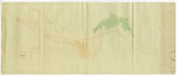 |
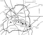
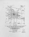
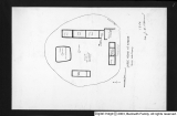
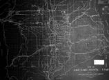
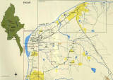
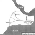
1833 Hyrum Reclamation Project Map | 1933-01 | Image; Text | dha_pour |
| 2 |
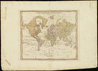 |
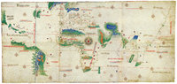
A chart of the world upon Mercator's projection : describing the tracks of Capt. Cook in the year 1768, 69, 70, 71, and in 1772, 73, 74, 75, with the new discoveries | | Image | uu_aah_art |
| 3 |
 |
A new plan of ye great town of Boston in New England in America, with the many additionall [sic] buildings, & new streets, to the year, 1769 | | Image | uu_aah_art |
| 4 |
 |
A Plan of the Town of New Haven with all the Buildings in 1748 | | Image | uu_aah_art |
| 5 |
 |
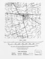
Air View Map | 1951-11-07 | Image | dha_scp |
| 6 |
 |
Air View Map | 1951-11-07 | Image | dha_scp |
| 7 |
 |
Americae sive Novi Orbis, Noca Descripto (A New Description of America or the New World) | | Image | uu_aah_art |
| 8 |
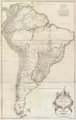 |
Amerique Meridionale Publiee sous les Auspices de Monseigneur le Duc d'Orleans | | Image | uu_aah_art |
| 9 |
 |
Athens, Greece, plan | | Image | uu_aah_art |
| 10 |
 |
Atlas of Maritime Charts (The Catalan Atlas) | | Image | uu_aah_art |
| 11 |
 |
Atlas of Maritime Charts (The Catalan Atlas), detail showing Mansa Musa | | Image | uu_aah_art |
| 12 |
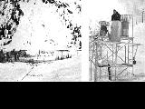 |
Avalanche tower and map | 1940; 1941; 1942; 1943; 1944; 1945; 1946; 1947; 1948; 1949; 1950; 1951; 1952; 1953; 1954; 1955; 1956; 1957; 1958; 1959; 1960; 1961; 1962; 1963; 1964; 1965; 1966; 1967; 1968; 1969 | Image | uum_map_usa |
| 13 |
 |
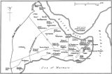
Battle of Bear River--Map P.1 | | Image | dha_cp |
| 14 |
 |
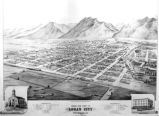
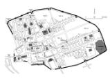
Birdseye View of Salt Lake City P.1 | | Image | dha_cp |
| 15 |
 |
Boston, its environs and harbour, with the rebels works raised against that town in 1775 | | Image | uu_aah_art |
| 16 |
 |
British North America P.1 | | Image | dha_cp |
| 17 |
 |
Cache Valley Relief Map P.1 | | Image | dha_cp |
| 18 |
 |
Camp Floyd Mining District P.1 | | Image | dha_cp |
| 19 |
 |
Cantino Planisphere | | Image | uu_aah_art |
| 20 |
 |
Carbon County, Utah P.1 | | Image | dha_cp |
| 21 |
 |
Churches, Schools NE | | Image | wc_pc |
| 22 |
 |
Churches, Schools, Missions in Utah. | | Image | wc_pc |
| 23 |
 |
City of Zion--Map P.1 | | Image | dha_cp |
| 24 |
 |
Civic Center, Salt Lake City P.1 | | Image | dha_cp |
| 25 |
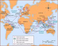
 |
Clarkston, Utah P.1 | | Image | dha_cp |
| 26 |
 |
Colorado Plateau--Map P.1 | | Image | dha_cp |
| 27 |
 |
Colorado River (Bishop Map) P.1 | | Image | dha_cp |
| 28 |
 |
Colorado River (Upper Basin) P.1 | | Image | dha_cp |
| 29 |
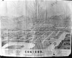 |
Corinne, Utah P.1 | | Image | dha_cp |
| 30 |
 |
Cottonwood Mining District P.1 | | Image | dha_cp |
| 31 |
 |
Dinosaur National Monument | 1958-05-29 | Image | ucl_vep |
| 32 |
 |
Dry Canyon Ophir Mining District P.1 | | Image | dha_cp |
| 33 |
 |
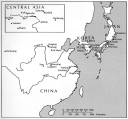
Dura Europos, general site plan | | Image | uu_aah_art |
| 34 |
 |
Echo Canyon P.1 | | Image | dha_cp |
| 35 |
 |
Echo Canyon P.2 | | Image | dha_cp |
| 36 |
 |
Echo Canyon P.3 | | Image | dha_cp |
| 37 |
 |
El Palacio, volume 30, nos.19-20 (May 20, 1931) [02]: Map, Nine Mile Canyon | 1931-05-20 | Image | dc_bpc |
| 38 |
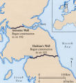
 |
Emigrant Road from Independence to San Fran. P.1 | | Image | dha_cp |
| 39 |
 |
Escalante Map P.1 | | Image | dha_cp |
| 40 |
 |
Escalante Route Map P.1 | | Image | dha_cp |
| 41 |
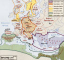
 |
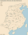
Escalante Valley Improvement Company Map | 1915-11-19 | Image | dha_scp |
| 42 |
 |
Escalante, Utah--Map P.1 | | Image | dha_cp |
| 43 |
 |
Fort Bridger P.1 | | Image | dha_cp |
| 44 |
 |
Fort Douglas Utah Territory P.1 | | Image | dha_cp |
| 45 |
 |
Fur Traders' Route (Peter Skene Ogden) P.1 | | Image | dha_cp |
| 46 |
 |
Great Salt Lake P.1 | | Image | dha_cp |
| 47 |
 |
Great Salt Lake P.2 | | Image | dha_cp |
| 48 |
 |
Great Salt Lake City P.1 | | Image | dha_cp |
| 49 |
 |
Great Salt Lake--Ferris P.1 | | Image | dha_cp |
| 50 |
 |
Great Salt Lake--Trails of Charles Stoddard P.1 | | Image | dha_cp |
| 51 |
 |
The Green & Colorado Rivers P.1 | | Image | dha_cp |
| 52 |
 |
Gunnison Massacre [19] : Map accompanying a transcript of part of Josiah Gibbs' account, from "Lights and Shadows of Mormonism" (1909), pp. 176-189 | 1926 | Image | dc_bpc |
| 53 |
 |
Gunnison Massacre--Site P.1 | | Image | dha_cp |
| 54 |
 |
Harrisburg Mining District P.1 | | Image | dha_cp |
| 55 |
 |
Hastings Cutoff--Map P.1 | | Image | dha_cp |
| 56 |
 |
Host City map of downtown | 2002 | Image | dha_olyleg |
| 57 |
 |
Jeremy Ranch--Map P.1 | | Image | dha_cp |
| 58 |
 |
Joe's grandfather, Leo Frazier scrapbook | 1985 | Image; Text | dha_pour |
| 59 |
 |
Johnston's Army P.1 | | Image | dha_cp |
| 60 |
 |
Kanosh, Black Rock, Pumice and Connor Spring scrapbook [02] : Kanosh mounds inside cover | 1930 | Image | dc_bpc |
| 61 |
 |
Kanosh, Black Rock, Pumice and Connor Spring scrapbook [03] : Kanosh mounds | 1930 | Image | dc_bpc |
| 62 |
 |
Kirtland, Ohio P.1 | | Image | dha_cp |
| 63 |
 |
Kirtland, Ohio P.2 | | Image | dha_cp |
| 64 |
 |
Lake Bonneville P.1 | | Image | dha_cp |
| 65 |
 |
Lake Bonneville P.2 | | Image | dha_cp |
| 66 |
 |
Land Use--Map P.1 | | Image | dha_cp |
| 67 |
 |
Lepcis Magna, plan | | Image | uu_aah_art |
| 68 |
 |
Lewis & Clark Trail P.1 | | Image | dha_cp |
| 69 |
 |
Lewis & Clark Trail P.2 | | Image | dha_cp |
| 70 |
 |
Little Cottonwood Canyon Mining District P.1 | | Image | dha_cp |
| 71 |
 |
Logan, Utah (Birdseye View) P.1 | | Image | dha_cp |
| 72 |
 |
Lucin Cut-off P.1 | | Image | dha_cp |
| 73 |
 |
Map based on Bunyan's "Pilgrim's Progress" | | Image | uu_aah_art |
| 74 |
 |
Map of America | | Image | uu_aah_art |
| 75 |
 |
Map of Constantinople | | Image | uu_aah_art |
| 76 |
 |
Map of Dutch East India Company (V.O.C.) Trade Routes | | Image | uu_aah_art |
| 77 |
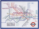 |
Map of London Underground, After Re-Design | | Image | uu_aah_art |
| 78 |
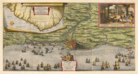 |
Map of the Dutch capture of the town of Olinda in Pernambuco by the Dutch West Indies Company in February 1630 | | Image | uu_aah_art |
| 79 |
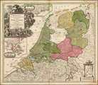 |
Map of the Dutch Republic | | Image | uu_aah_art |
| 80 |
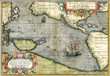 |
Map of the Pacific | | Image | uu_aah_art |
| 81 |
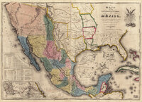 |
Map of the United States of Méjico (Mexico) | | Image | uu_aah_art |
| 82 |
 |
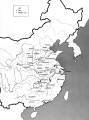
Map of Utah with Cross | 1951-10-18 | Image | dha_scp |
| 83 |
 |
Map on Wall at Walgreen Drug Store, May 1936 | 1936-05-28 | Image | dha_cbfm |
| 84 |
 |
Map on Wall at Walgreen Drug Store, May 1936 | 1936-05-28 | Image | dha_cbfm |
| 85 |
 |
Map showing Ravenna and Aachen | | Image | uu_aah_art |
| 86 |
 |
Map showing the dissolution of the former Roman Empire, c. 600 | | Image | uu_aah_art |
| 87 |
 |
Map showing three locations of Zhuang Hui's site-specific project "Longitude 109.88°E and Latitude 31.09°N | | Image | uu_aah_art |
| 88 |
 |
Map, annotated | 1975 | Image | dha_eftl |
| 89 |
 |
Map, July 1938 | 1938-07-12 | Image | dha_cbfm |
| 90 |
 |
Map, July 1938 | 1938-07-12 | Image | dha_cbfm |
| 91 |
 |
Map, Mar. 1938 | 1938-03-03 | Image | dha_cbfm |
| 92 |
 |
Map, Mar. 1938 | 1938-03-03 | Image | dha_cbfm |
| 93 |
 |
Map, Mar. 1938 | 1938-03-03 | Image | dha_cbfm |
| 94 |
 |
Map, May 1938 | 1938-05-16 | Image | dha_cbfm |
| 95 |
 |
Map, Salt Lake Valley | 1975 | Image | dha_eftl |
| 96 |
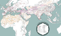 |
Map: 11th - 12th Century Trade Routes | | Image | uu_aah_art |
| 97 |
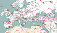 |
Map: 11th - 12th Century Trade Routes including Rome, Constantinople, Damascus, Jerusalem, and Dura-Europos | | Image | uu_aah_art |
| 98 |
 |
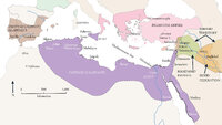
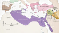
Map: Abbasid caliphate | | Image | uu_aah_art |
| 99 |
 |
Map: Ancient Egypt | | Image | uu_aah_art |
| 100 |
 |
Map: Ancient Near East | | Image | uu_aah_art |
| 101 |
 |
Map: Ancient Silk Routes between China and the West | | Image | uu_aah_art |
| 102 |
 |
Map: Approximate Spheres and Succession of the Xia, Shang, and Zhou Dynasties | | Image | uu_aah_art |
| 103 |
 |
Map: Areas in northeast Brazil occupied by the Dutch, showing the main regions under Johan Maurits van Nassau's rule, 1637 - 1644 | | Image | uu_aah_art |
| 104 |
 |
Map: Asia circa 1250 CE | | Image | uu_aah_art |
| 105 |
 |
Map: Asia circa 450 CE | | Image | uu_aah_art |
| 106 |
 |
Map: Asia circa 850 CE | | Image | uu_aah_art |
| 107 |
 |
Map: Australia | | Image | uu_aah_art |
| 108 |
 |
Map: Aztec Empire in 1518 CE | | Image | uu_aah_art |
| 109 |
 |
Map: Bagan (Pagan) Temples, Stupas, and Monasteries | | Image | uu_aah_art |
| 110 |
 |
Map: Berlin | | Image | uu_aah_art |
| 111 |
 |
Map: Berlin, City Center | | Image | uu_aah_art |
| 112 |
 |
Map: Borobudur and Kedu Plain | | Image | uu_aah_art |
| 113 |
 |
Map: Brazil | | Image | uu_aah_art |
| 114 |
 |
Map: Brazil | | Image | uu_aah_art |
| 115 |
 |
Map: Britain, showing Antonine Wall and Hadrian's Wall | | Image | uu_aah_art |
| 116 |
 |
Map: British Empire, excluding Americas, 1921 CE | | Image | uu_aah_art |
| 117 |
 |
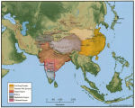
Map: Buddhist Asia | | Image | uu_aah_art |
| 118 |
 |
Map: Buddhist Sites in China, Central Asia, Korea, and Japan | | Image | uu_aah_art |
| 119 |
 |
Map: Buddhist Sites in India, Neighboring Regions, and Southeast Asia | | Image | uu_aah_art |
| 120 |
 |
Map: Buddhist World Showing the Main Pilgrimmage and Trade Routes | | Image | uu_aah_art |
| 121 |
 |
Map: Cairo and environs during Fatimid period | | Image | uu_aah_art |
| 122 |
 |
Map: Cairo and environs during Fatimid period | | Image | uu_aah_art |
| 123 |
 |
Map: Central Europe in 1890 | | Image | uu_aah_art |
| 124 |
 |
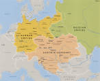
Map: Central Europe in 1930 | | Image | uu_aah_art |
| 125 |
 |
Map: China | | Image | uu_aah_art |
| 126 |
 |
Map: China and Korea, showing Neolithic and Bronze Age sites | | Image | uu_aah_art |
| 127 |
 |
Map: China during the Spring and Autumn Period | | Image | uu_aah_art |
| 128 |
 |
Map: China during the Warring States Period | | Image | uu_aah_art |
| 129 |
 |
Map: Christian Basilicas of Constantinian Rome | | Image | uu_aah_art |
| 130 |
 |
Map: Christian Reconquest in Iberia, 790-1300 CE | | Image | uu_aah_art |
| 131 |
 |
Map: Cities in India | | Image | uu_aah_art |
| 132 |
 |
Map: Constantinople in the early 4th century | | Image | uu_aah_art |
| 133 |
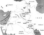 |
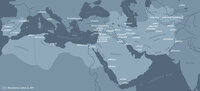
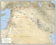
Map: Current Middle East Showing Ancient Mesopotamia | | Image | uu_aah_art |
| 134 |
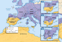 |
Map: Decline of Muslim Rule in the Iberian Peninsula that culminated in the Reconquista, Inquisition, and the rise of Spanish and Portuguese kingdoms, 1000-1300 CE | | Image | uu_aah_art |
| 135 |
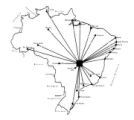 |
Map: Distances between Brasilia and other major Brazilian cities | | Image | uu_aah_art |
| 136 |
 |
Map: Dutch Trade Routes | | Image | uu_aah_art |
| 137 |
 |
Map: Early Bronze Age Sites in China | | Image | uu_aah_art |
| 138 |
 |
Map: Early China | | Image | uu_aah_art |
| 139 |
 |
Map: East Asia, circa 615 CE | | Image | uu_aah_art |
| 140 |
 |
Map: East Asia, circa 715 CE | | Image | uu_aah_art |
| 141 |
 |
Map: East Coast Prehistoric Cultures | | Image | uu_aah_art |
| 142 |
 |
Map: Empires and Spheres of Influence | | Image | uu_aah_art |
| 143 |
 |
Map: Europe during the 14th Century CE | | Image | uu_aah_art |
| 144 |
 |
Map: Europe, 1648 CE | | Image | uu_aah_art |
| 145 |
 |
Map: Europe, about 1100 CE | | Image | uu_aah_art |
| 146 |
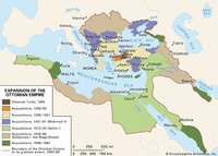 |
Map: Extent of Ottoman Empire, 1300-1699 CE | | Image | uu_aah_art |
| 147 |
 |
Map: Fatimid Caliphate Rule | | Image | uu_aah_art |
| 148 |
 |
Map: Fatimid Caliphate Rule | | Image | uu_aah_art |
| 149 |
 |
Map: Fatimid Dynasty | | Image | uu_aah_art |
| 150 |
 |
Map: Flemish / Dutch Lowlands, 1585 - 1700 | | Image | uu_aah_art |
| 151 |
 |
Map: Florence, Italy, 1400 CE | | Image | uu_aah_art |
| 152 |
 |
Map: Han Empire | | Image | uu_aah_art |
| 153 |
 |
Map: Historical Sites in the Kyoto, Osaka, and Nara areas | | Image | uu_aah_art |
| 154 |
 |
Map: Important Archaeological Sites of the Erlitou culture period | | Image | uu_aah_art |
| 155 |
 |
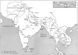
Map: India, South and Central Asia | | Image | uu_aah_art |
| 156 |
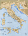 |
Map: Italy | | Image | uu_aah_art |
| 157 |
 |
Map: Italy, c.1410 CE | | Image | uu_aah_art |
| 158 |
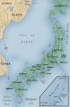 |
Map: Japan | | Image | uu_aah_art |
| 159 |
 |
Map: Kiln Sites of China | | Image | uu_aah_art |
| 160 |
 |
Map: Korea | | Image | uu_aah_art |
| 161 |
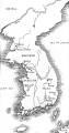 |
Map: Korea | | Image | uu_aah_art |
| 162 |
 |
Map: Latin America around the year 1500, with the principal native societies and the three empires: Aztec, Mayan, and Incan | | Image | uu_aah_art |
| 163 |
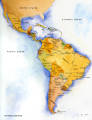 |
Map: Latin America Political Map | | Image | uu_aah_art |
| 164 |
 |
Map: Location of Dura Europos in the Middle East | | Image | uu_aah_art |
| 165 |
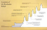 |
Map: Location of the Borobudur reliefs | | Image | uu_aah_art |
| 166 |
 |
Map: Locations of 1937 Paris World's Fair, the Berlin Olympics, Nuremberg Rallies, and Great German and Degenerate Art Exhibits | | Image | uu_aah_art |
| 167 |
 |
Map: Major sites in Rome, Italy | | Image | uu_aah_art |
| 168 |
 |
Map: Major Sites of the Eastern Zhou Dynasty | | Image | uu_aah_art |
| 169 |
 |
Map: Major Sites of the Qin State and Dynasty | | Image | uu_aah_art |
| 170 |
 |
Map: Major Sites of the Shang Dynasty, Erligang Culture | | Image | uu_aah_art |
| 171 |
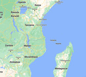 |
Map: Makonde people were in contemporary Kenya, Tanzania, and Mozambique | | Image | uu_aah_art |
| 172 |
 |
Map: Mediterranean and Northern Africa | | Image | uu_aah_art |
| 173 |
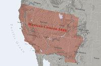 |
Map: Mexican Cession 1848 | | Image | uu_aah_art |
| 174 |
 |
Map: Minoan Crete and the Bronze Age Aegean | | Image | uu_aah_art |
| 175 |
 |
Map: Nara, Japan | | Image | uu_aah_art |
| 176 |
 |
Map: Nigeria in West Africa | | Image | uu_aah_art |
| 177 |
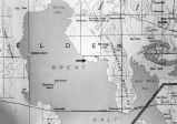 |
Map: Northen Great Salt Lake Area | | Image | uu_aah_art |
| 178 |
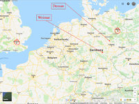 |
Map: Northern Europe showing Dessau and Weimar, Germany | | Image | uu_aah_art |
| 179 |
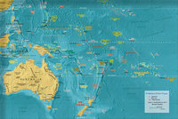 |
Map: Oceania | | Image | uu_aah_art |
| 180 |
 |
Map: Osogbo | | Image | uu_aah_art |
| 181 |
 |
Map: Paris and Versailles, France | | Image | uu_aah_art |
| 182 |
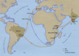 |
Map: Pedro Álvares Cabral's Voyage to and from India with the discovery of Brazil | | Image | uu_aah_art |
| 183 |
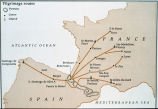 |
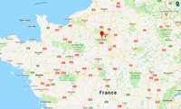
Map: Pilgrimage Routes of France and Spain | | Image | uu_aah_art |
| 184 |
 |
Map: Plan of Constantinople during the Middle Byzantine Period | | Image | uu_aah_art |
| 185 |
 |
Map: Pompeii | | Image | uu_aah_art |
| 186 |
 |
Map: Pompeii in 79 CE | | Image | uu_aah_art |
| 187 |
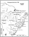 |
Map: Portuguese America in 1750 | | Image | uu_aah_art |
| 188 |
 |
Map: Portuguese Voyage Routes, 15th and 16th Century CE | | Image | uu_aah_art |
| 189 |
 |
Map: Prehistoric Europe and the Near East | | Image | uu_aah_art |
| 190 |
 |
Map: Principal Sites of Ancient Egypt | | Image | uu_aah_art |
| 191 |
 |
Map: Pueblo Cultures in the American Southwest | | Image | uu_aah_art |
| 192 |
 |
Map: Qin Dynasty, China | | Image | uu_aah_art |
| 193 |
 |
Map: Regional bronze-using cultures during the Shang Dynasty | | Image | uu_aah_art |
| 194 |
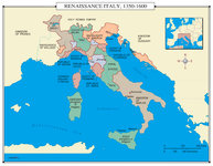 |
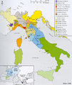
Map: Renaissance Italy 1350 - 1600 CE | | Image | uu_aah_art |
| 195 |
 |
Map: Rio de Janeiro | | Image | uu_aah_art |
| 196 |
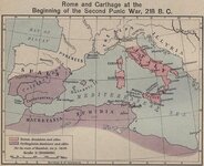 |
Map: Roman and Carthaginian Territories at the beginning of the Second Punic War, 218 BCE | | Image | uu_aah_art |
| 197 |
 |
Map: Route of Mansa Musa's hajj | | Image | uu_aah_art |
| 198 |
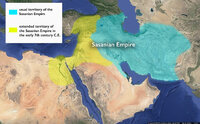 |
Map: Sasanian Empire showing original territory and extended territory in early 7th century CE | | Image | uu_aah_art |
| 199 |
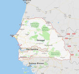 |
Map: Senegal | | Image | uu_aah_art |
| 200 |
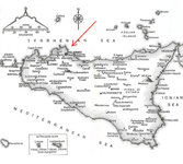 |
Map: Sicily | | Image | uu_aah_art |