Home
Browse
Ask Us
Chat
Harmful Language Statement
Log in
Advanced Search
Year
1915
1916
1917
1918
1919
1920
1921
1922
1923
1924
1925
1926
1927
1928
1929
1930
1931
1932
1933
1934
1935
1936
1937
1938
1939
1940
1941
1942
1943
1944
1945
1946
1947
1948
1949
1950
1951
1952
1953
1954
1955
1956
1957
1958
1959
1960
1961
1962
1963
1964
1965
1966
1967
1968
1969
1970
1971
1972
1973
1974
1975
1976
1977
1978
1979
1980
1981
1982
1983
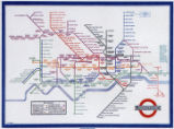
1984
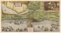
1985
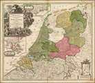
1986
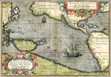
1987
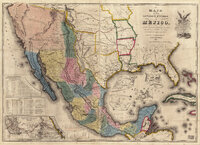
1988
1989
1990
1991
1992
1993
1994
1995
1996
1997
1998
1999
2000
2001
2002
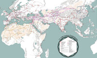
TO
1915
1916
1917
1918
1919
1920
1921
1922
1923
1924
1925
1926
1927
1928
1929
1930
1931
1932
1933
1934
1935
1936
1937
1938
1939
1940
1941
1942
1943
1944
1945
1946
1947
1948
1949
1950
1951
1952
1953
1954
1955
1956
1957
1958
1959
1960
1961
1962
1963
1964
1965
1966
1967
1968
1969
1970
1971
1972
1973
1974
1975
1976
1977
1978
1979
1980
1981
1982
1983
1984
1985
1986
1987
1988
1989
1990
1991
1992
1993
1994
1995
1996
1997
1998
1999
2000
2001
2002
Type
Image
270
Text
2
Format
image/jpeg
269
application/pdf
1
Collection
Art and Art History
169
Beckwith Photograph Collection
8
Classified Photographs
52
Clifton Bray Film Negatives
10
Extractions from the Land: Mining and...
2
Olympic Legacy
5
Peoples of Utah Revisited
2
Photo Archives
8
Shipler Commercial Photographers
6
Ski and Snow Sports Archives
1
Vernal Express Photographs
2
Westminster College Photographs
5
More
Filters:
Subject:
"Maps"
Type:
"Image"
1
-
100
of
270
<
1
2
3
>
Gallery view
Number of results to display per page
10
25
50
100
200
Sort by Relevance
Sort by Title A-Z
Sort by Title Z-A
Sort by Date Ascending
Sort by Date Descending
Sort by Last Modified Ascending
Sort by Last Modified Descending
Title
Date
Type
Setname
1
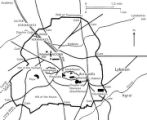
1833 Hyrum Reclamation Project Map
1933-01
Image; Text
dha_pour
2
A chart of the world upon Mercator's projection : describing the tracks of Capt. Cook in the year 1768, 69, 70, 71, and in 1772, 73, 74, 75, with the new discoveries
Image
uu_aah_art
3
A new plan of ye great town of Boston in New England in America, with the many additionall [sic] buildings, & new streets, to the year, 1769
Image
uu_aah_art
4
A Plan of the Town of New Haven with all the Buildings in 1748
Image
uu_aah_art
5
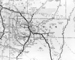
Air View Map
1951-11-07
Image
dha_scp
6
Air View Map
1951-11-07
Image
dha_scp
7
Americae sive Novi Orbis, Noca Descripto (A New Description of America or the New World)
Image
uu_aah_art
8
Amerique Meridionale Publiee sous les Auspices de Monseigneur le Duc d'Orleans
Image
uu_aah_art
9
Athens, Greece, plan
Image
uu_aah_art
10
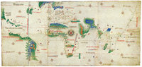
Atlas of Maritime Charts (The Catalan Atlas)
Image
uu_aah_art
11
Atlas of Maritime Charts (The Catalan Atlas), detail showing Mansa Musa
Image
uu_aah_art
12
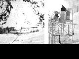
Avalanche tower and map
1940; 1941; 1942; 1943; 1944; 1945; 1946; 1947; 1948; 1949; 1950; 1951; 1952; 1953; 1954; 1955; 1956; 1957; 1958; 1959; 1960; 1961; 1962; 1963; 1964; 1965; 1966; 1967; 1968; 1969
Image
uum_map_usa
13
Battle of Bear River--Map P.1
Image
dha_cp
14
Birdseye View of Salt Lake City P.1
Image
dha_cp
15
Boston, its environs and harbour, with the rebels works raised against that town in 1775
Image
uu_aah_art
16
British North America P.1
Image
dha_cp
17
Cache Valley Relief Map P.1
Image
dha_cp
18
Camp Floyd Mining District P.1
Image
dha_cp
19
Cantino Planisphere
Image
uu_aah_art
20
Carbon County, Utah P.1
Image
dha_cp
21
Churches, Schools NE
Image
wc_pc
22
Churches, Schools, Missions in Utah.
Image
wc_pc
23
City of Zion--Map P.1
Image
dha_cp
24
Civic Center, Salt Lake City P.1
Image
dha_cp
25
Clarkston, Utah P.1
Image
dha_cp
26
Colorado Plateau--Map P.1
Image
dha_cp
27
Colorado River (Bishop Map) P.1
Image
dha_cp
28
Colorado River (Upper Basin) P.1
Image
dha_cp
29
Corinne, Utah P.1
Image
dha_cp
30
Cottonwood Mining District P.1
Image
dha_cp
31
Dinosaur National Monument
1958-05-29
Image
ucl_vep
32
Dry Canyon Ophir Mining District P.1
Image
dha_cp
33
Dura Europos, general site plan
Image
uu_aah_art
34
Echo Canyon P.1
Image
dha_cp
35
Echo Canyon P.2
Image
dha_cp
36
Echo Canyon P.3
Image
dha_cp
37
El Palacio, volume 30, nos.19-20 (May 20, 1931) [02]: Map, Nine Mile Canyon
1931-05-20
Image
dc_bpc
38
Emigrant Road from Independence to San Fran. P.1
Image
dha_cp
39
Escalante Map P.1
Image
dha_cp
40
Escalante Route Map P.1
Image
dha_cp
41
Escalante Valley Improvement Company Map
1915-11-19
Image
dha_scp
42
Escalante, Utah--Map P.1
Image
dha_cp
43
Fort Bridger P.1
Image
dha_cp
44
Fort Douglas Utah Territory P.1
Image
dha_cp
45
Fur Traders' Route (Peter Skene Ogden) P.1
Image
dha_cp
46
Great Salt Lake P.1
Image
dha_cp
47
Great Salt Lake P.2
Image
dha_cp
48
Great Salt Lake City P.1
Image
dha_cp
49
Great Salt Lake--Ferris P.1
Image
dha_cp
50
Great Salt Lake--Trails of Charles Stoddard P.1
Image
dha_cp
51
The Green & Colorado Rivers P.1
Image
dha_cp
52
Gunnison Massacre [19] : Map accompanying a transcript of part of Josiah Gibbs' account, from "Lights and Shadows of Mormonism" (1909), pp. 176-189
1926
Image
dc_bpc
53
Gunnison Massacre--Site P.1
Image
dha_cp
54
Harrisburg Mining District P.1
Image
dha_cp
55
Hastings Cutoff--Map P.1
Image
dha_cp
56
Host City map of downtown
2002
Image
dha_olyleg
57
Jeremy Ranch--Map P.1
Image
dha_cp
58
Joe's grandfather, Leo Frazier scrapbook
1985
Image; Text
dha_pour
59
Johnston's Army P.1
Image
dha_cp
60
Kanosh, Black Rock, Pumice and Connor Spring scrapbook [02] : Kanosh mounds inside cover
1930
Image
dc_bpc
61
Kanosh, Black Rock, Pumice and Connor Spring scrapbook [03] : Kanosh mounds
1930
Image
dc_bpc
62
Kirtland, Ohio P.1
Image
dha_cp
63
Kirtland, Ohio P.2
Image
dha_cp
64
Lake Bonneville P.1
Image
dha_cp
65
Lake Bonneville P.2
Image
dha_cp
66
Land Use--Map P.1
Image
dha_cp
67
Lepcis Magna, plan
Image
uu_aah_art
68
Lewis & Clark Trail P.1
Image
dha_cp
69
Lewis & Clark Trail P.2
Image
dha_cp
70
Little Cottonwood Canyon Mining District P.1
Image
dha_cp
71
Logan, Utah (Birdseye View) P.1
Image
dha_cp
72
Lucin Cut-off P.1
Image
dha_cp
73
Map based on Bunyan's "Pilgrim's Progress"
Image
uu_aah_art
74
Map of America
Image
uu_aah_art
75
Map of Constantinople
Image
uu_aah_art
76
Map of Dutch East India Company (V.O.C.) Trade Routes
Image
uu_aah_art
77
Map of London Underground, After Re-Design
Image
uu_aah_art
78
Map of the Dutch capture of the town of Olinda in Pernambuco by the Dutch West Indies Company in February 1630
Image
uu_aah_art
79
Map of the Dutch Republic
Image
uu_aah_art
80
Map of the Pacific
Image
uu_aah_art
81
Map of the United States of Méjico (Mexico)
Image
uu_aah_art
82
Map of Utah with Cross
1951-10-18
Image
dha_scp
83
Map on Wall at Walgreen Drug Store, May 1936
1936-05-28
Image
dha_cbfm
84
Map on Wall at Walgreen Drug Store, May 1936
1936-05-28
Image
dha_cbfm
85
Map showing Ravenna and Aachen
Image
uu_aah_art
86
Map showing the dissolution of the former Roman Empire, c. 600
Image
uu_aah_art
87
Map showing three locations of Zhuang Hui's site-specific project "Longitude 109.88°E and Latitude 31.09°N
Image
uu_aah_art
88
Map, annotated
1975
Image
dha_eftl
89
Map, July 1938
1938-07-12
Image
dha_cbfm
90
Map, July 1938
1938-07-12
Image
dha_cbfm
91
Map, Mar. 1938
1938-03-03
Image
dha_cbfm
92
Map, Mar. 1938
1938-03-03
Image
dha_cbfm
93
Map, Mar. 1938
1938-03-03
Image
dha_cbfm
94
Map, May 1938
1938-05-16
Image
dha_cbfm
95
Map, Salt Lake Valley
1975
Image
dha_eftl
96
Map: 11th - 12th Century Trade Routes
Image
uu_aah_art
97
Map: 11th - 12th Century Trade Routes including Rome, Constantinople, Damascus, Jerusalem, and Dura-Europos
Image
uu_aah_art
98
Map: Abbasid caliphate
Image
uu_aah_art
99
Map: Ancient Egypt
Image
uu_aah_art
100
Map: Ancient Near East
Image
uu_aah_art
1
-
100
of
270
<
1
2
3
>