|
|
Title | Date | Type | Setname |
| 601 |
 |
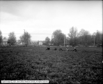
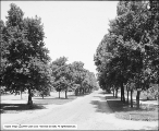
Douglas Park | 1914-09-25 | Image | dha_scp |
| 602 |
 |
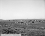
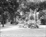
Douglas Park | 1914; 1910; 1911; 1912; 1913; 1915; 1916; 1917; 1918 | Image | dha_scp |
| 603 |
 |
Douglas Park | 1914; 1910; 1911; 1912; 1913; 1915; 1916; 1917; 1918 | Image | dha_scp |
| 604 |
 |
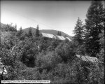
Douglas Park, East High | 1914; 1910; 1911; 1912; 1913; 1915; 1916; 1917; 1918 | Image | dha_scp |
| 605 |
 |
Douglas Park, Smoke over City | 1916-02-09 | Image | dha_scp |
| 606 |
 |
Douglas Park, View of City | 1916-05-06 | Image | dha_scp |
| 607 |
 |
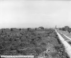
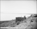
Ely, Grading Townsite | 1906-12 | Image | dha_scp |
| 608 |
 |
Evanston Panorama A | 1912-08-11 | Image | dha_scp |
| 609 |
 |
Evanston Panorama B | 1912-08-11 | Image | dha_scp |
| 610 |
 |
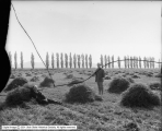
Farm | 1905-09-07 | Image | dha_scp |
| 611 |
 |
Farms at Littlefield, Arizona From Townsite | 1913-06-14 | Image | dha_scp |
| 612 |
 |
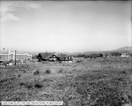
Garden at Ranch, Wells, Nevada | 1910-08-23 | Image | dha_scp |
| 613 |
 |
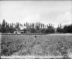
George E. Gunn Farm, Beans and Strawberries Towards Mountains | 1911-06-21 | Image | dha_scp |
| 614 |
 |
George E. Gunn Farm, Looking Southeast Toward House | 1911-06-21 | Image | dha_scp |
| 615 |
 |
George E. Gunn Farm, Looking West From Hill | 1911-06-21 | Image | dha_scp |
| 616 |
 |
George E. Gunn Farm, Strawberry Patch | 1911-06-21 | Image | dha_scp |
| 617 |
 |
George E. Gunn Farm, Strawberry Patch Toward House | 1911-06-21 | Image | dha_scp |
| 618 |
 |
George E. Gunn, Looking Southwest From Dr. Dull's | 1911-06-21 | Image | dha_scp |
| 619 |
 |
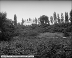
Gramling Property, Logan Avenue | 1906-04-30 | Image | dha_scp |
| 620 |
 |
Gramling Property, Panorama #1 | 1906-04-30 | Image | dha_scp |
| 621 |
 |
Gramling Property, Panorama #2 | 1906-04-30 | Image | dha_scp |
| 622 |
 |
Gramling Property, Panorama #3 | 1906-04-30 | Image | dha_scp |
| 623 |
 |
Gunn's Farm, Strawberries | 1912-08-22 | Image | dha_scp |
| 624 |
 |
Gus Buzanus' Property, International Smelting and Refining Company | 1917-08-21 | Image | dha_scp |
| 625 |
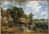 |
The Hay Wain | | Image | uu_aah_art |
| 626 |
 |
Highland Park | 1910-04-18 | Image | dha_scp |
| 627 |
 |
Highland Park | 1910-04-18 | Image | dha_scp |
| 628 |
 |
Highland Park | 1910-04-18 | Image | dha_scp |
| 629 |
 |
Highland Park | 1910-04-18 | Image | dha_scp |
| 630 |
 |
Highland Park | 1910-04-18 | Image | dha_scp |
| 631 |
 |
Home | 1930; 1931; 1932; 1933; 1934; 1935; 1936; 1937; 1938; 1939; 1940 | Image/StillImage | dha_rkc |
| 632 |
 |
Home and Dairy | 1909-11-30 | Image | dha_scp |
| 633 |
 |
Home landscapes: tradition, identity, and environments | 2011-08 | Text | ir_etd |
| 634 |
 |
Hot Pot, Midway | 1911-07-21 | Image | dha_scp |
| 635 |
 |
Hot Pots, Midway | 1911-07-21 | Image | dha_scp |
| 636 |
 |
Hot Pots, Midway | 1911-07-21 | Image | dha_scp |
| 637 |
 |
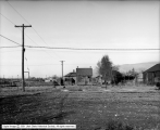
Hubbard Insurance Company, Southeast | 1905-05-29 | Image | dha_scp |
| 638 |
 |
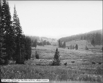
In Big Cottonwood Canyon, Looking Down From Cut | 1910-04-10 | Image | dha_scp |
| 639 |
 |
International Smelting and Refining Company, Testing Flow of Water (Moses Bruneau) | 1916-07-01 | Image | dha_scp |
| 640 |
 |
Irrigation Project Near Milford | 1914; 1910; 1911; 1912; 1913; 1915; 1916; 1917; 1918 | Image | dha_scp |
| 641 |
 |
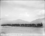
J. R. Allen and Brothers | 1910-07-27 | Image | dha_scp |
| 642 |
 |
J. R. Allen and Brothers | 1910-07-27 | Image | dha_scp |
| 643 |
 |
J. R. Allen and Brothers | 1910-07-25 | Image | dha_scp |
| 644 |
 |
J. R. Allen and Brothers | 1910-07-25 | Image | dha_scp |
| 645 |
 |
J. R. Allen and Brothers | 1910-07-25 | Image | dha_scp |
| 646 |
 |
J. W. Foote, Property | 1917-11-30 | Image | dha_scp |
| 647 |
 |
Judge Mining and Smelting, Robison Property Looking North | 1916-09-26 | Image | dha_scp |
| 648 |
 |
Kimball and Richards | 1910-01-17 | Image | dha_scp |
| 649 |
 |
Kimball and Richards | 1910-01-17 | Image | dha_scp |
| 650 |
 |
Kimball and Richards | 1910-01-17 | Image | dha_scp |
| 651 |
 |
Kimball and Richards | 1910-01-17 | Image | dha_scp |
| 652 |
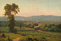 |
The Lackawanna Valley | | Image | uu_aah_art |
| 653 |
 |
Land North of Wandamere, Angus McKellar | 1912-05-20 | Image | dha_scp |
| 654 |
 |
Land North of Wandamere, Angus McKellar | 1912-05-20 | Image | dha_scp |
| 655 |
 |
Land Northeast of Aberdeen, Idaho (Foulks) | 1911-05-17 | Image | dha_scp |
| 656 |
 |
Landscape, Cliffs and Trees | | Image | uu_aah_art |
| 657 |
 |
Leaping Horse | | Image | uu_aah_art |
| 658 |
 |
Liberty Park, Center Drive (600 East) | 1907-06-19 | Image | dha_scp |
| 659 |
 |
Liberty Park, Lawn in Center of Park | 1910; 1906; 1907; 1908; 1909; 1911; 1912; 1913; 1914 | Image | dha_scp |
| 660 |
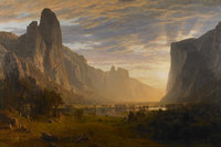 |
Looking Down Yosemite Valley, California | | Image | uu_aah_art |
| 661 |
 |
Looking North From Lynn | 1909-06-07 | Image | dha_scp |
| 662 |
 |
Lots in Denver Place | 1909-06-24 | Image | dha_scp |
| 663 |
 |
Lots in Denver Place, Laird | 1909-06-24 | Image | dha_scp |
| 664 |
 |
MFA exhibition | 2017-09 | Text | ir_mfafp |
| 665 |
 |
Milford Lands | 1910-08 | Image | dha_scp |
| 666 |
 |
Milford Lands | 1910-08 | Image | dha_scp |
| 667 |
 |
Milford Lands | 1910-08 | Image | dha_scp |
| 668 |
 |
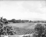
Mill Creek Farm, Field Looking West | 1911-06-21 | Image | dha_scp |
| 669 |
 |
Milner Corporation Iron Mine | 1925; 1921; 1922; 1923; 1924; 1926; 1927; 1928; 1929 | Image | dha_scp |
| 670 |
 |
Mosida Fruit Lands Company | 1910-04-29 | Image | dha_scp |
| 671 |
 |
Mosida Fruit Lands Company | 1910-04-29 | Image | dha_scp |
| 672 |
 |
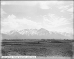
Mountains from Capitol Grounds | 1912-02-01 | Image | dha_scp |
| 673 |
 |
Mountains From Roof Garden (Caithness Apartments) | 1909-07-09 | Image | dha_scp |
| 674 |
 |
Mrs. Campbell [Ranch] | 1916-06-07 | Image | dha_scp |
| 675 |
 |
Mrs. N. Gilmor, View of Land | 1912-05-06 | Image | dha_scp |
| 676 |
 |
Mrs. Sweet Residence | 1914-08-27 | Image | dha_scp |
| 677 |
 |
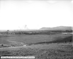
Neponset Land and Livestock Company, General View Looking South from Hill | 1912-08-10 | Image | dha_scp |
| 678 |
 |
Nevada Blossom Land Company | 1914-04-12 | Image | dha_scp |
| 679 |
 |
Nevada Blossom Land Company | 1914-04-12 | Image | dha_scp |
| 680 |
 |
Nevada Blossom Land Company | 1914-04-12 | Image | dha_scp |
| 681 |
 |
Nevada Blossom Land Company | 1914-04-12 | Image | dha_scp |
| 682 |
 |
Oral history interview with Alan Davis by Amber VanAlfen [Transcript and Audio] | 2009-10-16 | Image/MovingImage | dha_uhsoh |
| 683 |
 |
Oral history interview with Alan Davis by Amber VanAlfen [Video] | 2009-10-16 | Image/MovingImage | dha_uhsoh |
| 684 |
 |
Oral history interview with Heidi Redd | 2009-01-22 | Text; Sound | dha_uhsoh |
| 685 |
 |
Park Crescent | 1910-04-15 | Image | dha_scp |
| 686 |
 |
Park Crescent | 1910-04-15 | Image | dha_scp |
| 687 |
 |
Park Crescent | 1910-04-15 | Image | dha_scp |
| 688 |
 |
Park Crescent | 1910-04-15 | Image | dha_scp |
| 689 |
 |
People's Sugar Plant, Moroni, James Stewart and Company | 1917 | Image | dha_scp |
| 690 |
 |
People's Sugar Plant, Moroni, James Stewart and Company | 1917-03 | Image | dha_scp |
| 691 |
 |
Pinecrest Inn Under Construction | 1914 | Image | dha_scp |
| 692 |
 |
Pinecrest Inn Under Construction | 1914 | Image | dha_scp |
| 693 |
 |
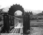
Pioneer Plat, Bishop Woolley, View West From 2500 East and 1800 South | 1913-10 | Image | dha_scp |
| 694 |
 |
Pioneer Plat, Bishop Woolley, View West From 2600 East and 1700 South | 1913-10 | Image | dha_scp |
| 695 |
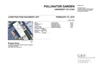 |
Pollinator Garden, University of Utah Construction Document Set | 2019 | Text | ir_su |
| 696 |
 |
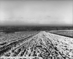
Price Irrigated Land | 1910-05 | Image | dha_scp |
| 697 |
 |
Ranch, Wells, Nevada | 1910-08-23 | Image | dha_scp |
| 698 |
 |
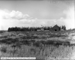
Ray Walker Country House | 1906-05-09 | Image | dha_scp |
| 699 |
 |
Ray Walker Residence, Cottonwood Canyon | 1912-06-10 | Image | dha_scp |
| 700 |
 |
Ray Walker Residence, Cottonwood Canyon | 1912-06-10 | Image | dha_scp |