176 - 200 of 606
Number of results to display per page
TitleDateType
176 Letter to James D. Doty, Territorial Governor, Utah from William P. Dole, Commissioner Indian Affairs dated 20 July 18631863-07-20Image/StillImage
177 Letter to Lee William dated January 18, 18701870-01-18Image/StillImage
178 Letter to Rober H. dated Jun. 30, 18591859-06-30Image/StillImage
179 Letter to Superintendent Indian Affairs, Utah Territory from Dennis N. Cooley, Commissioner of Indian Affairs dated cira 18651865Image/StillImage
180 Letter to Superintendent of the Census from Commissioner of Indian Affairs E.S. Parkerdated May 20, 18701870-05-20Image/StillImage
181 Letter to Utah Superintendent Jacob Forney from Indian Agent Boyce dated October 31, 18581858-10-31Image/StillImage
182 Letter to Utah Superintendent of Indian Affairs J.E. Tourtellotte from Commissioner of Indian Affairs E.S. Parker dated November 9, 18691869-11-09Image/StillImage
183 List of articles for Ruby and Deep Creek Indian Farms dated April 7, 18591859-04-07Image/StillImage
184 List of Indian Farms and Indian tribesImage/StillImage
185 Map of a portion of the Uncompahgre Ute Indian Reservation, surveyed and subdivided for allotments to the Uncompahgre Ute Indians in accordance with the Act approved June 1880 by authority of Honorable N. C. McFarland, Commissioner General Land Office Daniel G. Major U.S. Surveyor 1882-18831882; 1883Image/StillImage
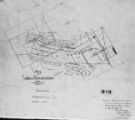
186 Map of Dry Gulch Irrigation District, Uintah Indian Reservation, UtahImage/StillImage
187 Map of East Central Utah, Uintah Ouray Reservation, Utah ValleyImage/StillImage
188 Map of Indian Reservation in the West, 1929Image/StillImage
189 Map of Indian Reservation. 1884Image/StillImage
190 Map of Indian Reservations in the Western United StatesImage/StillImage
191 Map of Part of the West Boundary of the Uncompahgre Ute Indian Reservation as Surveyed by William B. DougallImage/StillImage
192 Map of Reservations of the Western United States and the Religions that Worked on the Reservations 1870's1873Image/StillImage
193 Map of Shoshone Territory; Prepared by Doty, 1859Image/StillImage
194 Map of Southern Colorado and the Ute Mountain Ute ReservationImage/StillImage
195 Map of Southern Ute AgenciesImage/StillImage
196 Map of Stock Mining Claims in the Uintah BasinImage/StillImage
197 Map of the Four Corners Region and the Reservation of the Ute Mountain Ute TribeImage/StillImage
198 Map of the Northern Part of the Former Uintah Indian Reservation Showing the Irrigation SystemImage/StillImage
199 Map of the South West Boundary of the Uintah Indian Reserve Utah Territory1920; 1921; 1922; 1923; 1924; 1925; 1926; 1927; 1928; 1929; 1930; 1931; 1932; 1933; 1934; 1935; 1936; 1937; 1938; 1939; 1940Image/StillImage
200 Map of the South West Boundary of the Uintah Indian Reserve Utah Territory.Image/StillImage
176 - 200 of 606