Home
Browse
Ask Us
Chat
Harmful Language Statement
Log in
Advanced Search
Year
1830
1831
1832
1833
1834
1835
1836
1837
1838
1839
1840
1841
1842
1843
1844
1845
1846
1847
1848
1849
1850
1851
1852
1853
1854
1855
1856
1857
1858
1859
1860
1861
1862
1863
1864
1865
1866
1867
1868
1869
1870
1871
1872
1873
1874
1875
1876
1877
1878
1879
1880
1881
1882
1883
1884
1885
1886
1887
1888
1889
1890
1891
1892
1893
1894
1895
1896
1897
1898
1899
1900
1901
1902
1903
1904
1905
1906
1907
1908
1909
1910
1911
1912
1913
1914
1915
1916
1917
1918
1919
1920
1921
1922
1923
1924
1925
1926
1927
1928
1929
1930
1931
1932
1933
1934
1935
1936
1937
1938
1939
1940
1941
1942
1943
1944
1945
1946
1947
1948
1949
1950
1951
1952
1953
1954
1955
1956
1957
1958
1959
1960
1961
1962
1963
1964
1965
1966
1967
1968
1969
1970
1971
1972
1973
1974
1975
1976
1977
1978
1979
1980
1981
1982
1983
1984
1985
1986
1987
1988
1989
1990
1991
1992
1993
1994
1995
1996
1997
1998
1999
2000
2001
2002
2003
2004
2005
2006
2007
2008
2009
2010
2011
2012
2013
2014
2015
2016
2017
2018
2019
2020
2021
2022
TO
1830
1831
1832
1833
1834
1835
1836
1837
1838
1839
1840
1841
1842
1843
1844
1845
1846
1847
1848
1849
1850
1851
1852
1853
1854
1855
1856
1857
1858
1859
1860
1861
1862
1863
1864
1865
1866
1867
1868
1869
1870
1871
1872
1873
1874
1875
1876
1877
1878
1879
1880
1881
1882
1883
1884
1885
1886
1887
1888
1889
1890
1891
1892
1893
1894
1895
1896
1897
1898
1899
1900
1901
1902
1903
1904
1905
1906
1907
1908
1909
1910
1911
1912
1913
1914
1915
1916
1917
1918
1919
1920
1921
1922
1923
1924
1925
1926
1927
1928
1929
1930
1931
1932
1933
1934
1935
1936
1937
1938
1939
1940
1941
1942
1943
1944
1945
1946
1947
1948
1949
1950
1951
1952
1953
1954
1955
1956
1957
1958
1959
1960
1961
1962
1963
1964
1965
1966
1967
1968
1969
1970
1971
1972
1973
1974
1975
1976
1977
1978
1979
1980
1981
1982
1983
1984
1985
1986
1987
1988
1989
1990
1991
1992
1993
1994
1995
1996
1997
1998
1999
2000
2001
2002
2003
2004
2005
2006
2007
2008
2009
2010
2011
2012
2013
2014
2015
2016
2017
2018
2019
2020
2021
2022
Type
Text
67
Image
53
Image/StillImage
18
Sound
4
Image/MovingImage
2
Dataset
1
More
Format
application/pdf
74
image/jpeg
23
application/vnd.google-earth.kmz
14
application/zip
13
video/mp4
1
Collection
Beckwith Photograph Collection
6
Classified Photographs
6
Electronic University Archive
2
Great Salt Lake Oral History Collection
5
Park City Historical Society & Museum
1
Rare Books Collection
4
Regional History Center
3
Theses & Dissertations
78
UAIDA Main Collection
1
Uintah County Regional History Center...
11
Utah Historical Society Oral History ...
4
Western Waters Books
1
Western Waters Electronic Resources
4
More
Filters:
Subject:
"Geology"
Year End:
2019
1
-
25
of
126
<
1
2
3
4
5
6
>
Gallery view
Number of results to display per page
10
25
50
100
200
Sort by Relevance
Sort by Title A-Z
Sort by Title Z-A
Sort by Date Ascending
Sort by Date Descending
Sort by Last Modified Ascending
Sort by Last Modified Descending
Title
Date
Type
Setname
1
A Preliminary study of the use of oxygen isotope ratios as an exploration tool in the Park City District, Utah
1971
Text
ir_etd
2
A reconnaissance if the promontory point Mining District, Utah
1924
Text
ir_etd
3
A study of primary sedimentary structures around the Moab anticline, Grand County, Utah (Google Earth map overlay KMZ file)
1965-08
Image
ir_etd
4
A study of primary sedimentary structures around the Moab anticline, Grand County, Utah (Thesis and maps)
1965-08
Text; Image
ir_etd
5
A study of primary sedimentary structures around the Moab anticline, Grand County, Utah: Georeferenced map files
1965-08
Image
ir_etd
6
Allen-Warner Valley Energy System Environmental Impact Statement
1980
Text
uaida_main
7
An interdisciplinary geological and geomorphic characterization and landslide investigation in Red Butte Canyon, Utah
2013-08
Text
ir_etd
8
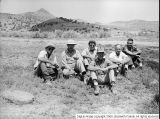
Antelope Spring [03]
1950-08-21
Image
dc_bpc
9
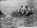
Antelope Spring [04]
1950-08-21
Image
dc_bpc
10
Antelope Spring [05]
1950-08-21
Image
dc_bpc
11
Areal geology of the Coalville vicinity, Summit County, Utah
1953-06
Text; Image
ir_etd
12
Areal geology of the Coalville vicinity, Summit County, Utah (Google Earth map overlay KMZ file)
1953-06
Image
ir_etd
13
Areal geology of the Coalville vicinity, Summit County, Utah: Georeferenced map files
1953-06
Image
ir_etd
14
Areal geology of the Wanship-Coalville Area
1952-06
Text
ir_etd
15
Biostratigraphy of the albertella and glossopleura zones (lower middle cambrian) of Northern Utah and Southern Idaho
1974
Text
ir_etd
16
Cat Creek & Pebble Puppy Placer Gold Claims, Uintah County, Utah 1994
1994
Image/StillImage
ucl_maps
17
Characterizing background seismicity in the region surrounding Milford, Utah
2017
Text
ir_etd
18
Coastal margin reservoir quality: subsurface analysis of the late cretaceous John Henry member, Kaiparowits Plateau, Southern Utah
2017
Text
ir_etd
19
Core sample library catalog
2004-07-15
Dataset
ir_eua
20
Cowboy Vein Shaft No 1 Horizontal & Vertical Deviation Plat, 1995
1995
Image/StillImage
ucl_maps
21
Cowboy Vein Vertical Hole 71-3 Geologic Section
1975
Image/StillImage
ucl_maps
22
Dynamic displacement analysis of a shallow landslide in Norwood Tuff
2011-05
Text
ir_etd
23
Energy resources map of Utah (no. 68)
1983-05
Text
ir_eua
24
Environmental differences in tropical soil temperatures in Kenya
2012-12
Text
ir_etd
25
Evaluating fluid-rock interactions in geothermal and contact metamorphic systems
2012-05
Text
ir_etd
1
-
25
of
126
<
1
2
3
4
5
6
>