|
|
Title | Date | Type | Setname |
| 1 |
 |
A Preliminary study of the use of oxygen isotope ratios as an exploration tool in the Park City District, Utah | 1971 | Text | ir_etd |
| 2 |
 |
A reconnaissance if the promontory point Mining District, Utah | 1924 | Text | ir_etd |
| 3 |
 |
A study of primary sedimentary structures around the Moab anticline, Grand County, Utah (Google Earth map overlay KMZ file) | 1965-08 | Image | ir_etd |
| 4 |
 |
A study of primary sedimentary structures around the Moab anticline, Grand County, Utah (Thesis and maps) | 1965-08 | Text; Image | ir_etd |
| 5 |
 |
A study of primary sedimentary structures around the Moab anticline, Grand County, Utah: Georeferenced map files | 1965-08 | Image | ir_etd |
| 6 |
 |
AJ Eardley 1935 Diary | | | ir_eua |
| 7 |
 |
Allen-Warner Valley Energy System Environmental Impact Statement | 1980 | Text | uaida_main |
| 8 |
 |
An interdisciplinary geological and geomorphic characterization and landslide investigation in Red Butte Canyon, Utah | 2013-08 | Text | ir_etd |
| 9 |
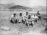 |
Antelope Spring [03] | 1950-08-21 | Image | dc_bpc |
| 10 |
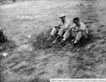 |
Antelope Spring [04] | 1950-08-21 | Image | dc_bpc |
| 11 |
 |
Antelope Spring [05] | 1950-08-21 | Image | dc_bpc |
| 12 |
 |
Areal geology of the Coalville vicinity, Summit County, Utah | 1953-06 | Text; Image | ir_etd |
| 13 |
 |
Areal geology of the Coalville vicinity, Summit County, Utah (Google Earth map overlay KMZ file) | 1953-06 | Image | ir_etd |
| 14 |
 |
Areal geology of the Coalville vicinity, Summit County, Utah: Georeferenced map files | 1953-06 | Image | ir_etd |
| 15 |
 |
Areal geology of the Upton region, Summit County, Utah-Maps | 1953-06 | Image | ir_etd |
| 16 |
 |
Areal geology of the Wanship-Coalville Area | 1952-06 | Text | ir_etd |
| 17 |
 |
Biostratigraphy of the albertella and glossopleura zones (lower middle cambrian) of Northern Utah and Southern Idaho | 1974 | Text | ir_etd |
| 18 |
 |
Brush Creek | | Image | ucl_rhc |
| 19 |
 |
Brush Creek | | Image | ucl_rhc |
| 20 |
 |
Cat Creek & Pebble Puppy Placer Gold Claims, Uintah County, Utah 1994 | 1994 | Image/StillImage | ucl_maps |
| 21 |
 |
Characterizing background seismicity in the region surrounding Milford, Utah | 2017 | Text | ir_etd |
| 22 |
 |
Clarence King | | Image | dha_cp |
| 23 |
 |
Coastal margin reservoir quality: subsurface analysis of the late cretaceous John Henry member, Kaiparowits Plateau, Southern Utah | 2017 | Text | ir_etd |
| 24 |
 |
Core sample library catalog | 2004-07-15 | Dataset | ir_eua |
| 25 |
 |
Cowboy Vein Shaft No 1 Horizontal & Vertical Deviation Plat, 1995 | 1995 | Image/StillImage | ucl_maps |
| 26 |
 |
Cowboy Vein Vertical Hole 71-3 Geologic Section | 1975 | Image/StillImage | ucl_maps |
| 27 |
 |
Dynamic displacement analysis of a shallow landslide in Norwood Tuff | 2011-05 | Text | ir_etd |
| 28 |
 |
Energy resources map of Utah (no. 68) | 1983-05 | Text | ir_eua |
| 29 |
 |
Environmental differences in tropical soil temperatures in Kenya | 2012-12 | Text | ir_etd |
| 30 |
 |
Evaluating fluid-rock interactions in geothermal and contact metamorphic systems | 2012-05 | Text | ir_etd |
| 31 |
 |
Fossils and Geology scrapbook [01] : Front cover | | Image | dc_bpc |
| 32 |
 |
Fossils and Geology scrapbook [02] | 1930; 1931; 1932; 1933; 1934; 1935; 1936; 1937; 1938; 1939; 1940; 1941; 1942; 1943; 1944; 1945; 1946; 1947; 1948 | Image | dc_bpc |
| 33 |
 |
Fossils and Geology scrapbook [03] | | Image | dc_bpc |
| 34 |
 |
Fossils and Geology scrapbook [51] | | Image | dc_bpc |
| 35 |
 |
Fossils and Geology scrapbook [52] | 1937-05-20 | Image | dc_bpc |
| 36 |
 |
Fossils and Geology scrapbook [53] | 1930 | Image | dc_bpc |
| 37 |
 |
Fossils and Geology scrapbook [65] | | Image | dc_bpc |
| 38 |
 |
Fossils and Geology scrapbook [66] | | Image | dc_bpc |
| 39 |
 |
Fossils and Geology scrapbook [70] | | Image | dc_bpc |
| 40 |
 |
Fossils and Geology scrapbook [92] : Index inside of back cover | | Image | dc_bpc |
| 41 |
 |
Fossils and Geology scrapbook [93]: Back cover | | Image | dc_bpc |
| 42 |
 |
Fractures and surface lineaments in northeastern Utah | 1975-12 | Text | ir_etd |
| 43 |
 |
Frank Beckwith | 1948 | Image | dha_cp |
| 44 |
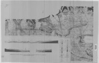 |
Geologic Map and Structure Sections of the Uinta River-Brush Creek Area, Duchesne and Uintah Counties, Utah | 1947 | Image/StillImage | ucl_maps |
| 45 |
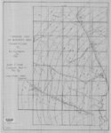 |
Geologic Map of Bonanza Area, Uintah County, Utah 1976 | 1976 | Image/StillImage | ucl_maps |
| 46 |
 |
Geologic Map of the Blue Mountain Area 1963 | 1963 | Image/StillImage | ucl_maps |
| 47 |
 |
Geologic North-South Cross Profile Whiterocks Area 1957 | 1957 | Image/StillImage | ucl_maps |
| 48 |
 |
Geologic studies of the Platte River, south-central Nebraska and adjacent areas--geologic maps, subsurface study, and geologic history | 2005 | Text | wwdl_er |
| 49 |
 |
Geological and geophysical studies of the Gilson Mountains and vicinity, Juab County, Utah | 1970-06 | Text | ir_etd |
| 50 |
 |
Geological Map of Uintah County, Utah - North Half - 1950s | 1950; 1951; 1952; 1953; 1954; 1955; 1956; 1957; 1958; 1959 | Image/StillImage | ucl_maps |
| 51 |
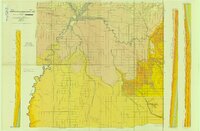 |
Geological Map of Uintah County, Utah - South Half - 1950s | 1950; 1951; 1952; 1953; 1954; 1955; 1956; 1957; 1958; 1959 | Image/StillImage | ucl_maps |
| 52 |
 |
The geology and erosional development Northern Bryce Canyon National Park | 1961 | Text | ir_etd |
| 53 |
 |
Geology and geochemistry of the colt mesa copper deposit, Circle Cliffs Area, Utah | 1975-08 | Text | ir_etd |
| 54 |
 |
Geology and mineral deposits of the western portion church hills, Millard County, Utah | 1971-06 | Text | ir_etd |
| 55 |
 |
Geology and mineralogy of the Milford Flat Quadrangle and the Old Moscow Mine Star District, Beaver County, Utah | 1968-08 | Text | ir_etd |
| 56 |
 |
Geology and structure of Stansbury Island (Thesis and maps) | 1969-06 | Text; Image | ir_etd |
| 57 |
 |
Geology and structure of Stansbury Island: Georeferenced map files | 1969-06 | Image | ir_etd |
| 58 |
 |
Geology of a part of Northwestern Uinta County, Wyoming | 1961-06 | Text | ir_etd |
| 59 |
 |
Geology of the Cedar Mountains,Tooele County, Utah (Thesis and maps) | 1970-06 | Text; Image | ir_etd |
| 60 |
 |
Geology of the Cove Creek area Millard County and Beaver County, Utah | 1961-06 | Text; Image | ir_etd |
| 61 |
 |
Geology of the Keetley-Kamas volcanic area | 1951 | Text; Image | ir_etd |
| 62 |
 |
Geology of the Keetley-Kamas volcanic area (Google Earth map overlay KMZ file) | 1951 | Image | ir_etd |
| 63 |
 |
Geology of the Keetley-Kamas volcanic area: Georeferenced map files | 1951 | Image | ir_etd |
| 64 |
 |
Geology of the Lothidok Range, Northern Kenya | 1988-08 | Text | ir_etd |
| 65 |
 |
Geology of the Morgan-Henefer area Morgan and Summit Counties, Utah | 1955-05 | Text | ir_etd |
| 66 |
 |
Geology of the Newfoundland Mountains, Box Elder County, Utah | 1956-12 | Text; Image | ir_etd |
| 67 |
 |
Geology of the Newfoundland Mountains, Box Elder County, Utah: Georeferenced map files | 1956-12 | Image | ir_etd |
| 68 |
 |
Geology of the Northern Silver Island Mountains, Box Elder and Tooele Counties, Utah | 1957-06 | Text; Image | ir_etd |
| 69 |
 |
Geology of the Northern Silver Island Mountains, Box Elder and Tooele Counties, Utah (Google Earth map overlay KMZ file) | 1957-06 | Image | ir_etd |
| 70 |
 |
Geology of the northern Silver Island Mountains, Box Elder and Tooele Counties, Utah: Georeferenced maps | 1957-06 | Image | ir_etd |
| 71 |
 |
Geology of the Picture Rock Hills quadrangle, Southwestern Keg Mountains, Juab County, Utah (Google Earth map overlay KMZ file) | 1975 | Image | ir_etd |
| 72 |
 |
Geology of the Picture Rock Hills quadrangle, Southwestern Keg Mountains, Juab County, Utah (Thesis and maps) | 1975 | Text; Image | ir_etd |
| 73 |
 |
Geology of the Picture Rock Hills quadrangle, Southwestern Keg Mountains, Juab County, Utah: Georeferenced map files | 1975 | Image | ir_etd |
| 74 |
 |
Geology of the San Arroyo gas Field Grand County, Utah | 1972-08 | Text | ir_etd |
| 75 |
 |
Geology of the Smith and Morehouse-Hayden Fork area, Utah | 1952 | Text; Image | ir_etd |
| 76 |
 |
Geology of the Soldier Summit quadrangle, Utah (Thesis and maps) | 1965-06 | Text; Image | ir_etd |
| 77 |
 |
Geology of the Soldier Summit quadrangle, Utah: Georeferenced map files | 1965-06 | Image | ir_etd |
| 78 |
 |
Geology of the Southern Lakeside Mountains, Utah | 1953-08 | Text | ir_etd |
| 79 |
 |
Geology of the Southern Stansbury Range, Tooele County, Utah | 1958-06 | Text | ir_etd |
| 80 |
 |
Geology Search | 1948; 1949; 1950; 1951; 1952; 1953; 1954; 1955; 1956; 1957; 1958 | Image/StillImage | ucl_rhc |
| 81 |
 |
Geology Search | 1948; 1949; 1950; 1951; 1952; 1953; 1954; 1955; 1956; 1957; 1958 | Image/StillImage | ucl_rhc |
| 82 |
 |
Geology Search | 1948; 1949; 1950; 1951; 1952; 1953; 1954; 1955; 1956; 1957; 1958 | Image/StillImage | ucl_rhc |
| 83 |
 |
Gilsonite Vein System - Geologic Map of the Ute Area | 1977 | Image/StillImage | ucl_maps |
| 84 |
 |
Glaciation of the High Uintas Primitive Area, Utah with emphasis on the Northern slope | 1974 | Text | ir_etd |
| 85 |
 |
Ground-water resources of the Middle Rio Grande Basin | 2002 | Text | wwdl_er |
| 86 |
 |
Ground-water resources of the middle Rio Grande basin, New Mexico | 2002 | Text | wwdl_er |
| 87 |
 |
The Guardian of the Desert (3) | | Image | dc_bpc |
| 88 |
 |
Highly seasonal and perennial fluvial facies: implications for climatic control on the Douglas Creek and Parachute Creek Members, Green River Formation, Southeastern Uinta Basin, Utah | 2017 | Text | ir_etd |
| 89 |
 |
James E. Talmage | | Image | dha_cp |
| 90 |
 |
James E. Talmage | | Image | dha_cp |
| 91 |
 |
James E. Talmage | 1904; 1900; 1901; 1902; 1903; 1905; 1906; 1907; 1908 | Image | dha_cp |
| 92 |
 |
James E. Talmage | | Image | dha_cp |
| 93 |
 |
James E. Talmage | | Image | dha_cp |
| 94 |
 |
James E. Talmage | | Image | dha_cp |
| 95 |
 |
John F. Boynton | | Image | dha_cp |
| 96 |
 |
John F. Steward | | Image | dha_cp |
| 97 |
 |
Journal of Researches in Geology and Natural History of the Various Countries Visted by H.M.S. Beagle | 1839 | Text | uum_rbc |
| 98 |
 |
Map 1 Geologic map of the Soldier Summit Quadrangle, Utah (Google Earth map overlay KMZ file) | 1965-06 | Image | ir_etd |
| 99 |
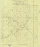 |
Map Showing Geologic Structure of Rainbow - Bonanza - Black Dragon Areas, Uintah County, Utah | 1978 | Image/StillImage | ucl_maps |
| 100 |
 |
Map1 Geologic map and sections of Newfoundland Mountains, Box Elder County, Utah (Google Earth map overlay KMZ file) | 1956-12 | Image | ir_etd |