Home
Browse
Ask Us
Chat
Harmful Language Statement
Log in
Advanced Search
Year
1914
1915
1916
1917
1918
1919
1920
1921
1922
1923
1924
1925
1926
1927
1928
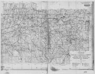
1929
1930
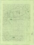
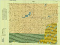
1931
1932
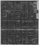
1933
1934
1935
1936
1937
1938
1939
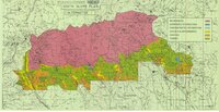
1940
1941
1942
1943
1944
1945
1946
1947
1948
1949
1950
1951
1952
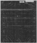
1953
1954
1955
1956
1957
1958
1959
1960
1961
1962
1963
1964
1965
1966
1967
1968
1969
1970
1971
1972
1973
1974
1975
1976
1977
1978
1979
1980
1981
1982
1983
1984
1985
1986
1987
1988
1989
1990
1991
1992
1993
1994
1995
1996
1997
1998
1999
2000
2001
2002
2003
2004
2005
2006
2007
2008
2009
TO
1914
1915
1916
1917
1918
1919
1920
1921
1922
1923
1924
1925
1926
1927
1928
1929
1930
1931
1932
1933
1934
1935
1936
1937
1938
1939
1940
1941
1942
1943
1944
1945
1946
1947
1948
1949
1950
1951
1952
1953
1954
1955
1956
1957
1958
1959
1960
1961
1962
1963
1964
1965
1966
1967
1968
1969
1970
1971
1972
1973
1974
1975
1976
1977
1978
1979
1980
1981
1982
1983
1984
1985
1986
1987
1988
1989
1990
1991
1992
1993
1994
1995
1996
1997
1998
1999
2000
2001
2002
2003
2004
2005
2006
2007
2008
2009
Type
Image/StillImage
51
Text
3
Format
image/jpeg
34
application/pdf
20
Collection
Electronic University Archive
2
Theses & Dissertations
1
Uintah County Regional History Center...
51
Filters:
Subject:
"Duchesne County"
1
-
100
of
54
Gallery view
Number of results to display per page
10
25
50
100
200
Sort by Relevance
Sort by Title A-Z
Sort by Title Z-A
Sort by Date Ascending
Sort by Date Descending
Sort by Last Modified Ascending
Sort by Last Modified Descending
Title
Date
Type
Setname
1
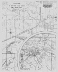
Ashley National Forest - Analysis Units - High Uintas Roadless Area Study
Image/StillImage
ucl_maps
2
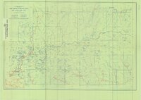
Ashley National Forest - Forest Visitor Map 1998
1998
Image/StillImage
ucl_maps
3
Ashley National Forest - Uinta National Forest - Wasatch National Forest - Manti La Sal National Forest
Image/StillImage
ucl_maps
4
Ashley National Forest - Vernal Ranger District Travel Map 1999 - Revised 2003
1999; 2003
Image/StillImage
ucl_maps
5
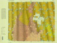
Ashley National Forest Proposed Travel Alts (Alt. C) Vernal Ranger District April 2009
2009
Image/StillImage
ucl_maps
6
Ashley National Forest Utah - Salt Lake and Uinta Special Meridians 1955
1955
Image/StillImage
ucl_maps
7
Ashley National Forest Utah and Wyoming - Salt Lake, Uinta Special, and Sixth Principal Meridians 1945
1945
Image/StillImage
ucl_maps
8
Ashley National Forest Wilderness Proposal 1967 - South Slope Plan
1967
Image/StillImage
ucl_maps
9
Ashley National Forest Wilderness Proposal 1967 - South Slope Plan - Roadless Areas - Alternative 1
1967
Image/StillImage
ucl_maps
10
Ashley National Forest Wilderness Proposal 1967 - South Slope Plan - Roadless Areas - Alternative 2
1967
Image/StillImage
ucl_maps
11
Ashley National Forest Wilderness Proposal 1967 - South Slope Plan - Roadless Areas - Alternative 3
1967
Image/StillImage
ucl_maps
12
Ashley National Forest Wilderness Proposal 1967 - South Slope Plan - Roadless Areas - Alternative 4
1967
Image/StillImage
ucl_maps
13
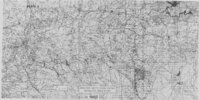
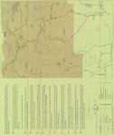
Ashley National Forest, Roosevelt and Duchesne Ranger Districts 1971
1971
Image/StillImage
ucl_maps
14
Ashley National Forest, Utah - Salt Lake and Uinta Special Meridians
1962
Image/StillImage
ucl_maps
15
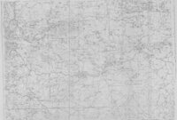
Ashley National Forest, Utah - Salt Lake and Uinta Special Meridians 1962
1962
Image/StillImage
ucl_maps
16
Ashley National Forest, Utah and Wyoming - Salt Lake, Uinta Special, and Sixth Principal Meridians 1928
1928
Image/StillImage
ucl_maps
17
Ashley National Forest, Utah and Wyoming - Salt Lake, Uinta Special, and Sixth Principal Meridians 1933
1933
Image/StillImage
ucl_maps
18
Ashley National Forest, Utah, Salt Lake and Uinta Special Meridians. 1955 - reprint of 1945 edition
1955
Image/StillImage
ucl_maps
19
Basin US DOI BLM 1977
1977
Image/StillImage
ucl_maps
20
Book Cliffs US DOI BLM 1979
1979
Image/StillImage
ucl_maps
21
Carter Military Road, Map & Brochure
Image/StillImage
ucl_maps
22
Critical Habitat Polygons for Penstemon Grahamii
Image/StillImage
ucl_maps
23
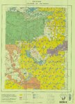
Duchesne County Road Map
2004
Image/StillImage
ucl_maps
24
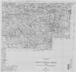
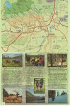
Duchesne County Tourism Map
Image/StillImage
ucl_maps
25
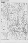
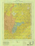
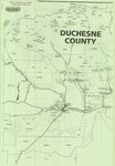
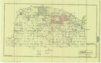
Duchesne County, Utah
Image/StillImage
ucl_maps
26
Duchesne US DOI BLM 1977
1977
Image/StillImage
ucl_maps
27
Duchesne, Duchesne County, Utah, Sanborn Map Company, April 1917
1917
Image/StillImage
ucl_maps
28
Duchesne, Duchesne County, Utah. Sanborn Map Co. April 1917. Corrected July 1931.
1914; 1931
Image/StillImage
ucl_maps
29
Ecoshale: Environmental alternative fuels
2008-11-13
Text
ir_eua
30
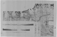
Geologic Map and Structure Sections of the Uinta River-Brush Creek Area, Duchesne and Uintah Counties, Utah
1947
Image/StillImage
ucl_maps
31
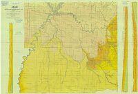
Geologic Map of Uintah County, Utah - South Half - 1950s
1950; 1951; 1952; 1953; 1954; 1955; 1956; 1957; 1958; 1959
Image/StillImage
ucl_maps
32
Geology of the Soapstone Basin and vicinity, Wasatch, Summit, and Duchesne Counties, Utah
1953-06
Text
ir_etd
33
H. Bert and Diana Jensen Home Directions
Image/StillImage
ucl_maps
34
High Uintas Primitive Area - Ashley and Wasatch National Forests, Utah 1958
1958
Image/StillImage
ucl_maps
35
Hill Creek (Planimetric) NE-17 (US DOI BLM) 1975 (revised)
1975
Image/StillImage
ucl_maps
36
Land Map for Pleasant Valley
1981
Image/StillImage
ucl_maps
37
Myton, Duchesne County, Utah - Sanborn Map Company, April 1917 - Corrected July 1931
1931
Image/StillImage
ucl_maps
38
Myton, Duchesne County, Utah; Sanborn Map Company, April 1917
1917
Image/StillImage
ucl_maps
39
Myton, Utah - 1964
1964
Image/StillImage
ucl_maps
40
Myton-Duchesne (Planimetric) NE-12 (US DOI BLM) 1977 (revised)
1977
Image/StillImage
ucl_maps
41
Ouray (Planimetric) NE-13 (US DOI BLM) 1975 (revised)
1975
Image/StillImage
ucl_maps
42
Ouray, Utah - 1964
1964
Image/StillImage
ucl_maps
43
Overburden map and thickness determinations, Sunnyside oil-impregnated sandstone deposit, Carbon and Duchesne Counties, Utah
1986
Text
ir_eua
44
Pariatte-Northwest Castle Peak Area (Ziegler Chemical & Mineral Corp)
Image/StillImage
ucl_maps
45
Partial Map of Gusher, Utah
1963; 1964
Image/StillImage
ucl_maps
46
Partial Map of Gusher, Utah
Image/StillImage
ucl_maps
47
Roosevelt, Duchesne County, Utah - Sanborn Map Company - May 1917 Corrected July 1931 Plate 1
1931
Image/StillImage
ucl_maps
48
Roosevelt, Duchesne County, Utah - Sanborn Map Company - May 1917 Corrected July 1931 Plate 2
1931
Image/StillImage
ucl_maps
49
Roosevelt, Duchesne County, Utah - Sanborn Map Company - May 1917 plate 1
1917
Image/StillImage
ucl_maps
50
Roosevelt, Duchesne County, Utah - Sanborn Map Company - May 1917 plate 2
1917
Image/StillImage
ucl_maps
51
Sunnyside (Planimetric) NE-16 (US DOI BLM) 1974
1974
Image/StillImage
ucl_maps
52
Taylor Mountain Formations
Image/StillImage
ucl_maps
53
Vernal District Recreation Map, 1969
1969
Image/StillImage
ucl_maps
54
Windy Ridge, Utah - 1964
1964
Image/StillImage
ucl_maps
1
-
100
of
54