| Title | Date | Type | Setname | ||
|---|---|---|---|---|---|
| 1126 |  | Tetons | 1936 | Image/StillImage | uum_map |
| 1127 |  | Tetons, glacial valley | 1936 | Image/StillImage | uum_map |
| 1128 | 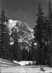 | Tetons-near Lake Solitude; pre-WWII | 1937; 1938; 1939; 1940; 1941 | uum_map_usa | |
| 1129 | 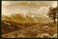 | That Grand Teton climb | 1936 | Image/StillImage | uum_map |
| 1130 |  | Theatrical production at Lyman High school, Wyoming, 1924 | 1924 | Image/StillImage | uum_map |
| 1131 | 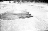 | Thermal pool | 1935; 1936; 1937; 1938; 1939; 1940; 1941; 1942; 1943; 1944; 1945; 1946; 1947; 1948; 1949; 1950 | uum_map_usa | |
| 1132 |  | Thermopolis Hot Springs - Wyoming | 1907; 1908; 1909; 1910; 1911; 1912; 1913; 1914; 1915; 1916; 1917; 1918; 1919; 1920; 1921; 1922; 1923; 1924; 1925; 1926; 1927; 1928; 1929; 1930; 1931; 1932; 1933; 1934; 1935 | Image/StillImage | uum_map |
| 1133 |  | Thermopolis Hot Springs - Wyoming | 1907; 1908; 1909; 1910; 1911; 1912; 1913; 1914; 1915; 1916; 1917; 1918; 1919; 1920; 1921; 1922; 1923; 1924; 1925; 1926; 1927; 1928; 1929; 1930; 1931; 1932; 1933; 1934; 1935 | Image/StillImage | uum_map |
| 1134 |  | Thermopolis Hot Springs - Wyoming | 1907; 1908; 1909; 1910; 1911; 1912; 1913; 1914; 1915; 1916; 1917; 1918; 1919; 1920; 1921; 1922; 1923; 1924; 1925; 1926; 1927; 1928; 1929; 1930; 1931; 1932; 1933; 1934; 1935 | Image/StillImage | uum_map |
| 1135 |  | Thumb, Yellowstone Lake, Yellowstone National Park, Wyoming | 1920; 1921; 1922; 1923; 1924 | Image/StillImage | uum_map |
| 1136 | 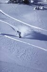 | Tina Dixon snowboarding at Togwotee Pass, WY, 1998. | 1998 | Image | uum_map_usa |
| 1137 |  | Tina Dixon snowboarding at Togwotee Pass, WY, 1998. | 1998 | Image | uum_map_usa |
| 1138 |  | Topographical Map of the Road From Missouri To Oregon Commencing at the Mouth of the Kansas in the Missouri River and Ending at the Mouth of the Wallah-Wallah in the Columbia. Section 3 | 1846 | Image/StillImage | uu_awm |
| 1139 |  | Topographical Map of the Road From Missouri To Oregon Commencing at the Mouth of the Kansas in the Missouri River and Ending at the Mouth of the Wallah-Wallah in the Columbia. Section 4 | 1846 | Image/StillImage | uu_awm |
| 1140 |  | Topographical Map of the Road From Missouri To Oregon Commencing at the Mouth of the Kansas in the Missouri River and Ending at the Mouth of the Wallah-Wallah in the Columbia. Section 5 | 1846 | Image/StillImage | uu_awm |
| 1141 |  | Tourist Group at Grotto - Upper Geyser Basin | 1908-08-15 | Image | dha_scp |
| 1142 |  | Tourists at Castle Geyser - Upper Geyser Basin | 1908-08-16 | Image | dha_scp |
| 1143 |  | Tourists at Giant Basin - Upper Geyser Basin | 1908-08-16 | Image | dha_scp |
| 1144 | 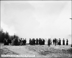 | Tourists at Grotto Geyser - Upper Geyser Basin | 1908-08 | Image | dha_scp |
| 1145 |  | Tourists at Lion and Lioness - Upper Geyser Basin | 1908-08-16 | Image | dha_scp |
| 1146 |  | Tourists at Upper Geyser Basin | 1908-08-16 | Image | dha_scp |
| 1147 | 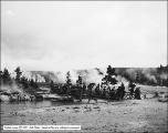 | Tourists Crossing Firehole River | 1908-08 | Image | dha_scp |
| 1148 |  | Tower Fall, Yellowstone | 1930; 1931; 1932; 1933; 1934; 1935; 1936; 1937; 1938; 1939; 1940 | Image/StillImage | uum_map |
| 1149 | 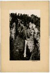 | Tower Falls | 1930; 1931; 1932; 1933; 1934; 1935; 1936; 1937; 1938; 1939; 1940 | Image/StillImage | uum_map |
| 1150 |  | Tree in solid rock, Wyoming | 1940; 1941; 1942; 1943; 1944; 1945; 1946; 1947; 1948; 1949; 1950; 1951; 1952; 1953; 1954; 1955; 1956; 1957; 1958; 1959 | Image | uum_map |