| Title | Date | Type | Setname | ||
|---|---|---|---|---|---|
| 276 |  | Letter to Col. F.H. Head from A. Carter dated January 11, 1868 | 1868-01-11 | Image/StillImage | uaida_main |
| 277 |  | Look out I am coming. Jackson Hole, Wyoming | 1920; 1921; 1922; 1923; 1924 | Image/StillImage | uum_map |
| 278 |  | Look out I am coming. Jackson Hole, Wyoming | 1920; 1921; 1922; 1923; 1924 | Image/StillImage | uum_map |
| 279 | 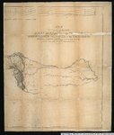 | Map of an exploring expedition to the Rocky Mountains in the year 1842 and to Oregon & North California in the years 1843-44 | 1845 | Image/StillImage | uu_awm |
| 280 |  | Map of Indian Reservation in the West, 1929 | Image/StillImage | uaida_main | |
| 281 | 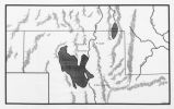 | Map of Northern Utah, Early Settlements | Image/StillImage | uaida_main | |
| 282 |  | Map of Shoshone, Goshute, Bannock, Wind River and Panamint Indian Tribal Groups | 1957 | Image/StillImage | uaida_main |
| 283 |  | Map of the South West Boundary of the Uintah Indian Reserve Utah Territory | 1920; 1921; 1922; 1923; 1924; 1925; 1926; 1927; 1928; 1929; 1930; 1931; 1932; 1933; 1934; 1935; 1936; 1937; 1938; 1939; 1940 | Image/StillImage | uaida_main |
| 284 |  | Map of Western Indian Territory Before 1850 | Image/StillImage | uaida_main | |
| 285 |  | Map showing the boundary of the Shoshone Indian territory | 1941 | Image/StillImage | uaida_main |
| 286 | 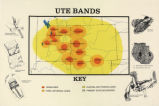 | Map titled "Ute Bands Map" | Image/StillImage | uaida_main | |
| 287 | 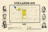 | Map titled "Ute Lands, 1876" | Image/StillImage | uaida_main | |
| 288 | 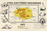 | Map titled, "Utes and Their Neighbors" | Image/StillImage | uaida_main | |
| 289 |  | Marriner Eccles and friends [02] | 1930; 1931; 1932; 1933; 1934; 1935; 1936; 1937; 1938; 1939; 1940; 1941; 1942; 1943; 1944; 1945; 1946; 1947; 1948; 1949; 1950; 1951; 1952; 1953; 1954; 1955; 1956; 1957; 1958; 1959; 1960 | Image/StillImage | uum_map |
| 290 |  | Marvin and Tony in Jackson Lake area, 1977 | 1977 | Image/StillImage | uum_map |
| 291 | 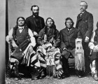 | Matchie, Shavano, Utoka, & others | 1880 | Image/StillImage | uaida_main |
| 292 |  | Meandering Stream - Yellowstone NP | 1910; 1911; 1912; 1913; 1914; 1915; 1916; 1917; 1918; 1919; 1920; 1921; 1922; 1923; 1924; 1925; 1926; 1927; 1928; 1929; 1930; 1931; 1932; 1933; 1934; 1935 | Image/StillImage | uum_map |
| 293 |  | Mobile home park by Bear River, Evanston, Wyoming (negative) [1] | 2002-04-25 | Image/StillImage | uum_map |
| 294 |  | Mobile home park by Bear River, Evanston, Wyoming (negative) [2] | 2002-04-25 | Image/StillImage | uum_map |
| 295 |  | Mobile home park by Bear River, Evanston, Wyoming (negative) [3] | 2002-04-25 | Image/StillImage | uum_map |
| 296 | 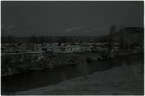 | Mobile home park by Bear River, Evanston, Wyoming (negative) [4] | 2002-04-25 | Image/StillImage | uum_map |
| 297 | 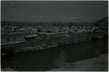 | Mobile home park by Bear River, Evanston, Wyoming (negative) [5] | 2002-04-25 | Image/StillImage | uum_map |
| 298 |  | Mobile home park by Bear River, Evanston, Wyoming (negative) [6] | 2002-04-25 | Image/StillImage | uum_map |
| 299 | 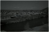 | Mobile home park by Bear River, Evanston, Wyoming (negative) [7] | 2002-04-25 | Image/StillImage | uum_map |
| 300 |  | Moose Falls 1918 | 1918 | Image/StillImage | uum_map |