TO
Filters: Spatial Coverage: "West (U.S.)"
| Title | Date | Type | Setname | ||
|---|---|---|---|---|---|
| 1 |
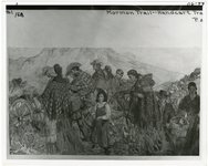 |
"Mormon Trail, handcart travel" | 1856; 1857; 1858; 1859; 1860 | uum_map | |
| 2 |
 |
A Primer on Stone Age Glyphs | 1942 | Text | dc_bpc |
| 3 |
 |
A turning point for the Bureau of Land Management | 2013-12-18 | Text | uum_mlds_public |
| 4 |
 |
Aerial view of river and house. | 1940; 1941; 1942; 1943; 1944; 1945; 1946; 1947; 1948; 1949; 1950; 1951; 1952; 1953; 1954; 1955; 1956; 1957; 1958; 1959; 1960; 1961; 1962; 1963; 1964; 1965; 1966; 1967; 1968; 1969; 1970; 1971; 1972; 1973; 1974; 1975; 1976; 1977; 1978; 1979; 1980 | Image | uum_map |
| 5 |
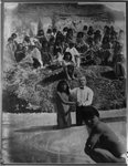 |
Baptizing Indians. | 1850; 1851; 1852; 1853; 1854; 1855; 1856; 1857; 1858; 1859; 1860 | uum_map | |
| 6 |
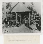 |
Camp Party, 1888 | 1888 | Image | uum_map |
| 7 |
 |
Church of Jesus Christ of Latter -day Saints Journal History dated May 14, 1849 | 1849-05-14 | Text | uaida_main |
| 8 |
 |
Church of Jesus Christ of Latter-day Saints Journal History dated May 8, 1853 | 1853-05-08 | Text | uaida_main |
| 9 |
 |
Church of Jesus Christ of Latter-day Saints Journal History December 2, 1857 | 1857-12-02 | Text | uaida_main |
| 10 |
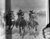 |
Cowboys [1] | 1870; 1871; 1872; 1873; 1874; 1875; 1876; 1877; 1878; 1879; 1880; 1881; 1882; 1883; 1884; 1885; 1886; 1887; 1888; 1889; 1890; 1891; 1892; 1893; 1894; 1895; 1896; 1897; 1898; 1899 | uum_map | |
| 11 |
 |
Cowboys [2] | 1870; 1871; 1872; 1873; 1874; 1875; 1876; 1877; 1878; 1879; 1880; 1881; 1882; 1883; 1884; 1885; 1886; 1887; 1888; 1889; 1890; 1891; 1892; 1893; 1894; 1895; 1896; 1897; 1898; 1899 | uum_map | |
| 12 |
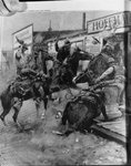 |
Cowboys [3] | 1870; 1871; 1872; 1873; 1874; 1875; 1876; 1877; 1878; 1879; 1880; 1881; 1882; 1883; 1884; 1885; 1886; 1887; 1888; 1889; 1890; 1891; 1892; 1893; 1894; 1895; 1896; 1897; 1898; 1899 | uum_map | |
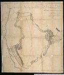
| 13 |
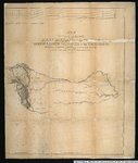
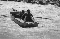 |
Dallas Wayne Nichol on cataract boat | 1940; 1941; 1942; 1943; 1944; 1945; 1946; 1947; 1948; 1949; 1950; 1951; 1952; 1953; 1954; 1955; 1956; 1957; 1958; 1959; 1960 | uum_map_usa | |
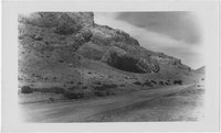
| 14 |
 |
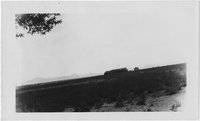
Desert landscape with mesas | 1945; 1946; 1947; 1948; 1949; 1950; 1951; 1952; 1953; 1954; 1955; 1956; 1957; 1958; 1959; 1960; 1961; 1962; 1963; 1964; 1965; 1966; 1967; 1968; 1969; 1970; 1971; 1972; 1973; 1974; 1975; 1976; 1977; 1978; 1979; 1980 | Image | uum_map |
| 15 |
 |
Diary of Bathsheba W. Bigler Smith | 1849 | Text | uu_awm |
| 16 |
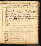 |
Diary of John Boylston Fairbanks | 1838; 1846; 1847 | Text | uu_awm |
| 17 |
 |
Diary of Joseph C. Kingsbury | 1846; 1847; 1848; 1849; 1850; 1851; 1852; 1853; 1854; 1855; 1856; 1857; 1858; 1859; 1860; 1861; 1862; 1863; 1864; 1865; 1866; 1867; 1868; 1869; 1870; 1871; 1872; 1873; 1874; 1875; 1876; 1877; 1878; 1879; 1880; 1881; 1882; 1883; 1884; 1885; 1886; 1887; 1888; 1889; 1890; 1891; 1892; 1893 | Text | uu_awm |
| 18 |
 |
Diary of Lucia Eugenia Lamb Everett | 1862 | Text | uu_awm |
| 19 |
 |
Excerpt from the History of Brigham Young dated May 30, 1854 | 1854-05-30 | Text | uaida_main |
| 20 |
 |
Exploration routes and trails--Spanish, 1512-1675, 1675-1811 | 1982 | Image/StillImage | uaida_main |
| 21 |
 |
Exploration routes and trails: 1800-1820, and 1820-1835 | 1982 | Image/StillImage | uaida_main |
| 22 |
 |
Fremont Map. | 1910; 1911; 1912; 1913; 1914; 1915; 1916; 1917; 1918; 1919; 1920; 1921; 1922; 1923; 1924; 1925; 1926; 1927; 1928; 1929; 1930; 1931; 1932; 1933; 1934; 1935; 1936; 1937; 1938; 1939 | Image | uum_map |
| 23 |
 |
Journal kept by George B. Sanderson, Ast. Surgeon, United States Army from Fort Leavenworth, Missouri, to Santa Fe, New Mexico and to San Diego, Upper California, and back to the United States in the years 1846 & 1847 | 1846; 1847 | uum_manu | |
| 24 |
 |
Journal kept by George B. Sanderson, Ast. Surgeon, United States Army from Fort Leavenworth, Missouri, to Santa Fe, New Mexico and to San Diego, Upper California, and back to the United States in the years 1846 & 1847 [transcript] | 1895 | uum_manu | |
| 25 |
 |
Journal of Energy Law and Policy Vol. 09 1988-89 | 1988 | Text | uu_law_clp |
| 26 |
 |
Journal of Land, Resources & Environmental Law Volume 17 No. 1 1997 | 1997 | Text | uu_law_clp |
| 27 |
 |
Journal of Land, Resources & Environmental Law Volume 19 No. 2 1999 | 1999 | Text | uu_law_clp |
| 28 |
 |
Journal of Land, Resources & Environmental Law Volume 20 No. 1 2000 | 2000 | Text | uu_law_clp |
| 29 |
 |
Journal of Land, Resources & Environmental Law Volume 21 No. 1 2001 | 2001 | Text | uu_law_clp |
| 30 |
 |
Journal of Land, Resources & Environmental Law Volume 21 No. 2A 2001 | 2001 | Text | uu_law_clp |
| 31 |
 |
Journal of Land, Resources & Environmental Law Volume 21 No. 2B 2001 | 2001 | Text | uu_law_clp |
| 32 |
 |
Journal of Land, Resources & Environmental Law Volume 23 No. 1 2003 | 2003 | Text | uu_law_clp |
| 33 |
 |
Journal of Land, Resources & Environmental Law Volume 26 No. 1 2006 | 2006 | Text | uu_law_clp |
| 34 |
 |
Journal of Land, Resources, and Environmental Law Vol. 24 No. 1 2004 | 2004 | Text | uu_law_clp |
| 35 |
 |
Letter from J.H. Holeman to Brigham Young dated September 30, 1853 | 1853-09-30 | Text | uaida_main |
| 36 |
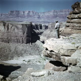 |
Man looking down at river with mesa in background | 1945; 1946; 1947; 1948; 1949; 1950; 1951; 1952; 1953; 1954; 1955; 1956; 1957; 1958; 1959; 1960; 1961; 1962; 1963; 1964; 1965; 1966; 1967; 1968; 1969; 1970; 1971; 1972; 1973; 1974; 1975; 1976; 1977; 1978; 1979; 1980 | Image | uum_map |
| 37 |
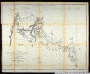 |
Map exhibiting the routes between Fort Dalles and the Great Salt Lake. | 1859 | Image/StillImage | uu_awm |
| 38 |
 |
Map no. 2, from the mouth of Trap Creek to the Santa Fe crossing. | 1855 | Image/StillImage | uu_awm |
| 39 |
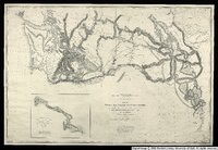 |
Map no. 3, Rocky Mountains to Puget Sound. | 1855 | Image/StillImage | uu_awm |
| 40 |
 |
Map of an exploring expedition to the Rocky Mountains in the year 1842 and to Oregon & North California in the years 1843-4 | 1845 | Image/StillImage | uu_awm |
| 41 |
 |
Map of an exploring expedition to the Rocky Mountains in the year 1842 and to Oregon & North California in the years 1843-44 | 1845 | Image/StillImage | uu_awm |
| 42 |
 |
Marriner S. Eccles, general correspondence, 1951 - 1977: R [02] | 1957; 1959; 1960; 1965; 1968; 1969; 1970; 1971; 1973 | Text | uum_msep |
| 43 |
 |
Miscellaneous, Western landscapes [01] | 1940; 1941; 1942; 1943; 1944; 1945; 1946; 1947; 1948; 1949; 1950; 1951; 1952; 1953; 1954; 1955; 1956; 1957; 1958; 1959 | Image | uum_map |
| 44 |
 |
Miscellaneous, Western landscapes [02] | 1940; 1941; 1942; 1943; 1944; 1945; 1946; 1947; 1948; 1949; 1950; 1951; 1952; 1953; 1954; 1955; 1956; 1957; 1958; 1959 | Image | uum_map |
| 45 |
 |
Miscellaneous, Western landscapes [03] | 1940; 1941; 1942; 1943; 1944; 1945; 1946; 1947; 1948; 1949; 1950; 1951; 1952; 1953; 1954; 1955; 1956; 1957; 1958; 1959 | Image | uum_map |
| 46 |
 |
Miscellaneous, Western landscapes [04] | 1940; 1941; 1942; 1943; 1944; 1945; 1946; 1947; 1948; 1949; 1950; 1951; 1952; 1953; 1954; 1955; 1956; 1957; 1958; 1959 | Image | uum_map |
| 47 |
 |
Miscellaneous, Western landscapes [05] | 1940; 1941; 1942; 1943; 1944; 1945; 1946; 1947; 1948; 1949; 1950; 1951; 1952; 1953; 1954; 1955; 1956; 1957; 1958; 1959 | Image | uum_map |
| 48 |
 |
Mountain scenery [01] | 1928; 1929; 1930; 1931; 1932; 1933 | uum_map | |
| 49 |
 |
Mountain scenery [02] | 1928; 1929; 1930; 1931; 1932; 1933 | uum_map | |
| 50 |
 |
Mountain scenery [03] | 1928; 1929; 1930; 1931; 1932; 1933 | uum_map | |
| 51 |
 |
Mountain scenery [04] | 1928; 1929; 1930; 1931; 1932; 1933 | uum_map | |
| 52 |
 |
Mountain scenery [05] | 1928; 1929; 1930; 1931; 1932; 1933 | uum_map | |
| 53 |
 |
Mountain scenery [06] | 1928; 1929; 1930; 1931; 1932; 1933 | uum_map | |
| 54 |
 |
Mountain scenery [07] | 1928; 1929; 1930; 1931; 1932; 1933 | uum_map | |
| 55 |
 |
Mountain scenery [08] | 1928; 1929; 1930; 1931; 1932; 1933 | uum_map | |
| 56 |
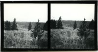 |
Mountain scenery [09] | 1928; 1929; 1930; 1931; 1932; 1933 | uum_map | |
| 57 |
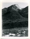 |
Mountain scenery [10] | 1928; 1929; 1930; 1931; 1932; 1933 | uum_map | |
| 58 |
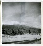 |
Mountain scenery [11] | 1928; 1929; 1930; 1931; 1932; 1933 | uum_map | |
| 59 |
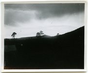 |
Mountain scenery [12] | 1928; 1929; 1930; 1931; 1932; 1933 | uum_map | |
| 60 |
 |
Mountain scenery [13] | 1928; 1929; 1930; 1931; 1932; 1933 | uum_map | |
| 61 |
 |
Mountain scenery [14] | 1928; 1929; 1930; 1931; 1932; 1933 | uum_map | |
| 62 |
 |
Mountain scenery [15] | 1928; 1929; 1930; 1931; 1932; 1933 | uum_map | |
| 63 |
 |
Mountain scenery [16] | 1928; 1929; 1930; 1931; 1932; 1933 | uum_map | |
| 64 |
 |
Mountain scenery [17] | 1928; 1929; 1930; 1931; 1932; 1933 | uum_map | |
| 65 |
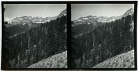 |
Mountain scenery [18] | 1928; 1929; 1930; 1931; 1932; 1933 | uum_map | |
| 66 |
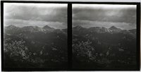 |
Mountain scenery [19] | 1928; 1929; 1930; 1931; 1932; 1933 | uum_map | |
| 67 |
 |
Mountain scenery [20] | 1928; 1929; 1930; 1931; 1932; 1933 | uum_map | |
| 68 |
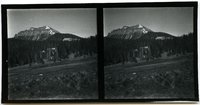 |
Mountain scenery [21] | 1928; 1929; 1930; 1931; 1932; 1933 | uum_map | |
| 69 |
 |
Mountain scenery [22] | 1928; 1929; 1930; 1931; 1932; 1933 | uum_map | |
| 70 |
 |
Mountain scenery [23] | 1928; 1929; 1930; 1931; 1932; 1933 | uum_map | |
| 71 |
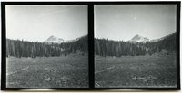 |
Mountain scenery [24] | 1928; 1929; 1930; 1931; 1932; 1933 | uum_map | |
| 72 |
 |
Mountain scenery [25] | 1928; 1929; 1930; 1931; 1932; 1933 | uum_map | |
| 73 |
 |
Mountain scenery [26] | 1928; 1929; 1930; 1931; 1932; 1933 | uum_map | |
| 74 |
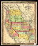 |
New map of the state of California, the territories of Oregon, Washington, Utah & New Mexico. | 1853 | Image/StillImage | uu_awm |
| 75 |
 |
Of Pride and Politics: Brigham Young as Indian Superintendent | 1878 | Text | uaida_main |
| 76 |
 |
Open Hand and Mailed Fist: Mormon-Indian Relations In Utah, 1847-52 | 1978 | Text | uaida_main |
| 77 |
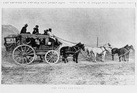 |
Overland coach | 1850; 1851; 1852; 1853; 1854; 1855; 1856; 1857; 1858; 1859; 1860 | uum_map | |
| 78 |
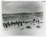 |
Overland trail | 1850; 1851; 1852; 1853; 1854; 1855; 1856; 1857; 1858; 1859; 1860 | uum_map | |
| 79 |
 |
Policty Analysis of Produced Water Issues Associated with In-Situ Thermal Technologies | 2011-01 | Text | ir_uspace |
| 80 |
 |
Policty Analysis of Water Availability and Use Issues for Domestic Oil Shale and Oil Sands Development | 2012-03 | Text | ir_uspace |
| 81 |
 |
Policy Analysis of Produced Water Issues Associated with In-Situ Thermal Technologies | 2011-01 | Text | uu_law_clp |
| 82 |
 |
Policy Analysis of Water Availability and Use Issues for Domestic Oil Shale and Oil Sands Development | 2012-03 | Text | uu_law_clp |
| 83 |
 |
Stalagmites and stalactites in unidentified cave [1] | 1937; 1938; 1939; 1940; 1941; 1942; 1943; 1944; 1945; 1946; 1947; 1948; 1949; 1950; 1951; 1952; 1953; 1954; 1955; 1956; 1957; 1958; 1959; 1960; 1961; 1962; 1963; 1964; 1965; 1966; 1967; 1968; 1969; 1970; 1971; 1972; 1973; 1974; 1975; 1976; 1977; 1978; 1979; 1980 | Image | uum_map_rr |
| 84 |
 |
Stalagmites and stalactites in unidentified cave [2] | 1937; 1938; 1939; 1940; 1941; 1942; 1943; 1944; 1945; 1946; 1947; 1948; 1949; 1950; 1951; 1952; 1953; 1954; 1955; 1956; 1957; 1958; 1959; 1960; 1961; 1962; 1963; 1964; 1965; 1966; 1967; 1968; 1969; 1970; 1971; 1972; 1973; 1974; 1975; 1976; 1977; 1978; 1979; 1980 | Image | uum_map_rr |
| 85 |
 |
Stalagmites and stalactites in unidentified cave [3] | 1937; 1938; 1939; 1940; 1941; 1942; 1943; 1944; 1945; 1946; 1947; 1948; 1949; 1950; 1951; 1952; 1953; 1954; 1955; 1956; 1957; 1958; 1959; 1960; 1961; 1962; 1963; 1964; 1965; 1966; 1967; 1968; 1969; 1970; 1971; 1972; 1973; 1974; 1975; 1976; 1977; 1978; 1979; 1980 | Image | uum_map_rr |
| 86 |
 |
Sunset on the desert | 1930; 1931; 1932; 1933; 1934; 1935; 1936; 1937; 1938; 1939; 1940; 1941; 1942; 1943; 1944; 1945 | Image | uum_map |
| 87 |
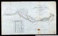 |
Topographical Map of the Road From Missouri To Oregon Commencing at the Mouth of the Kansas in the Missouri River and Ending at the Mouth of the Wallah-Wallah in the Columbia. Section 1 | 1846 | Image/StillImage | uu_awm |
| 88 |
 |
Topographical Map of the Road From Missouri To Oregon Commencing at the Mouth of the Kansas in the Missouri River and Ending at the Mouth of the Wallah-Wallah in the Columbia. Section 2 | 1846 | Image/StillImage | uu_awm |
| 89 |
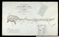 |
Topographical Map of the Road From Missouri To Oregon Commencing at the Mouth of the Kansas in the Missouri River and Ending at the Mouth of the Wallah-Wallah in the Columbia. Section 3 | 1846 | Image/StillImage | uu_awm |
| 90 |
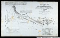 |
Topographical Map of the Road From Missouri To Oregon Commencing at the Mouth of the Kansas in the Missouri River and Ending at the Mouth of the Wallah-Wallah in the Columbia. Section 4 | 1846 | Image/StillImage | uu_awm |
| 91 |
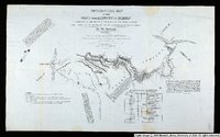 |
Topographical Map of the Road From Missouri To Oregon Commencing at the Mouth of the Kansas in the Missouri River and Ending at the Mouth of the Wallah-Wallah in the Columbia. Section 5 | 1846 | Image/StillImage | uu_awm |
| 92 |
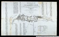 |
Topographical Map of the Road From Missouri To Oregon Commencing at the Mouth of the Kansas in the Missouri River and Ending at the Mouth of the Wallah-Wallah in the Columbia. Section 7 | 1846 | Image/StillImage | uu_awm |
| 93 |
 |
Trappers and Indians [1] | 1800; 1801; 1802; 1803; 1804; 1805; 1806; 1807; 1808; 1809; 1810; 1811; 1812; 1813; 1814; 1815; 1816; 1817; 1818; 1819; 1820; 1821; 1822; 1823; 1824; 1825; 1826; 1827; 1828; 1829; 1830; 1831; 1832; 1833; 1834; 1835; 1836; 1837; 1838; 1839; 1840; 1841; 1842; 1843; 1844; 1845; 1846; 1847; 1848; 1849; ... | uum_map | |
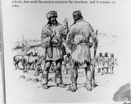
| 94 |
 |
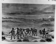
Trappers and Indians [2] | 1800; 1801; 1802; 1803; 1804; 1805; 1806; 1807; 1808; 1809; 1810; 1811; 1812; 1813; 1814; 1815; 1816; 1817; 1818; 1819; 1820; 1821; 1822; 1823; 1824; 1825; 1826; 1827; 1828; 1829; 1830; 1831; 1832; 1833; 1834; 1835; 1836; 1837; 1838; 1839; 1840; 1841; 1842; 1843; 1844; 1845; 1846; 1847; 1848; 1849; ... | uum_map | |
| 95 |
 |
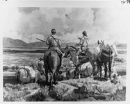
Trappers and Indians [4] | 1800; 1801; 1802; 1803; 1804; 1805; 1806; 1807; 1808; 1809; 1810; 1811; 1812; 1813; 1814; 1815; 1816; 1817; 1818; 1819; 1820; 1821; 1822; 1823; 1824; 1825; 1826; 1827; 1828; 1829; 1830; 1831; 1832; 1833; 1834; 1835; 1836; 1837; 1838; 1839; 1840; 1841; 1842; 1843; 1844; 1845; 1846; 1847; 1848; 1849; ... | uum_map | |
| 96 |
 |
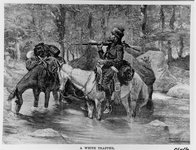
Trappers and Indians [5] | 1800; 1801; 1802; 1803; 1804; 1805; 1806; 1807; 1808; 1809; 1810; 1811; 1812; 1813; 1814; 1815; 1816; 1817; 1818; 1819; 1820; 1821; 1822; 1823; 1824; 1825; 1826; 1827; 1828; 1829; 1830; 1831; 1832; 1833; 1834; 1835; 1836; 1837; 1838; 1839; 1840; 1841; 1842; 1843; 1844; 1845; 1846; 1847; 1848; 1849; ... | uum_map | |
| 97 |
 |
Trappers and Indians [6] | 1800; 1801; 1802; 1803; 1804; 1805; 1806; 1807; 1808; 1809; 1810; 1811; 1812; 1813; 1814; 1815; 1816; 1817; 1818; 1819; 1820; 1821; 1822; 1823; 1824; 1825; 1826; 1827; 1828; 1829; 1830; 1831; 1832; 1833; 1834; 1835; 1836; 1837; 1838; 1839; 1840; 1841; 1842; 1843; 1844; 1845; 1846; 1847; 1848; 1849; ... | uum_map | |
| 98 |
 |
Trappers and Indians [7] | 1800; 1801; 1802; 1803; 1804; 1805; 1806; 1807; 1808; 1809; 1810; 1811; 1812; 1813; 1814; 1815; 1816; 1817; 1818; 1819; 1820; 1821; 1822; 1823; 1824; 1825; 1826; 1827; 1828; 1829; 1830; 1831; 1832; 1833; 1834; 1835; 1836; 1837; 1838; 1839; 1840; 1841; 1842; 1843; 1844; 1845; 1846; 1847; 1848; 1849; ... | uum_map | |
| 99 |
 |
Trappers and Indians [8] | 1840; 1841; 1842; 1843; 1844; 1845; 1846; 1847; 1848; 1849; 1850; 1851; 1852; 1853; 1854; 1855; 1856; 1857; 1858; 1859; 1860; 1861; 1862; 1863; 1864; 1865; 1866; 1867; 1868; 1869; 1870 | uum_map | |
| 100 |
 |
Unidentified desert scene with distant rock formations | 1950; 1951; 1952; 1953; 1954; 1955; 1956; 1957; 1958; 1959; 1960; 1961; 1962; 1963; 1964; 1965; 1966; 1967; 1968; 1969; 1970; 1971; 1972; 1973; 1974; 1975; 1976; 1977; 1978; 1979; 1980 | Image | uum_map_rr |
