|
|
Title | Date | Type | Setname |
| 601 |
 |
Sandstone in Chinle marls, Springdale, 1936. | 1936 | Image | uum_map |
| 602 |
 |
Sandstone ledges in upper part of Moenkopi. Shinarump conglomerate at extreme top. Rockville, Washington County, Utah, 1936. | 1936 | Image | uum_map |
| 603 |
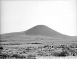 |
Santa Clara Creek | 1931-10-17 | Image | dc_bpc |
| 604 |
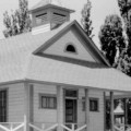 |
Santa Clara Indian Agency; Santa Clara, Washington County, Utah | 1936 | Image/StillImage | uaida_main |
| 605 |
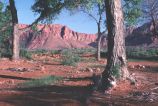 |
Santa Clara Valley and Red Mountains, Washington County, Utah | 1950; 1951; 1952; 1953; 1954; 1955; 1956; 1957; 1958; 1959; 1960; 1961; 1962; 1963; 1964; 1965; 1966; 1967; 1968; 1969; 1970; 1971; 1972; 1973; 1974; 1975; 1976; 1977; 1978; 1979; 1980 | Image | uum_map_rr |
| 606 |
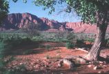 |
Santa Clara Valley and Red Mountains, Washington County, Utah [1] | 1950; 1951; 1952; 1953; 1954; 1955; 1956; 1957; 1958; 1959; 1960; 1961; 1962; 1963; 1964; 1965; 1966; 1967; 1968; 1969; 1970; 1971; 1972; 1973; 1974; 1975; 1976; 1977; 1978; 1979; 1980 | Image | uum_map_rr |
| 607 |
 |
Santa Clara Valley and Red Mountains, Washington County, Utah [3] | 1950; 1951; 1952; 1953; 1954; 1955; 1956; 1957; 1958; 1959; 1960; 1961; 1962; 1963; 1964; 1965; 1966; 1967; 1968; 1969; 1970; 1971; 1972; 1973; 1974; 1975; 1976; 1977; 1978; 1979; 1980 | Image | uum_map_rr |
| 608 |
 |
Santa Clara, 20 miles west of St. George, UT. New canyon cut through lava fill of old valley. Washington County, UT. 1922 | 1922 | Image | uum_map |
| 609 |
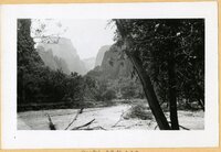 |
Scenes in Zion Canyon, 1920s [01] | 1920; 1921; 1922; 1923 | | uum_map |
| 610 |
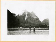 |
Scenes in Zion Canyon, 1920s [02] | 1920; 1921; 1922; 1923 | | uum_map |
| 611 |
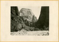 |
Scenes in Zion Canyon, 1920s [03] | 1920; 1921; 1922; 1923 | | uum_map |
| 612 |
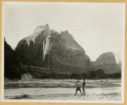 |
Scenes in Zion Canyon, 1920s [04] | 1920; 1921; 1922; 1923 | | uum_map |
| 613 |
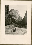 |
Scenes in Zion Canyon, 1920s [05] | 1920; 1921; 1922; 1923 | | uum_map |
| 614 |
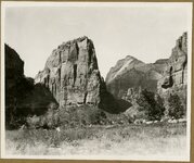 |
Scenes in Zion Canyon, 1920s [06] | 1920; 1921; 1922; 1923 | | uum_map |
| 615 |
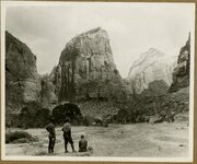 |
Scenes in Zion Canyon, 1920s [07] | 1920; 1921; 1922; 1923 | | uum_map |
| 616 |
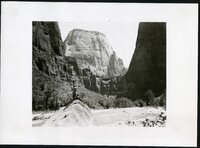 |
Scenes in Zion Canyon, 1920s [08] | 1920; 1921; 1922; 1923 | | uum_map |
| 617 |
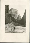 |
Scenes in Zion Canyon, 1920s [09] | 1920; 1921; 1922; 1923 | | uum_map |
| 618 |
 |
Scenes in Zion Canyon, 1920s [10] | 1920; 1921; 1922; 1923 | | uum_map |
| 619 |
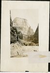 |
Scenes in Zion Canyon, 1920s [11] | 1920; 1921; 1922; 1923 | | uum_map |
| 620 |
 |
Scenes toward St. George [1] | 1950-07-12 | Image | dc_bpc |
| 621 |
 |
Scenes toward St. George [2] | 1950-07-12 | Image | dc_bpc |
| 622 |
 |
Scenes toward St. George [3] | 1950-07-12 | Image | dc_bpc |
| 623 |
 |
Scenes toward St. George [4] | 1950-07-12 | Image | dc_bpc |
| 624 |
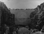 |
Settlers building the Enterprise Dam in southwestern Utah, ca. 1910. | 1910 | Image | uum_map |
| 625 |
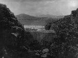 |
Settlers building the Enterprise Dam in southwestern Utah, ca. 1910. | 1910 | Image | uum_map |
| 626 |
 |
Seven Sisters quilt, by Lorraine Elder Pennington | 1930; 1931; 1932; 1933; 1934; 1935; 1936; 1937; 1938; 1939 | Text | uum_uqhr |
| 627 |
 |
Shale formation where fossils are found. Near the Pine Creek bridge at the base of the switchboard on new Mt. Carmel road, Zion Canyon. | 1930; 1931; 1932; 1933; 1934; 1935; 1936; 1937 | Image | uum_map |
| 628 |
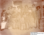 |
Shebit Indian School | | Image | wc_pc |
| 629 |
 |
Shinarump conglomerate at mouth of Parunuweap Canyon, Washington County, Utah, 1936. | 1936 | Image | uum_map |
| 630 |
 |
Shivwits home; Santa Clara, Washington County, Utah | 1936 | Image/StillImage | uaida_main |
| 631 |
 |
Shivwits Indian Agency and School | 1920-05-20 | Image | wc_pc |
| 632 |
 |
Shivwits Indian School | 1918-11-29 | Image | wc_pc |
| 633 |
 |
Shnabkaib member (left) and upper red beds of Moenkopi formation, Taylor Creek. Washington County, UT, 1940 | 1940 | Image | uum_map |
| 634 |
 |
Shoal Creek Dam : Equalizing reservoir no. 1 on Shoal Creek [and] Equalizing reservoir no. 2 on Shoal Creek | 1930; 1931; 1932 | Image/StillImage | uum_map |
| 635 |
 |
Shoal Creek Dam : Excavation for Shoal Creek diversion dam above Enterprise [and] The same after dam was finally completed | 1930; 1931; 1932 | Image/StillImage | uum_map |
| 636 |
 |
Shoal Creek Dam : Looking up stream through spillway of Shoal Creek diversion dam [and] The same looking down stream | 1930; 1931; 1932 | Image/StillImage | uum_map |
| 637 |
 |
Side canyon from highway in Zion National Park | 1974-04-16 | Image | uum_map |
| 638 |
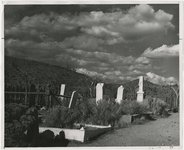 |
Silver Reef graveyard | 1950; 1951; 1952; 1953; 1954; 1955; 1956; 1957; 1958; 1959; 1960 | Image | uum_map |
| 639 |
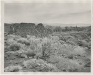 |
Silver Reef, 1951 | 1951 | Image | uum_map |
| 640 |
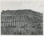 |
Silver Reef, 1951 | 1951 | Image | uum_map |
| 641 |
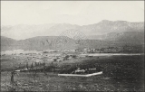 |
Silver Reef, Washington Co., Utah. Given to RJ [Rufus Johnson?] by Mr. Pendleton, whose childhood was spent at Silver Reef. | 1890; 1891; 1892; 1893; 1894; 1895; 1896; 1897; 1898; 1899; 1900; 1901; 1902; 1903; 1904; 1905; 1906; 1907; 1908; 1909; 1910; 1911; 1912; 1913; 1914; 1915; 1916; 1917; 1918; 1919; 1920; 1921; 1922; 1923; 1924; 1925; 1926; 1927; 1928; 1929; 1930; 1931; 1932; 1933; 1934; 1935; 1936; 1937; 1938; 1939; ... | | uum_map |
| 642 |
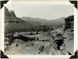 |
Site of Springdale, Virgin River Valley, below mouth of Zion Canyon. At left, the Watchman. Navajo sandstone, underlaid by Chinle: middle cliff is Springdale member. Washington County, UT | 1937; 1938 | Image | uum_map |
| 643 |
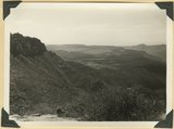 |
Smith Mesa viewed from the northeast, mesa top developed on Springdale member of the Chinle formation; upper Chinle and Navajo (right), La Verkin Canyon (left), Hurricane Cliffs (on skyline) | 1940 | Image | uum_map |
| 644 |
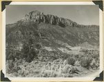 |
Smithsonian Butte from north base. Chinle, including Springdale member (middle ledge), Wingate? and Kayenta?, Navajo top. Washington County, UT | 1937; 1938 | Image | uum_map |
| 645 |
 |
Some animal | 1931 | Image | dc_bpc |
| 646 |
 |
Some musical reminiscences of Dixie | 1905-04-29 | Text | uum_uhrf |
| 647 |
 |
South from Angels Landing trailhead | 1959-06-24 | Image | uum_map |
| 648 |
 |
South wall of Timpoweap Canyon near mouth of Alkali Wash. Kaibab limestone (base), two beds of conglomerate separated by erosion surface, Moenkopi limestone top, Washington County, UT. 1939 | 1939 | Image | uum_map |
| 649 |
 |
Southern Utah, 1920: Paiute infant in cradleboard, Pine Valley | 1920-08 | Image/StillImage | uum_map |
| 650 |
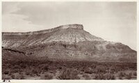 |
Southern Utah, 1920: Approaching Zion Canyon | 1920-08 | Image/StillImage | uum_map |
| 651 |
 |
Southern Utah, 1920: Columnar structure west of Rockville - UT | 1920-08 | Image/StillImage | uum_map |
| 652 |
 |
Southern Utah, 1920: Columnar structure west of Rockville - UT | 1920-08 | Image/StillImage | uum_map |
| 653 |
 |
Southern Utah, 1920: Columnar structure west of Rockville - UT | 1920-08 | Image/StillImage | uum_map |
| 654 |
 |
Southern Utah, 1920: F. J. Pack, buying pine nuts from Paiute Indians, Pine Valley | 1920-08 | Image/StillImage | uum_map |
| 655 |
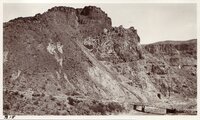 |
Southern Utah, 1920: Faulting - Hurricane Fault Scarp - Virgin River | 1920-08 | Image/StillImage | uum_map |
| 656 |
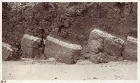 |
Southern Utah, 1920: Faults, Zion Canyon [01] | 1920-08 | Image/StillImage | uum_map |
| 657 |
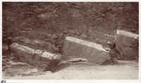 |
Southern Utah, 1920: Faults, Zion Canyon [02] | 1920-08 | Image/StillImage | uum_map |
| 658 |
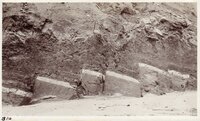 |
Southern Utah, 1920: Faults, Zion Canyon [03] | 1920-08 | Image/StillImage | uum_map |
| 659 |
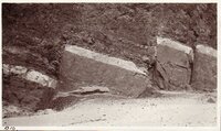 |
Southern Utah, 1920: Faults, Zion Canyon [04] | 1920-08 | Image/StillImage | uum_map |
| 660 |
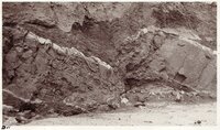 |
Southern Utah, 1920: Faults, Zion Canyon [05] | 1920-08 | Image/StillImage | uum_map |
| 661 |
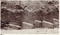 |
Southern Utah, 1920: Faults, Zion Canyon [06] | 1920-08 | Image/StillImage | uum_map |
| 662 |
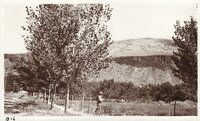 |
Southern Utah, 1920: Hurricane Fault Scarp - Lava on surface of Hurricane, Ut. | 1920-08 | Image/StillImage | uum_map |
| 663 |
 |
Southern Utah, 1920: Hurricane Fault Scarp - Lava on surface of Hurricane, Ut. | 1920-08 | Image/StillImage | uum_map |
| 664 |
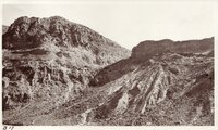 |
Southern Utah, 1920: Hurricane Fault Scarp - Virgin River [01] | 1920-08 | Image/StillImage | uum_map |
| 665 |
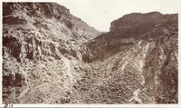 |
Southern Utah, 1920: Hurricane Fault Scarp - Virgin River [02] | 1920-08 | Image/StillImage | uum_map |
| 666 |
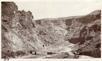 |
Southern Utah, 1920: Hurricane Fault Scarp - Virgin River [03] | 1920-08 | Image/StillImage | uum_map |
| 667 |
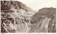 |
Southern Utah, 1920: Hurricane Fault Scarp - Virgin River [04] | 1920-08 | Image/StillImage | uum_map |
| 668 |
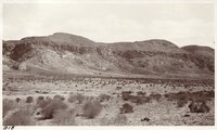 |
Southern Utah, 1920: Hurricane Fault Scarp north of La Verkin, Utah | 1920-08 | Image/StillImage | uum_map |
| 669 |
 |
Southern Utah, 1920: Lava flow on cross bedding, Diamond Valley, Utah | 1920-08 | Image/StillImage | uum_map |
| 670 |
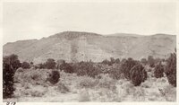 |
Southern Utah, 1920: Lava flow on Hurricane Fault - East of Pine Valley Mountain | 1920-08 | Image/StillImage | uum_map |
| 671 |
 |
Southern Utah, 1920: Lava flow, on ridge near Zion Canyon | 1920-08 | Image/StillImage | uum_map |
| 672 |
 |
Southern Utah, 1920: Paiute children, Diamond Valley | 1920-08 | Image/StillImage | uum_map |
| 673 |
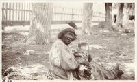 |
Southern Utah, 1920: Paiute elder, Pine Valley | 1920-08 | Image/StillImage | uum_map |
| 674 |
 |
Southern Utah, 1920: Purgatory Flats south of Washington, Utah | 1920-08 | Image/StillImage | uum_map |
| 675 |
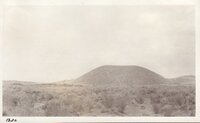 |
Southern Utah, 1920: Volcanic cone, Diamond Valley | 1920-08 | Image/StillImage | uum_map |
| 676 |
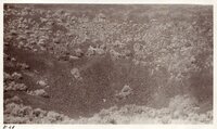 |
Southern Utah, 1920: Volcanic cone, Diamond Valley | 1920-08 | Image/StillImage | uum_map |
| 677 |
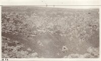 |
Southern Utah, 1920: Volcanic cone, Diamond Valley | 1920-08 | Image/StillImage | uum_map |
| 678 |
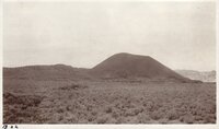 |
Southern Utah, 1920: Volcanic cone, Diamond Valley | 1920-08 | Image/StillImage | uum_map |
| 679 |
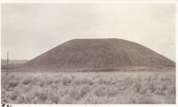 |
Southern Utah, 1920: Volcanic cone, Diamond Valley | 1920-08 | Image/StillImage | uum_map |
| 680 |
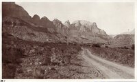 |
Southern Utah, 1920: Zion Canyon [01] | 1934-03 | Image/StillImage | uum_map |
| 681 |
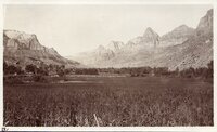 |
Southern Utah, 1920: Zion Canyon [02] | 1920-08 | Image/StillImage | uum_map |
| 682 |
 |
Southern Utah, 1920: Zion Canyon [03] | 1920-08 | Image/StillImage | uum_map |
| 683 |
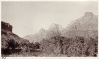 |
Southern Utah, 1920: Zion Canyon [04] | 1920-08 | Image/StillImage | uum_map |
| 684 |
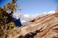 |
Southern Utah, Winter 1965 [25] | 1965 | Image/StillImage | uum_map_usa |
| 685 |
 |
Southern Utah, Winter 1965 [26] | 1965 | Image/StillImage | uum_map_usa |
| 686 |
 |
Southern Utah, Winter 1965 [27] | 1965 | Image/StillImage | uum_map_usa |
| 687 |
 |
Southern Utah, Winter 1965 [28] | 1965 | Image/StillImage | uum_map_usa |
| 688 |
 |
Southern Utah, Winter 1965 [29] | 1965 | Image/StillImage | uum_map_usa |
| 689 |
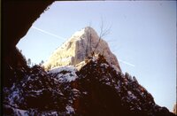 |
Southern Utah, Winter 1965 [30] | 1965 | Image/StillImage | uum_map_usa |
| 690 |
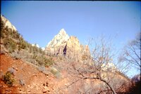 |
Southern Utah, Winter 1965 [31] | 1965 | Image/StillImage | uum_map_usa |
| 691 |
 |
Southern Utah, Winter 1965 [32] | 1965 | Image/StillImage | uum_map_usa |
| 692 |
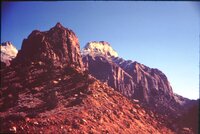 |
Southern Utah, Winter 1965 [33] | 1965 | Image/StillImage | uum_map_usa |
| 693 |
 |
Southern Utah, Winter 1965 [34] | 1965 | Image/StillImage | uum_map_usa |
| 694 |
 |
Southern Utah, Winter 1965 [35] | 1965 | Image/StillImage | uum_map_usa |
| 695 |
 |
Southern Utah, Winter 1965 [36] | 1965 | Image/StillImage | uum_map_usa |
| 696 |
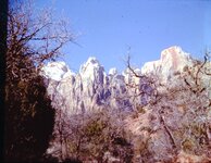 |
Southern Utah, Winter 1965 [37] | 1965 | Image/StillImage | uum_map_usa |
| 697 |
 |
Spendlove Knoll, volcanic cone on Navajo sandstone, head of Hop Valley. Washington County, UT, 1940 | 1940 | Image | uum_map |
| 698 |
 |
Springdale | 1936 | Image | uum_map |
| 699 |
 |
Springdale 1936 | 1936 | Image | uum_map |
| 700 |
 |
Springdale 1936 | 1936 | Image | uum_map |