Home
Browse
Ask Us
Chat
Harmful Language Statement
Log in
Advanced Search
Year
1850
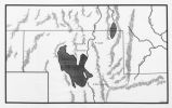
1851
1852
1853
1854
1855
1856
1857
1858
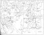
1859
1860
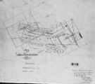
1861
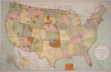
1862
1863
1864
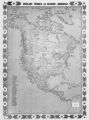
1865
1866
1867
1868
1869
1870
1871
1872
1873
1874
1875
1876
1877
1878
1879
1880
1881
1882
1883
1884
1885
1886
1887
1888
1889
1890
1891
1892
1893
1894
1895
1896
1897
1898
1899
1900
1901
1902
1903
1904
1905
1906
1907
1908
1909
1910
1911
1912
1913
1914
1915
1916
1917
1918
1919
1920
1921
1922
1923
1924
1925
1926
1927
1928
1929
1930
1931
1932
1933
1934
1935
1936
1937
1938
1939
1940
1941
1942
1943
1944
1945
1946
1947
1948
1949
1950
1951
1952
1953
1954
1955
1956
1957
1958
1959
1960
1961
1962
1963
1964
1965
1966
1967
1968
1969
1970
1971
1972
1973
1974
1975
1976
1977
1978
1979
1980
1981
1982
1983
1984
1985
1986
1987
1988
1989
1990
1991
1992
1993
1994
1995
1996
1997
1998
1999
2000
2001
2002
2003
2004
TO
1850
1851
1852
1853
1854
1855
1856
1857
1858
1859
1860
1861
1862
1863
1864
1865
1866
1867
1868
1869
1870
1871
1872
1873
1874
1875
1876
1877
1878
1879
1880
1881
1882
1883
1884
1885
1886
1887
1888
1889
1890
1891
1892
1893
1894
1895
1896
1897
1898
1899
1900
1901
1902
1903
1904
1905
1906
1907
1908
1909
1910
1911
1912
1913
1914
1915
1916
1917
1918
1919
1920
1921
1922
1923
1924
1925
1926
1927
1928
1929
1930
1931
1932
1933
1934
1935
1936
1937
1938
1939
1940
1941
1942
1943
1944
1945
1946
1947
1948
1949
1950
1951
1952
1953
1954
1955
1956
1957
1958
1959
1960
1961
1962
1963
1964
1965
1966
1967
1968
1969
1970
1971
1972
1973
1974
1975
1976
1977
1978
1979
1980
1981
1982
1983
1984
1985
1986
1987
1988
1989
1990
1991
1992
1993
1994
1995
1996
1997
1998
1999
2000
2001
2002
2003
2004
Type
Image/StillImage
86
Format
image/jpeg
57
application/pdf
29
Collection
Classified Photographs
9
UAIDA Main Collection
77
Filters:
Spatial Coverage:
"Utah"
Subject:
"Maps"
Type:
"Image/StillImage"
1
-
25
of
86
<
1
2
3
4
>
Gallery view
Number of results to display per page
10
25
50
100
200
Sort by Relevance
Sort by Title A-Z
Sort by Title Z-A
Sort by Date Ascending
Sort by Date Descending
Sort by Last Modified Ascending
Sort by Last Modified Descending
Title
Date
Type
Setname
1
2010 Boundary Validation Program_002
Image/StillImage
uaida_main
2
A Theory of Southern Athabascan Migration
Image/StillImage
uaida_main
3
Annual Report of the Commissioner of Indian Affairs - 1874
1874
Image/StillImage
uaida_main
4
Annual Report of the Commissioner of Indian Affairs - 1878
1878
Image/StillImage
uaida_main
5
Annual Report of the Commissioner of Indian Affairs - 1882
1882
Image/StillImage
uaida_main
6
Annual Report of the Commissioner of Indian Affairs - 1898
1898
Image/StillImage
uaida_main
7
Black Hawk War 1865-72
Image/StillImage
uaida_main
8
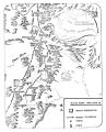
Boundary of Shoshone Indian Territory according to Swanton, 1952
1952
Image/StillImage
uaida_main
9
Boundary of Shoshone Indian Territory and Neighboring Tribes
1957
Image/StillImage
uaida_main
10
Boundary of Shoshone Indian Territory, Linguistic Boundaries of Shoshone and Bannock.
1941
Image/StillImage
uaida_main
11
Boundary of Shoshone Indian Territory, showing the locations of the Bannock
1957
Image/StillImage
uaida_main
12
Boundary of Shoshone Indian Territory, showing the locations of the Bannock from 1819 to 1951
1957
Image/StillImage
uaida_main
13
Boundary of Shoshone Indian Territory, showing the locations where the Bannock and Shoshone reported together 1819-1956
1957
Image/StillImage
uaida_main
14
Boundary of Shoshone Indian Territory; Doty Map of 1863 Indian Claims Commission
1957
Image/StillImage
uaida_main
15
Capitol Building-Exhibits P.1
1920; 1921; 1922; 1923; 1924; 1925; 1926; 1927; 1928; 1929; 1930; 1931; 1932; 1933; 1934; 1935; 1936; 1937; 1938; 1939; 1940; 1941; 1942; 1943; 1944; 1945; 1946; 1947; 1948; 1949; 1950
Image/StillImage
dha_cp
16
Colorado River -- Excursions p.14
1935; 1936; 1937; 1938; 1939; 1940; 1941; 1942; 1943; 1944; 1945
Image/StillImage
dha_cp
17
Goshute Indian Reservation Nevada and Utah
Image/StillImage
uaida_main
18
Land Allotments, White Mesa
Image/StillImage
uaida_main
19
Map of Dry Gulch Irrigation District, Uintah Indian Reservation, Utah
Image/StillImage
uaida_main
20
Map of Indian Reservation in the West, 1929
Image/StillImage
uaida_main
21
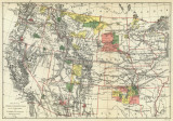
Map of Indian Reservation. 1884
Image/StillImage
uaida_main
22
Map of Indian Territory in the Western United States
Image/StillImage
uaida_main
23
Map of Indian Tribes of North America
Image/StillImage
uaida_main
24
Map of Northern Utah, Early Settlements
Image/StillImage
uaida_main
25
Map of Part of the West Boundary of the Uncompahgre Ute Indian Reservation as Surveyed by William B. Dougall
Image/StillImage
uaida_main
1
-
25
of
86
<
1
2
3
4
>