| | Title | Date | Type | Setname |
|---|
| 1 |  | Abancay to La Estrella. Concacha. Nearer view of the same. | 1911; 1912; 1915 | Image | uum_map |
| 2 | 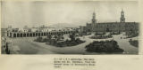 | Arequipa. The main plaza and Mt. Chachani, from the second story of Morosini's Hotel Anexo. | 1911; 1912; 1915 | Image | uum_map |
| 3 |  | Arma Valley. Bumstead and signal on SE side. Arma-Puciura pass. | 1912 | Image | uum_map |
| 4 |  | Ayusbamba. General view of lake beds looking SE. | 1912; 1913; 1914; 1915 | Image | uum_map |
| 5 |  | Ayusbamba. Looking down Apurimac Caffon from Calvo's house. | 1912; 1913; 1914; 1915 | Image | uum_map |
| 6 |  | Ayusbamba. Looking north from Calvo's house across limestone mass. | 1912; 1913; 1914; 1915 | Image | uum_map |
| 7 |  | Ayusbamba. Senor and Senora Calvo at dining-room door. | 1912 | Image | uum_map |
| 8 | 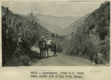 | Ayusbamba. View SW from same place 1/4 N. Ely from Taray. | 1912 | Image | uum_map |
| 9 |  | Baby Llamas. | 1911 | Image | uum_map |
| 10 |  | Basalt? Cliff below Rumicola Quarry | 1912; 1913; 1914; 1915 | Image | uum_map |
| 11 |  | Boat, Lake Titicaca. | 1912; 1913; 1914; 1915 | Image | uum_map |
| 12 |  | Cactus on the Calca road. | 1912; 1913; 1914; 1915 | Image | uum_map |
| 13 |  | Chinchero. 2 Alcaldes, ancient wall and restored wall. | 1911 | Image | uum_map |
| 14 |  | Corredor Hotal Central, Cuzco. Florentin Fluente. Front. | 1912 | Image | uum_map |
| 15 |  | Crucero Alto, railroad pass | 1912; 1913; 1914; 1915 | Image | uum_map |
| 16 |  | Cuzco Basin. Looking down the Valley from 'Island' toward the narrows | 1912; 1913; 1914; 1915 | Image | uum_map |
| 17 |  | Cuzco basin. North flat, looking up Valley from 'Island' high point over 1 mile SE of San Sebastian. | 1912; 1913; 1914; 1915 | Image | uum_map |
| 18 |  | Cuzco Indian. | 1912 | Image | uum_map |
| 19 |  | Cuzco Valley | 1911; 1912; 1913; 1914; 1915 | Image | uum_map |
| 20 |  | Cuzco Valley Choquo branch. Looking S or SE across Huancaro from west side. (compare 2987, 2988, and 2989) | 1912; 1913; 1914; 1915 | Image | uum_map |
| 21 |  | Cuzco Valley, Lava columns NE bank of Vilcanata at Sierra Bella. | 1912; 1913; 1914; 1915 | Image | uum_map |
| 22 |  | Cuzco Valley, Terrace. Ongapata. Looking upstream from 1/2 mile above mouth. Camera pointing south | 1912; 1913; 1914; 1915 | Image | uum_map |
| 23 |  | Cuzco Valley. A four-horned sheep | 1911; 1912; 1915 | Image | uum_map |
| 24 |  | Cuzco Valley. Abandoned moraine and cirque on Seneca, facing Chincheros road. | 1912; 1913; 1914; 1915 | Image | uum_map |
| 25 |  | Cuzco Valley. Abandoned moraine. Looking down Junapincha. Elev. 15,000 ft. | 1912; 1913; 1914; 1915 | Image | uum_map |
| 26 | 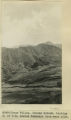 | Cuzco Valley. Choquo branch. Looking S or SE across Huancaro from west side. | 1912; 1913; 1914; 1915 | Image | uum_map |
| 27 |  | Cuzco Valley. Cirque & Moraine facing Carao Valley. Elev. 13,500-14,000 ft. | 1912; 1913; 1914; 1915 | Image | uum_map |
| 28 | 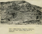 | Cuzco Valley. Deposits limestone, clay, and Cast. shale. Near mouth of Huancaro | 1912; 1913; 1914; 1915 | Image | uum_map |
| 29 |  | Cuzco Valley. Detail alluvium. N. of San Sebastian [1] | 1912; 1913; 1914; 1915 | Image | uum_map |
| 30 |  | Cuzco Valley. Detail alluvium. N. of San Sebastian [2] | 1912; 1913; 1914; 1915 | Image | uum_map |
| 31 |  | Cuzco Valley. Detail. | 1912; 1913; 1914; 1915 | Image | uum_map |
| 32 |  | Cuzco Valley. Divided spurs. Carao Valley | 1912; 1913; 1914; 1915 | Image | uum_map |
| 33 |  | Cuzco Valley. End of abandoned moraine. Largest glacier of Cuzco Valley, Elev. 13,500-13,700 ft. Upper right hand branch of Junajaneha | 1912; 1913; 1914; 1915 | Image | uum_map |
| 34 | 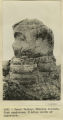 | Cuzco Valley. Erosion feature. Pink sandstone. 3 miles north of Angostura | 1912; 1913; 1914; 1915 | Image | uum_map |
| 35 | 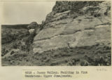 | Cuzco Valley. Faulting in Pink Sandstone. Upper Junajaneha | 1912; 1913; 1914; 1915 | Image | uum_map |
| 36 | 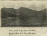 | Cuzco Valley. Fold (syncline) on the Choquo, SE tributary of Huancaro. Looking east [1] | 1912; 1913; 1914; 1915 | Image | uum_map |
| 37 | 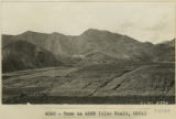 | Cuzco Valley. Fold (syncline) on the Choquo, SE tributary of Huancaro. Looking east [2] | 1912; 1913; 1914; 1915 | Image | uum_map |
| 38 | 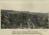 | Cuzco Valley. Fold on Paruro-Cuzco road, just beyond Huancaro divide. | 1912; 1913; 1914; 1915 | Image | uum_map |
| 39 |  | Cuzco Valley. Glaciated valley near head of Junajaneha stream. Elev 13,500-13,800 ft. | 1912; 1913; 1914; 1915 | Image | uum_map |
| 40 |  | Cuzco Valley. Huancaro, S. bank just below mouth of Huatanay. Material of lowest terrace. | 1912; 1913; 1914; 1915 | Image | uum_map |
| 41 | 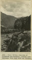 | Cuzco Valley. Junction of Vilcanata and Huatanay, looking down Huatanay. Note high rock cut terrace. | 1912; 1913; 1914; 1915 | Image | uum_map |
| 42 | 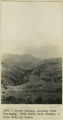 | Cuzco Valley. Looking down Huatanay, from above Anta Branch, 1 mile NW of Cuzco. | 1912; 1913; 1914; 1915 | Image | uum_map |
| 43 | 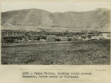 | Cuzco Valley. Looking south across Huancaro, below mouth of Huatanay | 1912; 1913; 1914; 1915 | Image | uum_map |
| 44 | 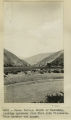 | Cuzco Valley. Mouth of Huatanay, looking upstream from East side Vilcanata. Note terrace and gorge | 1912; 1913; 1914; 1915 | Image | uum_map |
| 45 | 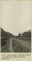 | Cuzco Valley. Narrows, looking upstream from 1,000 feet below Angostura. | 1912; 1913; 1914; 1915 | Image | uum_map |
| 46 | 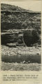 | Cuzco Valley. North bank of the Hautanay, showing buried wall South of San Sebastian. | 1912; 1913; 1914; 1915 | Image | uum_map |
| 47 |  | Cuzco Valley. North bank of the Huatanay, south of San Sebastian. | 1912; 1913; 1914; 1915 | Image | uum_map |
| 48 | 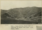 | Cuzco Valley. North limb of syncline on Choquo | 1912; 1913; 1914; 1915 | Image | uum_map |
| 49 | 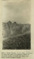 | Cuzco Valley. North limb, vertical, of syncline west of Ongapata (same as syncline shown in 2996-2997) but three miles further south | 1912; 1913; 1914; 1915 | Image | uum_map |
| 50 | 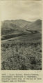 | Cuzco Valley. North-flowing, subsequent tributary to Huatanay, entering south side of valley at West (upper) end of Narrows. | 1912; 1913; 1914; 1915 | Image | uum_map |
| 51 | 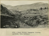 | Cuzco Valley. Ongapata. Looking upstream. Note terraces | 1912; 1913; 1914; 1915 | Image | uum_map |
| 52 | 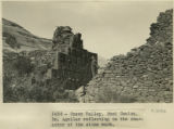 | Cuzco Valley. Rumi Colca. Dr. Aguilar reflecting on the character of the stone work. | 1911; 1912; 1915 | Image | uum_map |
| 53 | 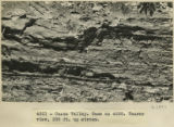 | Cuzco Valley. Same as 2976. Nearer view, 200 ft. upstream | 1912; 1913; 1914; 1915 | Image | uum_map |
| 54 | 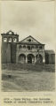 | Cuzco Valley. San Geronimo Facade of church (Juancatio basalt) | 1912; 1913; 1914; 1915 | Image | uum_map |
| 55 | 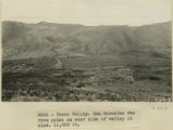 | Cuzco Valley. San Geronimo fan from point on east side of valley at elev 11,000 feet. | 1912; 1913; 1914; 1915 | Image | uum_map |
| 56 | 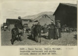 | Cuzco Valley. Saylla village. Road-side restaurant and chicha sellers. Bestor in mule at left. | 1911; 1912; 1915 | Image | uum_map |
| 57 | 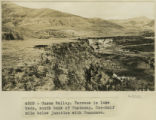 | Cuzco Valley. Terrace in lake beds, south bank of Huatanay. One-half mile below junction with Huancaro | 1912; 1913; 1914; 1915 | Image | uum_map |
| 58 | 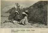 | Cuzco Valley. Tipon. Young goatherds | 1911; 1912; 1915 | Image | uum_map |
| 59 | 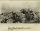 | Cuzco Valley. Typical outcrop of lower Cretaceous limestone, 1 mile NE of Cuzco | 1912; 1913; 1914; 1915 | Image | uum_map |
| 60 |  | Cuzco Valley. Upper part of Angostura Narrows from a point on north side of Narrows, elev. 11,000 ft. (Looking down valley) | 1912; 1913; 1914; 1915 | Image | uum_map |
| 61 |  | Cuzco Valley. Upper part of Angostura Narrows looking upstream. | 1912; 1913; 1914; 1915 | Image | uum_map |
| 62 | 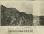 | Cuzco Valley. Vertical conglomerate beds (part of syncline shown in 2987). Extreme heads of Ongapata | 1912; 1913; 1914; 1915 | Image | uum_map |
| 63 |  | Cuzco Valley. Vilcanata Canyon, looking down stream NW from Sierra Bella. | 1912; 1913; 1914; 1915 | Image | uum_map |
| 64 | 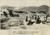 | Cuzco, 9:15 A.M. Brick Yard San Sebastian 50 ft. S. Wly | 1912 | Image | uum_map |
| 65 | 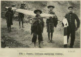 | Cuzco, Indians carrying timber. | 1911 | Image | uum_map |
| 66 | 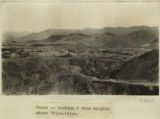 | Cuzco, looking S from heights above Ttica-ttica. | 1912; 1913; 1914; 1915 | Image | uum_map |
| 67 |  | Cuzco. "Rodadero" showing change in direction of fluting. N 30 degrees E and E 60 degrees W in close proximity | 1912; 1913; 1914; 1915 | Image | uum_map |
| 68 | 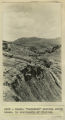 | Cuzco. "Rodadero" showing sharp break in continuity of fluting | 1912; 1913; 1914; 1915 | Image | uum_map |
| 69 |  | Cuzco. "Rodadero", looking NW across flutings | 1912; 1913; 1914; 1915 | Image | uum_map |
| 70 |  | Cuzco. Ayahuaycco quebrada. Portion of buried wall. | 1911; 1912; 1915 | Image | uum_map |
| 71 |  | Cuzco. In the convent of San Domingo | 1911 | Image | uum_map |
| 72 |  | Cuzco. Inca rubble wall 100 feet farther east on the same street as St. Dominicks N.Wall. 8 ft. | 1912 | Image | uum_map |
| 73 |  | Cuzco. Native Indians harvesting the barley crop, taking it to the threshing floor. Dr. Eaton and Lieut. Sotomayor on horseback. | 1911; 1912; 1915 | Image | uum_map |
| 74 |  | Cuzco. Near the railway station. A bluff washed by the Huantanay River. Shows Lieutenant Sotomayor pointing to a stratum containing fossil shells | 1911; 1912; 1915 | Image | uum_map |
| 75 |  | Cuzco. Rodadero Hill and Sacsahuaman hill and part of city. | 1911; 1912; 1915 | Image | uum_map |
| 76 |  | Cuzco. Similar place farther up the Anta road. Dr. Eaton pointing to the spot where a rib was found interstratified with the gravel | 1911; 1912; 1915 | Image | uum_map |
| 77 |  | Cuzco. Tame vicuna in the barracks. | 1911 | Image | uum_map |
| 78 | 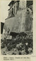 | Cuzco. Temple of the Sun. Outside wall | 1912 | Image | uum_map |
| 79 |  | Cuzco. Types of Indian women. | 1912 | Image | uum_map |
| 80 |  | Cuzco. Weathering in igneous mass underlying Sacsahuanan, Cuzco | 1912; 1913; 1914; 1915 | Image | uum_map |
| 81 |  | David O. McKay diary, January to March 1954 | 1954-01; 1954-02; 1954-03 | Text | uum_domp |
| 82 | 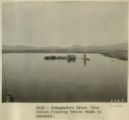 | Desaguadero River. Uros Indian floating Totora reeds to Ancoaqui. | 1911 | Image | uum_map |
| 83 |  | Essay on the historiography of the Indians of the Americas | 1977 | Text | uum_awcrp |
| 84 | 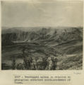 | Even topped upland in relation to geological structure south-southwest of Cuzco | 1911 | Image | uum_map |
| 85 | 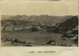 | Fort Sacsuahman | 1911; 1912; 1913; 1914; 1915 | Image | uum_map |
| 86 | 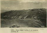 | From ridge 2 miles S of Cropesa looking SE | 1912 | Image | uum_map |
| 87 | 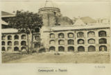 | Graveyard, Cuzco. | 1912; 1913; 1914; 1915 | Image | uum_map |
| 88 |  | Group at the Calca Sunday market. | 1912; 1913; 1914; 1915 | Image | uum_map |
| 89 | 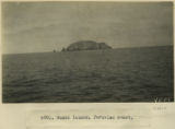 | Guano Island, Peruvian coast. | 1912; 1913; 1914; 1915 | Image | uum_map |
| 90 | 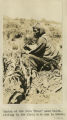 | Indian at the farm 'Urco' near Calca, sitting in the field with how in hands. | 1912; 1913; 1914; 1915 | Image | uum_map |
| 91 |  | Indian gathering firewood on mountain-side above Calca. | 1911 | Image | uum_map |
| 92 | 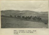 | Indian gathering firewood on mountain-side above Calca. | 1912 | Image | uum_map |
| 93 |  | Indian in act of using how-'Urco'-The farm near Calca. | 1912; 1913; 1914; 1915 | Image | uum_map |
| 94 |  | Indigenous Quechua with hoe for farming | 1912; 1913; 1914; 1915 | Image | uum_map |
| 95 |  | Interview with Dr. Philip Notarianni conducted by Dr. Greg Thompson | 2021-08-06 | Image/MovingImage | uum_uc19 |
| 96 | 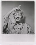 | Judy Draper (Annie), star of University of Utah State Department Tour production of "Annie From the Far West" performed in South America, Summer 1962 | 1962 | Image/StillImage | uum_map |
| 97 | 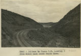 | Juliaca to Cuzco R.R. Looking S from water tank above Santa Rosa. | 1911; 1912; 1915 | Image | uum_map |
| 98 | 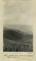 | Kettle hole north of Juancotis, Elev. 14,000 ft. | 1912; 1913; 1914; 1915 | Image | uum_map |
| 99 | 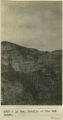 | La Paz. Details of the Bad Lands. | 1912; 1913; 1914; 1915 | Image | uum_map |
| 100 |  | La Raya. Abandoned moraine | 1912; 1913; 1914; 1915 | Image | uum_map |
| 101 | 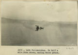 | Lake Parinacochas. Ox half a mile from shore, eating water grass. | 1911; 1912; 1915 | Image | uum_map |
| 102 | 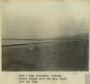 | Lake Titicaca. Looking toward Quaqui from the mole built into the lake | 1911 | Image | uum_map |
| 103 |  | Lake Titicaca. Reed belt, alluvial fringe and tilted strata, border of Lake Titicaca near Guaqui. | 1911 | Image | uum_map |
| 104 | 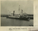 | Lake Titicaca. Steamer at Guaqui. | 1911 | Image | uum_map |
| 105 |  | Lake Titicaca. The dark point of land on the left cuts off the view into the Desaguadero River, the outlet of Lake Titicaca. The river rounds the dark point and turns to the left. | 1911 | Image | uum_map |
| 106 |  | Llamas at the Calca market. | 1912; 1913; 1914; 1915 | Image | uum_map |
| 107 |  | Llamas on the Calca road. | 1912; 1913; 1914; 1915 | Image | uum_map |
| 108 |  | Loading cattle, seacoast, Callao | 1912 | Image | uum_map |
| 109 |  | Loading the passengers by means of bucket, coast of Peru | 1911 | Image | uum_map |
| 110 |  | Machu Picchu. Camp. Erdis eating a tomato. | 1911; 1912; 1915 | Image | uum_map |
| 111 | 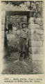 | Machu Picchu. King's Group. Entrance to Number 729, with Dr. Eaton. | 1911; 1912; 1915 | Image | uum_map |
| 112 | 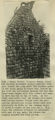 | Machu Picchu. Princess Group. House 856 showing southwest corner exterior from just inside the city wall. The further gable is the south gable of house 841. Notice on the left the partitions between 855 and 840. These were capped with flat stones and seem to have had mud on top of them. In the right hand gable over the window is a small ventilating window. Notice also the projecting cylindrical stones which show more distinctly in 3135. At the extreme right is shown a corner of the city wall. This house was probably stuccoed or plastered with mud. At any rate, the stones are roughly squared and laid in mud. | 1911; 1912 | Image | uum_map |
| 113 | 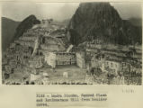 | Machu Picchu. Sacred Plaza and Intihuantana Hill from boulder caves. | 1911; 1912 | Image | uum_map |
| 114 | 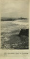 | Mollendo. Crest of incoming wave | 1912; 1913; 1914; 1915 | Image | uum_map |
| 115 | 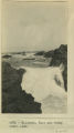 | Mollendo. Surf and rocky coast line | 1912; 1913; 1914; 1915 | Image | uum_map |
| 116 | 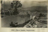 | Nusta Espana. Excavations | 1912 | Image | uum_map |
| 117 |  | Nusta Espana. Hardy and Little in Inca seat. | 1912 | Image | uum_map |
| 118 |  | Old Catholic church at Calca. | 1912; 1913; 1914; 1915 | Image | uum_map |
| 119 |  | Ollantaytambo. Continuation of panorama to right | 1911; 1912; 1915 | Image | uum_map |
| 120 |  | Ollantaytambo. Portrait of Indian boy. | 1911 | Image | uum_map |
| 121 | 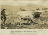 | Oxen ploughing at the Mission House, Cuzco. | 1912; 1913; 1914; 1915 | Image | uum_map |
| 122 |  | Pacasmayo. Rush balsas characteristic of this port and used by sea-going fishermen. Also characteristic hose made of split bamboo. Reading from left to right, Messrs. G. F. Eaton, Robert Stephenson, and H. Stuart Hotchkiss | 1912 | Image | uum_map |
| 123 |  | Pacasmayo. The cliffs and surf with distant view of port and pier from top of cliffs to the northwest | 1911; 1912; 1915 | Image | uum_map |
| 124 |  | Paruro Road, Pack train. | 1912; 1913; 1914; 1915 | Image | uum_map |
| 125 |  | Pasaje. Safely on his way across the Apurimac. | 1911; 1912; 1915 | Image | uum_map |
| 126 | 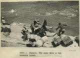 | Pasaje. The same mule a few moments later. | 1911; 1912; 1915 | Image | uum_map |
| 127 | 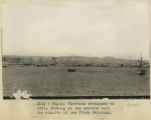 | Payta, Panprama continues to left, showing at the extreme left the station of the Piura railroad | 1911; 1912; 1915 | Image | uum_map |
| 128 |  | Payta. The beach. A typical dugout canoe, and characteristic houses of the better class. Looking east | 1911; 1912; 1915 | Image | uum_map |
| 129 | 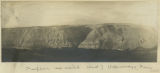 | Peneplain sea raised West of Uchumayo, Peru. | 1912; 1913; 1914; 1915 | Image | uum_map |
| 130 | 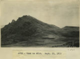 | Peru mountain | 1912; 1913; 1914; 1915 | Image | uum_map |
| 131 | 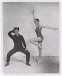 | Phil Keeler (Tommy Keeler) and Janice James (Minnie Tate), dancers for University of Utah State Department Tour production of "Annie From the Far West" performed in South America, Summer 1962 | 1962 | Image/StillImage | uum_map |
| 132 | 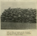 | Pile of Yareta on the railroad between Mollendo and Juliaca, a resinous root which is used as fuel. | 1911 | Image | uum_map |
| 133 |  | Pisac. Portrait of Indian man. | 1911 | Image | uum_map |
| 134 | 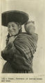 | Pisac. Portrait of Indian woman and baby. | 1911 | Image | uum_map |
| 135 | 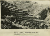 | Pisac. Terraces below the citadel. | 1911 | Image | uum_map |
| 136 | 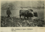 | Plowing at Tarai, Urubamba valley. | 1911 | Image | uum_map |
| 137 |  | Quechua children and woman in front of house at the farm 'Urco' near Calca. | 1912; 1913; 1914; 1915 | Image | uum_map |
| 138 |  | Quechua children in front of house at the farm 'Urco' near Calca. | 1912; 1913; 1914; 1915 | Image | uum_map |
| 139 | 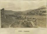 | Rodadero | 1911; 1912; 1913; 1914; 1915 | Image | uum_map |
| 140 | 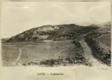 | Rodadero | 1911; 1912; 1913; 1914; 1915 | Image | uum_map |
| 141 | 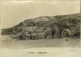 | Rodadero | 1911; 1912; 1913; 1914; 1915 | Image | uum_map |
| 142 | 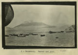 | Salaverry, harbor and pier | 1911 | Image | uum_map |
| 143 | 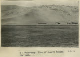 | Salaverry. View of desert behind the town. | 1911 | Image | uum_map |
| 144 | 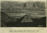 | San Geronimo from foot of Mt. Picol | 1912 | Image | uum_map |
| 145 | 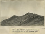 | San Geronimo. Upturned sandstone on mountain east of S.G. looking west | 1912; 1913; 1914; 1915 | Image | uum_map |
| 146 |  | Santa Ana. View looking up the valley of the Urubamba about 1 league south of Santa Ana. | 1911 | Image | uum_map |
| 147 |  | Source materials for comparative studies of the Indians of the Americas | 1977 | Text | uum_awcrp |
| 148 |  | Sunday market at Calca. | 1912; 1913; 1914; 1915 | Image | uum_map |
| 149 | 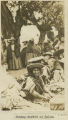 | Sunday market at Calca. | 1912; 1913; 1914; 1915 | Image | uum_map |
| 150 | 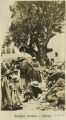 | Sunday market, Calca. | 1912; 1913; 1914; 1915 | Image | uum_map |
| 151 |  | Titicaca Island. 'Sacrificial Table.' (Near Chala). Showing Prof. Gregory. | 1912; 1913; 1914; 1915 | Image | uum_map |
| 152 | 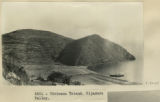 | Titicaca Island. Hijadero Valley. | 1912 | Image | uum_map |
| 153 | 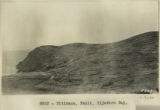 | Titicaca. Fault. Hijadero Bay. | 1912 | Image | uum_map |
| 154 | 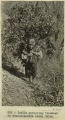 | Urubamba to Cuzco. Cargo trains of relics from Machu Picchu. | 1911 | Image | uum_map |
| 155 | 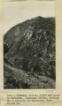 | Urubamba Valley, cliff and gorge on Urubamba. Huatenay Divide, looking SW, 4 miles N. of Angostura. Elev. 14,000 ft. | 1912; 1913; 1914; 1915 | Image | uum_map |
| 156 |  | View across flat in which La Paz Valley is sunk. Taken from Alto Station, looking NE. | 1912; 1913; 1914; 1915 | Image | uum_map |
| 157 | 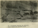 | Vilcabamba showing the thatched stone houses and pastures below. | 1911 | Image | uum_map |
| 158 |  | Vilcamamba. Old Spanish bells. | 1911 | Image | uum_map |
| 159 | 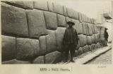 | Wall, Cuzco | 1912 | Image | uum_map |
| 160 |  | Yaurisque, view from the Paruro-Cuzco Road. | 1912; 1913; 1914; 1915 | Image | uum_map |