Home
Browse
Ask Us
Chat
Harmful Language Statement
Log in
Advanced Search
Year
1895
1896
1897
1898
1899
1900
1901
1902
1903
1904
1905
1906
1907
1908
1909
1910
1911
1912
1913
1914
1915
1916
1917
1918
1919
1920
1921
1922
1923
1924
1925
1926
1927
1928
1929
1930
1931
1932
1933
1934
1935
1936
1937
1938
1939
1940
1941
1942
1943
1944
1945
1946
1947
1948
1949
1950
1951
1952
1953
1954
1955
1956
1957
1958
1959
1960
1961
1962
1963
1964
1965
1966
1967
1968
1969
1970
1971
1972
1973
1974
1975
1976
1977
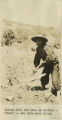
1978
1979
1980
1981
1982
1983
1984
1985
1986
1987
1988
1989
1990
1991
1992
1993
1994
1995
1996
1997
1998
1999
2000
2001
2002
2003
2004
2005
2006
2007
2008
2009
2010
2011
2012
2013
2014
2015
2016
2017
2018
2019
2020
2021
TO
1895
1896
1897
1898
1899
1900
1901
1902
1903
1904
1905
1906
1907
1908
1909
1910
1911
1912
1913
1914
1915
1916
1917
1918
1919
1920
1921
1922
1923
1924
1925
1926
1927
1928
1929
1930
1931
1932
1933
1934
1935
1936
1937
1938
1939
1940
1941
1942
1943
1944
1945
1946
1947
1948
1949
1950
1951
1952
1953
1954
1955
1956
1957
1958
1959
1960
1961
1962
1963
1964
1965
1966
1967
1968
1969
1970
1971
1972
1973
1974
1975
1976
1977
1978
1979
1980
1981
1982
1983
1984
1985
1986
1987
1988
1989
1990
1991
1992
1993
1994
1995
1996
1997
1998
1999
2000
2001
2002
2003
2004
2005
2006
2007
2008
2009
2010
2011
2012
2013
2014
2015
2016
2017
2018
2019
2020
2021
Type
Image
154
Text
3
Image/StillImage
2
Image/MovingImage
1
Format
image/jpeg
154
application/pdf
6
video/mp4
1
Institution
University of Utah Marriott Library
160
Westminster University
1
Collection
American West Center Research Projects
2
David Oman McKay Papers
1
Photo Archives
156
Utah COVID-19
1
Westminster University Textual Works
1
Filters:
Spatial Coverage:
"South America"
76
-
100
of
161
<
1
2
3
4
5
6
7
>
Gallery view
Number of results to display per page
10
25
50
100
200
Sort by Relevance
Sort by Title A-Z
Sort by Title Z-A
Sort by Date Ascending
Sort by Date Descending
Sort by Last Modified Ascending
Sort by Last Modified Descending
Title
Date
Type
Setname
76
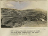
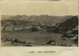
Cuzco. Rodadero Hill and Sacsahuaman hill and part of city.
1911; 1912; 1915
Image
uum_map
77
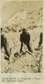
Cuzco. Similar place farther up the Anta road. Dr. Eaton pointing to the spot where a rib was found interstratified with the gravel
1911; 1912; 1915
Image
uum_map
78
Cuzco. Tame vicuna in the barracks.
1911
Image
uum_map
79
Cuzco. Temple of the Sun. Outside wall
1912
Image
uum_map
80
Cuzco. Types of Indian women.
1912
Image
uum_map
81
Cuzco. Weathering in igneous mass underlying Sacsahuanan, Cuzco
1912; 1913; 1914; 1915
Image
uum_map
82
David O. McKay diary, January to March 1954
1954-01; 1954-02; 1954-03
Text
uum_domp
83
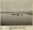
Desaguadero River. Uros Indian floating Totora reeds to Ancoaqui.
1911
Image
uum_map
84
Essay on the historiography of the Indians of the Americas
1977
Text
uum_awcrp
85
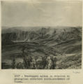
Even topped upland in relation to geological structure south-southwest of Cuzco
1911
Image
uum_map
86
Fort Sacsuahman
1911; 1912; 1913; 1914; 1915
Image
uum_map
87
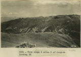
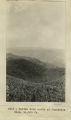
From ridge 2 miles S of Cropesa looking SE
1912
Image
uum_map
88
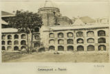
Graveyard, Cuzco.
1912; 1913; 1914; 1915
Image
uum_map
89
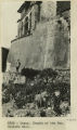
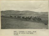
Group at the Calca Sunday market.
1912; 1913; 1914; 1915
Image
uum_map
90
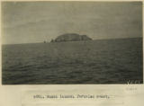
Guano Island, Peruvian coast.
1912; 1913; 1914; 1915
Image
uum_map
91
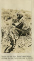
Indian at the farm 'Urco' near Calca, sitting in the field with how in hands.
1912; 1913; 1914; 1915
Image
uum_map
92
Indian gathering firewood on mountain-side above Calca.
1911
Image
uum_map
93
Indian gathering firewood on mountain-side above Calca.
1912
Image
uum_map
94
Indian in act of using how-'Urco'-The farm near Calca.
1912; 1913; 1914; 1915
Image
uum_map
95
Indigenous Quechua with hoe for farming
1912; 1913; 1914; 1915
Image
uum_map
96
Interview with Dr. Philip Notarianni conducted by Dr. Greg Thompson
2021-08-06
Image/MovingImage
uum_uc19
97
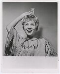
Judy Draper (Annie), star of University of Utah State Department Tour production of "Annie From the Far West" performed in South America, Summer 1962
1962
Image/StillImage
uum_map
98
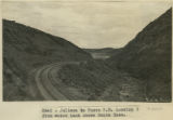
Juliaca to Cuzco R.R. Looking S from water tank above Santa Rosa.
1911; 1912; 1915
Image
uum_map
99
Kettle hole north of Juancotis, Elev. 14,000 ft.
1912; 1913; 1914; 1915
Image
uum_map
100
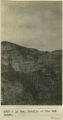
La Paz. Details of the Bad Lands.
1912; 1913; 1914; 1915
Image
uum_map
76
-
100
of
161
<
1
2
3
4
5
6
7
>