Home
Browse
Ask Us
Chat
Harmful Language Statement
Log in
University of Utah Marriott Library
Advanced Search
Year
1911
1912
1913
1914
1915
1916
1917
1918
1919
1920
1921
1922
1923
1924
1925
1926
1927
1928
1929
1930
1931
1932
1933
1934
1935
1936
1937
1938
1939
1940
1941
1942
1943
1944
1945
1946
1947
1948
1949
1950
1951
1952
1953
1954
1955
1956
1957
1958
1959
1960
1961
1962
1963
1964
1965
1966
1967
1968
1969
1970
1971
1972
1973
1974
1975
1976
1977
1978
1979
1980
1981
1982
1983
1984
1985
1986
1987
1988
1989
1990
1991
1992
1993
1994
1995
1996
1997
1998
1999
2000
2001
2002
2003
2004
2005
2006
2007
2008
2009
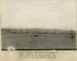
2010
2011
2012
2013
2014
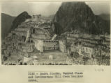
2015
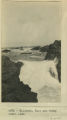
2016
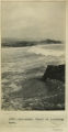
2017
2018
2019
2020
2021
TO
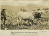
1911
1912
1913
1914
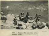
1915
1916
1917
1918
1919
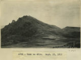
1920
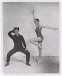
1921
1922
1923
1924
1925
1926
1927
1928
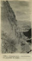
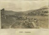
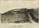
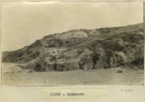
1929
1930
1931
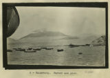
1932
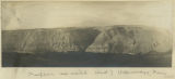
1933
1934
1935
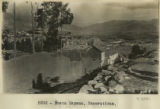
1936
1937
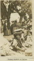
1938
1939
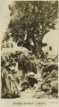
1940
1941
1942
1943
1944
1945
1946
1947
1948
1949
1950
1951
1952
1953
1954
1955
1956
1957
1958
1959
1960
1961
1962
1963
1964
1965
1966
1967
1968
1969
1970
1971
1972
1973
1974
1975
1976
1977
1978
1979
1980
1981
1982
1983
1984
1985
1986
1987
1988
1989
1990
1991
1992
1993
1994
1995
1996
1997
1998
1999
2000
2001
2002
2003
2004
2005
2006
2007
2008
2009
2010
2011
2012
2013
2014
2015
2016
2017
2018
2019
2020
2021
Type
Image
154
Text
3
Image/StillImage
2
Image/MovingImage
1
Format
image/jpeg
154
application/pdf
5
video/mp4
1
Institution
University of Utah Marriott Library
160
Collection
American West Center Research Projects
2
David Oman McKay Papers
1
Photo Archives
156
Utah COVID-19
1
Filters:
Spatial Coverage:
"South America"
101
-
150
of
160
<
1
2
3
4
>
Gallery view
Number of results to display per page
10
25
50
100
200
Sort by Relevance
Sort by Title A-Z
Sort by Title Z-A
Sort by Date Ascending
Sort by Date Descending
Sort by Last Modified Ascending
Sort by Last Modified Descending
Title
Date
Type
Setname
101
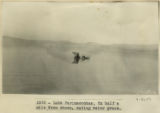
Lake Parinacochas. Ox half a mile from shore, eating water grass.
1911; 1912; 1915
Image
uum_map
102
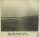
Lake Titicaca. Looking toward Quaqui from the mole built into the lake
1911
Image
uum_map
103
Lake Titicaca. Reed belt, alluvial fringe and tilted strata, border of Lake Titicaca near Guaqui.
1911
Image
uum_map
104
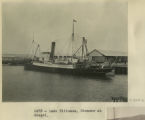
Lake Titicaca. Steamer at Guaqui.
1911
Image
uum_map
105
Lake Titicaca. The dark point of land on the left cuts off the view into the Desaguadero River, the outlet of Lake Titicaca. The river rounds the dark point and turns to the left.
1911
Image
uum_map
106
Llamas at the Calca market.
1912; 1913; 1914; 1915
Image
uum_map
107
Llamas on the Calca road.
1912; 1913; 1914; 1915
Image
uum_map
108
Loading cattle, seacoast, Callao
1912
Image
uum_map
109
Loading the passengers by means of bucket, coast of Peru
1911
Image
uum_map
110
Machu Picchu. Camp. Erdis eating a tomato.
1911; 1912; 1915
Image
uum_map
111
Machu Picchu. King's Group. Entrance to Number 729, with Dr. Eaton.
1911; 1912; 1915
Image
uum_map
112
Machu Picchu. Princess Group. House 856 showing southwest corner exterior from just inside the city wall. The further gable is the south gable of house 841. Notice on the left the partitions between 855 and 840. These were capped with flat stones and seem to have had mud on top of them. In the right hand gable over the window is a small ventilating window. Notice also the projecting cylindrical stones which show more distinctly in 3135. At the extreme right is shown a corner of the city wall. This house was probably stuccoed or plastered with mud. At any rate, the stones are roughly squared and laid in mud.
1911; 1912
Image
uum_map
113
Machu Picchu. Sacred Plaza and Intihuantana Hill from boulder caves.
1911; 1912
Image
uum_map
114
Mollendo. Crest of incoming wave
1912; 1913; 1914; 1915
Image
uum_map
115
Mollendo. Surf and rocky coast line
1912; 1913; 1914; 1915
Image
uum_map
116
Nusta Espana. Excavations
1912
Image
uum_map
117
Nusta Espana. Hardy and Little in Inca seat.
1912
Image
uum_map
118
Old Catholic church at Calca.
1912; 1913; 1914; 1915
Image
uum_map
119
Ollantaytambo. Continuation of panorama to right
1911; 1912; 1915
Image
uum_map
120
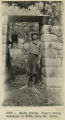
Ollantaytambo. Portrait of Indian boy.
1911
Image
uum_map
121
Oxen ploughing at the Mission House, Cuzco.
1912; 1913; 1914; 1915
Image
uum_map
122
Pacasmayo. Rush balsas characteristic of this port and used by sea-going fishermen. Also characteristic hose made of split bamboo. Reading from left to right, Messrs. G. F. Eaton, Robert Stephenson, and H. Stuart Hotchkiss
1912
Image
uum_map
123
Pacasmayo. The cliffs and surf with distant view of port and pier from top of cliffs to the northwest
1911; 1912; 1915
Image
uum_map
124
Paruro Road, Pack train.
1912; 1913; 1914; 1915
Image
uum_map
125
Pasaje. Safely on his way across the Apurimac.
1911; 1912; 1915
Image
uum_map
126
Pasaje. The same mule a few moments later.
1911; 1912; 1915
Image
uum_map
127
Payta, Panprama continues to left, showing at the extreme left the station of the Piura railroad
1911; 1912; 1915
Image
uum_map
128
Payta. The beach. A typical dugout canoe, and characteristic houses of the better class. Looking east
1911; 1912; 1915
Image
uum_map
129
Peneplain sea raised West of Uchumayo, Peru.
1912; 1913; 1914; 1915
Image
uum_map
130
Peru mountain
1912; 1913; 1914; 1915
Image
uum_map
131
Phil Keeler (Tommy Keeler) and Janice James (Minnie Tate), dancers for University of Utah State Department Tour production of "Annie From the Far West" performed in South America, Summer 1962
1962
Image/StillImage
uum_map
132
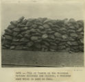
Pile of Yareta on the railroad between Mollendo and Juliaca, a resinous root which is used as fuel.
1911
Image
uum_map
133
Pisac. Portrait of Indian man.
1911
Image
uum_map
134
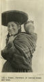
Pisac. Portrait of Indian woman and baby.
1911
Image
uum_map
135
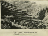
Pisac. Terraces below the citadel.
1911
Image
uum_map
136
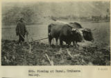
Plowing at Tarai, Urubamba valley.
1911
Image
uum_map
137
Quechua children and woman in front of house at the farm 'Urco' near Calca.
1912; 1913; 1914; 1915
Image
uum_map
138
Quechua children in front of house at the farm 'Urco' near Calca.
1912; 1913; 1914; 1915
Image
uum_map
139
Rodadero
1911; 1912; 1913; 1914; 1915
Image
uum_map
140
Rodadero
1911; 1912; 1913; 1914; 1915
Image
uum_map
141
Rodadero
1911; 1912; 1913; 1914; 1915
Image
uum_map
142
Salaverry, harbor and pier
1911
Image
uum_map
143
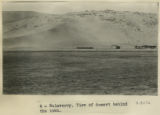
Salaverry. View of desert behind the town.
1911
Image
uum_map
144
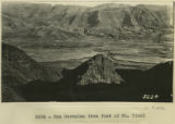
San Geronimo from foot of Mt. Picol
1912
Image
uum_map
145
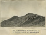
San Geronimo. Upturned sandstone on mountain east of S.G. looking west
1912; 1913; 1914; 1915
Image
uum_map
146
Santa Ana. View looking up the valley of the Urubamba about 1 league south of Santa Ana.
1911
Image
uum_map
147
Source materials for comparative studies of the Indians of the Americas
1977
Text
uum_awcrp
148
Sunday market at Calca.
1912; 1913; 1914; 1915
Image
uum_map
149
Sunday market at Calca.
1912; 1913; 1914; 1915
Image
uum_map
150
Sunday market, Calca.
1912; 1913; 1914; 1915
Image
uum_map
101
-
150
of
160
<
1
2
3
4
>