Home
Browse
Ask Us
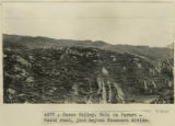
Chat
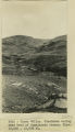
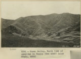
Harmful Language Statement
Log in
Photo Archives
Advanced Search
About
Over 90,000 photos covering a variety of topics from Marriott Library Special Collections.
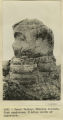
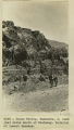
Year
1911
1912
1913
1914
1915
TO
1911
1912
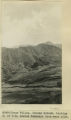
1913
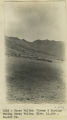
1914
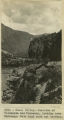
1915
Type
Image
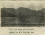
154
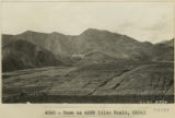
Format
image/jpeg
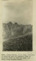
154
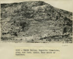
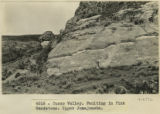
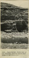
Institution
University of Utah Marriott Library
154
Collection
Photo Archives
154
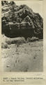
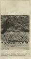
Filters:
Spatial Coverage:
"South America"
Type:
"Image"
1
-
50
of
154
<
1
2
3
4
>
Gallery view
Number of results to display per page
10
25
50
100
200
Sort by Relevance
Sort by Title A-Z
Sort by Title Z-A
Sort by Date Ascending
Sort by Date Descending
Sort by Last Modified Ascending
Sort by Last Modified Descending
Title
Date
Type
1
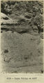
Abancay to La Estrella. Concacha. Nearer view of the same.
1911; 1912; 1915
Image
2
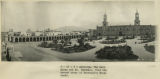
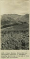
Arequipa. The main plaza and Mt. Chachani, from the second story of Morosini's Hotel Anexo.
1911; 1912; 1915
Image
3
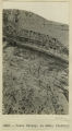
Arma Valley. Bumstead and signal on SE side. Arma-Puciura pass.
1912
Image
4
Ayusbamba. General view of lake beds looking SE.
1912; 1913; 1914; 1915
Image
5
Ayusbamba. Looking down Apurimac Caffon from Calvo's house.
1912; 1913; 1914; 1915
Image
6
Ayusbamba. Looking north from Calvo's house across limestone mass.
1912; 1913; 1914; 1915
Image
7
Ayusbamba. Senor and Senora Calvo at dining-room door.
1912
Image
8
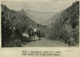
Ayusbamba. View SW from same place 1/4 N. Ely from Taray.
1912
Image
9
Baby Llamas.
1911
Image
10
Basalt? Cliff below Rumicola Quarry
1912; 1913; 1914; 1915
Image
11
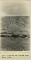
Boat, Lake Titicaca.
1912; 1913; 1914; 1915
Image
12
Cactus on the Calca road.
1912; 1913; 1914; 1915
Image
13
Chinchero. 2 Alcaldes, ancient wall and restored wall.
1911
Image
14
Corredor Hotal Central, Cuzco. Florentin Fluente. Front.
1912
Image
15
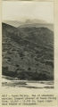
Crucero Alto, railroad pass
1912; 1913; 1914; 1915
Image
16
Cuzco Basin. Looking down the Valley from 'Island' toward the narrows
1912; 1913; 1914; 1915
Image
17
Cuzco basin. North flat, looking up Valley from 'Island' high point over 1 mile SE of San Sebastian.
1912; 1913; 1914; 1915
Image
18
Cuzco Indian.
1912
Image
19
Cuzco Valley
1911; 1912; 1913; 1914; 1915
Image
20
Cuzco Valley Choquo branch. Looking S or SE across Huancaro from west side. (compare 2987, 2988, and 2989)
1912; 1913; 1914; 1915
Image
21
Cuzco Valley, Lava columns NE bank of Vilcanata at Sierra Bella.
1912; 1913; 1914; 1915
Image
22
Cuzco Valley, Terrace. Ongapata. Looking upstream from 1/2 mile above mouth. Camera pointing south
1912; 1913; 1914; 1915
Image
23
Cuzco Valley. A four-horned sheep
1911; 1912; 1915
Image
24
Cuzco Valley. Abandoned moraine and cirque on Seneca, facing Chincheros road.
1912; 1913; 1914; 1915
Image
25
Cuzco Valley. Abandoned moraine. Looking down Junapincha. Elev. 15,000 ft.
1912; 1913; 1914; 1915
Image
26
Cuzco Valley. Choquo branch. Looking S or SE across Huancaro from west side.
1912; 1913; 1914; 1915
Image
27
Cuzco Valley. Cirque & Moraine facing Carao Valley. Elev. 13,500-14,000 ft.
1912; 1913; 1914; 1915
Image
28
Cuzco Valley. Deposits limestone, clay, and Cast. shale. Near mouth of Huancaro
1912; 1913; 1914; 1915
Image
29
Cuzco Valley. Detail alluvium. N. of San Sebastian [1]
1912; 1913; 1914; 1915
Image
30
Cuzco Valley. Detail alluvium. N. of San Sebastian [2]
1912; 1913; 1914; 1915
Image
31
Cuzco Valley. Detail.
1912; 1913; 1914; 1915
Image
32
Cuzco Valley. Divided spurs. Carao Valley
1912; 1913; 1914; 1915
Image
33
Cuzco Valley. End of abandoned moraine. Largest glacier of Cuzco Valley, Elev. 13,500-13,700 ft. Upper right hand branch of Junajaneha
1912; 1913; 1914; 1915
Image
34
Cuzco Valley. Erosion feature. Pink sandstone. 3 miles north of Angostura
1912; 1913; 1914; 1915
Image
35
Cuzco Valley. Faulting in Pink Sandstone. Upper Junajaneha
1912; 1913; 1914; 1915
Image
36
Cuzco Valley. Fold (syncline) on the Choquo, SE tributary of Huancaro. Looking east [1]
1912; 1913; 1914; 1915
Image
37
Cuzco Valley. Fold (syncline) on the Choquo, SE tributary of Huancaro. Looking east [2]
1912; 1913; 1914; 1915
Image
38
Cuzco Valley. Fold on Paruro-Cuzco road, just beyond Huancaro divide.
1912; 1913; 1914; 1915
Image
39
Cuzco Valley. Glaciated valley near head of Junajaneha stream. Elev 13,500-13,800 ft.
1912; 1913; 1914; 1915
Image
40
Cuzco Valley. Huancaro, S. bank just below mouth of Huatanay. Material of lowest terrace.
1912; 1913; 1914; 1915
Image
41
Cuzco Valley. Junction of Vilcanata and Huatanay, looking down Huatanay. Note high rock cut terrace.
1912; 1913; 1914; 1915
Image
42
Cuzco Valley. Looking down Huatanay, from above Anta Branch, 1 mile NW of Cuzco.
1912; 1913; 1914; 1915
Image
43
Cuzco Valley. Looking south across Huancaro, below mouth of Huatanay
1912; 1913; 1914; 1915
Image
44
Cuzco Valley. Mouth of Huatanay, looking upstream from East side Vilcanata. Note terrace and gorge
1912; 1913; 1914; 1915
Image
45
Cuzco Valley. Narrows, looking upstream from 1,000 feet below Angostura.
1912; 1913; 1914; 1915
Image
46
Cuzco Valley. North bank of the Hautanay, showing buried wall South of San Sebastian.
1912; 1913; 1914; 1915
Image
47
Cuzco Valley. North bank of the Huatanay, south of San Sebastian.
1912; 1913; 1914; 1915
Image
48
Cuzco Valley. North limb of syncline on Choquo
1912; 1913; 1914; 1915
Image
49
Cuzco Valley. North limb, vertical, of syncline west of Ongapata (same as syncline shown in 2996-2997) but three miles further south
1912; 1913; 1914; 1915
Image
50
Cuzco Valley. North-flowing, subsequent tributary to Huatanay, entering south side of valley at West (upper) end of Narrows.
1912; 1913; 1914; 1915
Image
1
-
50
of
154
<
1
2
3
4
>