Home
Browse
Ask Us
Chat
Harmful Language Statement
Log in
Advanced Search
Year
1880
1881
1882
1883
1884
1885
1886
1887
1888
1889
1890
1891
1892
1893
1894
1895
1896
1897
1898
1899
1900
1901
1902
1903
1904
1905
1906
1907
1908
1909
1910
1911
1912
1913
1914
1915
1916
1917
1918
1919
1920
1921
1922
1923
1924
1925
1926
1927
1928
1929
1930
1931
1932
1933
1934
1935
1936
1937
1938
1939
1940
1941
1942
1943
1944
1945
1946
1947
1948
1949
1950
1951
1952
1953
1954
1955
1956
1957
1958
1959
1960
1961
1962
1963
1964
1965
1966
1967
1968
1969
1970
1971
1972
1973
1974
1975
1976
1977
1978
1979
1980
1981
1982
1983
1984
1985
1986
1987
1988
1989
1990
1991
1992
1993
1994
1995
1996
1997
TO
1880
1881
1882
1883
1884
1885
1886
1887
1888
1889
1890
1891
1892
1893
1894
1895
1896
1897
1898
1899
1900
1901
1902
1903
1904
1905
1906
1907
1908
1909
1910
1911
1912
1913
1914
1915
1916
1917
1918
1919
1920
1921
1922
1923
1924
1925
1926
1927
1928
1929
1930
1931
1932
1933
1934
1935
1936
1937
1938
1939
1940
1941
1942
1943
1944
1945
1946
1947
1948
1949
1950
1951
1952
1953
1954
1955
1956
1957
1958
1959
1960
1961
1962
1963
1964
1965
1966
1967
1968
1969
1970
1971
1972
1973
1974
1975
1976
1977
1978
1979
1980
1981
1982
1983
1984
1985
1986
1987
1988
1989
1990
1991
1992
1993
1994
1995
1996
1997
Type
Image
880
Image/StillImage
363
Text
30
Format
image/jpeg
1,264
application/pdf
235
Collection
Beckwith Photograph Collection
2
Photo Archives
552
Ski and Snow Sports Archives
14
UAIDA Main Collection
51
Utah River Running Photo Archives
883
Western Waters NEH
1
More
Filters:
Spatial Coverage:
"San Juan County (Utah)"
276
-
300
of
1,503
<
7
8
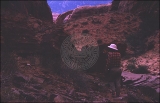
9
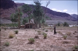
10
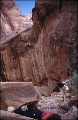
11
12
13
14
15
16
>
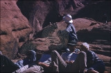
Gallery view
Number of results to display per page
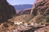
10
25
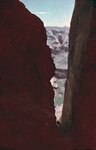
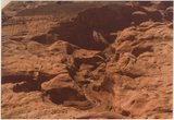
50
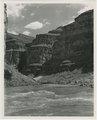
100
200
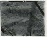
Sort by Relevance
Sort by Title A-Z
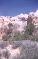
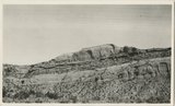
Sort by Title Z-A
Sort by Date Ascending
Sort by Date Descending
Sort by Last Modified Ascending
Sort by Last Modified Descending
Title
Date
Type
Setname
276
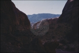
First glimpse of Rainbow Bridge.
1957; 1958; 1959; 1960; 1961; 1962
uum_map_rr
277
First glimpse of Rainbow Bridge.
1957; 1958; 1959; 1960; 1961; 1962
uum_map_rr
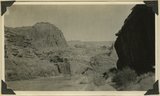
278
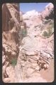
San Juan Canyon some 8 miles below Spencer camp. Canyon walls formed by Navajo, Todilto, and Wingate formations which dip at low angle to west. San Juan County, 1921
1921
Image
uum_map
279
Waiting turn at top of Bridge Country
1957; 1958; 1959; 1960; 1961; 1962
uum_map_rr
280
The narrow ten miles below Chin Lee
1921
Image/StillImage
uum_map
281
Music Temple, April 7, 1948
1948-04-07
Image/StillImage
uum_map
282
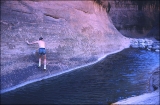
"Barbara drinking. 1.5 miles up stream on 6 mile hike to Rainbow Bridge."
1951-05-15
uum_map_rr
283
"Bert Loper's Cabin, Mile 150."
1951-05-11
uum_map_rr
284
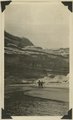
Glen Canyon scenery.
1958
Image
uum_map
285
Rainbow Bridge
1952
Image
uum_map
286
Rainbow Bridge
1952
Image
uum_map
287
Rainbow Bridge
1952
Image
uum_map
288
Rainbow Bridge
1952
Image
uum_map
289
Rainbow Bridge
1952
Image
uum_map
290
"Coming up" Bridge Hike.
1957; 1958; 1959; 1960; 1961; 1962
uum_map_rr
291
Above Contest Rock
1957; 1958; 1959; 1960; 1961; 1962
uum_map_rr
292
Looking down San Juan Canyon between mouth of Moonlight Creek and Clay Hill Crossing. Canyon walls formed by Moonlight sandstone. K.W. Trimble topographic engineer, at plane table. R.W. Allen recorder, standing nearby. San Juan County, UT. H. D. Miser, 1921
1921
Image
uum_map
293
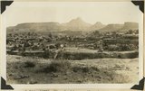
Looking into Moki Canyon 25 mi. up from the mouth. It is the only entrance except a trail nearby and one at the head. There is no way to get into the canyon between this point and the mouth 25 mi. below.
1930; 1931; 1932; 1933; 1934; 1935; 1936; 1937
Image
uum_map
294
View looking northwest across inner canyon of White Canyon between Rock Springs and Soldiers Crossing. "Kachina" (Cedar Mesa) sandstone forms floor of the outer canyon which is bordered by walls of "Frey" (Organ Rock), DeChelly, Moenkopi, Shinarump, Chinle, and Wingate (butte at top). San Juan County, Utah, 1932.
1932
Image
uum_map
295
The church arch in Cliff Canyon
1960-06-12
Image
uum_map
296
San Juan River, Glen Canyon
1962-06-23
Image
uum_map
297
Rainbow Bridge from air
1964
Image
uum_map
298
Thorn Mayes photos from a flight with Norm Nevills, October 1947 [117]
1947-10
Image/StillImage
uum_map_rr
299
Thorn Mayes photos from a flight with Norm Nevills, October 1947 [118]
1947-10
Image/StillImage
uum_map_rr
300
Arch Canyon, Utah
1930; 1931; 1932; 1933; 1934; 1935; 1936; 1937; 1938; 1939; 1940; 1941; 1942; 1943; 1944; 1945; 1946; 1947; 1948; 1949
Image
uum_map_rr
276
-
300
of
1,503
<
7
8
9
10
11
12
13
14
15
16
>