|
|
Title | Date | Type | Setname |
| 1 |
 |
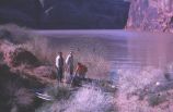
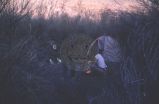
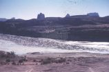
"So it's a lake now!" | 1963; 1964; 1965; 1966; 1967 | | uum_map_rr |
| 2 |
 |
A case analysis of policy implementation: the National Environmental Policy Act of 1969 | 1975 | Text | uu_gc |
| 3 |
 |
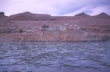
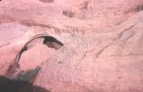
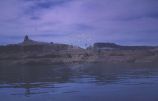
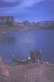
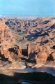
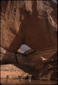
Above landing at Forbidden Canyon; Navajo Mountain in background, 1980s | 1980; 1981; 1982; 1983; 1984; 1985; 1986; 1987; 1988; 1989 | Image | uum_map |
| 4 |
 |
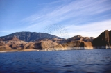
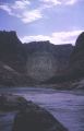
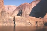
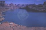
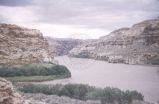
Aerial view of Glen Canyon | 1964-05 | Image | uum_map |
| 5 |
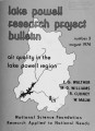 |
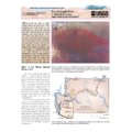
Air quality in the Lake Powell region | 1974 | Text | uu_gc |
| 6 |
 |
Allen-Warner Valley Energy System Environmental Impact Statement | 1980 | Text | uaida_main |
| 7 |
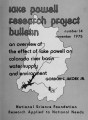 |
An overview of the effect of Lake Powell on Colorado River Basin water supply and environment | 1975 | Text | uu_gc |
| 8 |
 |
Analysis of metallic cations in the Lake Powell ecosystem and tributaries | 1978 | Text | uu_gc |
| 9 |
 |
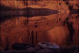
Annie's Canyon reflection | 1965-09-21 | Image | uum_map |
| 10 |
 |
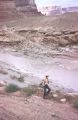
Approaching Hole-in-the-Rock from down lake | 1963-04-26 | Image | uum_map |
| 11 |
 |
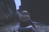
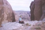
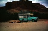
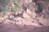
Before Lake Powell & Early Powell | 1963-03 | Image | uum_map_rr |
| 12 |
 |
Before Lake Powell & Early Powell | 1963-03 | Image | uum_map_rr |
| 13 |
 |
Before Lake Powell & Early Powell | 1963-03 | Image | uum_map_rr |
| 14 |
 |
Before Lake Powell & Early Powell | 1963-03 | Image | uum_map_rr |
| 15 |
 |
Before Lake Powell & Early Powell | 1963-03 | Image | uum_map_rr |
| 16 |
 |
Before Lake Powell & Early Powell | 1963-03 | Image | uum_map_rr |
| 17 |
 |
Before Lake Powell & Early Powell | 1963-03 | Image | uum_map_rr |
| 18 |
 |
Before Lake Powell & Early Powell | 1963-03 | Image | uum_map_rr |
| 19 |
 |
Before Lake Powell & Early Powell | 1963-03 | Image | uum_map_rr |
| 20 |
 |
Before Lake Powell & Early Powell | 1963-03 | Image | uum_map_rr |
| 21 |
 |
Before Lake Powell & Early Powell | 1963-03 | Image | uum_map_rr |
| 22 |
 |
Before Lake Powell & Early Powell | 1963-03 | Image | uum_map_rr |
| 23 |
 |
Before Lake Powell & Early Powell | 1963-03 | Image | uum_map_rr |
| 24 |
 |
Before Lake Powell & Early Powell | 1963-03 | Image | uum_map_rr |
| 25 |
 |
Before Lake Powell & Early Powell | 1963-03 | Image | uum_map_rr |
| 26 |
 |
Before Lake Powell & Early Powell | 1963-03 | Image | uum_map_rr |
| 27 |
 |
Before Lake Powell & Early Powell | 1963-03 | Image | uum_map_rr |
| 28 |
 |
Before Lake Powell & Early Powell | 1963-03 | Image | uum_map_rr |
| 29 |
 |
Before Lake Powell & Early Powell | 1963-03 | Image | uum_map_rr |
| 30 |
 |
Before Lake Powell & Early Powell | 1963-03 | Image | uum_map_rr |
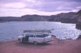
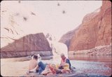
| 31 |
 |
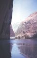
Before Lake Powell & Early Powell | 1963-03 | Image | uum_map_rr |
| 32 |
 |
Before Lake Powell & Early Powell | 1963-03 | Image | uum_map_rr |
| 33 |
 |
Before Lake Powell & Early Powell | 1963-03 | Image | uum_map_rr |
| 34 |
 |
Before Lake Powell & Early Powell | 1963-03 | Image | uum_map_rr |
| 35 |
 |
Before Lake Powell & Early Powell | 1963-03 | Image | uum_map_rr |
| 36 |
 |
Before Lake Powell & Early Powell | 1963-03 | Image | uum_map_rr |
| 37 |
 |
Before Lake Powell & Early Powell | 1963-03 | Image | uum_map_rr |
| 38 |
 |
Before Lake Powell & Early Powell | 1963-03 | Image | uum_map_rr |
| 39 |
 |
Before Lake Powell & Early Powell | 1963-03 | Image | uum_map_rr |
| 40 |
 |
Before Lake Powell & Early Powell | 1963-03 | Image | uum_map_rr |
| 41 |
 |
Before Lake Powell & Early Powell | 1963-03 | Image | uum_map_rr |
| 42 |
 |
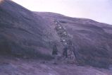
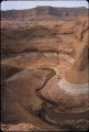
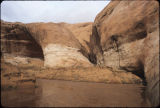
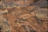
Beginning of deep road cut on road to Hite | 1965-09-21 | Image | uum_map |
| 43 |
 |
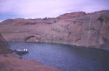
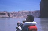
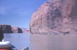
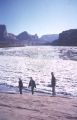
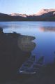
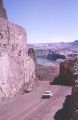
Boaters on early Lake Powell | 1964-05 | Image | uum_map |
| 44 |
 |
Boaters, early Lake Powell | 1964-05 | Image | uum_map |
| 45 |
 |
Boomtown impacts of energy development in the Lake Powell region | 1976 | Text | uu_gc |
| 46 |
 |
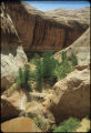
Castle Butte, 1980s | 1980; 1981; 1982; 1983; 1984; 1985; 1986; 1987; 1988; 1989 | Image | uum_map |
| 47 |
 |
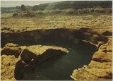
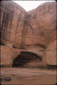
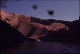
Cathedral in the Desert after Lake Powell was created | | Image | uum_map |
| 48 |
 |
Cathedral in the Desert, 1980s | 1980; 1981; 1982; 1983; 1984; 1985; 1986; 1987; 1988; 1989 | Image | uum_map |
| 49 |
 |
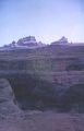
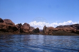
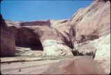
Chaotic landscape; Lake Powell (259-16) | 1962; 1963; 1964; 1965; 1966 | Image | uum_map_rr |
| 50 |
 |
Clear Creek above Cathedral in the Desert, Utah [1] | 2005-03-28 | Image | uum_map |
| 51 |
 |
Clear Creek above Cathedral in the Desert, Utah [2] | 2005-03-28 | Image | uum_map |
| 52 |
 |
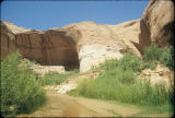
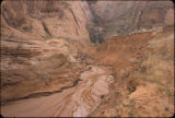
Clear Creek junction with Escalante River | 1965-09-21 | Image | uum_map |
| 53 |
 |
College of Medicine, University of Utah: Artificial organ research [1] | | Image | uum_uapp0305 |
| 54 |
 |
The Colorado River in Grand Canyon; how fast does it flow? | 1997 | Text | wwdl_er |
| 55 |
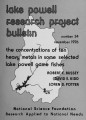 |
The concentrations of ten heavy metals in some selected Lake Powell game fishes | 1976 | Text | uu_gc |
| 56 |
 |
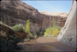
Cottonwood Canyon, 1970s? | 1970; 1971; 1972; 1973; 1974; 1975; 1976; 1977; 1978; 1979 | Image | uum_map |
| 57 |
 |
Cottonwood Canyon, 1980s | 1980; 1981; 1982; 1983; 1984; 1985; 1986; 1987; 1988; 1989 | Image | uum_map |
| 58 |
 |
Cottonwood Gulch, Kane County, Utah [1] | 2004-03-10 | Image | uum_map |
| 59 |
 |
Cottonwood Gulch, Kane County, Utah [2] | 2005-02-10 | Image | uum_map |
| 60 |
 |
Cottonwood Gulch, Kane County, Utah [3] | 2005-04-23 | Image | uum_map |
| 61 |
 |
Cottonwood Gulch, Kane County, Utah [4] | 2005-04-23 | Image | uum_map |
| 62 |
 |
Davis Gulch, 1980s | 1980; 1981; 1982; 1983; 1984; 1985; 1986; 1987; 1988; 1989 | Image | uum_map |
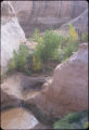
| 63 |
 |
Davis Gulch, Utah [01] | 1991-05-19 | Image | uum_map |
| 64 |
 |
Davis Gulch, Utah [02] | 2004-02-22 | Image | uum_map |
| 65 |
 |
Davis Gulch, Utah [03] | 2007-06-25 | Image | uum_map |
| 66 |
 |
Davis Gulch, Utah [04] | 1991-05-19 | Image | uum_map |
| 67 |
 |
Davis Gulch, Utah [05] | 2004-02-22 | Image | uum_map |
| 68 |
 |
Davis Gulch, Utah [06] | 2004-02-22 | Image | uum_map |
| 69 |
 |
Davis Gulch, Utah [07] | 2004-02-22 | Image | uum_map |
| 70 |
 |
Davis Gulch, Utah [08] | 2005-02-07 | Image | uum_map |
| 71 |
 |
Davis Gulch, Utah [09] | 2006-10-31 | Image | uum_map |
| 72 |
 |
Davis Gulch, Utah [10] | 2006-10-31 | Image | uum_map |
| 73 |
 |
Davis Gulch, Utah [11] | 2006-10-31 | Image | uum_map |
| 74 |
 |
Davis Gulch, Utah [12] | 2007-06-25 | Image | uum_map |
| 75 |
 |
Davis Gulch, Utah [13] | 2007-06-25 | Image | uum_map |
| 76 |
 |
Davis Gulch, Utah [14] | 1991-05-19 | Image | uum_map |
| 77 |
 |
Davis Gulch, Utah [15] | 1993-10-16 | Image | uum_map |
| 78 |
 |
Davis Gulch, Utah [16] | 2004-02-22 | Image | uum_map |
| 79 |
 |
Davis Gulch, Utah [17] | 2004-02-22 | Image | uum_map |
| 80 |
 |
Davis Gulch, Utah [18] | 2004-02-22 | Image | uum_map |
| 81 |
 |
Davis Gulch, Utah [19] | 2004-02-22 | Image | uum_map |
| 82 |
 |
Davis Gulch, Utah [20] | 2004-02-22 | Image | uum_map |
| 83 |
 |
Davis Gulch, Utah [21] | 2005-02-07 | Image | uum_map |
| 84 |
 |
Davis Gulch, Utah [22] | 2005-02-07 | Image | uum_map |
| 85 |
 |
Davis Gulch, Utah [23] | 2006-02-24 | Image | uum_map |
| 86 |
 |
Davis Gulch, Utah [24] | 2006-10-31 | Image | uum_map |
| 87 |
 |
Davis Gulch, Utah [25] | 2006-10-31 | Image | uum_map |
| 88 |
 |
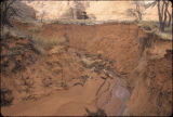
Deep road cut going to Hite | 1965-09-21 | Image | uum_map |
| 89 |
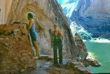 |
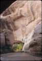
Defiance House, 1980s | 1970; 1971; 1972; 1973; 1974; 1975; 1976; 1977; 1978; 1979 | Image | uum_map |
| 90 |
 |
Disappearing cactus in full bloom across from Mystery Canyon | 1963-04-25 | Image | uum_map |
| 91 |
 |
Dry falls in Annie's Canyon | 1965-09-21 | Image | uum_map |
| 92 |
 |
Early Lake Powell | 1964-05 | Image | uum_map |
| 93 |
 |
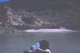
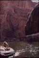
Early Lake Powell: motorboat and raft on shore | 1964-05 | Image | uum_map |
| 94 |
 |
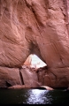
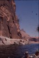
Early Lake Powell: Raft on water beneath sandstone walls | 1964-05 | Image | uum_map |
| 95 |
 |
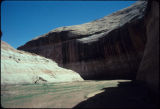
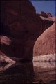
Early Lake Powell: sandstone cliffs | 1964-05 | Image | uum_map |
| 96 |
 |
Early Lake Powell: sandstone shoreline | 1964-05 | Image | uum_map |
| 97 |
 |
Early Lake Powell: sandstone shoreline | 1964-05 | Image | uum_map |
| 98 |
 |
Early Lake Powell: sandstone shoreline | 1964-05 | Image | uum_map |
| 99 |
 |
Early Lake Powell: sandstone shoreline | 1964-05 | Image | uum_map |
| 100 |
 |
Early Lake Powell: sandstone shoreline | 1964-05 | Image | uum_map |