Home
Browse
Ask Us
Chat
Harmful Language Statement
Log in
Advanced Search
Year
1846
1847
1848
1849
1850
1851
1852
1853
1854
1855
1856
1857
1858
1859
1860
1861
1862
1863
1864
1865
1866
1867
1868
1869
1870
1871
1872
1873
1874
1875
1876
1877
1878
1879
1880
1881
1882
1883
1884
1885
1886
1887
1888
1889
1890
1891
1892
1893
1894
1895
1896
1897
1898
1899
1900
1901
1902
1903
1904
1905
1906
1907
1908
1909
1910
1911
1912
1913
1914
1915
1916
1917
1918
1919
1920
1921
1922
1923
1924
1925
1926
1927
1928
1929
1930
1931
1932
1933
1934
1935
1936
1937
1938
1939
1940
1941
1942
1943
1944
1945
1946
1947
1948
1949
1950
1951
1952
1953
1954
1955
1956
1957
1958
1959
1960
1961
1962
1963
1964
1965
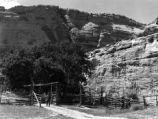
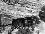
1966
1967
1968
1969
1970
1971
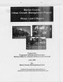
1972
1973
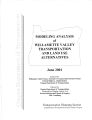
1974
1975
1976
1977
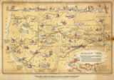
1978
1979
1980
1981
1982
1983
1984
1985
1986
1987
1988
1989
1990
1991
1992
1993
1994
1995
1996
1997
1998
1999
2000
2001
2002
2003
2004
2005
2006
2007
2008
2009
2010
2011
2012
2013
2014
2015
2016
2017
2018
2019
2020
2021
2022
2023
TO
1846
1847
1848
1849
1850
1851
1852
1853
1854
1855
1856
1857
1858
1859
1860
1861
1862
1863
1864
1865
1866
1867
1868
1869
1870
1871
1872
1873
1874
1875
1876
1877
1878
1879
1880
1881
1882
1883
1884
1885
1886
1887
1888
1889
1890
1891
1892
1893
1894
1895
1896
1897
1898
1899
1900
1901
1902
1903
1904
1905
1906
1907
1908
1909
1910
1911
1912
1913
1914
1915
1916
1917
1918
1919
1920
1921
1922
1923
1924
1925
1926
1927
1928
1929
1930
1931
1932
1933
1934
1935
1936
1937
1938
1939
1940
1941
1942
1943
1944
1945
1946
1947
1948
1949
1950
1951
1952
1953
1954
1955
1956
1957
1958
1959
1960
1961
1962
1963
1964
1965
1966
1967
1968
1969
1970
1971
1972
1973
1974
1975
1976
1977
1978
1979
1980
1981
1982
1983
1984
1985
1986
1987
1988
1989
1990
1991
1992
1993
1994
1995
1996
1997
1998
1999
2000
2001
2002
2003
2004
2005
2006
2007
2008
2009
2010
2011
2012
2013
2014
2015
2016
2017
2018
2019
2020
2021
2022
2023
Type
Image
78
Text
71
Image/StillImage
57
Sound
37
Image/MovingImage
1
InteractiveResource
1
More
Format
image/jpeg
178
application/pdf
72
video/mp4
25
audio/mpeg
13
Collection
American Westward Migration
2
Beckwith Photograph Collection
1
Classified Photographs
7
George A. Smith Papers
2
Land Use - Transportation Scenario Pl...
13
Photo Archives
51
Ski and Snow Sports Photo Archives
99
Taylor A. Woolley Papers
2
UAIDA Main Collection
2
Utah River Running Photo Archives
17
Western Soundscape
38
Western Waters Electronic Resources
56
More
Filters:
Spatial Coverage:
"Oregon"
Year End:
2016
126
-
150
of
290
<
1
2
3
4
5
6
7
8
9
10
>
Gallery view
Number of results to display per page
10
25
50
100
200
Sort by Relevance
Sort by Title A-Z
Sort by Title Z-A
Sort by Date Ascending
Sort by Date Descending
Sort by Last Modified Ascending
Sort by Last Modified Descending
Title
Date
Type
Setname
126
Major-ion, nutrient, and trace-element concentrations in the Steamboat Creek Basin, Oregon, 1996
1998
Text
wwdl_er
127
Making the Connections: a Summary of the LUTRAQ Project: Volume 7
1997-02
Text
uu_lu_tsp
128
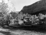
Mantle Ranch P.3
1955-07-01
Image
dha_cp
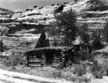
129
Mantle Ranch P.4
1955-07-01
Image
dha_cp
130
Mantle Ranch P.5
1955-07-01
Image
dha_cp
131
Mantle Ranch P.6
1955-07-01
Image
dha_cp
132
Map of Shoshone, Goshute, Bannock, Wind River and Panamint Indian Tribal Groups
1957
Image/StillImage
uaida_main
133
Map showing the boundary of the Shoshone Indian territory
1941
Image/StillImage
uaida_main
134
Marion County Urban Growth Management Project: Phase I and II Report
2001-06
Text
uu_lu_tsp
135
Mice in barn faint squeaks 100904
2010-09-04
Sound
uu_wss
136
Modeling Analysis of Willamette Valley Transportation and Land Use Alternatives
2001-06
Text
uu_lu_tsp
137
Modeling streamflow and water temperature in the North Santiam And Santiam Rivers, Oregon, 2001-02
2004
Text
wwdl_er
138
Modeling water quality in the Tualatin River, Oregon, 1991-1997
2001
Text
wwdl_er
139
Monitoring instream turbidity to estimate continuous suspended-sediment loads and yields and clay-water volumes in the Upper North Santiam River Basin, Oregon, 1998-2000
2003
Text
wwdl_er
140
Mormon Trail map
1947
Image/StillImage
uum_tawp
141
Mouse in barn faint squeaks 100904
2010-09-04
Sound
uu_wss
142
MS Random
1997; 1998; 1999; 2000; 2001; 2002
Image
uum_map_usa
143
MS Random
1997; 1998; 1999; 2000; 2001; 2002
Image
uum_map_usa
144
MS Random
1997; 1998; 1999; 2000; 2001; 2002
Image
uum_map_usa
145
MS Random
1997; 1998; 1999; 2000; 2001; 2002
Image
uum_map_usa
146
MS Random
1997; 1998; 1999; 2000; 2001; 2002
Image
uum_map_usa
147
MS Random
1997; 1998; 1999; 2000; 2001; 2002
Image
uum_map_usa
148
MS Random
1997; 1998; 1999; 2000; 2001; 2002
Image
uum_map_usa
149
MS Random
1997; 1998; 1999; 2000; 2001; 2002
Image
uum_map_usa
150
MS Random
1997; 1998; 1999; 2000; 2001; 2002
Image
uum_map_usa
126
-
150
of
290
<
1
2
3
4
5
6
7
8
9
10
>