| | Title | Date | Type | Setname |
|---|
| 201 | 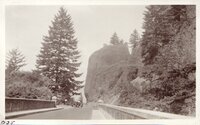 | Oregon-California trip, 1921: Columbia River Drive east of Portland | 1921-07 | Image/StillImage | uum_map |
| 202 |  | Oregon-California trip, 1921: Eleanor - In Woods - Near Portland.tif | 1921-07 | Image/StillImage | uum_map |
| 203 | 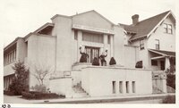 | Oregon-California trip, 1921: LDS Chapel - Portland - Eugene and Companion | 1921-07; 1921-08 | Image/StillImage | uum_map |
| 204 | 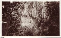 | Oregon-California trip, 1921: Packs in southern Oregon | 1921-08 | Image/StillImage | uum_map |
| 205 |  | Oregon-California trip, 1921: Packs in southern Oregon | 1921-08 | Image/StillImage | uum_map |
| 206 |  | Oregon-California trip, 1921: Packs near Albany, Oregon | 1921-08 | Image/StillImage | uum_map |
| 207 |  | Oregon-California trip, 1921: Packs near Crater Lake | 1921-08-08 | Image/StillImage | uum_map |
| 208 | 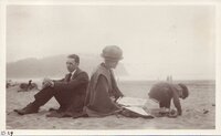 | Oregon-California trip, 1921: Packs: Eugene, Sadie, Eleanor - Seaside, Oregon | 1921-07 | Image/StillImage | uum_map |
| 209 |  | Oregon-California trip, 1921: Road approaching Crater Lake | 1921-08-08 | Image/StillImage | uum_map |
| 210 | 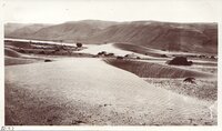 | Oregon-California trip, 1921: Sand dunes, Columbia River | 1921-07 | Image/StillImage | uum_map |
| 211 | 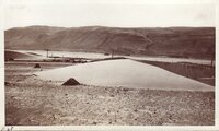 | Oregon-California trip, 1921: Sand dunes, Columbia River | 1921-07 | Image/StillImage | uum_map |
| 212 |  | Oregon-California trip, 1921: Sandstone dikes near Astoria, Oregon | 1921-07 | Image/StillImage | uum_map |
| 213 | 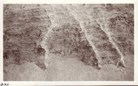 | Oregon-California trip, 1921: Sandstone dikes near Astoria, Oregon | 1921-07 | Image/StillImage | uum_map |
| 214 |  | Oregon-California trip, 1921: Sandstone dikes near Astoria, Oregon | 1921-07 | Image/StillImage | uum_map |
| 215 | 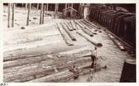 | Oregon-California trip, 1921: Saw mill, Astoria, Oregon [01] | 1921-07 | Image/StillImage | uum_map |
| 216 |  | Oregon-California trip, 1921: Saw mill, Astoria, Oregon [02] | 1921-07 | Image/StillImage | uum_map |
| 217 |  | Oregon-California trip, 1921: Saw mill, Astoria, Oregon [03] | 1921-07 | Image/StillImage | uum_map |
| 218 |  | Oregon-California trip, 1921: Saw mill, Astoria, Oregon [04] | 1921-07 | Image/StillImage | uum_map |
| 219 |  | Oregon-California trip, 1921: Saw mill, Astoria, Oregon [05] | 1921-07 | Image/StillImage | uum_map |
| 220 |  | Oregon-California trip, 1921: Scenery approaching Crater Lake | 1921-08-08 | Image/StillImage | uum_map |
| 221 | 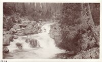 | Oregon-California trip, 1921: Scenery approaching Crater Lake | 1921-08-08 | Image/StillImage | uum_map |
| 222 | 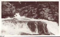 | Oregon-California trip, 1921: Scenery approaching Crater Lake | 1921-08-08 | Image/StillImage | uum_map |
| 223 | 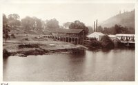 | Oregon-California trip, 1921: Scenery, southern Oregon | 1921-08 | Image/StillImage | uum_map |
| 224 |  | Oregon-California trip, 1921: Scenery, southern Oregon | 1921-08 | Image/StillImage | uum_map |
| 225 |  | Oregon-California trip, 1921: Scenic drive, Columbia River | 1921-07 | Image/StillImage | uum_map |
| 226 |  | Oregon-California trip, 1921: State Capitol, Salem, Oregon | 1921-08 | Image/StillImage | uum_map |
| 227 | 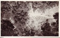 | Oregon-California trip, 1921: Syncline, southern Oregon | 1921-08 | Image/StillImage | uum_map |
| 228 |  | Oregon-California trip, 1921: Waterfalls - Multnomah, east of Portland | 1921-07 | Image/StillImage | uum_map |
| 229 |  | Oregon-California trip, 1921: Waterfalls - Multnomah, east of Portland | 1921-07 | Image/StillImage | uum_map |
| 230 |  | Oregon-California trip, 1921: Waterfalls - Multnomah, east of Portland | 1921-07 | Image/StillImage | uum_map |
| 231 |  | Oregon-California trip, 1921: Waterfalls - Multnomah, east of Portland | 1921-07 | Image/StillImage | uum_map |
| 232 |  | Oregon-California trip, 1921: Waterfalls - Multnomah, east of Portland | 1921-07 | Image/StillImage | uum_map |
| 233 |  | Oregon-California trip, 1921: Waterfalls - Multnomah, east of Portland | 1921-07 | Image/StillImage | uum_map |
| 234 |  | Oregon-California trip, 1921: Waterfalls east of Portland, Oregon | 1921-07 | Image/StillImage | uum_map |
| 235 |  | Oregon: Water Resources Department | | Text | wwdl_er |
| 236 |  | Osprey (100821) a | 2010-08-21 | Sound | uu_wss |
| 237 |  | Packs - on ferry south of Portland | 1921-08 | Image/StillImage | uum_map |
| 238 |  | Pesticides in surface water of the Yakima River Basin, Washington, 1999-2000-their occurrence and an assessment of factors affecting concentrations and loads | 2002 | Text | wwdl_er |
| 239 |  | Pesticides in the Lower Clackamas River Basin, Oregon, 2000-01 | 2004 | Text | wwdl_er |
| 240 |  | Phosphorus and E. Coli and their relation to selected constituents during storm runoff conditions in Fanno Creek, Oregon, 1998-99 | 2003 | Text | wwdl_er |
| 241 |  | Phosphorus and E. coli in the Fanno and Bronson Creek subbasins of the Tualatin River Basin, Oregon, during summer low-flow conditions, 1996 | 2000 | Text | wwdl_er |
| 242 | 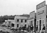 | Portland, Oregon P.1 | | Image | dha_cp |
| 243 |  | Precipitation-runoff and streamflow-routing models for the Willamette River Basin, Oregon | 1997 | Text | wwdl_er |
| 244 | 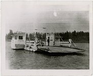 | Present-day power ferry at Wheatland | 1930; 1931; 1932; 1933; 1934; 1935; 1936; 1937; 1938; 1939; 1940; 1941; 1942; 1943; 1944; 1945; 1946; 1947; 1948; 1949; 1950 | Image/StillImage | uum_map |
| 245 |  | Processes controlling dissolved oxygen and pH in the upper Willamette River Basin, Oregon, 1994 | 1995 | Text | wwdl_er |
| 246 |  | Quality of shallow ground water in alluvial aquifers of the Willamette Basin, Oregon, 1993-95 | 1997 | Text | wwdl_er |
| 247 |  | Quality-assurance data, comparison to water-quality standards, and site considerations for total dissolved gas and water temperature, Lower Columbia River, Oregon and Washington, 2001 | 2001 | Text | wwdl_er |
| 248 |  | Raven (100818) | 2010-08-18 | Sound | uu_wss |
| 249 |  | Ravens (100820) a | 2010-08-20 | Sound | uu_wss |
| 250 |  | Ravens close (100822) | 2010-08-22 | Sound | uu_wss |
| 251 | 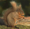 | Red Squirrel (100818) a | 2010-08-18 | Sound | uu_wss |
| 252 |  | Red Squirrel (100820) a | 2010-08-20 | Sound | uu_wss |
| 253 |  | Red Squirrels close (100818) | 2010-08-18 | Sound | uu_wss |
| 254 |  | Region 2040 Concepts for Growth: Report to Council | 1994-06 | Text | uu_lu_tsp |
| 255 |  | Region 2040 Preferred Alternative | 1994-09-02 | Text | uu_lu_tsp |
| 256 |  | Relation between selected water-quality variables and lake level in Upper Klamath and Agency Lakes, Oregon | 1996 | Text | wwdl_er |
| 257 |  | Relations of Tualatin River water temperatures to natural and human-caused factors | 1997 | Text | wwdl_er |
| 258 |  | Rolling Thunder (100817) a | 2010-08-17 | Sound | uu_wss |
| 259 | 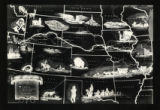 | Route of the Mormon Pioneers map | 1947 | Image/StillImage | uum_tawp |
| 260 |  | Ruffed Grouse flying (100820) | 2010-08-20 | Sound | uu_wss |
| 261 |  | Ruffed Grouse vocalizations (100820) a | 2010-08-20 | Sound | uu_wss |
| 262 |  | Ruffed Grouse vocalizations (100820) extended | 2010-08-20 | Sound | uu_wss |
| 263 | 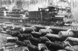 | Salt Lake & Mercur Railroad P.11 | | Image | dha_cp |
| 264 |  | Sand dunes and pines [1] | 1937; 1938; 1939; 1940; 1941; 1942; 1943; 1944; 1945; 1946; 1947; 1948; 1949; 1950; 1951; 1952; 1953; 1954; 1955; 1956; 1957; 1958; 1959; 1960; 1961; 1962; 1963; 1964; 1965; 1966; 1967; 1968; 1969; 1970; 1971; 1972; 1973; 1974; 1975; 1976; 1977; 1978; 1979; 1980 | Image | uum_map_rr |
| 265 |  | Sand dunes and pines [2] | 1937; 1938; 1939; 1940; 1941; 1942; 1943; 1944; 1945; 1946; 1947; 1948; 1949; 1950; 1951; 1952; 1953; 1954; 1955; 1956; 1957; 1958; 1959; 1960; 1961; 1962; 1963; 1964; 1965; 1966; 1967; 1968; 1969; 1970; 1971; 1972; 1973; 1974; 1975; 1976; 1977; 1978; 1979; 1980 | Image | uum_map_rr |
| 266 | 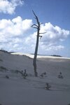 | Sand dunes and pines [3] | 1937; 1938; 1939; 1940; 1941; 1942; 1943; 1944; 1945; 1946; 1947; 1948; 1949; 1950; 1951; 1952; 1953; 1954; 1955; 1956; 1957; 1958; 1959; 1960; 1961; 1962; 1963; 1964; 1965; 1966; 1967; 1968; 1969; 1970; 1971; 1972; 1973; 1974; 1975; 1976; 1977; 1978; 1979; 1980 | Image | uum_map_rr |
| 267 |  | Sand dunes and pines [4] | 1937; 1938; 1939; 1940; 1941; 1942; 1943; 1944; 1945; 1946; 1947; 1948; 1949; 1950; 1951; 1952; 1953; 1954; 1955; 1956; 1957; 1958; 1959; 1960; 1961; 1962; 1963; 1964; 1965; 1966; 1967; 1968; 1969; 1970; 1971; 1972; 1973; 1974; 1975; 1976; 1977; 1978; 1979; 1980 | Image | uum_map_rr |
| 268 |  | Seasonal and spatial variability of nutrients and pesticides in streams of the Willamette Basin, Oregon, 1993-95 | 1998 | Text | wwdl_er |
| 269 |  | Sediment oxygen demand in Upper Klamath and Agency Lakes, Oregon, 1999 | 2001 | Text | wwdl_er |
| 270 |  | Selected elements and organic chemicals in bed sediment and tissue of the Tualatin River Basin, Oregon, 1992-96 | 1999 | Text | wwdl_er |
| 271 | 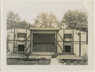 | Shakespearian theater at Ashland, Oregon, August 1951 | 1951-08 | Image | uum_map |
| 272 | 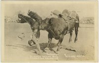 | Sharkey, the famous bucking bull, Pendleton Round-up | 1913 | Image | uum_map |
| 273 |  | Silver-haired Bat distress calls | | Sound | uu_wss |
| 274 |  | Southern Willamette Valley Regional Growth Management Strategy | 2006-08-31 | Text | uu_lu_tsp |
| 275 |  | Stream velocity and dispersion characteristics determined by dye-tracer studies on selected stream reaches in the Willamette River Basin, Oregon | 1995 | Text | wwdl_er |
| 276 |  | Striped Skunk (possible) (100818) a | 2010-08-18 | Sound | uu_wss |
| 277 |  | Summary of information on aquatic biota and their habitats in the Willamette Basin, Oregon, through 1995 | 1997 | Text | wwdl_er |
| 278 |  | Surface-water-quality assessment of the Yakima River Basin in Washington: Overview of Major Findings, 1987-91 | 1999 | Text | wwdl_er |
| 279 |  | Thunder 1 at Nye Beach (Oregon) August 18, 2008 | 2008-08-18 | Sound | uu_wss |
| 280 |  | Thunder 2 at Nye Beach (Oregon) August 18, 2008 | 2008-08-18 | Sound | uu_wss |
| 281 |  | Thunderstorm at Nye Beach (Oregon) extended (080817_PCMD50) | 2008-08-18 | Sound | uu_wss |
| 282 | 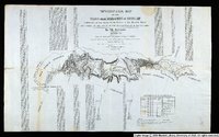 | Topographical Map of the Road From Missouri To Oregon Commencing at the Mouth of the Kansas in the Missouri River and Ending at the Mouth of the Wallah-Wallah in the Columbia. Section 7 | 1846 | Image/StillImage | uu_awm |
| 283 |  | Total dissolved gas and water temperature in the Lower Columbia River, Oregon and Washington, 2003: quality-assurance data and comparison to water-quality standards | 2003 | Text | wwdl_er |
| 284 |  | Total dissolved gas, barometric pressure, and water temperature data, lower Columbia River, Oregon and Washington, 1996 | 1996 | Text | wwdl_er |
| 285 |  | Townsend's Chipmunk (video) | 2007 | Image/MovingImage | uu_wss |
| 286 |  | Townsend's Chipmunk 1 | 2007 | Sound | uu_wss |
| 287 |  | Townsend's Chipmunk 2 | 2007 | Sound | uu_wss |
| 288 |  | Train 1 in Hood River, Oregon 090725 | 2009-07-25 | Sound | uu_wss |
| 289 |  | Train 2 in Hood River, Oregon 090726 | 2009-07-25 | Sound | uu_wss |
| 290 |  | UMNH:Mamm:24995 | 2022-04-29 | | umnh_vz_voucher |
| 291 |  | UMNH:Mamm:26185 | 2021-09-01 | | umnh_vz_voucher |
| 292 |  | UMNH:Mamm:26186 | 2022-02-18 | | umnh_vz_voucher |
| 293 |  | UMNH:Mamm:26187 | 2022-02-18 | | umnh_vz_voucher |
| 294 |  | UMNH:Mamm:26188 | 2022-02-23 | | umnh_vz_voucher |
| 295 |  | UMNH:Mamm:26372 | 2022-04-01 | | umnh_vz_voucher |
| 296 |  | UMNH:Mamm:26466 | 2022-04-01 | | umnh_vz_voucher |
| 297 |  | UMNH:Mamm:26467 | 2022-04-01 | | umnh_vz_voucher |
| 298 |  | UMNH:Mamm:26469 | 2022-04-01 | | umnh_vz_voucher |
| 299 |  | UMNH:Mamm:26470 | 2022-04-01 | | umnh_vz_voucher |
| 300 |  | UMNH:Mamm:26471 | 2022-04-01 | | umnh_vz_voucher |