| | Title | Date | Type | Setname |
|---|
| 101 |  | Jeff Davis snowboarding at Mt. Hood [38] | 1988 | | uum_map_usa |
| 102 | 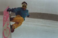 | Jeff Davis snowboarding at Mt. Hood [39] | 1988 | | uum_map_usa |
| 103 |  | Jeff Davis snowboarding at Mt. Hood [40] | 1988 | | uum_map_usa |
| 104 |  | Jeff Davis snowboarding at Mt. Hood [41] | 1988 | | uum_map_usa |
| 105 |  | Jeff Davis snowboarding at Mt. Hood [42] | 1988 | | uum_map_usa |
| 106 |  | Jeff Davis snowboarding at Mt. Hood [43] | 1988 | | uum_map_usa |
| 107 |  | Jeff Davis snowboarding at Mt. Hood [44] | 1988 | | uum_map_usa |
| 108 | 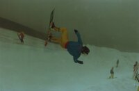 | Jeff Davis snowboarding at Mt. Hood [45] | 1988 | | uum_map_usa |
| 109 |  | Jeff Davis snowboarding at Mt. Hood [46] | 1988 | | uum_map_usa |
| 110 |  | Kim Bohnsack at Windells Snowboard Camp [01] | 1997; 1998; 1999; 2000; 2001; 2002; 2003 | Image | uum_map_usa |
| 111 |  | Kim Bohnsack at Windells Snowboard Camp [02] | 1997; 1998; 1999; 2000; 2001; 2002; 2003 | Image | uum_map_usa |
| 112 |  | Kim Bohnsack at Windells Snowboard Camp [03] | 1997; 1998; 1999; 2000; 2001; 2002; 2003 | Image | uum_map_usa |
| 113 |  | Kim Bohnsack at Windells Snowboard Camp [04] | 1997; 1998; 1999; 2000; 2001; 2002; 2003 | Image | uum_map_usa |
| 114 |  | Kim Bohnsack at Windells Snowboard Camp [05] | 1997; 1998; 1999; 2000; 2001; 2002; 2003 | Image | uum_map_usa |
| 115 | 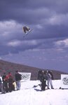 | Kim Bohnsack at Windells Snowboard Camp [06] | 1997; 1998; 1999; 2000; 2001; 2002; 2003 | Image | uum_map_usa |
| 116 | 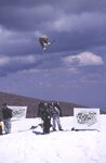 | Kim Bohnsack at Windells Snowboard Camp [07] | 1997; 1998; 1999; 2000; 2001; 2002; 2003 | Image | uum_map_usa |
| 117 |  | Kim Bohnsack at Windells Snowboard Camp [08] | 1997; 1998; 1999; 2000; 2001; 2002; 2003 | Image | uum_map_usa |
| 118 |  | Kim Bohnsack at Windells Snowboard Camp [09] | 1997; 1998; 1999; 2000; 2001; 2002; 2003 | Image | uum_map_usa |
| 119 |  | Kim Bohnsack at Windells Snowboard Camp [10] | 1997; 1998; 1999; 2000; 2001; 2002; 2003 | Image | uum_map_usa |
| 120 |  | Kim Bohnsack at Windells Snowboard Camp [11] | 1997; 1998; 1999; 2000; 2001; 2002; 2003 | Image | uum_map_usa |
| 121 |  | Kim Bohnsack at Windells Snowboard Camp [12] | 1997; 1998; 1999; 2000; 2001; 2002; 2003 | Image | uum_map_usa |
| 122 |  | Kim Bohnsack at Windells Snowboard Camp [13] | 1997; 1998; 1999; 2000; 2001; 2002; 2003 | Image | uum_map_usa |
| 123 |  | Kim Bohnsack at Windells Snowboard Camp [14] | 1997; 1998; 1999; 2000; 2001; 2002; 2003 | Image | uum_map_usa |
| 124 |  | Kim Bohnsack at Windells Snowboard Camp [15] | 1997; 1998; 1999; 2000; 2001; 2002; 2003 | Image | uum_map_usa |
| 125 |  | Klamath River Basin hydrologic conditions prior to the September 2002 die-off of Salmon and Steelhead | 2003 | Text | wwdl_er |
| 126 | 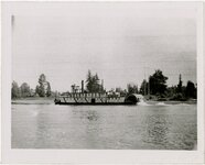 | Last steamer on Williamette River, Oregon | 1920; 1921; 1922; 1923; 1924; 1925; 1926; 1927; 1928; 1929; 1930; 1931; 1932; 1933; 1934; 1935; 1936; 1937; 1938; 1939; 1940; 1941; 1942; 1943; 1944; 1945; 1946; 1947; 1948; 1949; 1950 | Image/StillImage | uum_map |
| 127 |  | Long-eared Myotis | 2003-09 | Sound | uu_wss |
| 128 | | Long-legged Myotis distress calls | | Sound | uu_wss |
| 129 | 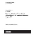 | Major-ion, nutrient, and trace-element concentrations in the Steamboat Creek Basin, Oregon, 1996 | 1998 | Text | wwdl_er |
| 130 |  | Making the Connections: a Summary of the LUTRAQ Project: Volume 7 | 1997-02 | Text | uu_lu_tsp |
| 131 | 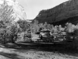 | Mantle Ranch P.3 | 1955-07-01 | Image | dha_cp |
| 132 | 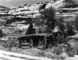 | Mantle Ranch P.4 | 1955-07-01 | Image | dha_cp |
| 133 | 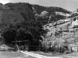 | Mantle Ranch P.5 | 1955-07-01 | Image | dha_cp |
| 134 | 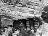 | Mantle Ranch P.6 | 1955-07-01 | Image | dha_cp |
| 135 |  | Map of Shoshone, Goshute, Bannock, Wind River and Panamint Indian Tribal Groups | 1957 | Image/StillImage | uaida_main |
| 136 |  | Map of Western Indian Territory Before 1850 | | Image/StillImage | uaida_main |
| 137 |  | Map of Western Shoshone and Northern Paiute Territory | | Image/StillImage | uaida_main |
| 138 |  | Map showing the boundary of the Shoshone Indian territory | 1941 | Image/StillImage | uaida_main |
| 139 |  | Marion County Urban Growth Management Project: Phase I and II Report | 2001-06 | Text | uu_lu_tsp |
| 140 | | Mice in barn faint squeaks 100904 | 2010-09-04 | Sound | uu_wss |
| 141 |  | Modeling Analysis of Willamette Valley Transportation and Land Use Alternatives | 2001-06 | Text | uu_lu_tsp |
| 142 |  | Modeling streamflow and water temperature in the North Santiam And Santiam Rivers, Oregon, 2001-02 | 2004 | Text | wwdl_er |
| 143 |  | Modeling water quality in the Tualatin River, Oregon, 1991-1997 | 2001 | Text | wwdl_er |
| 144 |  | Monitoring instream turbidity to estimate continuous suspended-sediment loads and yields and clay-water volumes in the Upper North Santiam River Basin, Oregon, 1998-2000 | 2003 | Text | wwdl_er |
| 145 | 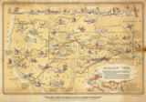 | Mormon Trail map | 1947 | Image/StillImage | uum_tawp |
| 146 | | Mouse in barn faint squeaks 100904 | 2010-09-04 | Sound | uu_wss |
| 147 |  | MS Random | 1997; 1998; 1999; 2000; 2001; 2002 | Image | uum_map_usa |
| 148 |  | MS Random | 1997; 1998; 1999; 2000; 2001; 2002 | Image | uum_map_usa |
| 149 |  | MS Random | 1997; 1998; 1999; 2000; 2001; 2002 | Image | uum_map_usa |
| 150 |  | MS Random | 1997; 1998; 1999; 2000; 2001; 2002 | Image | uum_map_usa |
| 151 |  | MS Random | 1997; 1998; 1999; 2000; 2001; 2002 | Image | uum_map_usa |
| 152 |  | MS Random | 1997; 1998; 1999; 2000; 2001; 2002 | Image | uum_map_usa |
| 153 |  | MS Random | 1997; 1998; 1999; 2000; 2001; 2002 | Image | uum_map_usa |
| 154 |  | MS Random | 1997; 1998; 1999; 2000; 2001; 2002 | Image | uum_map_usa |
| 155 |  | MS Random | 1997; 1998; 1999; 2000; 2001; 2002 | Image | uum_map_usa |
| 156 |  | MS Random | 1997; 1998; 1999; 2000; 2001; 2002 | Image | uum_map_usa |
| 157 |  | MS Random | 1997; 1998; 1999; 2000; 2001; 2002 | Image | uum_map_usa |
| 158 |  | MS Random | 1997; 1998; 1999; 2000; 2001; 2002 | Image | uum_map_usa |
| 159 |  | MS Random | 1997; 1998; 1999; 2000; 2001; 2002 | Image | uum_map_usa |
| 160 |  | MS Random | 1997; 1998; 1999; 2000; 2001; 2002 | Image | uum_map_usa |
| 161 |  | MS Random | 1997; 1998; 1999; 2000; 2001; 2002 | Image | uum_map_usa |
| 162 |  | MS Random | 1997; 1998; 1999; 2000; 2001; 2002 | Image | uum_map_usa |
| 163 |  | MS Random | 1997; 1998; 1999; 2000; 2001; 2002 | Image | uum_map_usa |
| 164 |  | MS Random | 1997; 1998; 1999; 2000; 2001; 2002 | Image | uum_map_usa |
| 165 | 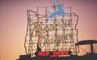 | MS Random; Made in Oregon sign. | 1997; 1998; 1999; 2000; 2001; 2002 | Image | uum_map_usa |
| 166 | 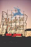 | MS Random; Made in Oregon sign. | 1997; 1998; 1999; 2000; 2001; 2002 | Image | uum_map_usa |
| 167 |  | MS Random; Made in Oregon sign. | 1997; 1998; 1999; 2000; 2001; 2002 | Image | uum_map_usa |
| 168 |  | MS Random; videographers | 1997; 1998; 1999; 2000; 2001; 2002 | Image | uum_map_usa |
| 169 |  | MS Random; videographers | 1997; 1998; 1999; 2000; 2001; 2002 | Image | uum_map_usa |
| 170 |  | MS Random; videographers | 1997; 1998; 1999; 2000; 2001; 2002 | Image | uum_map_usa |
| 171 | 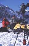 | MS Random; videographers | 1997; 1998; 1999; 2000; 2001; 2002 | Image | uum_map_usa |
| 172 | 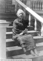 | Naomi Pike Schenck | 1933 | Image | dha_cp |
| 173 |  | The Nature of 2040: the Region's 50-Year Plan for Managing Growth | | Text | uu_lu_tsp |
| 174 | 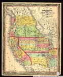 | New map of the state of California, the territories of Oregon, Washington, Utah & New Mexico. | 1853 | Image/StillImage | uu_awm |
| 175 |  | Nitrogen and phosphorus loading from drained wetlands adjacent to Upper Klamath and Agency Lakes, Oregon | 1997 | Text | wwdl_er |
| 176 |  | Nye Beach (Oregon) August 18, 2008 5:20 PM | 2008-08-18 | Sound | uu_wss |
| 177 |  | Occurrence of selected trace elements and organic compounds and their relation to land use in the Willamette River Basin, Oregon, 1992-94 | 1996 | Text | wwdl_er |
| 178 |  | Ogden, Peter Skene-Gravestone P.1 | 1914-06-10 | Image | dha_cp |
| 179 |  | Oregon City school house where I attended school: Mae Davis Nevills | 1925 | Image/StillImage | uum_map_rr |
| 180 |  | Oregon Coast [01] | 1930; 1931; 1932; 1933; 1934; 1935; 1936; 1937; 1938; 1939; 1940; 1941; 1942; 1943; 1944; 1945; 1946; 1947; 1948; 1949; 1950 | Image | uum_map_rr |
| 181 |  | Oregon Coast [02] | 1930; 1931; 1932; 1933; 1934; 1935; 1936; 1937; 1938; 1939; 1940; 1941; 1942; 1943; 1944; 1945; 1946; 1947; 1948; 1949; 1950 | Image | uum_map_rr |
| 182 |  | Oregon Coast [03] | 1930; 1931; 1932; 1933; 1934; 1935; 1936; 1937; 1938; 1939; 1940; 1941; 1942; 1943; 1944; 1945; 1946; 1947; 1948; 1949; 1950 | Image | uum_map_rr |
| 183 | 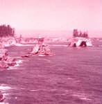 | Oregon Coast [04] | 1930; 1931; 1932; 1933; 1934; 1935; 1936; 1937; 1938; 1939; 1940; 1941; 1942; 1943; 1944; 1945; 1946; 1947; 1948; 1949; 1950 | Image | uum_map_rr |
| 184 |  | Oregon Coast [05]: Haystack Rock near Cannon Beach | 1930; 1931; 1932; 1933; 1934; 1935; 1936; 1937; 1938; 1939; 1940; 1941; 1942; 1943; 1944; 1945; 1946; 1947; 1948; 1949; 1950 | Image | uum_map_rr |
| 185 |  | Oregon Coast [06]: Haystack Rock near Cannon Beach | 1930; 1931; 1932; 1933; 1934; 1935; 1936; 1937; 1938; 1939; 1940; 1941; 1942; 1943; 1944; 1945; 1946; 1947; 1948; 1949; 1950 | Image | uum_map_rr |
| 186 |  | Oregon Coast [07]: Tolovana Beach | 1930; 1931; 1932; 1933; 1934; 1935; 1936; 1937; 1938; 1939; 1940; 1941; 1942; 1943; 1944; 1945; 1946; 1947; 1948; 1949; 1950 | Image | uum_map_rr |
| 187 |  | Oregon Coast [08]: Heceta Head | 1930; 1931; 1932; 1933; 1934; 1935; 1936; 1937; 1938; 1939; 1940; 1941; 1942; 1943; 1944; 1945; 1946; 1947; 1948; 1949; 1950 | Image | uum_map_rr |
| 188 |  | Oregon Coast [09]: Heceta Head | 1930; 1931; 1932; 1933; 1934; 1935; 1936; 1937; 1938; 1939; 1940; 1941; 1942; 1943; 1944; 1945; 1946; 1947; 1948; 1949; 1950 | Image | uum_map_rr |
| 189 |  | Oregon Coast [10] | 1930; 1931; 1932; 1933; 1934; 1935; 1936; 1937; 1938; 1939; 1940; 1941; 1942; 1943; 1944; 1945; 1946; 1947; 1948; 1949; 1950 | Image | uum_map_rr |
| 190 |  | Oregon Coast [11] | 1930; 1931; 1932; 1933; 1934; 1935; 1936; 1937; 1938; 1939; 1940; 1941; 1942; 1943; 1944; 1945; 1946; 1947; 1948; 1949; 1950 | Image | uum_map_rr |
| 191 |  | Oregon Region 2040 Recommended Alternative Decision Kit | 1994-09 | Text | uu_lu_tsp |
| 192 | 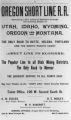 | Oregon Short Line Railroad Ad P.1 | | Image | dha_cp |
| 193 | 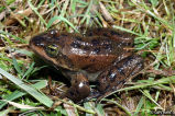 | Oregon Spotted Frog underwater calls | | Sound | uu_wss |
| 194 | 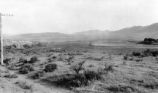 | Oregon Trail P.1 | | Image | dha_cp |
| 195 |  | Oregon Water Science Center | 2005 | Text; Image | wwdl_er |
| 196 |  | Oregon-California auto trip, 1921: Columbia River Drive - East of Portland | 1921 | Image/StillImage | uum_map |
| 197 | 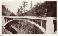 | Oregon-California trip, 1921: Bridge in southern Oregon | 1921-08 | Image/StillImage | uum_map |
| 198 |  | Oregon-California trip, 1921: Bridge near Portland, Oregon | 1921-08 | Image/StillImage | uum_map |
| 199 |  | Oregon-California trip, 1921: Columbia River drive | 1921-07 | Image/StillImage | uum_map |
| 200 | 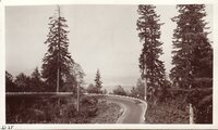 | Oregon-California trip, 1921: Columbia River drive | 1921-07 | Image/StillImage | uum_map |