| Title | Date | Type | Setname | ||
|---|---|---|---|---|---|
| 476 | 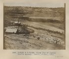 | Sheep Dip of Pueblo Bonito agency. Heald, photo. 1911 (Photo N-M132 & N-M132a) | 1911 | Image | uum_map |
| 477 | 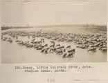 | Sheep, Little Colorado River, Ariz. Stephen Janus, photo. | 1909 | Image | uum_map |
| 478 |  | Ship Rock [Z-3701] | 1930; 1931; 1932; 1933; 1934; 1935; 1936; 1937; 1938; 1939; 1940; 1941; 1942; 1942; 1943; 1944; 1945 | Image/StillImage | uaida_main |
| 479 |  | Ship Rock [Z-3701] | 1930; 1931; 1932; 1933; 1934; 1935; 1936; 1937; 1938; 1939; 1940; 1941; 1942; 1942; 1943; 1944; 1945 | Image/StillImage | uaida_main |
| 480 | 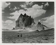 | Shiprock | 1945; 1946; 1947; 1948; 1949; 1950; 1951; 1952; 1953; 1954; 1955; 1956; 1957; 1958; 1959; 1960; 1961; 1962; 1963; 1964; 1965 | Image | uum_map |
| 481 | 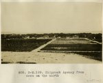 | Shiprock Agency from mesa on the north | 1913 | Image | uum_map |
| 482 | 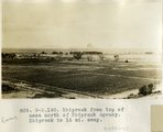 | Shiprock from top of mesa north of Shiprock Agency. Shiprock is 16 mi. away. | 1913 | Image | uum_map |
| 483 |  | Shiprock, New Mexico - aerial view | 1937; 1938; 1939; 1940; 1941; 1942; 1943; 1944; 1945; 1946; 1947; 1948; 1949; 1950; 1951; 1952; 1953; 1954; 1955; 1956; 1957; 1958; 1959; 1960; 1961; 1962; 1963; 1964; 1965; 1966; 1967; 1968; 1969; 1970; 1971; 1972; 1973; 1974; 1975; 1976; 1977; 1978; 1979; 1980 | Image | uum_map_rr |
| 484 | 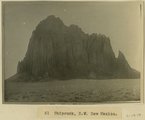 | Shiprock, NW New Mexico | 1915 | Image | uum_map |
| 485 | 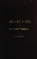 | The shortest route to California illustrated by a history of explorations of the Great Basin of Utah with its topographical and geological character and some account of the Indian tribes | Text | uaida_main | |
| 486 | 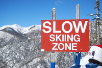 | Sign: Slow Skiing Zone | 2007-02-09; 2007-02-10; 2008-02-08 | Image/StillImage | uum_map_usa |
| 487 |  | Silk Crazy Patch quilt, by Miss Bureau | 1946 | Text | uum_uqhr |
| 488 |  | Simulated effects of ground-water management scenarios on the Santa Fe group aquifer system, Middle Rio Grande Basin, New Mexico, 2001-40 | 2003 | Text | wwdl_er |
| 489 |  | Simulation of ground-water flow in the Middle Rio Grande Basin between Cochiti and San Acacia, New Mexico | 2002 | Text | wwdl_er |
| 490 |  | Ski resort [03] | 1983; 1984; 1985; 1986; 1987; 1988 | Image/StillImage | uum_map_usa |
| 491 |  | Skis in the snow | 2007-02-09; 2007-02-10; 2008-02-08 | Image/StillImage | uum_map_usa |
| 492 |  | Sofia Smith | 2010-02 | Image/StillImage | uum_map_usa |
| 493 |  | Sofia Smith [01] | 2007-02-09; 2007-02-10; 2008-02-08 | Image/StillImage | uum_map_usa |
| 494 |  | Southeast edge of Todilto looking northeast from rim south of Dike "B" (Photo G393) | 1913 | Image | uum_map |
| 495 |  | Southern Paiute Bands | Image/StillImage | uaida_main | |
| 496 |  | Southern Ute Lands, 1848-1899; The Creation of a Reservation, March 1972 | 1972 | Text | uaida_main |
| 497 |  | Spanish at Indian pueblo | 1600; 1601; 1602; 1603; 1604; 1605; 1606; 1607; 1608; 1609; 1610; 1611; 1612; 1613; 1614; 1615; 1616; 1617; 1618; 1619; 1620; 1621; 1622; 1623; 1624; 1625; 1626; 1627; 1628; 1629; 1630; 1631; 1632; 1633; 1634; 1635; 1636; 1637; 1638; 1639; 1640; 1641; 1642; 1643; 1644; 1645; 1646; 1647; 1648; 1649; ... | Image/StillImage | uum_map |
| 498 |  | Spring at Wart-on-the-face, East face of Choiskai Mt., NM (Photo G206) | 1911 | Image | uum_map |
| 499 | 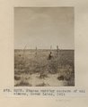 | Stakes marking corners of oil claims, Seven Lakes, 1911 (Photo G303) | 1911 | Image | uum_map |
| 500 | 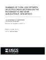 | Summary of flow loss between selected cross sections on the Rio Grande in and near Albuquerque, New Mexico | 2002 | Text | wwdl_er |