Home
Browse
Ask Us
Chat
Harmful Language Statement
Log in
Advanced Search
Year
1871
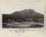
1872
1873
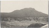
1874
1875
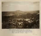
1876
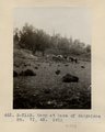
1877
1878
1879
1880
1881
1882
1883
1884
1885
1886
1887
1888
1889
1890
1891
1892
1893
1894
1895
1896
1897
1898
1899
1900
1901
1902
1903
1904
1905
1906
1907
1908
1909
1910
1911
1912
1913
1914
1915
1916
1917
1918
1919
1920
1921
1922
1923
1924
1925
1926
1927
1928
1929
1930
1931
1932
1933
1934
1935
1936
1937
1938
1939
1940
1941
1942
1943
1944
1945
1946
1947
1948
1949
1950
1951
1952
1953
1954
1955
1956
1957
1958
1959
1960
1961
1962
1963
1964
1965
1966
1967
1968
1969
1970
1971
1972
1973
1974
1975
1976
1977
1978
1979
1980
1981
1982
1983
1984
1985
1986
1987
1988
1989
1990
1991
1992
1993
1994
1995
1996
1997
1998
1999
2000
2001
2002
2003
2004
2005
TO
1871
1872
1873
1874
1875
1876
1877
1878
1879
1880
1881
1882
1883
1884
1885
1886
1887
1888
1889
1890
1891
1892
1893
1894
1895
1896
1897
1898
1899
1900
1901
1902
1903
1904
1905
1906
1907
1908
1909
1910
1911
1912
1913
1914
1915
1916
1917
1918
1919
1920
1921
1922
1923
1924
1925
1926
1927
1928
1929
1930
1931
1932
1933
1934
1935
1936
1937
1938
1939
1940
1941
1942
1943
1944
1945
1946
1947
1948
1949
1950
1951
1952
1953
1954
1955
1956
1957
1958
1959
1960
1961
1962
1963
1964
1965
1966
1967
1968
1969
1970
1971
1972
1973
1974
1975
1976
1977
1978
1979
1980
1981
1982
1983
1984
1985
1986
1987
1988
1989
1990
1991
1992
1993
1994
1995
1996
1997
1998
1999
2000
2001
2002
2003
2004
2005
Type
Image
162
Text
1
Format
image/jpeg
142
application/pdf
19
Collection
Beckwith Photograph Collection
2
Classified Photographs
14
Photo Archives
143
Utah River Running Photo Archives
2
Western Waters Electronic Resources
1
Filters:
Spatial Coverage:
"New Mexico"
Type:
"Image"
Year End:
2012
1
-
25
of
162
<
1
2
3
4
5
6
7
>
Gallery view
Number of results to display per page
10
25
50
100
200
Sort by Relevance
Sort by Title A-Z
Sort by Title Z-A
Sort by Date Ascending
Sort by Date Descending
Sort by Last Modified Ascending
Sort by Last Modified Descending
Title
Date
Type
Setname
1
"Beast Dike", from southwest (Photo N-M164)
1913
Image
uum_map
2
"Beast" dike, from north (Photo G387)
1913
Image
uum_map
3
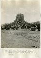
"Beelzebub," Black Creek valley, near spring in La Plata.
1913
Image
uum_map
4
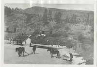
"How the Horse Helped Build America." Chapter 16, No. 11. Ice cutting, 1904
1904
Image
uum_map
5
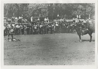
"How the Horse Helped Build America." Chapter 16, No. 13. Rodeo event
1945; 1946; 1947; 1948; 1949
Image
uum_map
6
Alcove in La Plata sandstone, Todilto Park (Photo G382)
1913
Image
uum_map
7
Another view of Photo G213. VI, 38 (Photo G213A)
1911
Image
uum_map
8
Baigaiche Mt.
1913
Image
uum_map
9
Baigaiche Mt. from "Beast" dike (Photo G388)
1913
Image
uum_map
10
Baigaiche Mt. from "Beast" dike (Photo G388)
1913
Image
uum_map
11
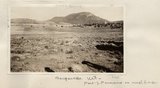
Baigaiche Mt., looking south across mouth of Black creek where it emerges from Todilto Park. Mrs. Gregory, photo. 1911 (Photo N-M118)
1911
Image
uum_map
12
Bennett Peak, NM, looking northwest. Shaler, photo
1890; 1891; 1892; 1893; 1894; 1895; 1896; 1897; 1898; 1899; 1900; 1901; 1902; 1903; 1904; 1905
Image
uum_map
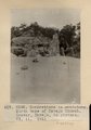
13
Camp and Indian pasture, Da-dat-soe. East terrace of Choiskai Mt., NM. 1911
1911
Image
uum_map
14
Camp at base of Baigaiche Mt. VI, 45. 1911 (Photo N-M113)
1911
Image
uum_map
15
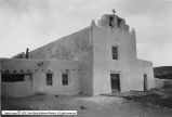
Catholic Churches p.1
1930; 1931; 1932; 1933; 1934; 1935; 1936; 1937; 1938; 1939
Image
dha_cp
16
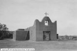
Catholic Churches p.2
1930; 1931; 1932; 1933; 1934; 1935; 1936; 1937; 1938; 1939
Image
dha_cp
17
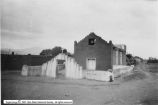
Catholic Churches p.3
1930; 1931; 1932; 1933; 1934; 1935; 1936; 1937; 1938; 1939
Image
dha_cp
18
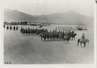
Cavalry in formation at Columbus, N.M., after Villa invasion
1916
Image
uum_map
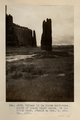
19
Cleopatra's Needle, Todilto Park, New Mexico
1950; 1951; 1952; 1953; 1954; 1955; 1956; 1957; 1958; 1959; 1960; 1961; 1962; 1963; 1964; 1965; 1966; 1967; 1968; 1969; 1970; 1971; 1972; 1973; 1974; 1975; 1976; 1977; 1978; 1979; 1980
Image
uum_map
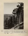
20
Cliff of volcanic ash 1 1/2 miles west of Cottonwood Pass, NM. VI, 35. 1911 (Photo N-M112)
1911
Image
uum_map
21
Column in La Plata sandstone, mouth of Black Creek canon, in Todilto Park. Heald or Mrs. G, photo. 1911 (Photo G217)
1911
Image
uum_map
22
Combined photograph used in Prof Paper 96
1913
Image
uum_map
23
Concretions in sandstone. North base of Navajo Church. Grover, Navajo, in picture. VI, 11. 1911 (Photo G192)
1911
Image
uum_map
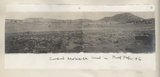
24
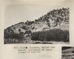
Contact, McElmo and Dakota, northeast of upper corner of Todilto (Photo G394)
1913
Image
uum_map
25
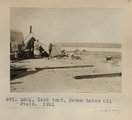
Cook tent, Seven Lakes Oil Field. 1911 (Photo G301)
1911
Image
uum_map
1
-
25
of
162
<
1
2
3
4
5
6
7
>