Home
Browse
Ask Us
Chat
Harmful Language Statement
Log in
Advanced Search
Year
1871
1872
1873
1874
1875
1876
1877
1878
1879
1880
1881
1882
1883
1884
1885
1886
1887
1888
1889
1890
1891
1892
1893
1894
1895
1896
1897
1898
1899
1900
1901
1902
1903
1904
1905
1906
1907
1908
1909
1910
1911
1912
1913
1914
1915
1916
1917
1918
1919
1920
1921
1922
1923
1924
1925
1926
1927
1928
1929
1930
1931
1932
1933
1934
1935
1936
1937
1938
1939
1940
1941
1942
1943
1944
1945
1946
1947
1948
1949
1950
1951
1952
1953
1954
1955
1956
1957
1958
1959
1960
1961
1962
1963
1964
1965
1966
1967
1968
1969
1970
1971
1972
1973
1974
1975
1976
1977
1978
1979
1980
1981
1982
1983
1984
1985
1986
1987
1988
1989
1990
1991
1992
1993
1994
1995
1996
1997
1998
1999
2000
2001
2002
2003
2004
2005
TO
1871
1872
1873
1874
1875
1876
1877
1878
1879
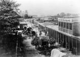
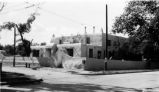
1880
1881
1882
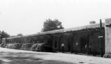
1883
1884
1885
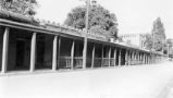
1886
1887
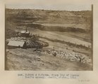
1888
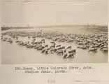
1889
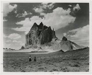
1890
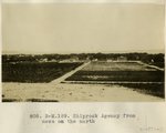
1891
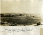
1892
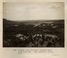
1893
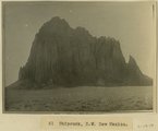
1894
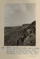
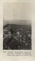
1895
1896
1897
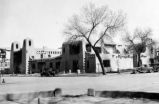
1898
1899
1900
1901
1902
1903
1904
1905
1906
1907
1908
1909
1910
1911
1912
1913
1914
1915
1916
1917
1918
1919
1920
1921
1922
1923
1924
1925
1926
1927
1928
1929
1930
1931
1932
1933
1934
1935
1936
1937
1938
1939
1940
1941
1942
1943
1944
1945
1946
1947
1948
1949
1950
1951
1952
1953
1954
1955
1956
1957
1958
1959
1960
1961
1962
1963
1964
1965
1966
1967
1968
1969
1970
1971
1972
1973
1974
1975
1976
1977
1978
1979
1980
1981
1982
1983
1984
1985
1986
1987
1988
1989
1990
1991
1992
1993
1994
1995
1996
1997
1998
1999
2000
2001
2002
2003
2004
2005
Type
Image
210
Text
2
Format
image/jpeg
189
application/pdf
19
Collection
Beckwith Photograph Collection
9
Classified Photographs
53
Photo Archives
144
Utah River Running Photo Archives
2
Western Waters Electronic Resources
2
Filters:
Spatial Coverage:
"New Mexico"
Type:
"Image"
151
-
175
of
210
<
1
2
3
4
5
6
7
8
9
>
Gallery view
Number of results to display per page
10
25
50
100
200
Sort by Relevance
Sort by Title A-Z
Sort by Title Z-A
Sort by Date Ascending
Sort by Date Descending
Sort by Last Modified Ascending
Sort by Last Modified Descending
Title
Date
Type
Setname
151
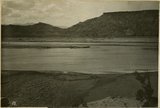
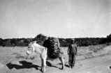
San Juan River. Mud flats like quicksand near Four Corners
1915
Image
uum_map
152
Sandstones above Moencopie shales. West entrance to Canon Bonito, Fort Defiance, AZ. 1911. VI, 57 (Photo G197)
1911
Image
uum_map
153
Santa Fe area, New Mexico P.1
Image
dha_cp
154
Santa Fe Trail P.2
1932
Image
dha_cp
155
Santa Fe, New Mexico P.1
Image
dha_cp
156
Santa Fe, New Mexico P.2
1938
Image
dha_cp
157
Santa Fe, New Mexico P.3
Image
dha_cp
158
Santa Fe, New Mexico P.4
1938
Image
dha_cp
159
Santa Fe, New Mexico P.5
Image
dha_cp
160
Santa Fe, New Mexico P.6
Image
dha_cp
161
Sheep Dip of Pueblo Bonito agency. Heald, photo. 1911 (Photo N-M132 & N-M132a)
1911
Image
uum_map
162
Sheep, Little Colorado River, Ariz. Stephen Janus, photo.
1909
Image
uum_map
163
Shiprock
1945; 1946; 1947; 1948; 1949; 1950; 1951; 1952; 1953; 1954; 1955; 1956; 1957; 1958; 1959; 1960; 1961; 1962; 1963; 1964; 1965
Image
uum_map
164
Shiprock Agency from mesa on the north
1913
Image
uum_map
165
Shiprock from top of mesa north of Shiprock Agency. Shiprock is 16 mi. away.
1913
Image
uum_map
166
Shiprock, New Mexico - aerial view
1937; 1938; 1939; 1940; 1941; 1942; 1943; 1944; 1945; 1946; 1947; 1948; 1949; 1950; 1951; 1952; 1953; 1954; 1955; 1956; 1957; 1958; 1959; 1960; 1961; 1962; 1963; 1964; 1965; 1966; 1967; 1968; 1969; 1970; 1971; 1972; 1973; 1974; 1975; 1976; 1977; 1978; 1979; 1980
Image
uum_map_rr
167
Shiprock, NW New Mexico
1915
Image
uum_map
168
Southeast edge of Todilto looking northeast from rim south of Dike "B" (Photo G393)
1913
Image
uum_map
169
Spring at Wart-on-the-face, East face of Choiskai Mt., NM (Photo G206)
1911
Image
uum_map
170
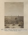
Stakes marking corners of oil claims, Seven Lakes, 1911 (Photo G303)
1911
Image
uum_map
171
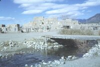
Taos Pueblo, New Mexico
1937; 1938; 1939; 1940; 1941; 1942; 1943; 1944; 1945; 1946; 1947; 1948; 1949; 1950; 1951; 1952; 1953; 1954; 1955; 1956; 1957; 1958; 1959; 1960; 1961; 1962; 1963; 1964; 1965; 1966; 1967; 1968; 1969; 1970; 1971; 1972; 1973; 1974; 1975; 1976; 1977; 1978; 1979; 1980
Image
uum_map_rr
172
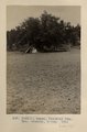
Tepee, Choiskai Mts. Mrs. Gregory, photo. 1911 (Photo N-M111)
1911
Image
uum_map
173
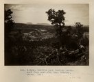
Todilto park looking northwest from east rim. Mrs. Gregory, photo. 1911 (Photo N-M116)
1911
Image
uum_map
174
Todilto park, looking south. Defiance Mesas in skyline. Heald, photo. 1911 (Photo N-M117)
1911
Image
uum_map
175
Todilto park, looking west from east rim. Mrs. Gregory, photo. 1911 (Photo N-M115)
1911
Image
uum_map
151
-
175
of
210
<
1
2
3
4
5
6
7
8
9
>