Home
Browse
Ask Us
Chat
Harmful Language Statement
Log in
Advanced Search
Year
1871
1872
1873
1874
1875
1876
1877
1878
1879
1880
1881
1882
1883
1884
1885
1886
1887
1888
1889
1890
1891
1892
1893
1894
1895
1896
1897
1898
1899
1900
1901
1902
1903
1904
1905
1906
1907
1908
1909
1910
1911
1912
1913
1914
1915
1916
1917
1918
1919
1920
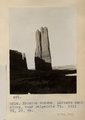
1921
1922
1923
1924
1925
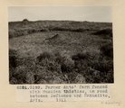
1926
1927
1928
1929
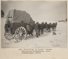
1930
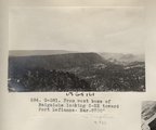
1931
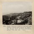
1932
1933
1934
1935
1936
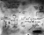
1937
1938
1939
1940
1941
1942
1943
1944
1945
1946
1947
1948
1949
1950
1951
1952
1953
1954
1955
1956
1957
1958
1959
1960
1961
1962
1963
1964
1965
1966
1967
1968
1969
1970
1971
1972
1973
1974
1975
1976
1977
1978
1979
1980
1981
1982
1983
1984
1985
1986
1987
1988
1989
1990
1991
1992
1993
1994
1995
1996
1997
1998
1999
2000
2001
2002
2003
2004
2005
TO
1871
1872
1873
1874
1875
1876
1877
1878
1879
1880
1881
1882
1883
1884
1885
1886
1887
1888
1889
1890
1891
1892
1893
1894
1895
1896
1897
1898
1899
1900
1901
1902
1903
1904
1905
1906
1907
1908
1909
1910
1911
1912
1913
1914
1915
1916
1917
1918
1919
1920
1921
1922
1923
1924
1925
1926
1927
1928
1929
1930
1931
1932
1933
1934
1935
1936
1937
1938
1939
1940
1941
1942
1943
1944
1945
1946
1947
1948
1949
1950
1951
1952
1953
1954
1955
1956
1957
1958
1959
1960
1961
1962
1963
1964
1965
1966
1967
1968
1969
1970
1971
1972
1973
1974
1975
1976
1977
1978
1979
1980
1981
1982
1983
1984
1985
1986
1987
1988
1989
1990
1991
1992
1993
1994
1995
1996
1997
1998
1999
2000
2001
2002
2003
2004
2005
Type
Image
210
Text
2
Format
image/jpeg
189
application/pdf
19
Collection
Beckwith Photograph Collection
9
Classified Photographs
53
Photo Archives
144
Utah River Running Photo Archives
2
Western Waters Electronic Resources
2
Filters:
Spatial Coverage:
"New Mexico"
Type:
"Image"
51
-
75
of
210
<
1
2
3
4
5
6
7
8
9
>
Gallery view
Number of results to display per page
10
25
50
100
200
Sort by Relevance
Sort by Title A-Z
Sort by Title Z-A
Sort by Date Ascending
Sort by Date Descending
Sort by Last Modified Ascending
Sort by Last Modified Descending
Title
Date
Type
Setname
51
El Morro National Monument P.4
Image
dha_cp
52
El Morro National Monument P.5
Image
dha_cp
53
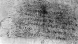
El Palacio, volume 30, nos.19-20 (May 20, 1931) [09]: Folk lore, music and art
1931-05-20
Image
dc_bpc
54
Elza Lay [William H. McGinnis]
1899
Image
dha_cp
55
Erosion column on Defiance-Tohatchie road, West of Tohatchie, NM, near top of Cretaceous. Mrs. Gregory, photo. 1911 (Photo G200)
1911
Image
uum_map
56
Erosion column Southeast Gallup, NM
1911
Image
uum_map
57
Erosion column, LaPlata sandstone, near Baigaiche Mt. 1911. VI, 39, 45 (Photo G214)
1911
Image
uum_map
58
Erosion column. Block of Dakota resting on LaPlata, Southeast of Gallup on west line of Wingate reservation. VII, 3. 1911 (Photo G189)
1911
Image
uum_map
59
Erosion column. Block of Dakota resting on LaPlata, Southeast of Gallup on west line of Wingate reservation. VII, 3. 1911 (Photo G189)
1911
Image
uum_map
60
Erosion surface; removal of peneplain; beveled edges of Trias, Southeast of Gallup. VI, 3-10. 1911 (Photo G190)
1911
Image
uum_map
61
Escalante Map P.1
Image
dha_cp
62
Escalante Route Map P.1
Image
dha_cp
63
Farmer Ants; farm fenced with Russian thistles, on road between Defiance and Manuelito, AZ. 1911 (G193)
1911
Image
uum_map
64
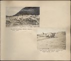
Flat-lying Tertiary on tilted Mesa-verde Choiskai Mesa; looking north at Choiskai Peak, NM. Shaler, photo
1890; 1891; 1892; 1893; 1894; 1895; 1896; 1897; 1898; 1899; 1900; 1901; 1902; 1903; 1904; 1905
Image
uum_map
65
Ford Peak, NM, looking northeast. Shaler, photo
1890; 1891; 1892; 1893; 1894; 1895; 1896; 1897; 1898; 1899; 1900; 1901; 1902; 1903; 1904; 1905
Image
uum_map
66
Four Corners-Marker P.1
Image
dha_cp
67
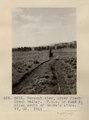
Freighting in winter between Gallup and St. Michaels, Ariz. Schwemberger, photo.
1909
Image
uum_map
68
From west base of Baigaiche looking S-SE toward Fort Defiance. Bar. 8700' (Photo G381)
1913
Image
uum_map
69
General view of LaPlata and McElmo taken from point on Dakota, Northeast of Fort Defiance, AZ. VI, 45, 55. 1911 (Photo G199)
1911
Image
uum_map
70
General view, Choiskai Mt. Tertiary. From south. 1911 (Photo G202)
1911
Image
uum_map
71
General view, upper Black Creek valley. H.E.G. on road 5± miles south of Moore's store. VI, 35. 1911 (Photo G212)
1911
Image
uum_map
72
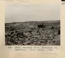
General view; erosion, talus, and slide cover. Tertiary. East side of Coiskai Mt. H.E.G. fixing drinking hole. (Photo N-M109)
1911
Image
uum_map
73
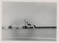
Helium plant, New Mexico
1945; 1946; 1947; 1948; 1949; 1950; 1951; 1952; 1953; 1954; 1955; 1956; 1957; 1958; 1959; 1960
Image
uum_map
74
Herbert E. Gregory Book 3: Navajo-Hopi, Arizona-New Mexico, 1909
1909
Image
uum_map
75
Herbert E. Gregory Book 5: Navajo, 1911
1911
Image
uum_map
51
-
75
of
210
<
1
2
3
4
5
6
7
8
9
>