TO
Filters: Spatial Coverage: "Nevada" Year End: 1959
| Title | Date | Type | Setname | ||
|---|---|---|---|---|---|
| 1 |
 |
"Mormon Fort" near Las Vegas, Nevada | 1940; 1941; 1942; 1943; 1944; 1945; 1946; 1947; 1948; 1949; 1950; 1951; 1952; 1953; 1954; 1955; 1956; 1957; 1958; 1959; 1960 | Image | uum_map |
| 2 |
 |
"Utah-Nevada state line. West Wendover, Nevada after Smith started his gas station" | 1941; 1942; 1943; 1944 | Image | uum_map |
| 3 |
 |
1908 U. S. Land Office Map of the State of Nevada; showing location of Fairview, Churchill County, Nevada | 1908 | Image | uum_map |
| 4 |
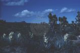 |
Agaves and Joshua trees | 1940; 1941; 1942; 1943; 1944; 1945; 1946; 1947; 1948; 1949; 1950; 1951; 1952; 1953; 1954; 1955; 1956; 1957; 1958; 1959; 1960; 1961; 1962; 1963; 1964; 1965; 1966; 1967; 1968; 1969; 1970; 1971; 1972; 1973; 1974; 1975; 1976; 1977; 1978; 1979; 1980 | Image | uum_map_rr |
| 5 |
 |
Agent Garland Hunt to Commissioner of Indian Affairs | 1855-07-14 | Text | uaida_main |
| 6 |
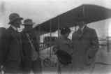 |
Airplanes-Wright Brothers P.2 | 1911-02-10 | Image | dha_cp |
| 7 |
 |
Al "Mustang" Nickols | 1929-09-15 | Image | dha_cp |
| 8 |
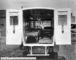 |
Ambulance Interior | 1918-04-01 | Image | dha_scp |
| 9 |
 |
Ambulance Side View | 1918-04-01 | Image | dha_scp |
| 10 |
 |
Annual Report of the Commissioner of Indian Affairs - 1873 | 1873 | Image/StillImage | uaida_main |
| 11 |
 |
Annual Report of the Commissioner of Indian Affairs Accompanying the Annual Report of the Secretary of the Interior for the Year 1861 | 1861 | Text | uaida_main |
| 12 |
 |
Annual Report of the Commissioner of Indian Affairs for the year 1865 | 1865 | Text | uaida_main |
| 13 |
 |
Auerbach Bros. P.15 | 1863 | Image/StillImage | dha_cp |
| 14 |
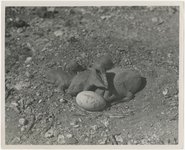 |
Baby pelicans, Pyramid Lake | 1945; 1946; 1947; 1948; 1949; 1950; 1951; 1952; 1953; 1954; 1955; 1956; 1957; 1958; 1959; 1960; 1961; 1962; 1963; 1964; 1965 | Image | uum_map |
| 15 |
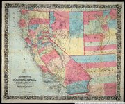 |
Bancroft's map of California, Nevada, Utah and Arizona | 1864 | Image | uu_awm |
| 16 |
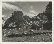 |
Basques, Sheep [03] | 1938; 1939; 1940; 1941; 1942; 1943; 1944; 1945; 1946; 1947 | Image | uum_map |
| 17 |
 |
Bill for A Baron | 1859 | Text | uaida_main |
| 18 |
 |
Bill for Corn Creek Indian Farm | 1850 | Text | uaida_main |
| 19 |
 |
Bill for Fillmore Indian Agency | 1850 | Text | uaida_main |
| 20 |
 |
Birds, Pyramid Lake | 1945; 1946; 1947; 1948; 1949; 1950; 1951; 1952; 1953; 1954; 1955; 1956; 1957; 1958; 1959; 1960; 1961; 1962; 1963; 1964; 1965 | Image | uum_map |
| 21 |
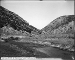 |
Bishop Canyon, Wells, Nevada | 1910-08-23 | Image | dha_scp |
| 22 |
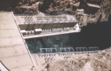 |
Boulder Dam. | 1956 | Image | uum_map |
| 23 |
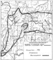 |
Boundary of Shoshone Indian Territory according to Swanton, 1952 | 1952 | Image/StillImage | uaida_main |
| 24 |
 |
Boundary of Shoshone Indian Territory, Linguistic Boundaries of Shoshone and Bannock. | 1941 | Image/StillImage | uaida_main |
| 25 |
 |
Boundary of Shoshone Indian Territory, showing the locations of the Bannock | 1957 | Image/StillImage | uaida_main |
