| Title | Date | Type | Setname | ||
|---|---|---|---|---|---|
| 51 | 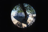 | Boulder City Airport 2004 | 2004 | Image/StillImage | uum_map_rr |
| 52 | 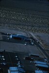 | Boulder City airport, 1960s [01] | 1961; 1962; 1963; 1964 | Image/StillImage | uum_map_rr |
| 53 | 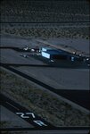 | Boulder City airport, 1960s [02] | 1961; 1962; 1963; 1964 | Image/StillImage | uum_map_rr |
| 54 | 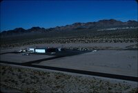 | Boulder City airport, 1960s [03] | 1961; 1962; 1963; 1964 | Image/StillImage | uum_map_rr |
| 55 | 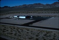 | Boulder City airport, 1960s [04] | 1961; 1962; 1963; 1964 | Image/StillImage | uum_map_rr |
| 56 | 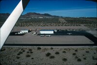 | Boulder City airport, 1960s [05] | 1961; 1962; 1963; 1964 | Image/StillImage | uum_map_rr |
| 57 | 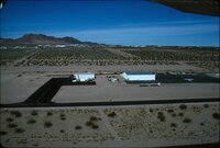 | Boulder City airport, 1960s [06] | 1961; 1962; 1963; 1964 | Image/StillImage | uum_map_rr |
| 58 |  | Boulder City Airport, summer 2004 | 2004 | Image/StillImage | uum_map_rr |
| 59 |  | Boulder City social event 1997 [01] | 1997-10 | Image/StillImage | uum_map_rr |
| 60 |  | Boulder City social event 1997 [02] | 1997-10 | Image/StillImage | uum_map_rr |
| 61 |  | Boulder City social event 1997 [03] | 1997-10 | Image/StillImage | uum_map_rr |
| 62 |  | Boulder City social event 1997 [04] | 1997-10 | Image/StillImage | uum_map_rr |
| 63 |  | Boulder City social event 1997 [05] | 1997-10 | Image/StillImage | uum_map_rr |
| 64 |  | Boulder Dam. | 1956 | Image | uum_map |
| 65 |  | Boundary of Shoshone Indian Territory according to Swanton, 1952 | 1952 | Image/StillImage | uaida_main |
| 66 |  | Boundary of Shoshone Indian Territory, Linguistic Boundaries of Shoshone and Bannock. | 1941 | Image/StillImage | uaida_main |
| 67 |  | Boundary of Shoshone Indian Territory, showing the locations of the Bannock | 1957 | Image/StillImage | uaida_main |
| 68 |  | Boundary of Shoshone Indian Territory, showing the locations of the Bannock from 1819 to 1951 | 1957 | Image/StillImage | uaida_main |
| 69 |  | Boundary of Shoshone Indian Territory, showing the locations where the Bannock and Shoshone reported together 1819-1956 | 1957 | Image/StillImage | uaida_main |
| 70 |  | Boundary of Shoshone Indian Territory; Doty Map of 1863 Indian Claims Commission | 1957 | Image/StillImage | uaida_main |
| 71 |  | Bovine Peak, Nevada p.1 | 1940; 1941; 1942; 1943; 1944; 1945; 1946; 1947; 1948; 1949; 1950 | Image/StillImage | dha_cp |
| 72 |  | Buckaroos | 1984 | Image/MovingImage | uum_avacr |
| 73 | 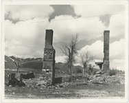 | Building ruins at Tuscarora | 1940; 1941; 1942; 1943; 1944; 1945; 1946; 1947; 1948; 1949; 1950; 1951; 1952; 1953; 1954; 1955; 1956; 1957; 1958; 1959; 1960 | Image | uum_map |
| 74 | 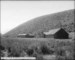 | Buildings at Bishop Creek, Wells, Nevada | 1910-08-23 | Image | dha_scp |
| 75 |  | By Path and Trail | 1908 | Text | uaida_main |