|
|
Title | Date | Type | Setname |
| 1 |
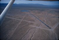
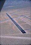
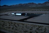
 | Abandoned airport [01] | 1987 | Image/StillImage | uum_map_rr |
| 2 |
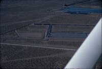
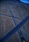
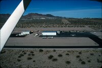
 | Abandoned airport [02] | 1987 | Image/StillImage | uum_map_rr |
| 3 |
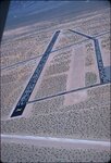
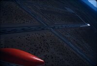
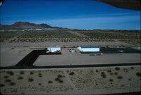
 | Abandoned airport [03] | 1987 | Image/StillImage | uum_map_rr |
| 4 |
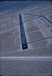
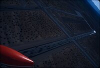
 | Abandoned airport [04] | 1987 | Image/StillImage | uum_map_rr |
| 5 |
 | Abandoned airport [05] | 1987 | Image/StillImage | uum_map_rr |
| 6 |
 | Abandoned airport [06] | 1987 | Image/StillImage | uum_map_rr |
| 7 |
 | Abandoned airport [07] | 1987 | Image/StillImage | uum_map_rr |
| 8 |
 | Abandoned airport [08] | 1987 | Image/StillImage | uum_map_rr |
| 9 |
 | Abandoned airport [09] | 1987 | Image/StillImage | uum_map_rr |
| 10 |
 | Abandoned airport [10] | 1987 | Image/StillImage | uum_map_rr |
| 11 |
 | Abandoned airport [11] | 1987 | Image/StillImage | uum_map_rr |
| 12 |
 | Abandoned airport [12] | 1987 | Image/StillImage | uum_map_rr |
| 13 |
 | Abandoned airport [13] | 1987 | Image/StillImage | uum_map_rr |
| 14 |
 | Annual Report of the Commissioner of Indian Affairs - 1873 | 1873 | Image/StillImage | uaida_main |
| 15 |
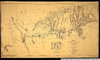
 | Annual Report upon the Geographical and Geological Surveys and Explorations West of the 100th Meridian, in Nevada, Utah, Colorado, New Mexico, and Arizona | | Image/StillImage | uaida_main |
| 16 |
 | Art Gallenson family and friends, 1990s [18] | 1994; 1995; 1996; 1997 | Image/StillImage | uum_map_rr |
| 17 |
 | Auerbach Bros. P.15 | 1863 | Image/StillImage | dha_cp |
| 18 |
 | Black Canyon rafting, 1982 [01] | 1982 | Image/StillImage | uum_map_rr |
| 19 |
 | Black Canyon rafting, 1982 [02] | 1982 | Image/StillImage | uum_map_rr |
| 20 |
 | Black Canyon rafting, 1982 [03] | 1982 | Image/StillImage | uum_map_rr |
| 21 |
 | Black Canyon rafting, 1982 [04] | 1982 | Image/StillImage | uum_map_rr |
| 22 |
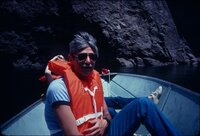 | Black Canyon rafting, 1982 [05] | 1982 | Image/StillImage | uum_map_rr |
| 23 |
 | Boulder City Airport 2004 | 2004 | Image/StillImage | uum_map_rr |
| 24 |
 | Boulder City airport, 1960s [01] | 1961; 1962; 1963; 1964 | Image/StillImage | uum_map_rr |
| 25 |
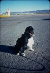
 | Boulder City airport, 1960s [02] | 1961; 1962; 1963; 1964 | Image/StillImage | uum_map_rr |
| 26 |
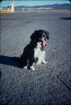
 | Boulder City airport, 1960s [03] | 1961; 1962; 1963; 1964 | Image/StillImage | uum_map_rr |
| 27 |
 | Boulder City airport, 1960s [04] | 1961; 1962; 1963; 1964 | Image/StillImage | uum_map_rr |
| 28 |
 | Boulder City airport, 1960s [05] | 1961; 1962; 1963; 1964 | Image/StillImage | uum_map_rr |
| 29 |
 | Boulder City airport, 1960s [06] | 1961; 1962; 1963; 1964 | Image/StillImage | uum_map_rr |
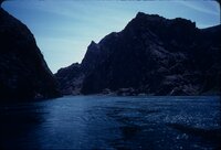
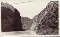
| 30 |
 | Boulder City Airport, summer 2004 | 2004 | Image/StillImage | uum_map_rr |
| 31 |
 | Boulder City social event 1997 [01] | 1997-10 | Image/StillImage | uum_map_rr |
| 32 |
 | Boulder City social event 1997 [02] | 1997-10 | Image/StillImage | uum_map_rr |
| 33 |
 | Boulder City social event 1997 [03] | 1997-10 | Image/StillImage | uum_map_rr |
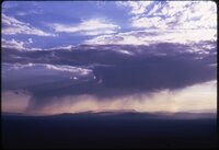
| 34 |
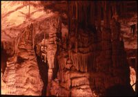
 | Boulder City social event 1997 [04] | 1997-10 | Image/StillImage | uum_map_rr |
| 35 |
 | Boulder City social event 1997 [05] | 1997-10 | Image/StillImage | uum_map_rr |
| 36 |
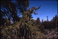
 | Boundary of Shoshone Indian Territory according to Swanton, 1952 | 1952 | Image/StillImage | uaida_main |
| 37 |
 | Boundary of Shoshone Indian Territory, Linguistic Boundaries of Shoshone and Bannock. | 1941 | Image/StillImage | uaida_main |
| 38 |
 | Boundary of Shoshone Indian Territory, showing the locations of the Bannock | 1957 | Image/StillImage | uaida_main |
| 39 |
 | Boundary of Shoshone Indian Territory, showing the locations of the Bannock from 1819 to 1951 | 1957 | Image/StillImage | uaida_main |
| 40 |
 | Boundary of Shoshone Indian Territory, showing the locations where the Bannock and Shoshone reported together 1819-1956 | 1957 | Image/StillImage | uaida_main |
| 41 |
 | Boundary of Shoshone Indian Territory; Doty Map of 1863 Indian Claims Commission | 1957 | Image/StillImage | uaida_main |
| 42 |
 | Bovine Peak, Nevada p.1 | 1940; 1941; 1942; 1943; 1944; 1945; 1946; 1947; 1948; 1949; 1950 | Image/StillImage | dha_cp |
| 43 |
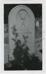
 | Carved headstone of young girl | 1956-08-08 | Image/StillImage | uum_map |
| 44 |
 | Central Pacific R.R. -- Construction P.16 | 1868 | Image/StillImage | dha_cp |
| 45 |
 | Central Pacific RR - Locomotives P.10 | 1891; 1892; 1893; 1894; 1895 | Image/StillImage | dha_cp |
| 46 |
 | Central Pacific RR - Locomotives P.9 | 1865; 1866; 1867; 1868; 1869 | Image/StillImage | dha_cp |
| 47 |
 | County And Township Map Of Utah And Nevada | 1884 | Image/StillImage | ucl_maps |
| 48 |
 | Crystals in a cave? | 1978; 1979; 1980; 1981; 1982 | Image/StillImage | uum_map |
| 49 |
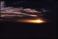 | Desert sunrise or sunset | 1978; 1979; 1980; 1981; 1982 | Image/StillImage | uum_map |
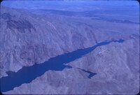
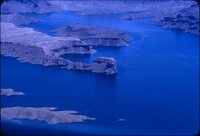
| 50 |
 | Desert tree | 1978; 1979; 1980; 1981; 1982 | Image/StillImage | uum_map |
| 51 |
 | Dixie US DOI BLM 1977 | 1977 | Image/StillImage | ucl_maps |
| 52 |
 | Dog at an airport, 1981 [01] | 1981 | Image/StillImage | uum_map_rr |
| 53 |
 | Dog at an airport, 1981 [02] | 1981 | Image/StillImage | uum_map_rr |
| 54 |
 | Dog at an airport, 1981 [03] | 1981 | Image/StillImage | uum_map_rr |
| 55 |
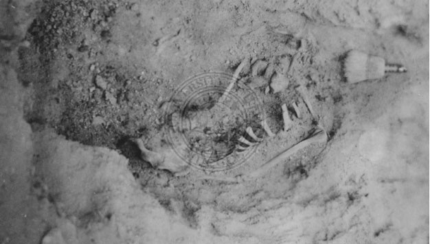 | Excavated Goshute burial site | 1930; 1931; 1932; 1933; 1934; 1935; 1936; 1937; 1938; 1939; 1940; 1941; 1942; 1944; 1945; 1946; 1947; 1948; 1949 | Image/StillImage | uaida_main |
| 56 |
 | Figure 18: The western limit of the Gosiute, the east slope of the Steptoe Mountains in Nevada. View south toward Spring Valley | 1939 | Image/StillImage | uum_mapr |
| 57 |
 | Fiscal Abstract from George Armstrong, Indian Agent dated 31 March 1856 | 1856-03-31 | Image/StillImage | uaida_main |
| 58 |
 | Fred Hale Jr., Goodsprings, Nevada | 1913; 1914; 1915; 1916; 1917; 1918 | Image/StillImage | uum_map |
| 59 |
 | Frederick and Elizabeth | 1911; 1912; 1913; 1914; 1915; 1916; 1917; 1918 | Image/StillImage | uum_map |
| 60 |
 | Frederick Fritech (white marble stone and elegant iron fencing) Genoa, Nevada, August 1956 | 1956-08-08 | Image/StillImage | uum_map |
| 61 |
 | Geology field trip, Fall 1929: Black Canyon of the Colorado | 1929 | Image/StillImage | uum_map |
| 62 |
 | Geology field trip, Fall 1929: Black Canyon of the Colorado | 1929-09 | Image/StillImage | uum_map |
| 63 |
 | Geology field trip, Fall 1929: Black Canyon of the Colorado | 1929 | Image/StillImage | uum_map |
| 64 |
 | Geology field trip, Fall 1929: Black Canyon of the Colorado | 1929 | Image/StillImage | uum_map |
| 65 |
 | Geology field trip, Fall 1929: Black Canyon of the Colorado | 1929-09 | Image/StillImage | uum_map |
| 66 |
 | Geology field trip, Fall 1929: Black Canyon of the Colorado | 1929-09 | Image/StillImage | uum_map |
| 67 |
 | Goshute Indian Reservation Nevada and Utah | | Image/StillImage | uaida_main |
| 68 |
 | Great Basin National Park: bristlecone pine | 1978; 1979; 1980; 1981; 1982 | Image/StillImage | uum_map |
| 69 |
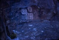
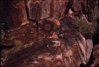
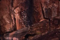
 | Great Basin National Park: desert rainstorm | 1978; 1979; 1980; 1981; 1982 | Image/StillImage | uum_map |
| 70 |
 | Great Basin National Park: Lehman Caves [01] | 1978; 1979; 1980; 1981; 1982 | Image/StillImage | uum_map |
| 71 |
 | Great Basin National Park: Lehman Caves [02] | 1978; 1979; 1980; 1981; 1982 | Image/StillImage | uum_map |
| 72 |
 | Great Basin National Park: Lehman Caves [03] | 1978; 1979; 1980; 1981; 1982 | Image/StillImage | uum_map |
| 73 |
 | Great Basin National Park: Lehman Caves [04] | 1978; 1979; 1980; 1981; 1982 | Image/StillImage | uum_map |
| 74 |
 | Great Basin National Park: mountain trees | 1978; 1979; 1980; 1981; 1982 | Image/StillImage | uum_map |
| 75 |
 | Great Basin National Park: mountains | 1978; 1979; 1980; 1981; 1982 | Image/StillImage | uum_map |
| 76 |
 | Great Basin National Park: Mountains in shadow | 1978; 1979; 1980; 1981; 1982 | Image/StillImage | uum_map |
| 77 |
 | Great Basin National Park: visitor center | 1978; 1979; 1980; 1981; 1982 | Image/StillImage | uum_map |
| 78 |
 | Great Basin National Park: Wheeler Peak east face | 1978; 1979; 1980; 1981; 1982 | Image/StillImage | uum_map |
| 79 |
 | Great Basin National Park: Wheeler Peak from north | 1978; 1979; 1980; 1981; 1982 | Image/StillImage | uum_map |
| 80 |
 | Group of Pah-Ute Indians, Nevada | 1871 | Image/StillImage | uaida_main |
| 81 |
 | John A. Thompson-"Snowshoe" Thompson | 1956-08-08 | Image/StillImage | uum_map |
| 82 |
 | Johnson's California, with Utah, Nevada, Colorado, New Mexico, and Arizona. | 1864 | Image/StillImage | uu_awm |
| 83 |
 | Keyhole Canyon, Nevada, Fall 1984 [01] | 1984 | Image/StillImage | uum_map_rr |
| 84 |
 | Keyhole Canyon, Nevada, Fall 1984 [02] | 1984 | Image/StillImage | uum_map_rr |
| 85 |
 | Keyhole Canyon, Nevada, Fall 1984 [03] | 1984 | Image/StillImage | uum_map_rr |
| 86 |
 | Keyhole Canyon, Nevada, Fall 1984 [04] | 1984 | Image/StillImage | uum_map_rr |
| 87 |
 | Keyhole Canyon, Nevada, Fall 1984 [05] | 1984 | Image/StillImage | uum_map_rr |
| 88 |
 | Keyhole Canyon, Nevada, Fall 1984 [06] | 1984 | Image/StillImage | uum_map_rr |
| 89 |
 | Keyhole Canyon, Nevada, Fall 1984 [07] | 1984 | Image/StillImage | uum_map_rr |
| 90 |
 | Keyhole Canyon, Nevada, Fall 1984 [08] | 1984 | Image/StillImage | uum_map_rr |
| 91 |
 | Keyhole Canyon, Nevada, Fall 1984 [09] | 1984 | Image/StillImage | uum_map_rr |
| 92 |
 | Keyhole Canyon, Nevada, Fall 1984 [10] | 1984 | Image/StillImage | uum_map_rr |
| 93 |
 | Keyhole Canyon, Nevada, Fall 1984 [11] | 1984 | Image/StillImage | uum_map_rr |
| 94 |
 | Keyhole Canyon, Nevada, Fall 1984 [12] | 1984 | Image/StillImage | uum_map_rr |
| 95 |
 | Keyhole Canyon, Nevada, Fall 1984 [13] | 1984 | Image/StillImage | uum_map_rr |
| 96 |
 | Keyhole Canyon, Nevada, Fall 1984 [14] | 1984 | Image/StillImage | uum_map_rr |
| 97 |
 | Keyhole Canyon, Nevada, Fall 1984 [15] | 1984 | Image/StillImage | uum_map_rr |
| 98 |
 | Keyhole Canyon, Nevada, Fall 1984 [16] | 1984 | Image/StillImage | uum_map_rr |
| 99 |
 | Keyhole Canyon, Nevada, Fall 1984 [17] | 1984 | Image/StillImage | uum_map_rr |
| 100 |
 | Keyhole Canyon, Nevada, Fall 1984 [18] | 1984 | Image/StillImage | uum_map_rr |
| 101 |
 | Lake Mead Air flight over Grand Canyon, July 1980 [04] | 1980 | Image/StillImage | uum_map_rr |
| 102 |
 | Lake Mead Air flight over Grand Canyon, July 1980 [05] | 1980 | Image/StillImage | uum_map_rr |
| 103 |
 | Lake Mead Air flight over Grand Canyon, July 1980 [06] | 1980 | Image/StillImage | uum_map_rr |
| 104 |
 | Letter from Boyer to Forney dated Jun. 30, 1859 | 1859-06-30 | Image/StillImage | uaida_main |
| 105 |
 | Letter from Commissioner of Indian Affairs H.R. Clum to Superintendent Tourtillotte dated October 4, 1870 | 1870-10-04 | Image/StillImage | uaida_main |
| 106 |
 | Letter from Forney to Rupell dated Sept. 30, 1859 | 1859-09-30 | Image/StillImage | uaida_main |
| 107 |
 | Letter from Head to Tourtellotte dated Mar. 14, 1870 | 1870-03-14 | Image/StillImage | uaida_main |
| 108 |
 | Letter from J.H. Goodman to J.E. Tourtellotte dated December 29, 1869 | 1869-12-29 | Image/StillImage | uaida_main |
| 109 |
 | Letter from L.H. Head to J.E. Tourtellotte dated August 20, 1869 | 1869-08-20 | Image/StillImage | uaida_main |
| 110 |
 | Letter from L.H. Head to J.E. Tourtelotte dated August 13, 1869 | 1869-08-13 | Image/StillImage | uaida_main |
| 111 |
 | Letter from L.H. Head to J.E. Tourtelotte dated July 27, 1869 | 1869-07-27 | Image/StillImage | uaida_main |
| 112 |
 | Letter from Mr. Forney to B. Buchman dated Sept. 28, 1859 | 1859-09-28 | Image/StillImage | uaida_main |
| 113 |
 | Letter from Mr. Forney to Hockaday Burr dated Sept. 30, 1859 | 1859-09-30 | Image/StillImage | uaida_main |
| 114 |
 | Letter from Mr. Forney to William H. Sherman dated Aug. 31, 1859 | 1859-08-31 | Image/StillImage | uaida_main |
| 115 |
 | Letter from P Boyer to J Forney dated June 13, 1859 | 1859-06-13 | Image/StillImage | uaida_main |
| 116 |
 | Letter from Superintendent L.H. Head to J.E. Tourtellotte dated January 12, 1870 | 1870-01-12 | Image/StillImage | uaida_main |
| 117 |
 | Letter from the superintendency dated Mar. 21, 1859 | 1859-03-21 | Image/StillImage | uaida_main |
| 118 |
 | Letter to Col. John E. Tourtellotte, Superintendent Indian Affairs, Utah from Major Douglas, Superintendent Indian Affairs, Nevada dated 17 June 1870 | 1870-06-17 | Image/StillImage | uaida_main |
| 119 |
 | Letter to Col. John E. Tourtellotte, Superintendent Indian Affairs, Utah from W.F. Cady, Commissioner Indian Affairs (Acting) dated 24 June 1870 - Page 1 | 1870-06-24 | Image/StillImage | uaida_main |
| 120 |
 | Letter to Col. John E. Tourtellotte, Superintendent Indian Affairs, Utah from W.F. Cady, Commissioner Indian Affairs (Acting) dated 7 July 1870 | 1870-07-07 | Image/StillImage | uaida_main |
| 121 |
 | Letter to John E. Tourtellotte, Superintendent Indian Affairs, Utah from Ely S. Parker, Commissioner Indian Affairs dated 6 May 1870 | 1870-05-06 | Image/StillImage | uaida_main |
| 122 |
 | Letter to Superintendent Indian Affairs, Utah from Commisioner Indian Affairs dated 8 June 1870 | 1870-06-08 | Image/StillImage | uaida_main |
| 123 |
 | List of articles for Ruby and Deep Creek Indian Farms dated April 7, 1859 | 1859-04-07 | Image/StillImage | uaida_main |
| 124 |
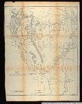
 | Map no. 2, from the Great Salt Lake to the Humboldt Mountains. | 1855 | Image/StillImage | uu_awm |
| 125 |
 | Map of Shoshone Indian Territory, and the Division of Shoshone Boundaries in Nevada | | Image/StillImage | uaida_main |
| 126 |
 | Map of Shoshone, Goshute, Bannock, Wind River and Panamint Indian Tribal Groups | 1957 | Image/StillImage | uaida_main |
| 127 |
 | Map of wagon routes in Utah Territory explored and opened by Capt. J. H. Simpson...in 1858-59. | 1859 | Image/StillImage | uu_awm |
| 128 |
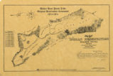 | Map of Walker River Paiute Tribe Original Reservation Centennial 1874-1974 | 1874 | Image/StillImage | uaida_main |
| 129 |
 | Map of Western Indian Territory Before 1850 | | Image/StillImage | uaida_main |
| 130 |
 | Map of Western Shoshone and Northern Paiute Territory | | Image/StillImage | uaida_main |
| 131 |
 | Map showing the boundary of the Shoshone Indian territory | 1941 | Image/StillImage | uaida_main |
| 132 |
 | Map showing the different routes travelled over by the detachments of the Overland Command in the spring of 1855 from Salt Lake City, Utah, to the Bay of San Francisco. | 1855 | Image/StillImage | uu_awm |
| 133 |
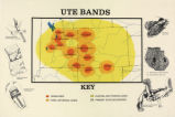 | Map titled "Ute Bands Map" | | Image/StillImage | uaida_main |
| 134 |
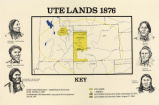 | Map titled "Ute Lands, 1876" | | Image/StillImage | uaida_main |
| 135 |
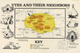 | Map titled, "Utes and Their Neighbors" | | Image/StillImage | uaida_main |
| 136 |
 | Muddy River, Glendale, Nev. P. 1 | 1932; 1933; 1934; 1935; 1936; 1937; 1938; 1939; 1940; 1941; 1942; 1943; 1944; 1945 | Image/StillImage | dha_cp |
| 137 |
 | New map of the state of California, the territories of Oregon, Washington, Utah & New Mexico. | 1853 | Image/StillImage | uu_awm |
| 138 |
 | Nuclear test, Nevada | 1958-10 | Image/StillImage | uum_map |
| 139 |
 | Oregon-California trip, 1921: Searchlight, Nevada, north of Needles, California | 1921-08-21 | Image/StillImage | uum_map |
| 140 |
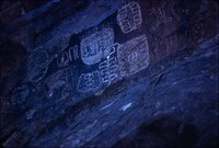
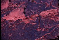
 | Pictographs in Tunnel Canyon, Nevada. | | Image/StillImage | uaida_main |
| 141 |
 | Pilot Peak p.1 | 1929; 1930 | Image/StillImage | dha_cp |
| 142 |
 | Pioche - Nevada | 1910-05 | Image/StillImage | uum_map |
| 143 |
 | Pioche - Nevada | 1910-05 | Image/StillImage | uum_map |
| 144 |
 | Pioche - Nevada - Abandoned Pumping Plant | 1910-05 | Image/StillImage | uum_map |
| 145 |
 | Pioche - Nevada - Dickie Hotel | 1910-05 | Image/StillImage | uum_map |
| 146 |
 | Pioche - Nevada - Mountains from Southwest | 1910-05 | Image/StillImage | uum_map |
| 147 |
 | Pioche - Nevada - Raymond and Ely fissure | 1910-05 | Image/StillImage | uum_map |
| 148 |
 | Pioche - Nevada - Ten Miles East of | 1910-05 | Image/StillImage | uum_map |
| 149 |
 | Pioche - Nevada - Ten Miles East of | 1910-05 | Image/StillImage | uum_map |
| 150 |
 | Pony Express Route - April 3, 1860 to October 24, 1861 | 1860; 1861; 1960 | Image/StillImage | ucl_maps |
| 151 |
 | Pulitzer-Prize novelist Wally Stegner on location for "Wilderness Journal," Black Rock Desert | 1983 | Image/StillImage | uum_map |
| 152 |
 | Receipt dated Mar. 21, 1859 | | Image/StillImage | uaida_main |
| 153 |
 | Restored homes; Lost City, Nevada | | Image/StillImage | uaida_main |
| 154 |
 | Southern part of Virginia City, from the Combination shaft, Mount Davidson in the distance | 1870; 1871; 1872; 1873; 1874; 1875; 1876; 1877; 1878; 1879; 1880; 1881; 1882; 1883; 1884; 1885; 1886; 1887; 1888; 1889; 1890 | Image/StillImage | uum_map |
| 155 |
 | Superintendency Property List dated May 24, 1866 | 1866-05-24 | Image/StillImage | uaida_main |
| 156 |
 | Superintendency Receipt April 10, 1867 | 1869-04-10 | Image/StillImage | uaida_main |
| 157 |
 | Superintendency Receipt dated June 11, 1869 | 1869-01-11 | Image/StillImage | uaida_main |
| 158 |
 | Tarantula Canyon p.1 | 1920; 1921; 1922; 1923; 1924; 1925; 1926; 1927; 1928; 1929; 1930 | Image/StillImage | dha_cp |
| 159 |
 | Telephone Lines P.5 | 1914 | Image/StillImage | dha_cp |
| 160 |
 | Telephone Lines P.7 | 1914 | Image/StillImage | dha_cp |
| 161 |
 | Telephone Lines P.8 | 1914 | Image/StillImage | dha_cp |
| 162 |
 | Two "old boys." | 1874 | Image/StillImage | uaida_main |
| 163 |
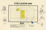 | Ute Lands, 1868 | | Image/StillImage | uaida_main |
| 164 |
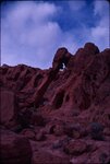
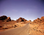 | Valley of Fire | 1950; 1951; 1952; 1953; 1954; 1955; 1956; 1957; 1958; 1959; 1960 | Image/StillImage | dha_alwmc |
| 165 |
 | Valley of Fire from air, 1983 | 1983 | Image/StillImage | uum_map_rr |
| 166 |
 | Valley of Fire, Fall of 1984 [01] | 1984 | Image/StillImage | uum_map_rr |
| 167 |
 | Valley of Fire, Fall of 1984 [02] | 1984 | Image/StillImage | uum_map_rr |
| 168 |
 | Valley of Fire, Fall of 1984 [03] | 1984 | Image/StillImage | uum_map_rr |
| 169 |
 | Valley of Fire, Fall of 1984 [04] | 1984 | Image/StillImage | uum_map_rr |
| 170 |
 | Valley of Fire, Fall of 1987 [01] | 1987 | Image/StillImage | uum_map_rr |
| 171 |
 | Valley of Fire, Fall of 1987 [02] | 1987 | Image/StillImage | uum_map_rr |
| 172 |
 | Valley of Fire, Fall of 1987 [03] | 1987 | Image/StillImage | uum_map_rr |
| 173 |
 | Valley of Fire, Fall of 1987 [04] | 1987 | Image/StillImage | uum_map_rr |
| 174 |
 | Valley of Fire, Fall of 1987 [05] | 1987 | Image/StillImage | uum_map_rr |
| 175 |
 | Valley of Fire, Nevada, spring 1984 [01] | 1984 | Image/StillImage | uum_map_rr |
| 176 |
 | Valley of Fire, Nevada, spring 1984 [02] | 1984 | Image/StillImage | uum_map_rr |
| 177 |
 | Valley of Fire, Nevada, spring 1984 [03] | 1984 | Image/StillImage | uum_map_rr |
| 178 |
 | Valley of Fire, Nevada, spring 1984 [04] | 1984 | Image/StillImage | uum_map_rr |
| 179 |
 | Valley of Fire, Nevada, spring 1984 [05] | 1984 | Image/StillImage | uum_map_rr |
| 180 |
 | Valley of Fire, Nevada, spring 1984 [06] | 1984 | Image/StillImage | uum_map_rr |
| 181 |
 | Valley of Fire, Nevada, spring 1984 [07] | 1984 | Image/StillImage | uum_map_rr |
| 182 |
 | Valley of Fire, Nevada, spring 1984 [08] | 1984 | Image/StillImage | uum_map_rr |
| 183 |
 | Valley of Fire, Nevada, spring 1984 [09] | 1984 | Image/StillImage | uum_map_rr |
| 184 |
 | Valley of Fire, Nevada, spring 1984 [10] | 1984 | Image/StillImage | uum_map_rr |
| 185 |
 | Valley of Fire, Nevada, spring 1984 [11] | 1984 | Image/StillImage | uum_map_rr |
| 186 |
 | Valley of Fire, Nevada, spring 1984 [12] | 1984 | Image/StillImage | uum_map_rr |
| 187 |
 | Valley of Fire, Nevada, spring 1984 [13] | 1984 | Image/StillImage | uum_map_rr |
| 188 |
 | Valley of Fire, Nevada, spring 1984 [14] | 1984 | Image/StillImage | uum_map_rr |
| 189 |
 | Valley of Fire, Nevada, spring 1984 [15] | 1984 | Image/StillImage | uum_map_rr |
| 190 |
 | Valley of Fire, Nevada, spring 1984 [16] | 1984 | Image/StillImage | uum_map_rr |
| 191 |
 | Valley of Fire, Nevada, spring 1984 [17] | 1984 | Image/StillImage | uum_map_rr |
| 192 |
 | Valley of Fire, Nevada, spring 1984 [18] | 1984 | Image/StillImage | uum_map_rr |
| 193 |
 | Virgin River from bridge at Mesquite, Nevada | 1907; 1908; 1909; 1910; 1911; 1912; 1913; 1914; 1915; 1916; 1917; 1918; 1919; 1920; 1921; 1922; 1923; 1924; 1925; 1926; 1927; 1928; 1929; 1930; 1931; 1932; 1933; 1934; 1935 | Image/StillImage | uum_map |
| 194 |
 | voucher from forney to leonard smith dated Feb. 5, 1859 | 1859-02-05 | Image/StillImage | uaida_main |
| 195 |
 | voucher from William Rogers to William Doiry(?) dated Oct. 12, 1859 | 1859-10-12 | Image/StillImage | uaida_main |
| 196 |
 | Voucher to Superintendent of Indian Affairs, Utah from dated 6 August 1853 | 1853-08-06 | Image/StillImage | uaida_main |
| 197 |
 | Wallace Stegner and William Devane, Nevada | 1983 | Image/StillImage | uum_map |
| 198 |
 | Wells, Nevada, church | 1961; 1962; 1963; 1964 | Image/StillImage | uum_map_rr |
| 199 |
 | Wrecked plane, airport, Fall 1984 [01] | 1984 | Image/StillImage | uum_map_rr |
| 200 |
 | Wrecked plane, airport, Fall 1984 [02] | 1984 | Image/StillImage | uum_map_rr |