Home
Browse
Ask Us
Chat
Harmful Language Statement
Log in
University of Utah Marriott Library
Advanced Search
Year
1879
1880
1881
1882
1883
1884
1885
1886
1887
1888
1889
1890
1891
1892
1893
1894
1895
1896
1897
1898
1899
1900
1901
1902
1903
1904
1905
1906
1907
1908
1909
1910
1911
1912
1913
1914
1915
1916
1917
1918
1919
1920
1921
1922
1923
1924
1925
1926
1927
1928
1929
1930
1931
1932
1933
1934
1935
1936
1937
1938
1939
1940
1941
1942
1943
1944
1945
1946
1947
1948
1949
1950
1951
1952
1953
1954
1955
1956
1957
1958
1959
1960
1961
1962
1963
1964
1965
1966
1967
1968
1969
TO
1879
1880
1881
1882
1883
1884
1885
1886
1887
1888
1889
1890
1891
1892
1893
1894
1895
1896
1897
1898
1899
1900
1901
1902
1903
1904
1905
1906
1907
1908
1909
1910
1911
1912
1913
1914
1915
1916
1917
1918
1919
1920
1921
1922
1923
1924
1925
1926
1927
1928
1929
1930
1931
1932
1933
1934
1935
1936
1937
1938
1939
1940
1941
1942
1943
1944
1945
1946
1947
1948
1949
1950
1951
1952
1953
1954
1955
1956
1957
1958
1959
1960
1961
1962
1963
1964
1965
1966
1967
1968
1969
Type
Image
1
Format
image/jpeg
246
application/pdf
1
Collection
Photo Archives
1
Ski and Snow Sports Archives
246
Filters:
Spatial Coverage:
"Little Cottonwood Canyon (Utah)"
1
-
25
of
247
<
1
2
3
4
5
6
7
8
9
10
>
Gallery view
Number of results to display per page
10
25
50
100
200
Sort by Relevance
Sort by Title A-Z
Sort by Title Z-A
Sort by Date Ascending
Sort by Date Descending
Sort by Last Modified Ascending
Sort by Last Modified Descending
Title
Date
Type
Setname
1
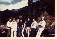
Bjorn Malkomsen and University of Utah Ski Team, 1969
1969
uum_map_usa
2
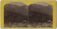
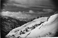
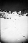
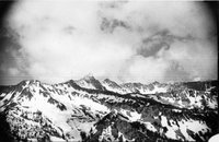
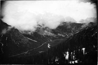
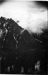
Looking up Cottonwood Canyon from Mt. Emma
1879; 1880; 1881
uum_map
3
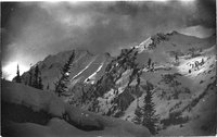
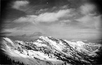
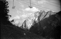
Cardiff and Superior (left) from lower terminal of lift
1941
uum_map_usa
4
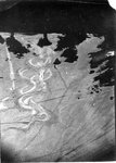
Dirty spring snow
1938; 1939; 1940; 1941
uum_map_usa
5
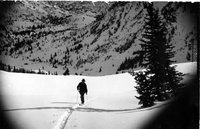
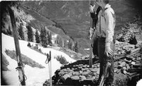
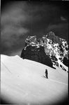
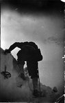
On way up Cardiff. Little Kandahar Race of 1941 ran down into gully at base of a long line of tree
1941
uum_map_usa
6
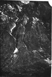
Largest slide gullies don't build largest fans(?)
1941
uum_map_usa
7
Up toward Cardiff. Entrance to Upper Basin back. Ted
1941
uum_map_usa
8
Cardiff
1941
uum_map_usa
9
Slide of 1-2 years previous started in this basin and ran down over our tracks
1938; 1939; 1940; 1941
uum_map_usa
10
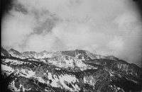
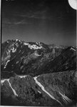
Kessler Peak and upper part of Mill D. Perfect for avalanches at left
1938; 1939; 1940; 1941
uum_map_usa
11
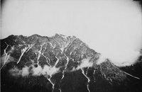
Baldy, Sugar Loaf and Devil's Castle recognizable
1938; 1939; 1940; 1941
uum_map_usa
12
Pfeiferhorn recognizable, American Fork Twins to right
1938; 1939; 1940; 1941
uum_map_usa
13
Pfeiferhorn, heads of all canyons West of Gad Valley
1938; 1939; 1940; 1941
uum_map_usa
14
Peruvian Gulch and American Fork Twins, Hidden Peak first at left
1938; 1939; 1940; 1941
uum_map_usa
15
Cliffs bonding, Hogum's Fork
1938; 1939; 1940; 1941
uum_map_usa
16
Dee LP at Cardiff
1938; 1939; 1940; 1941
uum_map_usa
17
Lift on June 17, with Dee and Chick up Collins Gulch, snowed 1 foot that night
1937; 1938; 1939; 1940; 1941
uum_map_usa
18
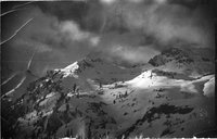
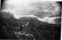
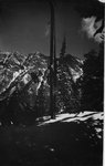
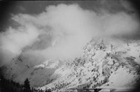
Wild Cannon, Superior thru clouds
1937; 1938; 1939; 1940; 1941
uum_map_usa
19
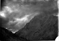
Superior, face is really very gently sloped as seen in this profile
1937; 1938; 1939; 1940; 1941
uum_map_usa
20
Superior right and the Dromedaries left
1937; 1938; 1939; 1940; 1941
uum_map_usa
21
Marble Cliffs below Alta, edge of Superior
1937; 1938; 1939; 1940; 1941
uum_map_usa
22
Superior from under lift
1937; 1938; 1939; 1940; 1941
uum_map_usa
23
Superior
1937; 1938; 1939; 1940; 1941
uum_map_usa
24
Superior, stormy day
1937; 1938; 1939; 1940; 1941
uum_map_usa
25
Superior
1937; 1938; 1939; 1940; 1941
uum_map_usa
1
-
25
of
247
<
1
2
3
4
5
6
7
8
9
10
>