Home
Browse
Ask Us
Chat
Harmful Language Statement
Log in
Advanced Search
Year
1880
1881
1882
1883
1884
1885
1886
1887
1888
1889
1890
1891
1892
1893
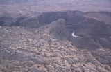
1894
1895
1896
1897
1898
1899
1900
1901
1902
1903
1904
1905
1906
1907
1908
1909
1910
1911
1912
1913
1914
1915
1916
1917
1918
1919
1920
1921
1922
1923
1924
1925
1926
1927
1928
1929
1930
1931
1932
1933
1934
1935
1936
1937
1938
1939
1940
1941
1942
1943
1944
1945
1946
1947
1948
1949
1950
1951
1952
1953
1954
1955
1956
1957
1958
1959
1960
1961
1962
1963
1964
1965
1966
1967
1968
1969
1970
1971
1972
1973
1974
1975
1976
1977
1978
1979
1980
1981
1982
1983
1984
1985
TO
1880
1881
1882
1883
1884
1885
1886
1887
1888
1889
1890
1891
1892
1893
1894
1895
1896
1897
1898
1899
1900
1901
1902
1903
1904
1905
1906
1907
1908
1909
1910
1911
1912
1913
1914
1915
1916
1917
1918
1919
1920
1921
1922
1923
1924
1925
1926
1927
1928
1929
1930
1931
1932
1933
1934
1935
1936
1937
1938
1939
1940
1941
1942
1943
1944
1945
1946
1947
1948
1949
1950
1951
1952
1953
1954
1955
1956
1957
1958
1959
1960
1961
1962
1963
1964
1965
1966
1967
1968
1969
1970
1971
1972
1973
1974
1975
1976
1977
1978
1979
1980
1981
1982
1983
1984
1985
Type
Image
1,124
Format
image/jpeg
1,067
application/pdf
57
Collection
Beckwith Photograph Collection
9
Photo Archives
1,061
Utah River Running Photo Archives
52
Westminster University Photographs
2
Filters:
Spatial Coverage:
"Kane County (Utah)"
Type:
"Image"
Year End:
2017
1
-
25
of
1,124
<
1
2
3
4
5
6
7
8
9
10
>
Gallery view
Number of results to display per page
10
25
50
100
200
Sort by Relevance
Sort by Title A-Z
Sort by Title Z-A
Sort by Date Ascending
Sort by Date Descending
Sort by Last Modified Ascending
Sort by Last Modified Descending
Title
Date
Type
Setname
1
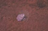
"Albino" frog found in shallow creek upstream from Gregory Bridge
1963-04-23
Image
uum_map
2
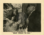
"Down through the Hole. What a sight to face a driver!"
1939
Image
uum_map_rr
3
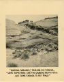
"Mormon Dugways," said one old pioneer, "were something like the cowboy's beefsteak. Just done enough to eat raw!"
1939
Image
uum_map_rr
4
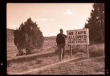
"No Japs allowed" sign, 1943
1943
Image
uum_map
5
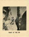
"Right at the Top. The stone steps cut by the pioneers to give their horses better footing! What were a few jolts on stone steps compared to surer footing for the team!"
1939
Image
uum_map_rr
6
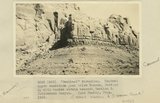
"Sentinel formation." Contact upper sandstone Section A with banded portion beneath, Section B. Cottonwood Canyon. Kane County, UT. 1922
1922
Image
uum_map
7
"Sentinel formation." Section B banded strata below heavy sandstone. Kaiparowitz region. Kane County, UT. 1922
1922
Image
uum_map
8
"Sentinel formation." Section B banded strata below heavy sandstone. Kaiparowitz region. Kane County, UT. 1922
1922
Image
uum_map
9
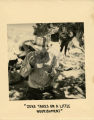
"Zeke takes on a little nourishment!"
1939
Image
uum_map_rr
10
'"Sentinel formation." Contact upper sandstone just below Dakota, Section A, with banded strata beneath, Section B. Cottonwood Canyon. Kane County, UT. 1922
1922
Image
uum_map
11
'Elephant feet'. Wingate sandstone, Kayenta above. Three Lakes Canyon, Kane County, UT, 1939
1939
Image
uum_map
12
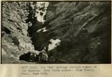
The 'Gut' passage through branch of the Wahweap. Mesa Verde strata. Kane County, UT. June 1918
1915
Image
uum_map
13
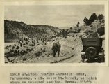
'Marine Jurassic' beds, Paunuweap, 4 miles below Mt. Carmel., at point where we measured section. UT
1922
Image
uum_map
14
'The Granary': one of many natural cavities in Wingate sandstone utilized for storage, Johnson Canyon, Kane County, UT, 1939
1939
Image
uum_map
15
'White Throne' remnant of Navajo sandstone in branch of Paria River. Kane County, UT, 1940
1940
Image
uum_map
16
1, Navajo sandstone (at base); 2, shales; 3, sandstone bed that forms "entablatures" on "Temples" of Zion National Park; 4, Carmel and above. Zion-Mount Carmel highway, Kane County, Utah, 1931.
1931
Image
uum_map
17
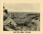
2000 feet above the River- Cottonwood Canyon in the background. "How the pioneers must have felt when they first stood at the top of Hole-in-the-Rock and saw this view!"
1939
Image
uum_map_rr
18
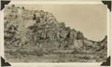
[Upper wall of Big Meadow Canyon (on Zion-Mt. Carmel road). Morrison strata, unconsolidated Dakota ? (black band), and coal-bearing Cretaceous. Kane County, Utah, 1930]
1930
Image
uum_map
19
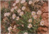
A few wild flowers
1985-05-10; 1985-05-11; 1985-05-12
Image
uum_map
20
A high grassy bar between views of Roost Arch
1963-04-23
Image
uum_map
21
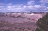
Across to snow covered peaks and Kodachrome Flats along Cottonwood Wash Road
1950; 1951; 1952; 1953; 1954; 1955; 1956; 1957; 1958; 1959; 1960; 1961; 1962; 1963; 1964; 1965; 1966; 1967; 1968; 1969; 1970
Image
uum_map
22
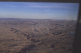
Aerial view of Escalante River canyon, from Glen Canyon
1962-09
Image
uum_map
23
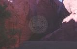
Aerial view of Hole in the Rock
1964-05
Image
uum_map
24
Aerial views of the Escalante River canyons, post-Lake Powell - looking toward Page, AZ
1963; 1964; 1965; 1966; 1967; 1968
Image
uum_map_rr
25
Aerial views of the Escalante River canyons, post-Lake Powell.
1963; 1964; 1965; 1966; 1967; 1968
Image
uum_map_rr
1
-
25
of
1,124
<
1
2
3
4
5
6
7
8
9
10
>