Filters: Spatial Coverage:"Idaho" Year End:1979
| Title | Date | Type | Setname | ||
|---|---|---|---|---|---|
| 176 |  | Larsen Family | 1950 | Image | ucl_rhc |
| 177 |  | Larsen Family | 1955; 1956; 1957 | Image | ucl_rhc |
| 178 |  | Lava flows and volcanic plugs | 1950; 1951; 1952; 1953; 1954; 1955; 1956; 1957; 1958; 1959; 1960; 1961; 1962; 1963; 1964; 1965; 1966; 1967; 1968; 1969; 1970; 1971; 1972; 1973; 1974; 1975; 1976; 1977; 1978; 1979; 1980 | Image | uum_map_rr |
| 179 |  | Lava Hot Springs. | 1952 | Image | uum_map |
| 180 |  | Leon Davies | 1930; 1931; 1932 | Image | ucl_rhc |
| 181 |  | Letter from O.H. Irish describing Indian John and the dispute between Shoshone leaders dated Apr. 2, 1870 | 1870-04-02 | Image/StillImage | uaida_main |
| 182 |  | Letter from Supervisor Engle to Commissioner of Indian Affairs Charles H. Burke dated March 10, 1925 | 1925-03-10 | Text | uaida_main |
| 183 |  | Letter from the Uintah Ouray Reservation Agent to the Commissioner of Indian Affairs dated May 4, 1914 | 1914-05-04 | Text | uaida_main |
| 184 |  | Letter to Obie Bounds from Commissioner of Indian Affairs C.F. Hauke dated September 9, 1908 | 1908-09-14 | Text | uaida_main |
| 185 |  | Lone Star quilt, by Sarah Ann Hatch Stewart | 1893 | Text | uum_uqhr |
| 186 |  | Looking over Shoshone Falls From North Rim | 1912-06-04 | Image | dha_scp |
| 187 | 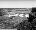 | Looking over Shoshone Falls From North Rim | 1912-06-04 | Image | dha_scp |
| 188 |  | Lorenzo Hill Hatch journal | 1958; 1962 | Text | uum_msa |
| 189 |  | Lower Blue Lakes and Perrines | 1912-06-04 | Image | dha_scp |
| 190 |  | Lucy Woodruff Smith correspondence, 1904 | 1904 | Text | uum_gasp |
| 191 |  | Main Street, Aberdeen, Idaho | 1911-05-17 | Image | dha_scp |
| 192 |  | Man seated outside loge house, Bannock Tribe, 1872 | 1872 | Image/StillImage | uaida_main |
| 193 |  | Manilla Folder | 1893; 1894; 1895; 1896; 1897; 1898; 1899; 1900; 1901; 1902; 1903; 1904; 1905; 1906; 1907; 1908; 1909; 1910; 1911; 1912; 1913; 1914; 1915; 1916; 1917; 1918; 1919; 1920; 1921; 1922; 1923; 1924; 1925; 1926; 1927; 1928; 1929; 1930; 1931; 1932; 1933; 1934; 1935; 1936; 1937; 1938; 1939; 1940; 1941; 1942; ... | Text | sc_hsi |
| 194 | 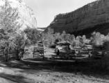 | Mantle Ranch P.3 | 1955-07-01 | Image | dha_cp |
| 195 | 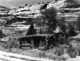 | Mantle Ranch P.4 | 1955-07-01 | Image | dha_cp |
| 196 | 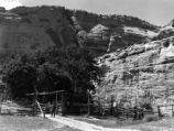 | Mantle Ranch P.5 | 1955-07-01 | Image | dha_cp |
| 197 |  | Mantle Ranch P.6 | 1955-07-01 | Image | dha_cp |
| 198 | 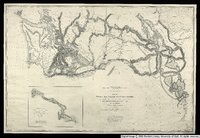 | Map no. 3, Rocky Mountains to Puget Sound. | 1855 | Image/StillImage | uu_awm |
| 199 |  | Map of Shoshone, Goshute, Bannock, Wind River and Panamint Indian Tribal Groups | 1957 | Image/StillImage | uaida_main |
| 200 |  | Map showing the boundary of the Shoshone Indian territory | 1941 | Image/StillImage | uaida_main |
