| Title | Date | Type | Setname | ||
|---|---|---|---|---|---|
| 351 |  | Lincoln's Sparrow (Idaho) song 8 | 2009-07-17 | Sound | uu_wss |
| 352 | | Lincoln's Sparrow (Idaho) song 9 | 2009-07-17 | Sound | uu_wss |
| 353 |  | Lone Star quilt, by Sarah Ann Hatch Stewart | 1893 | Text | uum_uqhr |
| 354 |  | Looking over Shoshone Falls From North Rim | 1912-06-04 | Image | dha_scp |
| 355 | 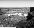 | Looking over Shoshone Falls From North Rim | 1912-06-04 | Image | dha_scp |
| 356 |  | Lorenzo Hill Hatch journal | 1958; 1962 | Text | uum_msa |
| 357 |  | Lower Blue Lakes and Perrines | 1912-06-04 | Image | dha_scp |
| 358 | 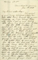 | Lucy Woodruff Smith correspondence, 1904 | 1904 | Text | uum_gasp |
| 359 |  | Main Street, Aberdeen, Idaho | 1911-05-17 | Image | dha_scp |
| 360 |  | Man seated outside loge house, Bannock Tribe, 1872 | 1872 | Image/StillImage | uaida_main |
| 361 |  | Manilla Folder | 1893; 1894; 1895; 1896; 1897; 1898; 1899; 1900; 1901; 1902; 1903; 1904; 1905; 1906; 1907; 1908; 1909; 1910; 1911; 1912; 1913; 1914; 1915; 1916; 1917; 1918; 1919; 1920; 1921; 1922; 1923; 1924; 1925; 1926; 1927; 1928; 1929; 1930; 1931; 1932; 1933; 1934; 1935; 1936; 1937; 1938; 1939; 1940; 1941; 1942; ... | Text | sc_hsi |
| 362 |  | Mantle Ranch P.3 | 1955-07-01 | Image | dha_cp |
| 363 |  | Mantle Ranch P.4 | 1955-07-01 | Image | dha_cp |
| 364 |  | Mantle Ranch P.5 | 1955-07-01 | Image | dha_cp |
| 365 | 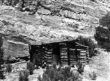 | Mantle Ranch P.6 | 1955-07-01 | Image | dha_cp |
| 366 | 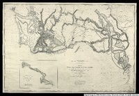 | Map no. 3, Rocky Mountains to Puget Sound. | 1855 | Image/StillImage | uu_awm |
| 367 | 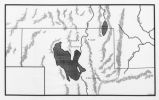 | Map of Northern Utah, Early Settlements | Image/StillImage | uaida_main | |
| 368 |  | Map of Shoshone, Goshute, Bannock, Wind River and Panamint Indian Tribal Groups | 1957 | Image/StillImage | uaida_main |
| 369 |  | Map of Western Indian Territory Before 1850 | Image/StillImage | uaida_main | |
| 370 | 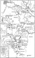 | Map of Western Shoshone and Northern Paiute Territory | Image/StillImage | uaida_main | |
| 371 |  | Map showing the boundary of the Shoshone Indian territory | 1941 | Image/StillImage | uaida_main |
| 372 | 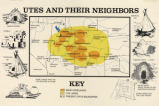 | Map titled, "Utes and Their Neighbors" | Image/StillImage | uaida_main | |
| 373 | 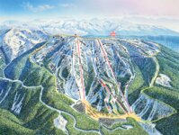 | Map, to Lakeview Bowl | 2000; 2001; 2002; 2003; 2004; 2005; 2006; 2007; 2008; 2009 | Image/StillImage | uum_map_usa |
| 374 | 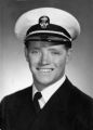 | Marvin Cecil Davies | 1945 | Image | ucl_rhc |
| 375 | 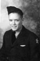 | Marvin Cecil Davies | 1942; 1943; 1944; 1945 | Image | ucl_rhc |