| Title | Date | Type | Setname | ||
|---|---|---|---|---|---|
| 1 | 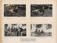 | 1935 vacation, fishing trip at Trude's Ranch in Idaho | 1935 | Image/StillImage | uum_map |
| 2 | 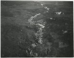 | Aerial view, possibly Idaho [01] | 1946; 1947; 1948; 1949 | Image/StillImage | uum_map_rr |
| 3 | 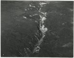 | Aerial view, possibly Idaho [02] | 1946; 1947; 1948; 1949 | Image/StillImage | uum_map_rr |
| 4 | 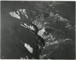 | Aerial view, possibly Idaho [03] | 1946; 1947; 1948; 1949 | Image/StillImage | uum_map_rr |
| 5 | 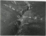 | Aerial view, possibly Idaho [04] | 1946; 1947; 1948; 1949 | Image/StillImage | uum_map_rr |
| 6 | 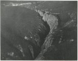 | Aerial view, possibly Idaho [05] | 1946; 1947; 1948; 1949 | Image/StillImage | uum_map_rr |
| 7 | 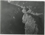 | Aerial view, possibly Idaho [06] | 1946; 1947; 1948; 1949 | Image/StillImage | uum_map_rr |
| 8 | 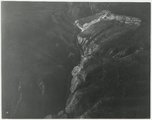 | Aerial view, possibly Idaho [07] | 1946; 1947; 1948; 1949 | Image/StillImage | uum_map_rr |
| 9 | 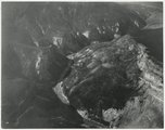 | Aerial view, possibly Idaho [08] | 1946; 1947; 1948; 1949 | Image/StillImage | uum_map_rr |
| 10 | 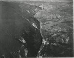 | Aerial view, possibly Idaho [09] | 1946; 1947; 1948; 1949 | Image/StillImage | uum_map_rr |
| 11 | 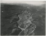 | Aerial view, possibly Idaho [10] | 1946; 1947; 1948; 1949 | Image/StillImage | uum_map_rr |
| 12 | 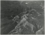 | Aerial view, possibly Idaho [11] | 1946; 1947; 1948; 1949 | Image/StillImage | uum_map_rr |
| 13 | 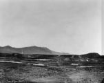 | Bear River p.2 | 1871 | Image/StillImage | dha_cp |
| 14 |  | Bear River p.3 | 1940 | Image/StillImage | dha_cp |
| 15 |  | Below Lightning Creek, Idaho, 1960s | 1961; 1962; 1963; 1964 | Image/StillImage | uum_map_rr |
| 16 |  | Boundary of Shoshone Indian Territory according to Swanton, 1952 | 1952 | Image/StillImage | uaida_main |
| 17 |  | Boundary of Shoshone Indian Territory, Linguistic Boundaries of Shoshone and Bannock. | 1941 | Image/StillImage | uaida_main |
| 18 |  | Boundary of Shoshone Indian Territory, showing the locations of the Bannock | 1957 | Image/StillImage | uaida_main |
| 19 |  | Boundary of Shoshone Indian Territory, showing the locations of the Bannock from 1819 to 1951 | 1957 | Image/StillImage | uaida_main |
| 20 |  | Boundary of Shoshone Indian Territory, showing the locations where the Bannock and Shoshone reported together 1819-1956 | 1957 | Image/StillImage | uaida_main |
| 21 |  | Boundary of Shoshone Indian Territory; Doty Map of 1863 Indian Claims Commission | 1957 | Image/StillImage | uaida_main |
| 22 | 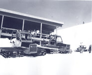 | Brundage Mountain Resort [01] | 1930; 1931; 1932; 1933; 1934; 1935; 1936; 1937; 1938; 1939; 1940; 1941; 1942; 1943; 1944; 1945; 1946; 1947; 1948; 1949; 1950; 1951; 1952; 1953; 1954; 1955; 1956; 1957; 1958; 1959 | Image/StillImage | uum_map_usa |
| 23 | 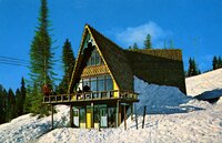 | Brundage Mountain Resort [02] | 1950; 1951; 1952; 1953; 1954; 1955; 1956; 1957; 1958; 1959; 1960; 1961; 1962; 1963; 1964; 1965; 1966; 1967; 1968; 1969 | Image/StillImage | uum_map_usa |
| 24 | 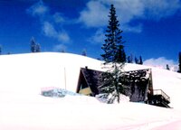 | Brundage Mountain Resort [03] | 1950; 1951; 1952; 1953; 1954; 1955; 1956; 1957; 1958; 1959; 1960; 1961; 1962; 1963; 1964; 1965; 1966; 1967; 1968; 1969 | Image/StillImage | uum_map_usa |
| 25 |  | Brundage Mountain Resort [04] | 1950; 1951; 1952; 1953; 1954; 1955; 1956; 1957; 1958; 1959; 1960; 1961; 1962; 1963; 1964; 1965; 1966; 1967; 1968; 1969 | Image/StillImage | uum_map_usa |