|
|
Title | Date | Type | Setname |
| 176 |
 | Arches, April 1982 [21] | 1982-04 | Image/StillImage | uum_map_usa |
| 177 |
 | Arches, April 1982 [22] | 1982-04 | Image/StillImage | uum_map_usa |
| 178 |
 | Arches, April 1982 [23] | 1982-04 | Image/StillImage | uum_map_usa |
| 179 |
 | Arches, April 1982 [24] | 1982-04 | Image/StillImage | uum_map_usa |
| 180 |
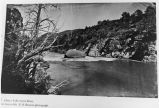 | Ashley Falls, Green River | 1871 | Image | uum_map_rr |
| 181 |
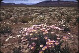 | Asters, Salt Valley, Arches | 1940; 1941; 1942; 1943; 1944; 1945; 1946; 1947; 1948; 1949 | Image/StillImage | uum_map_rr |
| 182 |
 | Back of "Disney" Train, Colorado River, near movie set, Cisco to Moab Run, August 22, 1965 | 1965-08-22 | Image/StillImage | uum_map_rr |
| 183 |
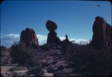
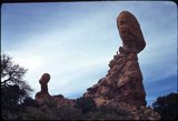
 | Balanced Rock and snow-covered La Sal Mountains in distance | 1960-10-12 | Image | uum_map |
| 184 |
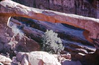
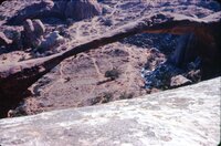
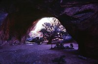
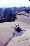
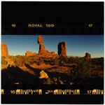
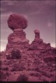
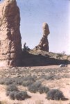 | Balanced Rock area, Arches National Park [1] | 1937; 1938; 1939; 1940; 1941; 1942; 1943; 1944; 1945; 1946; 1947; 1948; 1949; 1950; 1951; 1952; 1953; 1954; 1955; 1956; 1957; 1958; 1959; 1960; 1961; 1962; 1963; 1964; 1965; 1966; 1967; 1968; 1969; 1970; 1971; 1972; 1973; 1974; 1975; 1976; 1977; 1978; 1979; 1980 | Image | uum_map_rr |
| 185 |
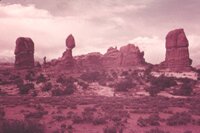
 | Balanced Rock area, Arches National Park [2] | 1937; 1938; 1939; 1940; 1941; 1942; 1943; 1944; 1945; 1946; 1947; 1948; 1949; 1950; 1951; 1952; 1953; 1954; 1955; 1956; 1957; 1958; 1959; 1960; 1961; 1962; 1963; 1964; 1965; 1966; 1967; 1968; 1969; 1970; 1971; 1972; 1973; 1974; 1975; 1976; 1977; 1978; 1979; 1980 | Image | uum_map_rr |
| 186 |
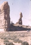
 | Balanced Rock area, Arches National Park [3] | 1937; 1938; 1939; 1940; 1941; 1942; 1943; 1944; 1945; 1946; 1947; 1948; 1949; 1950; 1951; 1952; 1953; 1954; 1955; 1956; 1957; 1958; 1959; 1960; 1961; 1962; 1963; 1964; 1965; 1966; 1967; 1968; 1969; 1970; 1971; 1972; 1973; 1974; 1975; 1976; 1977; 1978; 1979; 1980 | Image | uum_map_rr |
| 187 |
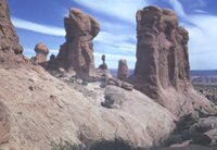
 | Balanced Rock area, Arches National Park [4] | 1937; 1938; 1939; 1940; 1941; 1942; 1943; 1944; 1945; 1946; 1947; 1948; 1949; 1950; 1951; 1952; 1953; 1954; 1955; 1956; 1957; 1958; 1959; 1960; 1961; 1962; 1963; 1964; 1965; 1966; 1967; 1968; 1969; 1970; 1971; 1972; 1973; 1974; 1975; 1976; 1977; 1978; 1979; 1980 | Image | uum_map_rr |
| 188 |
 | Balanced Rock area, Arches National Park [5] | 1937; 1938; 1939; 1940; 1941; 1942; 1943; 1944; 1945; 1946; 1947; 1948; 1949; 1950; 1951; 1952; 1953; 1954; 1955; 1956; 1957; 1958; 1959; 1960; 1961; 1962; 1963; 1964; 1965; 1966; 1967; 1968; 1969; 1970; 1971; 1972; 1973; 1974; 1975; 1976; 1977; 1978; 1979; 1980 | Image | uum_map_rr |
| 189 |
 | Balanced Rock, Arches | 1940; 1941; 1942; 1943; 1944; 1945; 1946; 1947; 1948; 1949 | Image/StillImage | uum_map_rr |
| 190 |
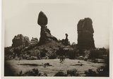 | Balanced Rock, Arches National Park | 1935; 1936; 1937; 1938; 1939; 1940; 1941; 1942; 1943; 1944; 1945; 1946; 1947; 1948; 1949 | Image/StillImage | uum_map_rr |
| 191 |
 | Balanced Rock, Arches National Park | 1934; 1935; 1936; 1937; 1938; 1939; 1940; 1941; 1942; 1943; 1944; 1945; 1946; 1947; 1948; 1949 | Image/StillImage | uum_map_rr |
| 192 |
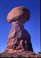
 | Balanced Rock, Arches, 1997 | 1997-10 | Image/StillImage | uum_map_rr |
| 193 |
 | Balanced rocks, Arches | 1934; 1935; 1936; 1937; 1938; 1939; 1940; 1941; 1942; 1943; 1944; 1945; 1946; 1947; 1948; 1949 | Image/StillImage | uum_map_rr |
| 194 |
 | Balanced rocks, Arches National Park | 1934; 1935; 1936; 1937; 1938; 1939; 1940; 1941; 1942; 1943; 1944; 1945; 1946; 1947; 1948; 1949 | Image/StillImage | uum_map_rr |
| 195 |
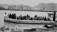
 | Barge or stern-wheel craft used by the Moab Garage Co. on the Colorado River during the 1920s to haul freight or passengers. Photo taken near Moab, Utah | 1920; 1921; 1922; 1923; 1924; 1925; 1926; 1927; 1928; 1929; 1930 | Image | uum_map_rr |
| 196 |
 | Barge or stern-wheel craft used by the Moab Garage Co. on the Colorado River during the 1920s to haul freight or passengers. Photo taken near Moab, Utah | 1920; 1921; 1922; 1923; 1924; 1925; 1926; 1927; 1928; 1929; 1930 | Image | uum_map_rr |
| 197 |
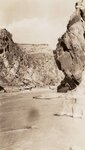 | Below a rapid in Westwater Canyon | 1933 | Image | uum_map_rr |
| 198 |
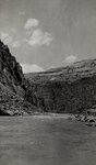 | Below the Little Hole in Westwater Canyon | 1933 | Image | uum_map_rr |
| 199 |
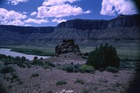
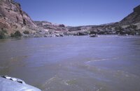 | Below Westwater [canyon], Colorado River | 1970-06 | Image | uum_map_rr |
| 200 |
 | Below Westwater [canyon], Colorado River | 1970-06 | Image | uum_map_rr |