| | Title | Date | Type | Setname |
|---|
| 1 | 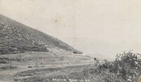 | "Baxter Pass - U.[intah] R.[ail wa]Y." | 1920; 1921; 1922; 1923; 1924; 1925; 1926; 1927; 1928; 1929 | Image | uum_map |
| 2 |  | "Blake Street in the 1400 Block where original Blake and Williams store stood in 1858. It's in the warehouse district now, mostly old ones, but still some thriving modern shops. The City has plans to renovate the whole Downtown Denver District; rebuild a lot of it and redeem the area for tax purposes, as adjoining sections now constitute the old "red light" district; they want to get it back uphill." | 1958 | Image/StillImage | uum_map |
| 3 |  | "Clyde Reedy / River customer w/ Bus" | 1950; 1951; 1952; 1953; 1954; 1955; 1956; 1957; 1958; 1959; 1960; 1961; 1962; 1963; 1964; 1965; 1966; 1967; 1968; 1969 | Image | uum_map_rr |
| 4 | 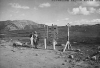 | "Independence Pass between Leadville & Aspen, Colo. - Elevation 12,095 above sea" | 1918; 1919; 1920; 1921; 1922; 1923; 1924; 1925; 1926; 1927; 1928; 1929; 1930; 1931; 1932 | Image | uum_map |
| 5 |  | "Jack Reynolds, Dennis Massey" Lunch table at Deer Lodge Park, Yampa River | 1950; 1951; 1952; 1953; 1954; 1955; 1956; 1957; 1958; 1959; 1960; 1961; 1962; 1963; 1964; 1965; 1966; 1967; 1968; 1969; 1970; 1971; 1972; 1973; 1974; 1975; 1976; 1977; 1978; 1979; 1980; 1981; 1982; 1983; 1984; 1985; 1986; 1987; 1988; 1989; 1990 | Image | uum_map_rr |
| 6 | 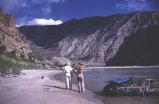 | "Jo & Don on shore. Yes, she was a problem" | 1950; 1951; 1952; 1953; 1954; 1955; 1956; 1957; 1958; 1959; 1960 | Image | uum_map_rr |
| 7 | 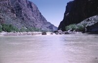 | "Little Stinker Rock" Lodore, Green River Colorado, May 1961 [01] | 1961-05 | Image/StillImage | uum_map_rr |
| 8 | 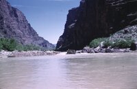 | "Little Stinker Rock" Lodore, Green River Colorado, May 1961 [02] | 1961-05 | Image/StillImage | uum_map_rr |
| 9 |  | "Little Stinker Rock" Lodore, Green River Colorado, May 1961 [03] | 1961-05 | Image/StillImage | uum_map_rr |
| 10 |  | "Little Stinker Rock" Lodore, Green River Colorado, May 1961 [04] | 1961-05 | Image/StillImage | uum_map_rr |
| 11 | 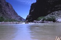 | "Little Stinker Rock" Lodore, Green River Colorado, May 1961 [05] | 1961-05 | Image/StillImage | uum_map_rr |
| 12 |  | "Little Stinker Rock" Lodore, Green River Colorado, May 1961 [06] | 1961-05 | Image/StillImage | uum_map_rr |
| 13 | 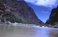 | "Little Stinker Rock" Lodore, Green River Colorado, May 1961 [07] | 1961-05 | Image/StillImage | uum_map_rr |
| 14 |  | "Loop," Georgetown, Colorado | 1897; 1898; 1899; 1900 | Image/StillImage | uum_map |
| 15 |  | "May 22, 1951. Upper Lodore Canyon, Green River. Left to Right: Harry Ratliff, Grant Merrell [sic; spelled differently on previous photo], Leon Christensen, C.C. Manion, Bill Slaugh, Bus Hatch, Gil Hunter, Sam Hatch, George Andrews, K. Kaye" | 1951-05-22 | Image | uum_map_rr |
| 16 | 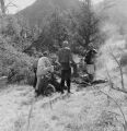 | "May 22, 1951. Disaster Flat, below Lower Disaster Falls, Lodore Canyon, Green River. Left to Right: Bill Slaugh, C.C. (Bubbles) Manion, K. Kaye, Harry Ratliff, and the beef stew." | 1951-05-22 | Image | uum_map_rr |
| 17 | 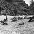 | "May 22, 1951. Disaster Flat, below Lower Disaster Falls, Lodore Canyon, Green River. Otto Roach, ? , Bill Slaugh | 1951-05-22 | Image | uum_map_rr |
| 18 |  | "May 23, 1951. Triplet Falls, Lodore Canyon, Green River. Lining a boat through. Grant Merrell, Frank Hatch, Bus Hatch" | 1951-05-23 | Image | uum_map_rr |
| 19 |  | "Mount of Olives," 1966, Aspen Colorado | 1966 | Image/StillImage | uum_map |
| 20 | 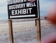 | "Rio Blanco County - color - Raven A-1 Discovery Well Exhibit sign" | 1970; 1971; 1972; 1973; 1974; 1975; 1976; 1977; 1978; 1979; 1980 | Image | uum_map |
| 21 |  | "Rob Roy" at the outlet of Grand Lake | 1933 | Image | uum_map_rr |
| 22 |  | 1849-1850 Annual Report of the Commissioner of Indian Affairs. | 1849 | Text | uaida_main |
| 23 |  | 1850 Annual Report of the Commissioner of Indian Affairs | 1850 | Text | uaida_main |
| 24 | 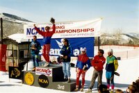 | 1993 NCAA Championships, Steamboat Springs | 1993 | Image/StillImage | uum_map_usa |
| 25 |  | 2006 NCAA Team Steamboat | 2005; 2006 | Image/StillImage | uum_map_usa |
| 26 |  | 2006 NCAA tournament Steamboat Springs, Colorado-Men's 10K [01] | 2006-03 | Image/StillImage | uum_map_usa |
| 27 |  | 2006 NCAA tournament Steamboat Springs, Colorado-Men's 10K [02] | 2006-03 | Image/StillImage | uum_map_usa |
| 28 |  | 2006 NCAA tournament Steamboat Springs, Colorado-Men's 10K [03] | 2006-03 | Image/StillImage | uum_map_usa |
| 29 |  | 2006 NCAA tournament Steamboat Springs, Colorado-Men's 10K [04] | 2006-03 | Image/StillImage | uum_map_usa |
| 30 |  | 2006 NCAA tournament Steamboat Springs, Colorado-Men's 10K. Jess Kiesel [01] | 2006-03 | Image/StillImage | uum_map_usa |
| 31 | 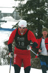 | 2006 NCAA tournament Steamboat Springs, Colorado-Men's 10K. Jess Kiesel [02] | 2006-03 | Image/StillImage | uum_map_usa |
| 32 |  | 2006 NCAA tournament Steamboat Springs, Colorado-Men's 20K | 2006-03 | Image/StillImage | uum_map_usa |
| 33 |  | 2006 NCAA tournament Steamboat Springs, Colorado-Men's Giant Slalom Champion, Scott Veenis. [01] | 2006-03 | Image/StillImage | uum_map_usa |
| 34 |  | 2006 NCAA tournament Steamboat Springs, Colorado-Men's Giant Slalom Champion, Scott Veenis. [02] | 2006-03 | Image/StillImage | uum_map_usa |
| 35 | 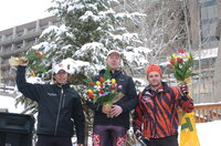 | 2006 NCAA tournament Steamboat Springs, Colorado-Men's Giant Slalom Champion, Scott Veenis. [03] | 2006-03 | Image/StillImage | uum_map_usa |
| 36 |  | 2006 NCAA tournament Steamboat Springs, Colorado-Men's Giant Slalom Champion, Scott Veenis. [04] | 2006-03 | Image/StillImage | uum_map_usa |
| 37 |  | 2006 NCAA tournament Steamboat Springs, Colorado-Men's Giant Slalom Champion, Scott Veenis. [05] | 2006-03 | Image/StillImage | uum_map_usa |
| 38 |  | 2006 NCAA tournament Steamboat Springs, Colorado-Men's Giant Slalom. Gaspar Perricone [01] | 2006-03 | Image/StillImage | uum_map_usa |
| 39 |  | 2006 NCAA tournament Steamboat Springs, Colorado-Men's Giant Slalom. Gaspar Perricone [02] | 2006-03 | Image/StillImage | uum_map_usa |
| 40 | 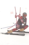 | 2006 NCAA tournament Steamboat Springs, Colorado-Men's Giant Slalom. Gaspar Perricone [03] | 2006-03 | Image/StillImage | uum_map_usa |
| 41 |  | 2006 NCAA tournament Steamboat Springs, Colorado-Men's Giant Slalom. Gaspar Perricone [04] | 2006-03 | Image/StillImage | uum_map_usa |
| 42 |  | 2006 NCAA tournament Steamboat Springs, Colorado-Men's Giant Slalom. Gaspar Perricone [05] | 2006-03 | Image/StillImage | uum_map_usa |
| 43 |  | 2006 NCAA tournament Steamboat Springs, Colorado-Men's Giant Slalom. Gaspar Perricone [06] | 2006-03 | Image/StillImage | uum_map_usa |
| 44 |  | 2006 NCAA tournament Steamboat Springs, Colorado-Men's Giant Slalom. Gaspar Perricone [07] | 2006-03 | Image/StillImage | uum_map_usa |
| 45 | 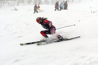 | 2006 NCAA tournament Steamboat Springs, Colorado-Men's Giant Slalom. Gaspar Perricone [08] | 2006-03 | Image/StillImage | uum_map_usa |
| 46 |  | 2006 NCAA tournament Steamboat Springs, Colorado-Men's Giant Slalom. Gaspar Perricone [09] | 2006-03 | Image/StillImage | uum_map_usa |
| 47 |  | 2006 NCAA tournament Steamboat Springs, Colorado-Men's Giant Slalom. Gaspar Perricone [10] | 2006-03 | Image/StillImage | uum_map_usa |
| 48 | 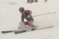 | 2006 NCAA tournament Steamboat Springs, Colorado-Men's Giant Slalom. Gaspar Perricone [11] | 2006-03 | Image/StillImage | uum_map_usa |
| 49 |  | 2006 NCAA tournament Steamboat Springs, Colorado-Men's Giant Slalom. Scott Veenis [01] | 2006-03 | Image/StillImage | uum_map_usa |
| 50 |  | 2006 NCAA tournament Steamboat Springs, Colorado-Men's Giant Slalom. Scott Veenis [02] | 2006-03 | Image/StillImage | uum_map_usa |
| 51 | 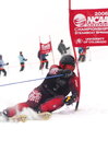 | 2006 NCAA tournament Steamboat Springs, Colorado-Men's Giant Slalom. Scott Veenis [03] | 2006-03 | Image/StillImage | uum_map_usa |
| 52 | 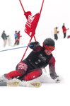 | 2006 NCAA tournament Steamboat Springs, Colorado-Men's Giant Slalom. Scott Veenis [04] | 2006-03 | Image/StillImage | uum_map_usa |
| 53 |  | 2006 NCAA tournament Steamboat Springs, Colorado-Men's Giant Slalom. Scott Veenis [05] | 2006-03 | Image/StillImage | uum_map_usa |
| 54 | 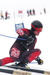 | 2006 NCAA tournament Steamboat Springs, Colorado-Men's Giant Slalom. Scott Veenis [06] | 2006-03 | Image/StillImage | uum_map_usa |
| 55 |  | 2006 NCAA tournament Steamboat Springs, Colorado-Men's Slalom [01] | 2006-03 | Image/StillImage | uum_map_usa |
| 56 |  | 2006 NCAA tournament Steamboat Springs, Colorado-Men's Slalom [02] | 2006-03 | Image/StillImage | uum_map_usa |
| 57 |  | 2006 NCAA tournament Steamboat Springs, Colorado-Men's Slalom [03] | 2006-03 | Image/StillImage | uum_map_usa |
| 58 |  | 2006 NCAA tournament Steamboat Springs, Colorado-Men's Slalom [04] | 2006-03 | Image/StillImage | uum_map_usa |
| 59 |  | 2006 NCAA tournament Steamboat Springs, Colorado-Men's Slalom. Will McDonald [01] | 2006-03 | Image/StillImage | uum_map_usa |
| 60 |  | 2006 NCAA tournament Steamboat Springs, Colorado-Men's Slalom. Will McDonald [02] | 2006-03 | Image/StillImage | uum_map_usa |
| 61 |  | 2006 NCAA tournament Steamboat Springs, Colorado-Men's Slalom. Will McDonald [03] | 2006-03 | Image/StillImage | uum_map_usa |
| 62 |  | 2006 NCAA tournament Steamboat Springs, Colorado-Men's Slalom. Will McDonald [04] | 2006-03 | Image/StillImage | uum_map_usa |
| 63 |  | 2006 NCAA tournament Steamboat Springs, Colorado-Men's Slalom. Will McDonald [05] | 2006-03 | Image/StillImage | uum_map_usa |
| 64 |  | 2006 NCAA tournament Steamboat Springs, Colorado-Women's 5K [01] | 2006-03 | Image/StillImage | uum_map_usa |
| 65 | 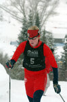 | 2006 NCAA tournament Steamboat Springs, Colorado-Women's 5K [02] | 2006-03 | Image/StillImage | uum_map_usa |
| 66 | 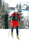 | 2006 NCAA tournament Steamboat Springs, Colorado-Women's 5K [03] | 2006-03 | Image/StillImage | uum_map_usa |
| 67 |  | 2006 NCAA tournament Steamboat Springs, Colorado-Women's 5K [04] | 2006-03 | Image/StillImage | uum_map_usa |
| 68 |  | 2006 NCAA tournament Steamboat Springs, Colorado-Women's 5K. Sara Schwieger [01] | 2006-03 | Image/StillImage | uum_map_usa |
| 69 |  | 2006 NCAA tournament Steamboat Springs, Colorado-Women's 5K. Sara Schwieger [02] | 2006-03 | Image/StillImage | uum_map_usa |
| 70 |  | 2006 NCAA tournament Steamboat Springs, Colorado-Women's Giant Slalom. [01] | 2006-03 | Image/StillImage | uum_map_usa |
| 71 |  | 2006 NCAA tournament Steamboat Springs, Colorado-Women's Giant Slalom. [02] | 2006-03 | Image/StillImage | uum_map_usa |
| 72 | 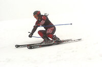 | 2006 NCAA tournament Steamboat Springs, Colorado-Women's Giant Slalom. [03] | 2006-03 | Image/StillImage | uum_map_usa |
| 73 |  | 2006 NCAA tournament Steamboat Springs, Colorado-Women's Giant Slalom. [04] | 2006-03 | Image/StillImage | uum_map_usa |
| 74 | 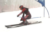 | 2006 NCAA tournament Steamboat Springs, Colorado-Women's Giant Slalom. [05] | 2006-03 | Image/StillImage | uum_map_usa |
| 75 | 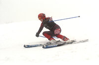 | 2006 NCAA tournament Steamboat Springs, Colorado-Women's Giant Slalom. [06] | 2006-03 | Image/StillImage | uum_map_usa |
| 76 |  | 2006 NCAA tournament Steamboat Springs, Colorado-Women's Giant Slalom. [07] | 2006-03 | Image/StillImage | uum_map_usa |
| 77 |  | 2006 NCAA tournament Steamboat Springs, Colorado-Women's Giant Slalom. Erika Hogan [01] | 2006-03 | Image/StillImage | uum_map_usa |
| 78 |  | 2006 NCAA tournament Steamboat Springs, Colorado-Women's Giant Slalom. Erika Hogan [02] | 2006-03 | Image/StillImage | uum_map_usa |
| 79 | 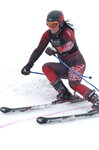 | 2006 NCAA tournament Steamboat Springs, Colorado-Women's Giant Slalom. Erika Hogan [03] | 2006-03 | Image/StillImage | uum_map_usa |
| 80 |  | 2006 NCAA tournament Steamboat Springs, Colorado-Women's Giant Slalom. Kim Stephens [01] | 2006-03 | Image/StillImage | uum_map_usa |
| 81 |  | 2006 NCAA tournament Steamboat Springs, Colorado-Women's Giant Slalom. Kim Stephens [02] | 2006-03 | Image/StillImage | uum_map_usa |
| 82 |  | 2006 NCAA tournament Steamboat Springs, Colorado-Women's Giant Slalom. Mikaela Grassl [01] | 2006-03 | Image/StillImage | uum_map_usa |
| 83 | 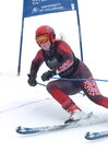 | 2006 NCAA tournament Steamboat Springs, Colorado-Women's Giant Slalom. Mikaela Grassl [02] | 2006-03 | Image/StillImage | uum_map_usa |
| 84 |  | 2006 NCAA tournament Steamboat Springs, Colorado-Women's Slalom. Erika Hogan [01] | 2006-03 | Image/StillImage | uum_map_usa |
| 85 |  | 2006 NCAA tournament Steamboat Springs, Colorado-Women's Slalom. Erika Hogan [02] | 2006-03 | Image/StillImage | uum_map_usa |
| 86 |  | 2006 NCAA tournament Steamboat Springs, Colorado-Women's Slalom. Kim Stephens | 2006-03 | Image/StillImage | uum_map_usa |
| 87 |  | 2006 NCAA tournament Steamboat Springs, Colorado-Women's Slalom. Mikaela Grassl [01] | 2006-03 | Image/StillImage | uum_map_usa |
| 88 | 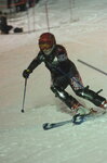 | 2006 NCAA tournament Steamboat Springs, Colorado-Women's Slalom. Mikaela Grassl [02] | 2006-03 | Image/StillImage | uum_map_usa |
| 89 | 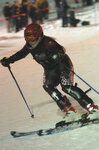 | 2006 NCAA tournament Steamboat Springs, Colorado-Women's Slalom. Mikaela Grassl [03] | 2006-03 | Image/StillImage | uum_map_usa |
| 90 | 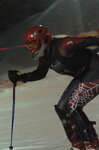 | 2006 NCAA tournament Steamboat Springs, Colorado-Women's Slalom. Mikaela Grassl [04] | 2006-03 | Image/StillImage | uum_map_usa |
| 91 |  | 2006 NCAA tournament Steamboat Springs, Colorado-Women's Slalom. Mikaela Grassl [05] | 2006-03 | Image/StillImage | uum_map_usa |
| 92 | 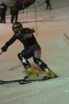 | 2006 NCAA tournament Steamboat Springs, Colorado-Women's Slalom. Mikaela Grassl [06] | 2006-03 | Image/StillImage | uum_map_usa |
| 93 | 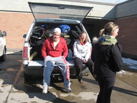 | 2006-2007 University of Utah ski team, Winter sports club, Steamboat springs, Colorado [01] | 2006; 2007 | Image/StillImage | uum_map_usa |
| 94 | 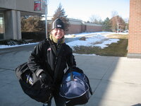 | 2006-2007 University of Utah ski team, Winter sports club, Steamboat springs, Colorado [02] | 2006; 2007 | Image/StillImage | uum_map_usa |
| 95 | 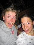 | 2006-2007 University of Utah ski team, Winter sports club, Steamboat springs, Colorado [03] | 2006; 2007 | Image/StillImage | uum_map_usa |
| 96 |  | 2006-2007 University of Utah ski team, Winter sports club, Steamboat springs, Colorado [04] | 2006; 2007 | Image/StillImage | uum_map_usa |
| 97 |  | 2006-2007 University of Utah ski team, Winter sports club, Steamboat springs, Colorado [05] | 2006; 2007 | Image/StillImage | uum_map_usa |
| 98 | 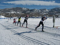 | 2006-2007 University of Utah ski team, Winter sports club, Steamboat springs, Colorado [06] | 2006; 2007 | Image/StillImage | uum_map_usa |
| 99 | 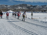 | 2006-2007 University of Utah ski team, Winter sports club, Steamboat springs, Colorado [07] | 2006; 2007 | Image/StillImage | uum_map_usa |
| 100 |  | 2006-2007 University of Utah ski team, Winter sports club, Steamboat springs, Colorado [08] | 2006; 2007 | Image/StillImage | uum_map_usa |