Home
Browse
Ask Us
Chat
Harmful Language Statement
Log in
Advanced Search
Year
1826
1827
1828
1829
1830
1831
1832
1833
1834
1835
1836
1837
1838
1839
1840
1841
1842
1843
1844
1845
1846
1847
1848
1849
1850
1851
1852
1853
1854
1855
1856
1857
1858
1859
1860
1861
1862
1863
1864
1865
1866
1867
1868
1869
1870
1871
1872
1873
1874
1875
1876
1877
1878
1879
1880
1881
1882
1883
1884
1885
1886
1887
1888
1889
1890
1891
1892
1893
1894
1895
1896
1897
1898
1899
1900
1901
1902
1903
1904
1905
1906
1907
1908
1909
1910
1911
1912
1913
1914
1915
1916
1917
1918
1919
1920
1921
1922
1923
1924
1925
1926
1927
1928
1929
1930
1931
1932
1933
1934
1935
1936
1937
1938
1939
1940
1941
1942
1943
1944
1945
1946
1947
1948
1949
1950
1951
1952
1953
1954
1955
1956
1957
1958
1959
1960
1961
1962
1963
1964
1965
1966
1967
1968
1969
1970
1971
1972
1973
1974
1975
1976
1977
1978
1979
1980
1981
1982
1983
1984
1985
1986
1987
1988
1989
1990
1991
1992
1993
1994
1995
1996
1997
1998
1999
2000
2001
2002
2003
2004
2005
2006
2007
2008
2009
2010
2011
2012
2013
2014
2015
2016
2017
2018
2019
2020
2021
2022
2023
TO
1826
1827
1828
1829
1830
1831
1832
1833
1834
1835
1836
1837
1838
1839
1840
1841
1842
1843
1844
1845
1846
1847
1848
1849
1850
1851
1852
1853
1854
1855
1856
1857
1858
1859
1860
1861
1862
1863
1864
1865
1866
1867
1868
1869
1870
1871
1872
1873
1874
1875
1876
1877
1878
1879
1880
1881
1882
1883
1884
1885
1886
1887
1888
1889
1890
1891
1892
1893
1894
1895
1896
1897
1898
1899
1900
1901
1902
1903
1904
1905
1906
1907
1908
1909
1910
1911
1912
1913
1914
1915
1916
1917
1918
1919
1920
1921
1922
1923
1924
1925
1926
1927
1928
1929
1930
1931
1932
1933
1934
1935
1936
1937
1938
1939
1940
1941
1942
1943
1944
1945
1946
1947
1948
1949
1950
1951
1952
1953
1954
1955
1956
1957
1958
1959
1960
1961
1962
1963
1964
1965
1966
1967
1968
1969
1970
1971
1972
1973
1974
1975
1976
1977
1978
1979
1980
1981
1982
1983
1984
1985
1986
1987
1988
1989
1990
1991
1992
1993
1994
1995
1996
1997
1998
1999
2000
2001
2002
2003
2004
2005
2006
2007
2008
2009
2010
2011
2012
2013
2014
2015
2016
2017
2018
2019
2020
2021
2022
2023
Type
Image
904
Image/StillImage
850
Text
226
Format
image/jpeg
1,501
application/pdf
321
Collection
Al W. Morton Collection, 1930s-1950s
5
Alta Avalanche
2
American Westward Migration
1
Classified Photographs
139
Colorado Riverbed Case
12
David Oman McKay Papers
1
John Hamilton Morgan Papers
43
Marriner S. Eccles Papers
1
Photo Archives
464
Regional History Center
38
Shipler Commercial Photographers
40
Ski and Snow Sports Photo Archives
82
Taylor A. Woolley Papers
2
Thorne Photographs
1
UAIDA Main Collection
522
Uintah County Regional History Center...
5
Utah Humanities Research Foundation
1
Utah Quilt Heritage Records
4
Utah River Running Photo Archives
726
Vernal Express Photographs
2
William Edward Hook Glass Negatives
70
More
Filters:
Spatial Coverage:
"Colorado"
Year End:
1969
1051
-
1075
of
2,161
<
38
39
40
41
42
43
44
45
46
47
>
Gallery view
Number of results to display per page
10
25
50
100
200
Sort by Relevance
Sort by Title A-Z
Sort by Title Z-A
Sort by Date Ascending
Sort by Date Descending
Sort by Last Modified Ascending
Sort by Last Modified Descending
Title
Date
Type
Setname
1051
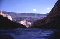
Lodore, Green River Utah, May 1961 [13]
1961-05
Image/StillImage
uum_map_rr
1052
Lodore, Green River Utah, May 1961 [14]
1961-05
Image/StillImage
uum_map_rr
1053
Lone Star quilt by Gerald Coltharp
1928
Text
uum_uqhr
1054
Long's Peak and a spur of Hallett Peak from Flattop
1933
Image
uum_map_rr
1055
Long's Peak from Tyndall Glacier
1933
Image
uum_map_rr
1056
Looking down Ladore Canyon, about 2 miles above Hell's Half Mile. (43)
1922-08-03
uum_map_rr
1057
Looking downriver from Camp in Harding Hole Area, Yampa River, May 1963
1963-05
Image/StillImage
uum_map_rr
1058
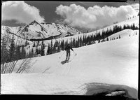
Looking South East at the bridge going up to Taggert Hut, circa May 1, 1948
1948-05-01
uum_map_usa
1059
Looking South East at the bridge going up to Taggert Hut, circa May 1, 1948 (Negative)
1948-05-01
uum_map_usa
1060
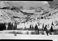
Looking South East at the tow in Pearl Basin, circa May 1, 1948
1948-05-01
uum_map_usa
1061
Looking South East at the tow in Pearl Basin, circa May 1, 1948 (Negative)
1948-05-01
uum_map_usa
1062
Looking South West from Taggert Hut, circa April 30, 1948
1948-04-28
uum_map_usa
1063
Looking South West from Taggert Hut, circa April 30, 1948 (Negative)
1948-04-28
uum_map_usa
1064
Looking up into the draw of Harding's Hole Cave, Yampa River, July 1963
1963-07
Image/StillImage
uum_map_rr
1065
Looking up into the draw of Harding's Hole Cave, Yampa River, May 1963
1963-05
Image/StillImage
uum_map_rr
1066
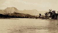
Looking upstream at the Book Cliffs from DeBeque. Mt. Logan l[eft]
1933
Image
uum_map_rr
1067
Looking West below Taggert Hut, circa May 1, 1948
1948-05-01
uum_map_usa
1068
Looking West below Taggert Hut, circa May 1, 1948
1948-05-01
uum_map_usa
1069
Looking West below Taggert Hut, circa May 1, 1948 (Negative)
1948-05-01
uum_map_usa
1070
Looking West below Taggert Hut, circa May 1, 1948 (Negative)
1948-05-01
uum_map_usa
1071
Looking West just below Taggert Hut (up and to the left), circa April 30, 1948
1948-04-28
uum_map_usa
1072
Looking West just below Taggert Hut (up and to the left), circa April 30, 1948 (Negative)
1948-04-28
uum_map_usa
1073
Lower cliffs on the North Face of Long's Peak
1933
Image
uum_map_rr
1074
Lower Disaster Falls, Lodore, Green River Colorado, May 1961 [01]
1961-05
Image/StillImage
uum_map_rr
1075
Lower Disaster Falls, Lodore, Green River Colorado, May 1961 [02]
1961-05
Image/StillImage
uum_map_rr
1051
-
1075
of
2,161
<
38
39
40
41
42
43
44
45
46
47
>