| Title | Date | Type | Setname | ||
|---|---|---|---|---|---|
| 351 |
 | Barrett Christy [19] | 2000 | Image | uum_map_usa |
| 352 |
 | Barrett Christy [20] | 2000 | Image | uum_map_usa |
| 353 |
 | Barrett Christy [21] | 2000 | Image | uum_map_usa |
| 354 |
 | Barrett Christy [22] | 2000 | Image | uum_map_usa |
| 355 |
 | Barrett Christy [23] | 2000 | Image | uum_map_usa |
| 356 |
 | Barrett Christy [24] | 2000 | Image | uum_map_usa |
| 357 |
 | Barrett Christy [25] | 2000 | Image | uum_map_usa |
| 358 |
 | Basis of American history, 1500-1900, by Livingston Farrand | Image/StillImage | uaida_main | |
| 359 |
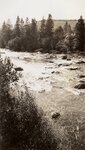
 | Battle Rock, McElmo Creek, SW Colorado | 1915 | Image | uum_map |
| 360 |
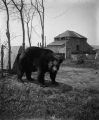 | Bear | 1910; 1911; 1912; 1913; 1914; 1915 | Image | dha_wehgn |
| 361 |
 | Beaver | 1950; 1951; 1952; 1953; 1954; 1955; 1956; 1957; 1958; 1959; 1960; 1961; 1962; 1963; 1964; 1965; 1966; 1967; 1968; 1969; 1970; 1971; 1972; 1973; 1974; 1975; 1976; 1977; 1978; 1979; 1980; 1981; 1982; 1983; 1984; 1985; 1986; 1987; 1988; 1989 | Image | uum_map_rr |
| 362 |
 | Beaver Creek | 2006; 2007 | Image/StillImage | uum_map_usa |
| 363 |
 | Below Columbine Creek | 1933 | Image | uum_map_rr |
| 364 |
 | Below Harding [Hole] | 1954-08 | Image | uum_map_rr |
| 365 |
 | Below Red Dirt Creek | 1933 | Image | uum_map_rr |
| 366 |
 | Berthoud Pass plaque | 1985 | Image/StillImage | uum_map_rr |
| 367 |
 | Big Chief of Ute Son | 1880; 1881; 1882; 1883; 1884; 1885; 1886; 1887; 1888; 1889; 1890; 1891; 1892; 1893; 1894; 1895; 1896; 1897; 1898; 1899; 1900 | Image/StillImage | uaida_main |
| 368 |
 | Bill and Alley Gadd | 1942; 1943; 1944; 1945 | Image/StillImage | ucl_rhc |
| 369 |
 | Biological and contaminant investigations, Upper Colorado River Basin : what's been done and how can the information be used? | 1997 | Text | wwdl_er |
| 370 |
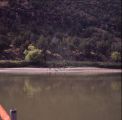 | Birds on shore, Yampa River | 1976 | Image | uum_map_rr |
| 371 |
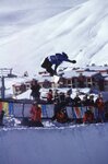 | Bjorn Leines competing in the X-Games | 1998 | uum_map_usa | |
| 372 |
 | Bjorn Leines competing in the X-Games. | 1998 | uum_map_usa | |
| 373 |
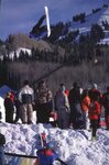
 | Bjorn Malkomsen, Crested Butte, Colorado, 1970 [1] | 1970 | uum_map_usa | |
| 374 |
 | Bjorn Malkomsen, Crested Butte, Colorado, 1970 [2] | 1970 | uum_map_usa | |
| 375 |
 | Black Canyon of Gunnison | 1908-07-17 | Image | dha_scp |