Home
Browse
Ask Us
Chat
Harmful Language Statement
Log in
Advanced Search
Year
1899
1900
1901
1902
1903
1904
1905
1906
1907
1908
1909
1910
1911
1912
1913
1914
1915
1916
1917
1918
1919
1920
1921
1922
1923
1924
1925
1926
1927
1928
1929
1930
1931
1932
1933
1934
1935
1936
1937
1938
1939
1940
1941
1942
1943
1944
1945
1946
1947
1948
1949
1950
1951
1952
1953
1954
1955
1956
1957
1958
1959
1960
1961
1962
1963
1964
1965
1966
1967
1968
1969
1970
1971
1972
1973
1974
1975
1976
1977
1978
1979
1980
1981
1982
1983
1984
1985
1986
1987
1988
1989
1990
TO
1899
1900
1901
1902
1903
1904
1905
1906
1907
1908
1909
1910
1911
1912
1913
1914
1915
1916
1917
1918
1919
1920
1921
1922
1923
1924
1925
1926
1927
1928
1929
1930
1931
1932
1933
1934
1935
1936
1937
1938
1939
1940
1941
1942
1943
1944
1945
1946
1947
1948
1949
1950
1951
1952
1953
1954
1955
1956
1957
1958
1959
1960
1961
1962
1963
1964
1965
1966
1967
1968
1969
1970
1971
1972
1973
1974
1975
1976
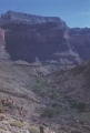
1977
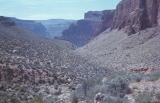
1978
1979
1980
1981
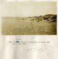
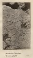
1982
1983
1984
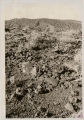
1985
1986
1987
1988
1989
1990
Type
Image
1,321
Format
image/jpeg
1,251
application/pdf
70
Collection
Beckwith Photograph Collection
3
Photo Archives
761
Utah River Running Photo Archives
557
Filters:
Spatial Coverage:
"Coconino County (Ariz.)"
Type:
"Image"
176
-
200
of
1,321
<
3
4
5
6
7
8
9
10
11
12
>
Gallery view
Number of results to display per page
10
25
50
100
200
Sort by Relevance
Sort by Title A-Z
Sort by Title Z-A
Sort by Date Ascending
Sort by Date Descending
Sort by Last Modified Ascending
Sort by Last Modified Descending
Title
Date
Type
Setname
176
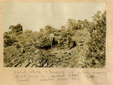
David White & Gregory at "Fern Quarry"; fossil ferns in Hermit Shale. Yaki trail... 1928
1928
Image
uum_map
177
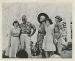
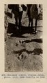
Dedication of the plaque to Norman and Doris Nevills, July 11, 1952. Joan Nevills, Frank "Fisheyes" Marsland, Mary Ogden Abbott, Sandra Nevills, Mae Davies Nevills, Marble Canyon Bridge, Arizona.
1952-07-11
Image
uum_map_rr
178
Deepest hole at Bass asbestos mine with bottle left by Park S.[ervice], Brian Gottfriedsen [?]
1971-05-10
Image
uum_map_rr
179
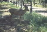
Deer at South Rim of Grand Canyon, Nevills Expedition Grand Canyon river trip, 1942
1942
Image
uum_map_rr
180
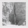
Deer Creek Falls
1909-09; 1909-10; 1909-11
Image
uum_map
181
Deer Creek Falls
1934; 1935; 1936; 1937; 1938; 1939; 1940; 1941; 1942; 1943; 1944; 1945; 1946; 1947; 1948; 1949
Image
uum_map_rr
182
Deer Creek from Surprise Valley
1970-04; 1970-05
Image
uum_map_rr
183
Deer Creek near right fork spring
1970-04; 1970-05
Image
uum_map_rr
184
Desert pavement between Red Lake and Tuba
1913
Image
uum_map
185
Desert pavement between Red Lake and Tuba
1913
Image
uum_map
186
Desert scenes from the Grand Canyon Bill folder. Photographs sent by Dr. Richard Thomson of Southern Utah State College, Ceder City, Utah.
Image
uum_map
187
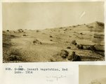
Desert vegetation, Red Lake, 1914
1914
Image
uum_map
188
Detail, Dolores section, as in No. 742 (Photo G425)
1913
Image
uum_map
189
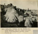
Details, McElmo or La Plata (?), Blue Canyon, 18± mi. east of Tuba, Ariz. (M. R. Campbell photo, 1909, U.S.G.S.)
1909
Image
uum_map
190
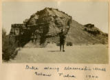
Dike along Moencopie near Tuba, 1900
1900
Image
uum_map
191
Dike along Moencopie Wash below Tuba 1900
1900
Image
uum_map
192
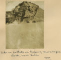
Dike in La Plata or Dolores, Moencopie Wash, near Tuba, 1900
1900
Image
uum_map
193
Dike,south side of Moenkopi valley, 5 mil SW of Tuba, 1914
1914
Image
uum_map
194
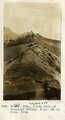
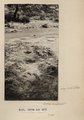
Dinosaur tracks (1)
1929-05-17
Image
dc_bpc
195
Dinosaur tracks (2)
1929-05-17
Image
dc_bpc
196
Dinosaur tracks (3)
1929-05-17
Image
dc_bpc
197
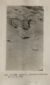
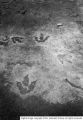
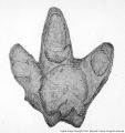
Dinosaur tracks (J. Wetherill photo)
1910
Image
uum_map
198
Dinosaur tracks (Janus photo)
1909
Image
uum_map
199
Dinosaur tracks (Stephen Janus photo, 1909. Same locality as G185)
1909
Image
uum_map
200
Dinosaur tracks (Stephen Janus photo, 1909. Same locality as G185)
1909
Image
uum_map
176
-
200
of
1,321
<
3
4
5
6
7
8
9
10
11
12
>