Home
Browse
Ask Us
Chat
Harmful Language Statement
Log in
Advanced Search
Year
1899
1900
1901
1902
1903
1904
1905
1906
1907
1908
1909
1910
1911
1912
1913
1914
1915
1916
1917
1918
1919
1920
1921
1922
1923
1924
1925
1926
1927
1928
1929
1930
1931
1932
1933
1934
1935
1936
1937
1938
1939
1940
1941
1942
1943
1944
1945
1946
1947
1948
1949
1950
1951
1952
1953
1954
1955
1956
1957
1958
1959
1960
1961
1962
1963
1964
1965
1966
1967
1968
1969
1970
1971
1972
1973
1974
1975
1976
1977
1978
1979
1980
1981
1982
1983
1984
1985
1986
1987
1988
1989
1990
TO
1899
1900
1901
1902
1903
1904
1905
1906
1907
1908
1909
1910
1911
1912
1913
1914
1915
1916
1917
1918
1919
1920
1921
1922
1923
1924
1925
1926
1927
1928
1929
1930
1931
1932
1933
1934
1935
1936
1937
1938
1939
1940
1941
1942
1943
1944
1945
1946
1947
1948
1949
1950
1951
1952
1953
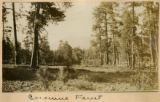
1954
1955
1956
1957
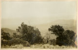
1958
1959
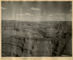
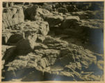
1960
1961
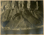
1962
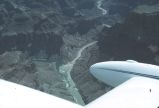
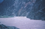
1963
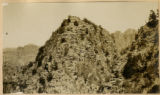
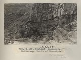
1964
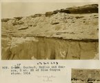
1965
1966
1967
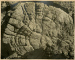
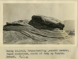
1968
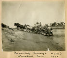
1969
1970
1971
1972
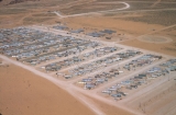
1973
1974
1975
1976
1977
1978
1979
1980
1981
1982
1983
1984
1985
1986
1987
1988
1989
1990
Type
Image
1,321
Format
image/jpeg
1,251
application/pdf
70
Collection
Beckwith Photograph Collection
3
Photo Archives
761
Utah River Running Photo Archives
557
Filters:
Spatial Coverage:
"Coconino County (Ariz.)"
Type:
"Image"
151
-
175
of
1,321
<
2
3
4
5
6
7
8
9
10
11
>
Gallery view
Number of results to display per page
10
25
50
100
200
Sort by Relevance
Sort by Title A-Z
Sort by Title Z-A
Sort by Date Ascending
Sort by Date Descending
Sort by Last Modified Ascending
Sort by Last Modified Descending
Title
Date
Type
Setname
151
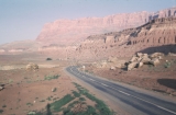
Cliff Dweller's Lodge
1965-06
Image
uum_map_rr
152
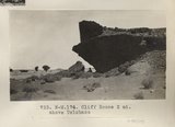
Cliff House 2 mi. above Tolchaco (Photo N-M174)
1913
Image
uum_map
153
Cliffs (Dolores strata) east of Little Colorado at Tolchaco, Arizona, 1909 (photo G-88)
1909
Image
uum_map
154
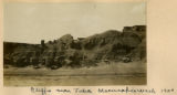
Cliffs at Lyon's Ranch, near Tuba, Ariz. Lower La Plata or upper Dolores strata, M. R. Campbell photo, 1909
1909
Image
uum_map
155
Cliffs near Tuba, Moencopie Wash, 1900
1900
Image
uum_map
156
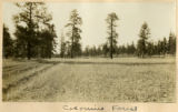
Coconino Forest
1900
Image
uum_map
157
Coconino Forest
1900
Image
uum_map
158
Coconino Forest Between Flagstaff & Grand Canyon, 1900 [1]
1900
Image
uum_map
159
Coconino Forest Between Flagstaff & Grand Canyon, 1900 [2]
1900
Image
uum_map
160
Colorado Canyon
1899
Image
uum_map
161
Colorado Canyon 1900
1900
Image
uum_map
162
Colorado Canyon 1900: fault
1900
Image
uum_map
163
Colorado Canyon 1900: Petrified wood
1900
Image
uum_map
164
Colorado Canyon 1900: terraces
1900
Image
uum_map
165
confluence of Colorado River and Little Colorado River - aerial view
1930; 1931; 1932; 1933; 1934; 1935; 1936; 1937; 1938; 1939; 1940; 1941; 1942; 1943; 1944; 1945; 1946; 1947; 1948; 1949; 1950
Image
uum_map_rr
166
Contact, Carboniferous and Permian, Wolf's Crossing (Photo N-M173)
1913
Image
uum_map
167
Contact, McElmo and Mancos, 3 mi. NE of Blue Canyon store, 1914
1914
Image
uum_map
168
Contact, Moencopie-Shinarump, Mouth of Moencopie (Photo G428)
1913
Image
uum_map
169
Cowboy Butte 2 miles north of Fredonia. Moenkopi (Shnabkaib member at base) and Shinarump, Coconino County, AZ. 1939
1939
Image
uum_map
170
Cross-bedding, summit member, Supai sandstone, mouth of Jump Up Canyon, AZ. 1922
1922
Image
uum_map
171
Crossing arroyo north of Winslow, Ariz, 1900
1900
Image
uum_map
172
Crossing Little Colorado, 1900
1900
Image
uum_map
173
Crystal Rapid [_?_ _?_]
1971-08-19
Image
uum_map_rr
174
Crystal Rapid looking up
1971-08-19
Image
uum_map_rr
175
Dam site construction camp.
1958-04
Image
uum_map_rr
151
-
175
of
1,321
<
2
3
4
5
6
7
8
9
10
11
>