Home
Browse
Ask Us
Chat
Harmful Language Statement
Log in
Advanced Search
Year
1899
1900
1901
1902
1903
1904
1905
1906
1907
1908
1909
1910
1911
1912
1913
1914
1915
1916
1917
1918
1919
1920
1921
1922
1923
1924
1925
1926
1927
1928
1929
1930
1931
1932
1933
1934
1935
1936
1937
1938
1939
1940
1941
1942
1943
1944
1945
1946
1947
1948
1949
1950
1951
1952
1953
1954
1955
1956
1957
1958
1959
1960
1961
1962
1963
1964
1965
1966
1967
1968
1969
1970
1971
1972
1973
1974
1975
1976
1977
1978
1979
1980
1981
1982
1983
1984
1985
1986
1987
1988
1989
1990
TO
1899
1900
1901
1902
1903
1904
1905
1906
1907
1908
1909
1910
1911
1912
1913
1914
1915
1916
1917
1918
1919
1920
1921
1922
1923
1924
1925
1926
1927
1928
1929
1930
1931
1932
1933
1934
1935
1936
1937
1938
1939
1940
1941
1942
1943
1944
1945
1946
1947
1948
1949
1950
1951
1952
1953
1954
1955
1956
1957
1958
1959
1960
1961
1962
1963
1964
1965
1966
1967
1968
1969
1970
1971
1972
1973
1974
1975
1976
1977
1978
1979
1980
1981
1982
1983
1984
1985
1986
1987
1988
1989
1990
Type
Image
1,321
Format
image/jpeg
1,251
application/pdf
70
Collection
Beckwith Photograph Collection
3
Photo Archives
761
Utah River Running Photo Archives
557
Filters:
Spatial Coverage:
"Coconino County (Ariz.)"
Type:
"Image"
226
-
250
of
1,321
<
5
6
7
8
9
10
11
12
13
14
>
Gallery view
Number of results to display per page
10
25
50
100
200
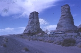
Sort by Relevance
Sort by Title A-Z
Sort by Title Z-A
Sort by Date Ascending
Sort by Date Descending
Sort by Last Modified Ascending
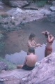
Sort by Last Modified Descending
Title
Date
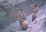
Type
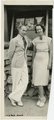
Setname
226
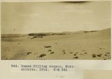
Dunes filling canyon, Bekishibito, 1914
1914
Image
uum_map
227
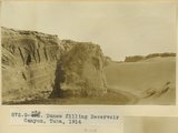
Dunes filling Reservoir Canyon, Tuba (IV-8 in film book is also like this) (Photo G441)
1913
Image
uum_map
228
Dunes filling Reservoir Canyon, Tuba (IV-8 in film book is also like this) (Photo G441)
1913
Image
uum_map
229
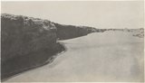
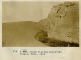
Dunes filling Reservoir Canyon, Tuba, 1914
1914
Image
uum_map
230
Dunes filling Reservoir Canyon, Tuba, 1914
1914
Image
uum_map
231
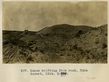
Dunes shifting from rock, Tuba Desert, 1914
1914
Image
uum_map
232
Dunes, Tuba desert (Photo G440)
1913
Image
uum_map
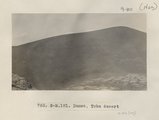
233
Dunes, Tuba desert (Photo N-M181)
1913
Image
uum_map
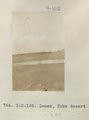
234
Dunes, Tuba desert (Photo N-M182)
1913
Image
uum_map
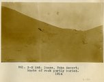
235
Dunes, Tuba Desert, knobs of rock partly buried, 1914
1914
Image
uum_map
236
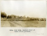
Eastern half of Tuba school grounds
1914
Image
uum_map
237
Elephant Rocks, Arizona
1928-08
Image
uum_map_rr
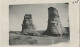
238
Elephant's feet
1925; 1926; 1927; 1928; 1929; 1930; 1931; 1932; 1933; 1934; 1935; 1936; 1937; 1938; 1939; 1940; 1941; 1942; 1943; 1944; 1945; 1946; 1947; 1948; 1949
Image
uum_map_rr
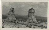
239
Elephant's Feet
1925; 1926; 1927; 1928; 1929; 1930; 1931; 1932; 1933; 1934; 1935; 1936; 1937; 1938; 1939; 1940; 1941; 1942; 1943; 1944; 1945; 1946; 1947; 1948; 1949
Image
uum_map_rr
240
Elephant's Feet, near Navajo Mt., April 1952 [01]
1952-04
Image
uum_map
241
Elephant's Feet, near Navajo Mt., April 1952 [02]
1952-04
Image
uum_map
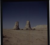
242
Elephant's Feet, Route 64 and 1, Arizona, May 26, 1962
1962-05-26
Image
uum_map
243
Elves Chasm
1971-08-22
Image
uum_map_rr
244
Elves Chasm
1971-08-22
Image
uum_map_rr
245
Elves Chasm, 22 Aug 71
1971-08-22
Image
uum_map_rr
246
Elves Chasm, Alta, JoAnn, and Merlin
1971-08-22
Image
uum_map_rr
247
Emery Kolb and Edith Kolb Lehnert, July 2, 1938, (friends of Norman D. Nevills).
1938-07-20; 1938-07-21
Image
uum_map_rr
248
Engleman cactus, Tapeats [creek]
1971-08-22
Image
uum_map_rr
249
Erosion details, LaPlata strata, 3 mi. west of Moencopie, Ariz. (Pogue photo, 1910)
1910
Image
uum_map
250
Erosion details, LaPlata strata, 3 mi. west of Moencopie, Ariz. (Pogue photo, 1910)
1910
Image
uum_map
226
-
250
of
1,321
<
5
6
7
8
9
10
11
12
13
14
>