Home
Browse
Ask Us
Chat
Harmful Language Statement
Log in
Advanced Search
Year
1849
1850
1851
1852
1853
1854
1855
1856
1857
1858
1859
1860
1861
1862
1863
1864
1865
1866
1867
1868
1869
1870
1871
1872
1873
1874
1875
1876
1877
1878
1879
1880
1881
1882
1883
1884
1885
1886
1887
1888
1889
1890
1891
1892
1893
1894
1895
1896
1897
1898
1899
1900
1901
1902
1903
1904
1905
1906
1907
1908
1909
1910
1911
1912
1913
1914
1915
1916
1917
1918
1919
1920
1921
1922
1923
1924
1925
1926
1927
1928
1929
1930
1931
1932
1933
1934
1935
1936
1937
1938
1939
1940
1941
1942
1943
1944
1945
1946
1947
1948
1949
1950
1951
1952
1953
1954
1955
1956
1957
1958
1959
1960
1961
1962
1963
1964
1965
1966
1967
1968
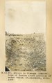
1969
1970
1971
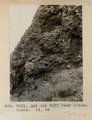
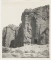
1972
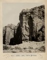
1973
1974
1975
1976
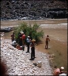
1977
1978
1979
1980
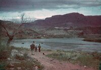
1981
1982
1983
1984
1985
1986
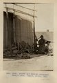
1987
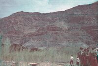
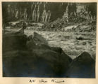
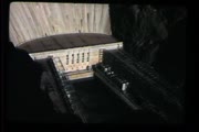
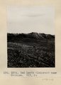
1988
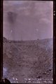
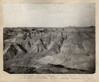
1989
1990
1991
1992
1993
1994
1995
1996
1997
1998
1999
2000
2001
2002
2003
2004
2005
2006
2007
2008
2009
2010
2011
2012
2013
2014
2015
2016
2017
2018
2019
2020
2021
2022
2023
TO
1849
1850
1851
1852
1853
1854
1855
1856
1857
1858
1859
1860
1861
1862
1863
1864
1865
1866
1867
1868
1869
1870
1871
1872
1873
1874
1875
1876
1877
1878
1879
1880
1881
1882
1883
1884
1885
1886
1887
1888
1889
1890
1891
1892
1893
1894
1895
1896
1897
1898
1899
1900
1901
1902
1903
1904
1905
1906
1907
1908
1909
1910
1911
1912
1913
1914
1915
1916
1917
1918
1919
1920
1921
1922
1923
1924
1925
1926
1927
1928
1929
1930
1931
1932
1933
1934
1935
1936
1937
1938
1939
1940
1941
1942
1943
1944
1945
1946
1947
1948
1949
1950
1951
1952
1953
1954
1955
1956
1957
1958
1959
1960
1961
1962
1963
1964
1965
1966
1967
1968
1969
1970
1971
1972
1973
1974
1975
1976
1977
1978
1979
1980
1981
1982
1983
1984
1985
1986
1987
1988
1989
1990
1991
1992
1993
1994
1995
1996
1997
1998
1999
2000
2001
2002
2003
2004
2005
2006
2007
2008
2009
2010
2011
2012
2013
2014
2015
2016
2017
2018
2019
2020
2021
2022
2023
Type
Image
2,080
Image/StillImage
635
Text
136
Image/MovingImage
3
Sound
2
Format
image/jpeg
2,392
application/pdf
415
video/mp4
3
audio/mpeg
2
Collection
Al W. Morton Collection, 1930s-1950s
55
American Westward Migration
3
Audio-Visual Archives Collections
2
Beckwith Photograph Collection
2
Classified Photographs
234
George A. Smith Papers
1
Mormon Settlement in Arizona
112
Photo Archives
1,880
Shipler Commercial Photographers
2
UAIDA Main Collection
109
Utah Humanities Research Foundation
5
Utah River Running Photo Archives
468
Vernal Express Photographs
1
Western Soundscape
2
More
Filters:
Spatial Coverage:
"Arizona"
Year End:
1959
126
-
150
of
2,876
<
1
2
3
4
5
6
7
8
9
10
>
Gallery view
Number of results to display per page
10
25
50
100
200
Sort by Relevance
Sort by Title A-Z
Sort by Title Z-A
Sort by Date Ascending
Sort by Date Descending
Sort by Last Modified Ascending
Sort by Last Modified Descending
Title
Date
Type
Setname
126
Arnold and family (Chinlee) Navajo loom. Heald, photo, 1911 (Photo G282)
1911
Image
uum_map
127
The arrow maker and his daughter
1874
Image/StillImage
uaida_main
128
Arroyo in Cienega (meadow), line of bushes shows position of water table, St. Michaels, Ariz., 1909 (photo G-3)
1909
Image
uum_map
129
Arroyo in cienega, St. Michaels, Ariz. (negative for G-3)
1909
Image
uum_map
130
Articles from the Deseret News, 1876-1878
1876; 1877; 1878
Text
uum_msa
131
Ash and tuff near Biddehoche. VI, 84 (Photo G231)
1911
Image
uum_map
132
Ash, Twin Buttes (Photo G252)
1911
Image
uum_map
133
Ash, Twin Buttes (Photo G252)
1911
Image
uum_map
134
At breakfast typical desert home of Navajo Indians (S. W.) Arizona
1900; 1901; 1902; 1903; 1904; 1905; 1906; 1907; 1908; 1909; 1910
Image/StillImage
uaida_main
135
At Grand View
1900
Image
uum_map
136
At Lee's Ferry, April 10, 1948 [01]
1948-04-10
Image/StillImage
uum_map
137
At Lee's Ferry, April 10, 1948 [02]
1948-04-10
Image/StillImage
uum_map
138
At Lee's Ferry, April 10, 1948 [03]
1948-04-10
Image/StillImage
uum_map
139
At Lee's Ferry, April 10, 1948 [04]
1948-04-10
Image/StillImage
uum_map
140
At the mouth of Tapeats Creek, Grand Canyon, June 1956
1956-06
Image/StillImage
uum_map_rr
141
At the River
1900
Image
uum_map
142
Aunt Eliza [Eliza Lewis Fish]
1944; 1945; 1946; 1947; 1948; 1949; 1950
Text
uum_uhrf
143
Auto trip to Arizona, Mexico, Texas, and Louisiana
1951
Image/MovingImage
uum_avac
144
Autobiographical notes of my life, by James Warren Le Sueur
1939-07
Text
uum_msa
145
Azra [that is, Arza] E. Hinckley journal no. 1, October, 1882 to January, 1884
1882; 1883; 1884; 1885; 1886
Text
uum_msa
146
B. P. road in Bonita Canyon
1940; 1941; 1942; 1943; 1944; 1945; 1946; 1947; 1948; 1949; 1950; 1951; 1952; 1953; 1954; 1955; 1956; 1957; 1958; 1959; 1960
Image
uum_map
147
Back of Roosevelt Dam
1932-05
Image
uum_map_rr
148
Bad Lands (Dolores) near Chinlee. VII, 26 (Photo G271)
1911
Image
uum_map
149
Bad lands, Chinle strata in Hopi Buttes region, north east of Holbrook, Ariz. USGS, probably Darton
1911
Image
uum_map
150
Bad Lands, Cottonwood Wash. 1909
1911
Image
uum_map
126
-
150
of
2,876
<
1
2
3
4
5
6
7
8
9
10
>