| | Title | Date | Type | Setname |
|---|
| 401 |  | Canyon at Tuba coal mine; McElmo capped by Cretaceous (Stephen Janus photo, 1909) | 1909 | Image | uum_map |
| 402 | 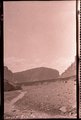 | Canyon Bonito, Ariz. (negative for photo G-6) | 1909 | Image | uum_map |
| 403 | 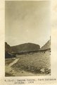 | Canyon Bonito, Fort Defiance, Arizona, 1909 (photo G-6) | 1909 | Image | uum_map |
| 404 | 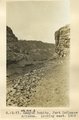 | Canyon Bonito, Fort Defiance, Arizona, looking west, 1909 (photo G-7) | 1909 | Image | uum_map |
| 405 | 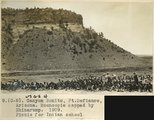 | Canyon Bonito, Fort Defiance, Arizona. Moencopie capped by Shinarump, 1909 (photo G-8) | 1909 | Image | uum_map |
| 406 | 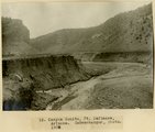 | Canyon Bonito, Ft. Defiance, Arizona, 1908 (Schwemberger photo) | 1908 | Image | uum_map |
| 407 | 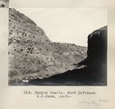 | Canyon Bonito. Fort Defiance E.C. Case, photo | 1913 | Image | uum_map |
| 408 | 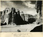 | Canyon de Chelly at Junction with Canyon del Muerto (Moencope strata), 1909 (W. C. Mendenhall, photo, U.S.G.S.) | 1909 | Image | uum_map |
| 409 | 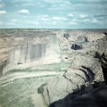 | Canyon de Chelly from mesa | 1940; 1941; 1942; 1943; 1944; 1945; 1946; 1947; 1948; 1949; 1950; 1951; 1952; 1953; 1954; 1955; 1956; 1957; 1958; 1959; 1960; 1961; 1962; 1963; 1964; 1965; 1966; 1967; 1968; 1969; 1970 | Image | uum_map |
| 410 |  | Canyon de Chelly looking west | 1950; 1951; 1952; 1953; 1954; 1955; 1956; 1957; 1958; 1959; 1960; 1961; 1962; 1963; 1964; 1965; 1966; 1967; 1968; 1969; 1970 | Image | uum_map |
| 411 |  | Canyon de Chelly near junction with Canyon del Muerto, 1910 (Edna H. Gregory photo, N-M101) | 1910 | Image | uum_map |
| 412 |  | Canyon de Chelly view | 1940; 1941; 1942; 1943; 1944; 1945; 1946; 1947; 1948; 1949; 1950; 1951; 1952; 1953; 1954; 1955; 1956; 1957; 1958; 1959; 1960; 1961; 1962; 1963; 1964; 1965; 1966; 1967; 1968; 1969; 1970 | Image | uum_map |
| 413 |  | Canyon de Chelly, 1± above White House (Moencopie strata), 1909 (W. C. Mendenhall, photo, U.S.G.S.) | 1909 | Image | uum_map |
| 414 |  | Canyon de Chelly, 3± mi. below Monument Canyon (Moencopie strata), 1909 (W. C. Mendenhall, photo, U.S.G.S.) | 1909 | Image | uum_map |
| 415 |  | Canyon de Chelly, 4± mi. below Monument Canyon (Moencopie strata), 1909 (W. C. Mendenhall, photo, U.S.G.S.) | 1909 | Image | uum_map |
| 416 |  | Canyon de Chelly, Indian ruins | 1873 | Image | uum_map |
| 417 | 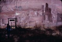 | Canyon de Chelly, January 1980 [01] | 1979-12; 1980-01 | Image/StillImage | uum_map_rr |
| 418 | 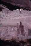 | Canyon de Chelly, January 1980 [02] | 1979-12; 1980-01 | Image/StillImage | uum_map_rr |
| 419 |  | Canyon de Chelly, January 1980 [03] | 1979-12; 1980-01 | Image/StillImage | uum_map_rr |
| 420 | 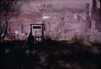 | Canyon de Chelly, January 1980 [04] | 1979-12; 1980-01 | Image/StillImage | uum_map_rr |
| 421 |  | Canyon de Chelly, January 1980 [05] | 1979-12; 1980-01 | Image/StillImage | uum_map_rr |
| 422 |  | Canyon de Chelly, January 1980 [06] | 1979-12; 1980-01 | Image/StillImage | uum_map_rr |
| 423 |  | Canyon de Chelly, January 1980 [07] | 1979-12; 1980-01 | Image/StillImage | uum_map_rr |
| 424 |  | Canyon de Chelly, January 1980 [08] | 1979-12; 1980-01 | Image/StillImage | uum_map_rr |
| 425 | 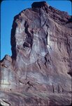 | Canyon de Chelly, January 1980 [09] | 1979-12; 1980-01 | Image/StillImage | uum_map_rr |
| 426 |  | Canyon de Chelly, January 1980 [10] | 1979-12; 1980-01 | Image/StillImage | uum_map_rr |
| 427 |  | Canyon de Chelly, January 1980 [11] | 1979-12; 1980-01 | Image/StillImage | uum_map_rr |
| 428 |  | Canyon de Chelly, January 1980 [12] | 1979-12; 1980-01 | Image/StillImage | uum_map_rr |
| 429 | 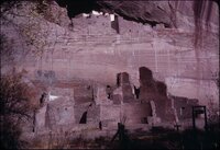 | Canyon de Chelly, January 1980 [13] | 1979-12; 1980-01 | Image/StillImage | uum_map_rr |
| 430 | 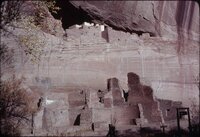 | Canyon de Chelly, January 1980 [14] | 1979-12; 1980-01 | Image/StillImage | uum_map_rr |
| 431 | 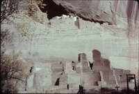 | Canyon de Chelly, January 1980 [15] | 1979-12; 1980-01 | Image/StillImage | uum_map_rr |
| 432 | 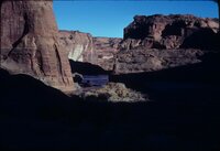 | Canyon de Chelly, January 1980 [16] | 1979-12; 1980-01 | Image/StillImage | uum_map_rr |
| 433 |  | Canyon de Chelly, near "Peach Orchard" (Moencopie shale), 1909 (M. R. Campbell, photo, U.S.G.S.) | 1909 | Image | uum_map |
| 434 | 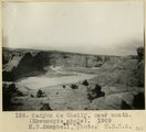 | Canyon de Chelly, near mouth (Moencopie shale), 1909 (M. R. Campbell, photo, U.S.G.S.) | 1909 | Image | uum_map |
| 435 |  | Canyon de Chelly, north wall midway between Canyon del Muerto and Monument Canyon. Moencopie strata, 1909 (W. C. Mendenhall, photo, U.S.G.S.) | 1909 | Image | uum_map |
| 436 | 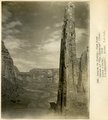 | Canyon de Chelly, view down stream at "The Captains" (Moencopie strata), 1909 (W. C. Mendenhall, photo, U.S.G.S.) | 1909 | Image | uum_map |
| 437 | 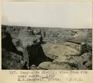 | Canyon de Chelly, view from rim near mouth, 1909 (M. R. Campbell, photo, U.S.G.S.) | 1909 | Image | uum_map |
| 438 |  | Canyon de Chelly. Cross-bedding (III-9 just like this) (Photo G374) | 1913 | Image | uum_map |
| 439 | 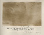 | Canyon de Chelly. Cross-bedding (III-9 just like this) (Photo G374) | 1913 | Image | uum_map |
| 440 | 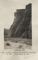 | Canyon de Chelly. Portion of wall, Shinarump on top (Photo G375) | 1913 | Image | uum_map |
| 441 | 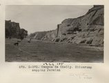 | Canyon de Chelly. Shinarump capping Permian (Photo G373) | 1913 | Image | uum_map |
| 442 | 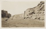 | Canyon de Chelly. Shinarump capping Permian (Photo G373) | 1913 | Image | uum_map |
| 443 |  | Canyon de Chelly. VII, 26 (Photo N-M131) | 1911 | Image | uum_map |
| 444 |  | Canyon de Chelly. Wall and sand dune (Photo G376) | 1913 | Image | uum_map |
| 445 |  | Canyon del Muerto, 2± mi. above mouth (Moencopie strata), 1909 (W. C. Mendenhall, photo, U.S.G.S.) | 1909 | Image | uum_map |
| 446 |  | Canyon from Grand View, Grand Canyon National Park, Arizona | 1930; 1931; 1932; 1933; 1934; 1935; 1936; 1937; 1938; 1939; 1940; 1941; 1942; 1943; 1944; 1945 | Image | uum_map |
| 447 |  | Canyon of the Little Colorado below Cameron. | 1941 | Image | uum_map |
| 448 | 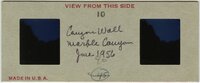 | Canyon wall, Marble Canyon, June 1956 | 1956-06 | Image/StillImage | uum_map_rr |
| 449 |  | Capt. Dave Neumena, chief of Paiutes | 1892 | Image/StillImage | uaida_main |
| 450 |  | Carriso Mt., Ariz., W. B. Emory photo, 1909 | 1909 | Image | uum_map |
| 451 |  | Carrizo Mt. Chinlee-Navaho (Wingate) contact in Cottonwood Dome. Chinee below hammer, Wingate above. Beds dip 11 °, N 15° E | 1913 | Image | uum_map |
| 452 |  | Carrizo Mt. looking 50° W at south side of Tse-lagai canyon. Wingate member of Navaho sandstone, conformably overlying Chinlee shale. Dip 15 degrees W | 1913 | Image | uum_map |
| 453 |  | Carrizo Mt. looking due west at amphitheater-like gulch on east side of Carrizo Mt. and south of Chejin-Dezah Canyon | 1913 | Image | uum_map |
| 454 |  | Carrizo Mt. looking S 30° E at west end of Chejin-Dezah Mesa. Shows cirque-like basins in monsonite cliff | 1913 | Image | uum_map |
| 455 | 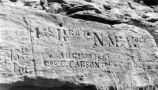 | Carson, Christopher--Inscription P.1 | | Image | dha_cp |
| 456 | 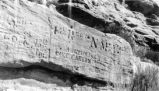 | Carson, Christopher--Inscription P.2 | | Image | dha_cp |
| 457 |  | Carson, Christopher--Inscription P.3 | | Image | dha_cp |
| 458 |  | Cathedral Rock on the road to Lees Ferry, Arizona, 1960 | 1960 | Image | uum_map |
| 459 |  | Cathedral Rock on the road to Lees Ferry, Arizona, before Grand Canyon boating trip | 1960 | Image | uum_map |
| 460 |  | Catholic Churches p.4 | 1930; 1931; 1932; 1933; 1934; 1935; 1936; 1937; 1938; 1939 | Image | dha_cp |
| 461 |  | Cause of Hance Rapid, Granite vein, June 1956 | 1956-06 | Image/StillImage | uum_map_rr |
| 462 |  | Cedar Ridge. Cap of Shinarump conglomerate and upper Moenkopi extending south from Vermillion Cliffs onto Uinkaret Plateau west of Pipe Wash, Mohave County, AZ. 1939 | 1939 | Image | uum_map |
| 463 |  | Cedar waxwings (100314) | 2010-03-14 | Sound | uu_wss |
| 464 |  | Central Pacific RR - Locomotives P.13 | 1895 | Image/StillImage | dha_cp |
| 465 |  | Central Pacific RR - Locomotives P.14 | 1894; 1895 | Image/StillImage | dha_cp |
| 466 |  | Central point, Mt. Trumbull | 1900 | Image | uum_map |
| 467 |  | Cha-ez Kla. (No. 4). Volcanic neck or dike, 2+ mi, south of Agathla Needle, Ariz., 1910 (Photo G147) | 1910 | Image | uum_map |
| 468 |  | The Changing Navajo Reservation | 1882; 1868; 1880; 1882; 1884; 1892; 1900; 1901; 1905; 1914; 1915; 1918; 1930; 1931; 1933; 1934 | Text | uaida_main |
| 469 |  | Charles Russell boat, Grand Canyon, June 1971 | 1971 | Image/StillImage | uum_map_rr |
| 470 |  | Chief Harry Supela (naked) about to enter snake kiva at Walpi, morning of snake dance. Great altar is partly seen through the covered passage way | 1915 | Image | uum_map |
| 471 | 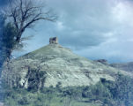 | Chimney Butte | 1945; 1946; 1947; 1948; 1949; 1950 | Image/StillImage | dha_alwmc |
| 472 | 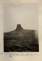 | Chimney Butte, volcanic neck, 25± mi. north of Winslow, AZ. 1911 (Photo G240) | 1911 | Image | uum_map |
| 473 |  | Chimney Rock on Tees-Nos-Pos trail | 1913 | Image | uum_map |
| 474 |  | Chinle "marls," Sand Wash, Mohave County, Arizona, 1936. | 1936 | Image | uum_map |
| 475 |  | Chinle "marls," Sand Wash, Mohave County, Arizona, 1936. | 1936 | Image | uum_map |
| 476 |  | Chinle "marls," Sand Wash, Mohave County, Arizona, 1936. | 1936 | Image | uum_map |
| 477 |  | Chinle "marls," Sand Wash, Mohave County, Arizona, 1936. | 1936 | Image | uum_map |
| 478 |  | Chinle "marls," Sand Wash, Mohave County, Arizona, 1936. | 1936 | Image | uum_map |
| 479 | 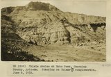 | Chinle shales at Echo Peak, Coconino County, Arizona. Standing on Shinarump conglomerate. June 6, 1915. | 1915 | Image | uum_map |
| 480 |  | Chinle Wash | 1925; 1926; 1927; 1928; 1929; 1930; 1931; 1932; 1933; 1934; 1935; 1936; 1937; 1938; 1939; 1940; 1941; 1942; 1943; 1944; 1945; 1946; 1947; 1948; 1949 | Image | uum_map_rr |
| 481 |  | Chinle Wash ruins | 1935; 1936; 1937; 1938; 1939; 1940; 1941; 1942; 1943; 1944; 1945; 1946; 1947; 1948; 1949 | Image/StillImage | uum_map_rr |
| 482 | 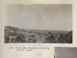 | Chinlee vicinity W.B.E. photo (Photo N-M152) | 1913 | Image | uum_map |
| 483 |  | Chiricahua Leopard Frog calling in captivity | 2008-06-02 | Sound | uu_wss |
| 484 |  | Chiricahua Leopard Frogs (020525) 1 | 2002-05-25 | Sound | uu_wss |
| 485 | | Chiricahua Leopard Frogs (020525) 2 | 2002-05-25 | Sound | uu_wss |
| 486 | | Chiricahua Leopard Frogs (020525) 3 | 2002-05-25 | Sound | uu_wss |
| 487 | | Chiricahua leopard frogs (100423) | 2010-04-23 | Sound | uu_wss |
| 488 |  | Christian L. Christensen articles | 1922 | Text | uum_msa |
| 489 |  | Christian L. Christensen diary and articles | 1922; 1923; 1924; 1925; 1926; 1927; 1928; 1929; 1930; 1931; 1932; 1933; 1934; 1935 | Text | uum_msa |
| 490 |  | Chu-aŕ-ru-um-peak, and his friends | 1874 | Image/StillImage | uaida_main |
| 491 |  | Chuar Butte below Little Colorado River, campsite | 1970-08 | Image/StillImage | uum_map_rr |
| 492 |  | Chuar Butte below Little Colorado River, campsite | 1970-08 | Image | uum_map_rr |
| 493 | 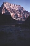 | Chuar Butte below Little Colorado River, campsite | 1970-08 | Image | uum_map_rr |
| 494 |  | Chuar Butte below Little Colorado River, campsite | 1970-08 | Image | uum_map_rr |
| 495 |  | Church of Jesus Christ of Latter-day Saints Journal History entry December 30, 1849 | 1849-12-30 | Text | uaida_main |
| 496 | 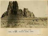 | Church Rock, 1914 | 1914 | Image | uum_map |
| 497 | 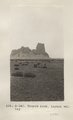 | Church Rock, Laguna valley (Photo G340) | 1913 | Image | uum_map |
| 498 | 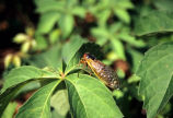 | Cicada (070517-52) | 2007-05-17 | Sound | uu_wss |
| 499 | 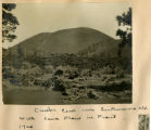 | Cinder cone near San Francisco Mtn, with lava flows in front, 1900 | 1900 | Image | uum_map |
| 500 |  | Cinder cones above Lava Falls, Grand Canyon - aerial view | 1950; 1951; 1952; 1953; 1954; 1955; 1956; 1957; 1958; 1959; 1960; 1961; 1962; 1963; 1964; 1965; 1966; 1967; 1968; 1969; 1970; 1971; 1972; 1973; 1974; 1975; 1976; 1977; 1978; 1979; 1980 | Image | uum_map_rr |