| | Title | Date | Type | Setname |
|---|
| 301 | 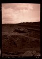 | Blue Canyon, Ariz. (negative for G-5) | 1909 | Image | uum_map |
| 302 |  | Blue Canyon, Ft. Defiance, Ariz. (negative for G-4) | 1909 | Image | uum_map |
| 303 | 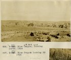 | Blue Canyon, looking north, 1914 | 1914 | Image | uum_map |
| 304 | 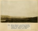 | Blue Canyon, looking toward Black Mesa. McElmo sandstone capped by Mancos in middle distance, 1914 | 1914 | Image | uum_map |
| 305 |  | Blue sky again | 1971-08 | Image | uum_map_rr |
| 306 |  | Boat display, Grand Canyon visitors center, Spring 1962 | 1962 | Image/StillImage | uum_map_rr |
| 307 |  | Boat on Shore | 1940; 1941; 1942; 1943; 1944; 1945; 1946; 1947; 1948; 1949; 1950 | Image/StillImage | dha_alwmc |
| 308 |  | Boat running a rapid in Grand Canyon, 1963 | 1963 | Image/StillImage | uum_map_rr |
| 309 | 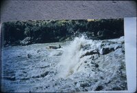 | Boat running a rapid in Grand Canyon, 1963 | 1963 | Image/StillImage | uum_map_rr |
| 310 | 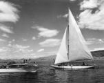 | Boating--Lake Mead P.1 | | Image | dha_cp |
| 311 |  | Boats in rapids in Cataract Canyon. | 1970-04; 1970-05 | Image | uum_map_rr |
| 312 |  | Boiler brought to Lee's Ferry circa 1900 by Charles H. Spencer | 1985-11 | | uum_map_rr |
| 313 |  | Boiler from steam boat Charles H. Spencer, just downstream from old Ferry site, Lee's Ferry | 1985-11 | | uum_map_rr |
| 314 |  | Bottom of Glen Canyon group. Color banded cross-bed sandstone in positions of Wingate, Rosencrans Wash, Mohave County, Arizona, 1936. | 1936 | Image | uum_map |
| 315 |  | Boulder Dam. | 1956 | Image | uum_map |
| 316 |  | Branch of Navajo Canyon, Ariz., 1910 (Photo G184) | 1910 | Image | uum_map |
| 317 |  | Branch of Navajo Canyon, Ariz., 1910 (Photo G184) | 1910 | Image | uum_map |
| 318 | 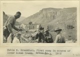 | Breakfast. First camp in canyon of lower Kanab Creek, AZ. 1922 | 1922 | Image | uum_map |
| 319 |  | Brewery Gulch, early Bisbee, Arizona | 1900; 1901; 1902; 1903; 1904; 1905; 1906; 1907; 1908; 1909; 1910; 1911; 1912; 1913; 1914; 1915; 1916; 1917; 1918; 1919; 1920; 1921; 1922; 1923; 1924; 1925; 1926; 1927; 1928; 1929; 1930; 1931; 1932; 1933; 1934; 1935; 1936; 1937; 1938; 1939; 1940 | Image | uum_map |
| 320 |  | Bridal couple, Lower Oraibi Wash. 1909 | 1909 | Image | uum_map |
| 321 | 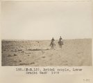 | Bridal couple, Lower Oraibi Wash. 1909 | 1909 | Image | uum_map |
| 322 |  | Bridge built by C.C.C. across recently eroded wash, near Pipe Springs. Mohave County, AZ. 1939 | 1939 | Image | uum_map |
| 323 |  | Bridge over Colorado, mouth of Bright Angel looking south up Zig-zag trail... 1928 | 1926 | Image | uum_map |
| 324 |  | Bridge, Little Colorado | 1913 | Image | uum_map |
| 325 |  | Bridge, Little Colorado (Photo N-M183) | 1913 | Image | uum_map |
| 326 |  | Brief sketch of the pioneer life of Lois A. Smith Bushman | 1937 | Text | uum_msa |
| 327 |  | Brigham Young letters to John R. Murdock, 1877, and Albert Carrington, 1876 | 1876; 1877 | Text | uum_msa |
| 328 |  | Brigham Young, Jr., letter to John W. Young, May 1886 | 1886-05-20 | Text | uum_msa |
| 329 |  | Bright Angel below Phantom Ranch, raining | 1965-06 | Image | uum_map_rr |
| 330 |  | Bright Angel Creek, Grand Canyon, Winter 1962 | 1962 | Image/StillImage | uum_map_rr |
| 331 |  | Bright Angel Creek, Nevills Expedition Grand Canyon river trip, 1942 | 1942 | Image | uum_map_rr |
| 332 |  | Bright Angel Point - Deluxe cabin | 1927-03 | Image/StillImage | uum_map |
| 333 |  | Bright Angel Point North Rim, Grand Canyon | 1930; 1931; 1932; 1933; 1934; 1935; 1936 | Image/StillImage | uum_map |
| 334 |  | Bright Angel Point, North Rim, Grand Canyon National Park, Arizona. Squirrel - Kaibab - Feeding." | 1933 | Image | uum_map |
| 335 |  | Bright Angel Trail, Grand Canyon | 1930; 1931; 1932; 1933; 1934; 1935; 1936; 1937; 1938; 1939; 1940; 1941; 1942; 1943; 1944; 1945; 1946; 1947; 1948; 1949; 1950; 1951; 1952; 1953; 1954; 1955; 1956; 1957; 1958; 1959; 1960 | Image | uum_map |
| 336 |  | Brittlebush | 1966-05 | Image | uum_map_rr |
| 337 |  | Brown Creeper (070516-469) | | Sound | uu_wss |
| 338 |  | Bruce Wilson with deer on South Rim of Grand Canyon, Nevills Expedition Grand Canyon river trip, 1942 | 1942 | Image | uum_map_rr |
| 339 | 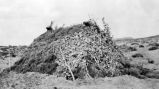 | Brush hogan | | Image/StillImage | uaida_main |
| 340 |  | Buck Farm Canyon | 1970-04; 1970-05 | Image | uum_map_rr |
| 341 |  | Buck Farm Canyon | 1969-04 | Image | uum_map_rr |
| 342 |  | Buck Farm Canyon: Euphorbia rossei [1] | 1970-04; 1970-05 | Image | uum_map_rr |
| 343 |  | Buck Farm Canyon: Euphorbia rossei [2] | 1970-04; 1970-05 | Image | uum_map_rr |
| 344 |  | Buck Farm Canyon: Euphorbia rossei [4] | 1970 | Image/StillImage | uum_map_rr |
| 345 |  | Buck Farm Canyon; Euphorbia rossei [3] | 1970-04; 1970-05 | Image | uum_map_rr |
| 346 | 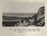 | Buell's Park from south rim. (I-20 in film book just like this) (Photo N-M141) | 1913 | Image | uum_map |
| 347 | 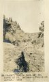 | Buells Park, 12± mi. north of Ft. Defiance, Ariz. Canyon at outlet, 1909 (photo G-26) | 1909 | Image | uum_map |
| 348 | 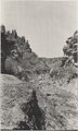 | Buells Park, 12± mi. north of Ft. Defiance, Ariz. Canyon at outlet, 1909 (photo G-26) | 1909 | Image | uum_map |
| 349 | 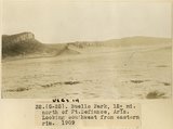 | Buells Park, 12± mi. north of Ft. Defiance, Ariz. Looking southwest from eastern rim, 1909 (photo G-25) | 1909 | Image | uum_map |
| 350 |  | Buells Park, 12± mi. north of Ft. Defiance, Ariz. Looking southwest from eastern rim, 1909 (photo G-25) | 1909 | Image | uum_map |
| 351 | 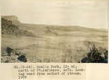 | Buells Park, 12± mi. north of Ft. Defiance, Ariz. Looking west from outlet of stream, 1909 (photo G-24) | 1909 | Image | uum_map |
| 352 | 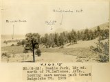 | Buells Park, 12± mi. north of Ft. Defiance, Ariz., looking east across park toward Baigaiche Mt., 1909 (photo G-23) | 1909 | Image | uum_map |
| 353 | 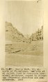 | Buells Park, 12± mi. north of Ft. Defiance. Dam site at outlet. Rock is Moencopie (Permian?) sandstone, capped by Shinarump (Triassic) sandstone and conglomerate, 1909 (photo G-27) | 1909 | Image | uum_map |
| 354 | 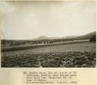 | Buells Park, 12± north of Ft. Defiance, looking east across park from west rim, Baigaiche Mt. in near distance, 1908 (D. B. Sterrett photo USGS) | 1908 | Image | uum_map |
| 355 |  | Buells Park, 12± north of Ft. Defiance, looking toward west rim. Hill of peridotite bearing gem peridots and garnets in center, 1908 (D. B. Sterrett photo USGS) | 1908 | Image | uum_map |
| 356 |  | Buells Park, N. Ft. Defiance (negative for photo G-24) | 1909 | Image | uum_map |
| 357 |  | Buells Park, N. Ft. Defiance (negative for photo G-27) | 1909 | Image | uum_map |
| 358 |  | Buells Park, north of Fort Defiance, D. B. Sterrett photo USGS, 1908 | 1908 | Image | uum_map |
| 359 |  | Buff-collared Nightjar 1 | 2009-05-21 | Sound | uu_wss |
| 360 |  | Bulletin of the Geological and Geographical Survey of The Territories, Volume II | 1876 | Text | uaida_main |
| 361 |  | Bunkerville, Arizona School | 1913-06-13 | Image | dha_scp |
| 362 |  | Burials P.5 | | Image | dha_cp |
| 363 |  | Burials p.5 | 1934 | Image | dha_cp |
| 364 |  | Burro, Ganado, Ariz. 1909 | 1909 | Image | uum_map |
| 365 |  | Butte, 3± mi. west of Stiles Ranche (Photo G238) | 1911 | Image | uum_map |
| 366 |  | Butte, 3± mi. west of Stiles Ranche (Photo G238) | 1911 | Image | uum_map |
| 367 |  | Butte, junction Sagy canyon with middle of East Branch, Ariz., 1910 (Photo G162) | 1910 | Image | uum_map |
| 368 |  | Butte, LaPlata on Dolores, 12+ mi. south of Oljato, Utah. Agathla Needle and QueenRock in distance, 1910 (Photo G159) | 1910 | Image | uum_map |
| 369 |  | Butte, LaPlata on Dolores, 12+ mi. south of Oljato, Utah. Agathla Needle in distance, 1910 (Photo N-M91A) | 1910 | Image | uum_map |
| 370 |  | Butte, LaPlata on Dolores, 12± mi. south of Oljato, Utah. Agathla Needle in distance, 1910 | 1910 | Image | uum_map |
| 371 |  | Butterfly Dance | 1938 | Image | dc_bpc |
| 372 |  | Cabin in the desert of Arizona [Z-7452] | 1910; 1911; 1912; 1913; 1914; 1915; 1916; 1917 | Image/StillImage | uaida_main |
| 373 |  | Cacti P.2 | 1941-03-19 | Image | dha_cp |
| 374 |  | Cacti P.3 | 1941-03-19 | Image | dha_cp |
| 375 |  | Cactus garden, Tapeats [creek] | 1971-08-22 | Image | uum_map_rr |
| 376 |  | Cactus typical, Moki Reservation 1900 | 1900 | Image | uum_map |
| 377 |  | Call of the canyons--A vacationist's-eye view of Bryce, Zion and the Grand Canyon | 1947; 1948 | Image/MovingImage | dha_alwmc |
| 378 |  | Calvin, Dock, & Jimmy | 1965-06 | Image | uum_map_rr |
| 379 |  | Cambridge Ditch men | 1880; 1881; 1882; 1883; 1884; 1885; 1886; 1887; 1888; 1889; 1890; 1891; 1892; 1893; 1894; 1895; 1896; 1897; 1899; 1900; 1901; 1902; 1903; 1904; 1905; 1906; 1907; 1908; 1909; 1910 | Image/StillImage | uaida_main |
| 380 |  | Cameron bridge | 1925; 1926; 1927; 1928; 1929; 1930; 1931; 1932; 1933; 1934; 1935; 1936; 1937; 1938; 1939; 1940; 1941; 1942; 1943; 1944; 1945; 1946; 1947; 1948; 1949 | Image | uum_map_rr |
| 381 |  | Cameron trading post, Arizona, March 1962 | 1962 | Image/StillImage | uum_map_rr |
| 382 |  | Cameron, Arizona, Winter 1962 | 1962 | Image/StillImage | uum_map_rr |
| 383 |  | Camp & landslides, Vermillion Cliffs 1900 | 1900 | Image | uum_map |
| 384 |  | Camp 6 mi. below Phantom Ranch, 94 mile creek, June 15-16, 1965 | 1965-06-15; 1965-06-16 | Image | uum_map_rr |
| 385 |  | Camp at head of To-chin-Sin Canyon | 1913 | Image | uum_map |
| 386 |  | Camp at Reservoir 2 miles south of Fredonia. Dr. and Mrs. Noble and three packers. Coconino County, AZ. 1922 | 1922 | Image | uum_map |
| 387 |  | Camp by Sonsala Buttes near Whiskey Creek. Heald, photo. 1911 (Photo N-M129) | 1911 | Image | uum_map |
| 388 |  | Camp in cave by spring, 8+ mi. southeast of Agathla Needle, 1910 (Photo N-M104) | 1910 | Image | uum_map |
| 389 |  | Camp in Pueblo Colorado Wash. Case digging for water (Photo N-M167) | 1913 | Image | uum_map |
| 390 |  | Camp on 'Lost Trail' between Jump Up Canyon and Ryan, AZ. Dr. and Mrs. Noble. Coconino County, AZ. 1922 | 1922 | Image | uum_map |
| 391 |  | Camp Verde, photo of Major Smiley | 1929 | Image | dc_bpc |
| 392 | 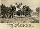 | Camp, Indian allotting agent, Lucasaca Spgs. Typical vegetation of Moqui Butte region, 1909 (photo G-59) | 1909 | Image | uum_map |
| 393 | 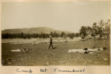 | Camp, Mt. Trumbull | 1900 | Image | uum_map |
| 394 | 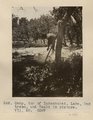 | Camp, top of Kukachukai. Lake, Oak trees, and Heald in picture. VII, 50 (Photo G287) | 1911 | Image | uum_map |
| 395 |  | Campsite, Nevills Expedition Grand Canyon river trip, 1942 | 1942 | Image | uum_map_rr |
| 396 | 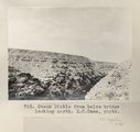 | Canon Diablo from below bridge looking north. E.C.Case, photo | 1913 | Image | uum_map |
| 397 | 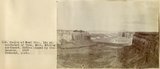 | Canyon at Coal Mine, 15± mil southeast of Tuba, Ariz., looking northeast. McElmo capped by Cretaceous, 1909 (Townsend photo) | 1909 | Image | uum_map |
| 398 | 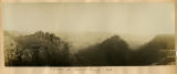 | Canyon at Hance's Trail, 1900 | 1900 | Image | uum_map |
| 399 |  | Canyon at Tuba coal mine; McElmo capped by Cretaceous (Stephen Janus photo, 1909) | 1909 | Image | uum_map |
| 400 |  | Canyon at Tuba coal mine; McElmo capped by Cretaceous (Stephen Janus photo, 1909) | 1909 | Image | uum_map |