| | Title | Date | Type | Setname |
|---|
| 201 |  | B. P. road in Bonita Canyon | 1940; 1941; 1942; 1943; 1944; 1945; 1946; 1947; 1948; 1949; 1950; 1951; 1952; 1953; 1954; 1955; 1956; 1957; 1958; 1959; 1960 | Image | uum_map |
| 202 |  | Back of Roosevelt Dam | 1932-05 | Image | uum_map_rr |
| 203 |  | Backpacker on Grand Canyon trail | 1961; 1962; 1963; 1964; 1965 | Image/StillImage | uum_map_rr |
| 204 |  | Bad Lands (Dolores) near Chinlee. VII, 26 (Photo G271) | 1911 | Image | uum_map |
| 205 |  | Bad lands, Chinle strata in Hopi Buttes region, north east of Holbrook, Ariz. USGS, probably Darton | 1911 | Image | uum_map |
| 206 |  | Bad Lands, Cottonwood Wash. 1909 | 1911 | Image | uum_map |
| 207 |  | Bad Lands, Cottonwood Wash. 1909 (photograph from Herbert E. Gregory Book 5: Navajo, 1911) | 1911 | Image | uum_map |
| 208 |  | Bad Lands, Dolores. Lower Pueblo Colorado Wash. Section VI, 79-80. 1911 (Photo G226) | 1911 | Image | uum_map |
| 209 |  | Bad Lands. Dolores. Butte No. 24. VI, 76 (Photo G227) | 1911 | Image | uum_map |
| 210 | 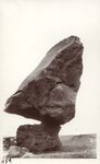 | Balanced boulder, near Navajo Bridge | 1932-05-19 | Image/StillImage | uum_map |
| 211 |  | Balanced Rock near Lee's Ferry, 1962 | 1962 | Image/StillImage | uum_map_rr |
| 212 | 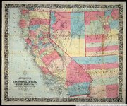 | Bancroft's map of California, Nevada, Utah and Arizona | 1864 | Image | uu_awm |
| 213 |  | Banded Navajo sandstone near place where Wingate and Kayenta first lose their identity. Chinle immediately below. Two miles northwest of Pipe Springs, Mohave County, Arizona, 1936. | 1936 | Image | uum_map |
| 214 | 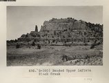 | Banded Upper LaPlata Black Creek (Photo G390) | 1913 | Image | uum_map |
| 215 |  | Barking Frog 1 | | Sound | uu_wss |
| 216 |  | Barrett, Gregory | 1900 | Image | uum_map |
| 217 | 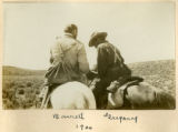 | Barrett, Gregory, 1900 | 1900 | Image | uum_map |
| 218 |  | Barth, Solomon, biographical sketches: Barth resolution | 1928-12-22 | Text | uum_msa |
| 219 | 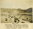 | Basalt cap on Dolores (Triassic) on Holbrook-Keams Canyon road, 9± mi. south of Biddehoche, Arizona, 1909 (photo G-69) | 1909 | Image | uum_map |
| 220 |  | Basalt, Cedar Springs, AZ. 35± mi. north of Winslow. 1911 (Photo G242) | 1911 | Image | uum_map |
| 221 |  | Basalt-capped mesa on Dolores (Triassic), 6± miles south of Beddehoche (Indian Wells), Ariz., 1909 (photo G-67) | 1909 | Image | uum_map |
| 222 |  | Basalt-capped mesa on Dolores (Triassic), 6± miles south of Beddehoche (Indian Wells), Ariz., 1909 (photo G-67) | 1909 | Image | uum_map |
| 223 |  | Basalt-capped mesa on Dolores (Triassic), 8± miles south of Beddehoche, Ariz., 1909 (photo G-68) | 1909 | Image | uum_map |
| 224 |  | Basalt-capped mesa on Dolores (Triassic), 8± miles south of Beddehoche, Ariz., 1909 (photo G-68) | 1909 | Image | uum_map |
| 225 |  | Basalt-capped mesa with dike on Dolores (Triassic), 8± miles south-southwest of Beddehoche (Indian Wells), Ariz., 1909 (photo G-66) | 1909 | Image | uum_map |
| 226 |  | Basalt-capped mesa, Biddehoche, Ariz. (negative for photo G-68) | 1909 | Image | uum_map |
| 227 |  | Basis of American history, 1500-1900, by Livingston Farrand | | Image/StillImage | uaida_main |
| 228 |  | The basket maker | 1905-02-16 | Image/StillImage | uaida_main |
| 229 |  | The Battleship | 1920; 1921; 1922; 1923; 1924; 1925; 1926; 1927; 1928; 1929 | Image/StillImage | uum_map |
| 230 |  | Battleship Rock - W of Fredonia Arizona | 1907; 1908; 1909; 1910; 1911; 1912; 1913; 1914; 1915; 1916; 1917; 1918; 1919; 1920; 1921; 1922; 1923; 1924; 1925; 1926; 1927; 1928; 1929; 1930; 1931; 1932; 1933; 1934; 1935 | Image/StillImage | uum_map |
| 231 |  | Battleship, Grand Canyon National Park, Arizona | 1930; 1931; 1932; 1933; 1934; 1935; 1936; 1937; 1938; 1939; 1940; 1941; 1942; 1943; 1944; 1945 | Image | uum_map |
| 232 |  | Beautiful Valley, Arizona (Negative for photo G-30) | 1909 | Image | uum_map |
| 233 |  | Beautiful Valley, fossil forest (Negative for photo G-29) | 1909 | Image | uum_map |
| 234 |  | Beautiful Valley, fossil forest (Negative for photo G-31) | 1909 | Image | uum_map |
| 235 |  | Beautiful Valley." Fossil forest (Dolores strata), 12± mi. north of Ganado, Ariz. Pebbles in foreground are chips of petrified wood, 1909 (photo G-32) | 1909 | Image | uum_map |
| 236 |  | Beautiful Valley." Fossil forest (Dolores strata), 12± mi. north of Ganado, Ariz. All pebbles in foreground are petrified wood, 1909 (photo G-28) | 1909 | Image | uum_map |
| 237 |  | Beautiful Valley." Fossil forest, Dolores strata, petrified log, 1909 (photo G-29) | 1909 | Image | uum_map |
| 238 |  | Beautiful Valley." Fossil forest, Dolores strata, petrified log, 1909 (photo G-30) | 1909 | Image | uum_map |
| 239 |  | Bed (4), section of Dolores and LaPlata, west of Chinlee. VII, 28 (Photo G278) | 1911 | Image | uum_map |
| 240 |  | Bed (9), section of Dolores and LaPlata west of Chinlee. VII, 28 (Photo G277) | 1911 | Image | uum_map |
| 241 |  | Bed of Little Colorado at crest of Grand Falls (Photo G420) | 1913 | Image | uum_map |
| 242 |  | Bed of Little Colorado, Black Falls (negative for photo G-92) | 1909 | Image | uum_map |
| 243 |  | Bed of Little Colorado, Black Falls, June 1909 (photo G-92) | 1909 | Image | uum_map |
| 244 |  | Bed of Little Colorado, Leupp, Ariz. (negative for photo G-90) | 1909 | Image | uum_map |
| 245 |  | Bed of Little Colorado, Leupp, Arizona (negative for photo G-89) | 1909 | Image | uum_map |
| 246 |  | Bed of Little Colorado, Leupp, Arizona, June 1909 (photo G-89) | 1909 | Image | uum_map |
| 247 |  | Bed of Little Colorado, Leupp, Arizona, May 1909 (photo G-90) | 1909 | Image | uum_map |
| 248 |  | Bedded ash and mud shales near Twin buttes. Barrows, photo 1911 (Photo G253) | 1911 | Image | uum_map |
| 249 |  | Bedded ash, 2± mi. south of Cedar Springs. VI, 73 (2) (Photo G232) | 1911 | Image | uum_map |
| 250 |  | Beecher, Seymour on Copper Mine Trail, Giant Mescals | 1900 | Image | uum_map |
| 251 |  | Beginning cloudburst | 1971-08 | Image | uum_map_rr |
| 252 | 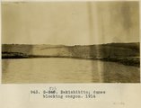 | Bekishibito: dunes blocking canyon, 1914 | 1914 | Image | uum_map |
| 253 | 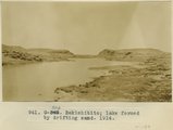 | Bekishibito: lake formed by drifting sand, 1914 | 1914 | Image | uum_map |
| 254 |  | Below Lava Falls | 1965-06 | Image | uum_map_rr |
| 255 |  | Below Lava Falls | 1965-06 | Image | uum_map_rr |
| 256 |  | Below Lava Falls | 1965-06 | Image | uum_map_rr |
| 257 |  | Below Lava Falls | 1965-06 | Image | uum_map_rr |
| 258 |  | Below Little Colorado | 1970-04; 1970-05 | Image | uum_map_rr |
| 259 |  | Below Little Colorado | 1970-04; 1970-05 | Image | uum_map_rr |
| 260 |  | Below Phantom [ranch] and above Bass | 1971-05-09 | Image | uum_map_rr |
| 261 |  | Below Phantom Ranch after rain | 1965-06 | Image | uum_map_rr |
| 262 |  | Ben Johnson with three of his seven wives in front of their home in Mesa, Arizona. | 1885 | Image/StillImage | uum_map |
| 263 |  | Bernheimer Bridge | 1925; 1926; 1927; 1928; 1929; 1930; 1931; 1932; 1933; 1934; 1935; 1936; 1937; 1938; 1939; 1940; 1941; 1942; 1943; 1944; 1945; 1946; 1947; 1948; 1949 | Image | uum_map_rr |
| 264 |  | Bernheimer Bridge | 1925; 1926; 1927; 1928; 1929; 1930; 1931; 1932; 1933; 1934; 1935; 1936; 1937; 1938; 1939; 1940; 1941; 1942; 1943; 1944; 1945; 1946; 1947; 1948; 1949 | Image | uum_map_rr |
| 265 |  | Bernheimer Bridge | 1925; 1926; 1927; 1928; 1929; 1930; 1931; 1932; 1933; 1934; 1935; 1936; 1937; 1938; 1939; 1940; 1941; 1942; 1943; 1944; 1945; 1946; 1947; 1948; 1949 | Image | uum_map_rr |
| 266 |  | Bert Loper | 1940; 1941; 1942; 1943; 1944; 1945; 1946; 1947; 1948; 1949; 1950 | Image/StillImage | dha_alwmc |
| 267 |  | Bert Loper and others | 1940; 1941; 1942; 1943; 1944; 1945; 1946; 1947; 1948; 1949; 1950 | Image/StillImage | dha_alwmc |
| 268 |  | Bert Loper's Boat | 1940; 1941; 1942; 1943; 1944; 1945; 1946; 1947; 1948; 1949; 1950 | Image/StillImage | dha_alwmc |
| 269 |  | Beryl on Snowball, at V.K. ranch, April 1936 | 1936-04 | Image | uum_map |
| 270 |  | Betatakin cliff ruins, west branch of Sagy canon, Ariz., (Townsend photo, 1909) | 1909 | Image | uum_map |
| 271 |  | Betatakin Ruin P.1 | | Image | dha_cp |
| 272 |  | Betatakin Ruin, Sagy Canyon (Townsend photo) | 1910 | Image | uum_map |
| 273 | 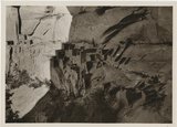 | Betatakin, Navajo National Monument | 1935; 1936; 1937; 1938; 1939; 1940; 1941; 1942; 1943; 1944; 1945; 1946; 1947; 1948; 1949 | Image/StillImage | uum_map_rr |
| 274 | 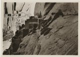 | Betatakin, Navajo National Monument | 1935; 1936; 1937; 1938; 1939; 1940; 1941; 1942; 1943; 1944; 1945; 1946; 1947; 1948; 1949 | Image/StillImage | uum_map_rr |
| 275 |  | Between Phantom [ranch] and Bass | 1971-05-09 | Image | uum_map_rr |
| 276 |  | Beveling and conglomerate cap of lower peneplain, north side Blue Canon, opposite old store. | 1913 | Image | uum_map |
| 277 |  | Beveling below Black Falls, looking north. | 1913 | Image | uum_map |
| 278 |  | Beveling of McElmo and conglomerate cap. Edge of Blue Canon, 1 1/2 mile north of old Blue Canon store. | 1913 | Image | uum_map |
| 279 | 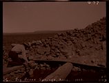 | Big Burro Springs, Arizona, 1909 (negative for photo G-77) | 1909 | Image | uum_map |
| 280 | 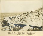 | Big Burro Springs, Arizona, 1909 (photo G-77) | 1909 | Image | uum_map |
| 281 |  | Billy Diet at Powdergun, Flagstaff's Bowl. | 1984; 1985 | | uum_map_usa |
| 282 |  | Billy Diet snowboarding at Powdergun. | 1983; 1984 | | uum_map_usa |
| 283 |  | Biography of Joseph Smith Tanner | 1966; 1967; 1968; 1969; 1970; 1971; 1972 | Text | uum_msa |
| 284 |  | Biography of Sarah Ellen Marsden Smith, better known as Nellie Marsden Smith, 1860 - 1924 | 1978 | Text | uum_msa |
| 285 |  | Bit of Grand Canyon cornice work | 1920; 1921; 1922; 1923; 1924; 1925; 1926; 1927; 1928; 1929; 1930; 1931; 1932; 1933; 1934; 1935; 1936; 1937; 1938; 1939; 1940; 1941; 1942; 1943; 1944; 1945; 1946; 1947; 1948; 1949; 1950 | Image | uum_map |
| 286 |  | Black Canyon rafting, 1982 [01] | 1982 | Image/StillImage | uum_map_rr |
| 287 |  | Black Canyon rafting, 1982 [02] | 1982 | Image/StillImage | uum_map_rr |
| 288 |  | Black Canyon rafting, 1982 [03] | 1982 | Image/StillImage | uum_map_rr |
| 289 |  | Black Canyon rafting, 1982 [04] | 1982 | Image/StillImage | uum_map_rr |
| 290 |  | Black Canyon rafting, 1982 [05] | 1982 | Image/StillImage | uum_map_rr |
| 291 |  | Black Creek Valley, Arizona (negative for photo G-11) | 1909 | Image | uum_map |
| 292 |  | Black Creek valley, east toward Baigaiche Mt. VI, 45, 55 (Photo G299) | 1911 | Image | uum_map |
| 293 | 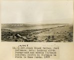 | Black Creek Valley, Fort Defiance, Ariz. Looking north. Foreground and middle distance Dolores; cliffs in distance La Plata to Mesa Verde, 1909 (photo G-13) | 1909 | Image | uum_map |
| 294 |  | Black Creek Valley, Fort Defiance, Ariz. Looking north. Foreground and middle distance Dolores; cliffs in distance La Plata to Mesa Verde, 1909 (photo G-13) | 1909 | Image | uum_map |
| 295 | 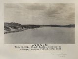 | Black Falls, looking up stream; canyon filled with sand (Photo G426) | 1913 | Image | uum_map |
| 296 | 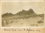 | Black Rock near Ft. Defiance, 1909 | 1909 | Image | uum_map |
| 297 | 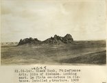 | Black Rock, Ft. Defiance, Ariz. Dike of diabase. Looking east. La Plata sandstone in distance. Detailed structure, 1909 (photo G-14) | 1909 | Image | uum_map |
| 298 |  | Black-tailed Rattlesnake | 2009-08-14 | Sound | uu_wss |
| 299 | 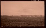 | Block mesas from south, panorama. | 1937 | Image | uum_map |
| 300 |  | Block mesas from the south, panorama. | 1937 | Image | uum_map |