Home
Browse
Ask Us
Chat
Harmful Language Statement
Log in
Advanced Search
Year
1849
1850
1851
1852
1853
1854
1855
1856
1857
1858
1859
1860
1861
1862
1863
1864
1865
1866
1867
1868
1869
1870
1871
1872
1873
1874
1875
1876
1877
1878
1879
1880
1881
1882
1883
1884
1885
1886
1887
1888
1889
1890
1891
1892
1893
1894
1895
1896
1897
1898
1899
1900
1901
1902
1903
1904
1905
1906
1907
1908
1909
1910
1911
1912
1913
1914
1915
1916
1917
1918
1919
1920
1921
1922
1923
1924
1925
1926
1927
1928
1929
1930
1931
1932
1933
1934
1935
1936
1937
1938
1939
1940
1941
1942
1943
1944
1945
1946
1947
1948
1949
1950
1951
1952
1953
1954
1955
1956
1957
1958
1959
1960
1961
1962
1963
1964
1965
1966
1967
1968
1969
1970
1971
1972
1973
1974
1975
1976
1977
1978
1979
1980
1981
1982
1983
1984
1985
1986
1987
1988
1989
1990
1991
1992
1993
1994
1995
1996
1997
1998
1999
2000
2001
2002
2003
2004
2005
2006
2007
2008
2009
2010
2011
2012
2013
2014
2015
2016
2017
2018
2019
2020
2021
2022
2023
TO
1849
1850
1851
1852
1853
1854
1855
1856
1857
1858
1859
1860
1861
1862
1863
1864
1865
1866
1867
1868
1869
1870
1871
1872
1873
1874
1875
1876
1877
1878
1879
1880
1881
1882
1883
1884
1885
1886
1887
1888
1889
1890
1891
1892
1893
1894
1895
1896
1897
1898
1899
1900
1901
1902
1903
1904
1905
1906
1907
1908
1909
1910
1911
1912
1913
1914
1915
1916
1917
1918
1919
1920
1921
1922
1923
1924
1925
1926
1927
1928
1929
1930
1931
1932
1933
1934
1935
1936
1937
1938
1939
1940
1941
1942
1943
1944
1945
1946
1947
1948
1949
1950
1951
1952
1953
1954
1955
1956
1957
1958
1959
1960
1961
1962
1963
1964
1965
1966
1967
1968
1969
1970
1971
1972
1973
1974
1975
1976
1977
1978
1979
1980
1981
1982
1983
1984
1985
1986
1987
1988
1989
1990
1991
1992
1993
1994
1995
1996
1997
1998
1999
2000
2001
2002
2003
2004
2005
2006
2007
2008
2009
2010
2011
2012
2013
2014
2015
2016
2017
2018
2019
2020
2021
2022
2023
Type
Image
2,258
Image/StillImage
1,644
Text
189
Image/MovingImage
3
Sound
2
Format
image/jpeg
3,577
application/pdf
477
video/mp4
3
audio/mpeg
2
Institution
University of Utah Marriott Library
3,694
Department of Cultural and Community ...
302
Utah American Indian Digital Archive
111
Utah Museum of Natural History
7
University of Utah Partnerships
5
Delta City Library
2
Uintah County Library
2
More
Collection
Al W. Morton Collection, 1930s-1950s
55
American Westward Migration
3
Audio-Visual Archives Collections
2
Beckwith Photograph Collection
2
Classified Photographs
245
George A. Smith Papers
1
Mormon Settlement in Arizona
164
Photo Archives
1,921
Shipler Commercial Photographers
2
UAIDA Main Collection
111
Uintah County Regional History Center...
1
Utah Humanities Research Foundation
5
Utah River Running Photo Archives
1,601
Vernal Express Photographs
1
Vertebrate Zoology Field Notes
7
Western Soundscape
2
More
Filters:
Spatial Coverage:
"Arizona"
Year End:
1969
701
-
725
of
4,123
<
24
25
26
27
28
29
30
31
32
33
>
Gallery view
Number of results to display per page
10
25
50
100
200
Sort by Relevance
Sort by Title A-Z
Sort by Title Z-A
Sort by Date Ascending
Sort by Date Descending
Sort by Last Modified Ascending
Sort by Last Modified Descending
Title
Date
Type
Setname
701
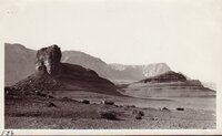
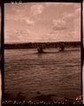
Farms at Littlefield, Arizona From Townsite
1913-06-14
Image
dha_scp
702
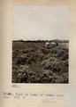
Fault in lower Moenkopi shaly sandstone head of Rock Canyon (of Short Creek), Mohave County, AZ, 1939
1939
Image
uum_map
703
Field trip, May 1931: Balanced Rock, Badger Creek - Near Navajo Bridge [01]
1931-05
Image/StillImage
uum_map
704
Field trip, May 1931: Balanced Rock, Badger Creek - Near Navajo Bridge [02]
1931-05
Image/StillImage
uum_map
705
Field trip, May 1931: Balanced Rock, Badger Creek - Near Navajo Bridge [03]
1931-05
Image/StillImage
uum_map
706
Field trip, May 1931: Balanced Rock, Badger Creek - Near Navajo Bridge [04]
1931-05
Image/StillImage
uum_map
707
Field trip, May 1931: Balanced Rock, Badger Creek - Near Navajo Bridge [05]
1931-05
Image/StillImage
uum_map
708
Field trip, May 1931: Balanced Rock, Badger Creek - Near Navajo Bridge [06]
1931-05
Image/StillImage
uum_map
709
Field trip, May 1931: Hopi Indians at Moencopi, Ariz
1931-05
Image/StillImage
uum_map
710
Field trip, May 1931: Hopi Indians at Moencopi, Ariz
1931-05
Image/StillImage
uum_map
711
Field trip, May 1931: Near Lee's Ferry
1931-05
Image/StillImage
uum_map
712
Field trip, May 1931: Painted Desert, Arizona.
1931-05
Image/StillImage
uum_map
713
Fire Place, Hermits Rest
1920; 1921; 1922; 1923; 1924; 1925; 1926; 1927; 1928; 1929
Image/StillImage
uum_map
714
First camp out of Fredonia, UT. 1922
1922
Image
uum_map
715
First Mesa Wash, near Walpi, Arizona, after shower, Aug. 1909 (photo G-94)
1909
Image
uum_map
716
First Mesa Wash, Walpi (Negative for photo G-94)
1909
Image
uum_map
717
First Settlements of San Juan County, Utah
1928; 1929; 1930; 1931; 1932; 1933
Text
uaida_main
718
First telegraph station in Arizona
1930; 1931; 1932; 1933; 1934; 1935; 1936; 1937; 1938; 1939; 1940; 1941; 1942; 1943; 1944; 1945; 1946; 1947; 1948; 1949; 1950; 1951; 1952; 1953; 1954; 1955; 1956; 1957; 1958; 1959; 1960
Image
uum_map
719
Flat at head of Keams Canyon. VII, 3 (Photo G263A)
1911
Image
uum_map
720
Flat between Little Colorado and Dolores cliff, Tolchaco. "Lake" shown is mirage (Photo G411)
1913
Image
uum_map
721
Flat between Little Colorado and Dolores cliff, Tolchaco. "Lake" shown is mirage (Photo G411)
1913
Image
uum_map
722
Flat possible for irrigation. Wheat fields near Sonsola Buttes, Ariz. Basalt-capped butte in background, 1909 (photo G-103)
1909
Image
uum_map
723
Flight over Grand Canyon, March 1963
1963
Image/StillImage
uum_map_rr
724
Flight over Grand Canyon, November 1969 [01]
1969
Image/StillImage
uum_map_rr
725
Flight over Grand Canyon, November 1969 [02]
1969
Image/StillImage
uum_map_rr
701
-
725
of
4,123
<
24
25
26
27
28
29
30
31
32
33
>