| | Title | Date | Type | Setname |
|---|
| 101 | 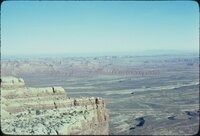 | Aerial view of Arizona desert, 1980 [01] | 1980 | Image/StillImage | uum_map_rr |
| 102 | 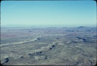 | Aerial view of Arizona desert, 1980 [02] | 1980 | Image/StillImage | uum_map_rr |
| 103 | 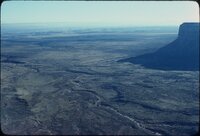 | Aerial view of Arizona desert, 1980 [03] | 1980 | Image/StillImage | uum_map_rr |
| 104 | 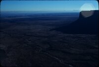 | Aerial view of Arizona desert, 1980 [04] | 1980 | Image/StillImage | uum_map_rr |
| 105 | 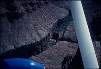 | Aerial view of Mooney Falls, 1983 | 1983 | Image/StillImage | uum_map_rr |
| 106 | 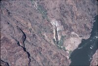 | Aerial view, Travertine Falls, Grand Canyon, Fall 1987 [01] | 1987 | Image/StillImage | uum_map_rr |
| 107 | 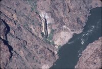 | Aerial view, Travertine Falls, Grand Canyon, Fall 1987 [02] | 1987 | Image/StillImage | uum_map_rr |
| 108 | 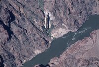 | Aerial view, Travertine Falls, Grand Canyon, Fall 1987 [03] | 1987 | Image/StillImage | uum_map_rr |
| 109 |  | Aerial view, Travertine Falls, Grand Canyon, Fall 1987 [04] | 1987 | Image/StillImage | uum_map_rr |
| 110 | 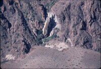 | Aerial view, Travertine Falls, Grand Canyon, Fall 1987 [05] | 1987 | Image/StillImage | uum_map_rr |
| 111 | 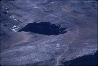 | Aerial view, upper Grand Canyon, Fall 1987 [01] | 1987 | Image/StillImage | uum_map_rr |
| 112 | 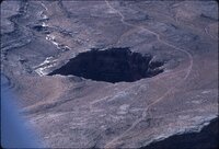 | Aerial view, upper Grand Canyon, Fall 1987 [02] | 1987 | Image/StillImage | uum_map_rr |
| 113 | 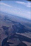 | Aerial view, upper Grand Canyon, Fall 1987 [03] | 1987 | Image/StillImage | uum_map_rr |
| 114 | 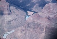 | Aerial view, upper Grand Canyon, Fall 1987 [04] | 1987 | Image/StillImage | uum_map_rr |
| 115 | 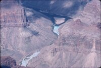 | Aerial view, upper Grand Canyon, Fall 1987 [05] | 1987 | Image/StillImage | uum_map_rr |
| 116 | 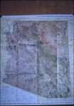 | Aeronautical map, Arizona | 1960; 1961; 1962; 1963; 1964 | Image/StillImage | uum_map_rr |
| 117 | 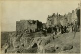 | After the dance, Walpi, AZ | 1915 | Image | uum_map |
| 118 | 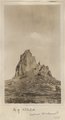 | Agathla (John Wetherill photo) | 1910 | Image | uum_map |
| 119 | 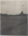 | Agathla and Slim (Queen) Rock, Ariz., from S.E. (Photo G144) | 1910 | Image | uum_map |
| 120 |  | Agathla and Slim (Queen) Rock, Ariz., from S.E. (Photo G144) | 1910 | Image | uum_map |
| 121 |  | Agathla and Slim (Queen) Rock, Ariz., from S.E. (Photo N-M86) | 1910 | Image | uum_map |
| 122 |  | Agathla, volcanic neck, between Chinlee, Ariz. and Oljato, Utah, 1910 (Photo G145) | 1910 | Image | uum_map |
| 123 |  | Agathla, volcanic neck, between Chinlee, Ariz. and Oljato, Utah, 1910 (Photo G145) | 1910 | Image | uum_map |
| 124 | 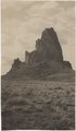 | Agathla, volcanic neck, between Chinlee, Ariz. and Oljato, Utah, 1910 (Photo G146) | 1910 | Image | uum_map |
| 125 |  | Agathla, volcanic neck, between Chinlee, Ariz. and Oljato, Utah, 1910 (Photo G146) | 1910 | Image | uum_map |
| 126 |  | Agathla, volcanic neck, between Chinlee, Ariz. and Oljato, Utah, 1910 (same as G145, Townsend photo) | 1910 | Image | uum_map |
| 127 | 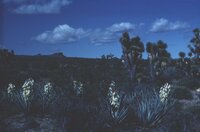 | Agaves and Joshua trees | 1940; 1941; 1942; 1943; 1944; 1945; 1946; 1947; 1948; 1949; 1950; 1951; 1952; 1953; 1954; 1955; 1956; 1957; 1958; 1959; 1960; 1961; 1962; 1963; 1964; 1965; 1966; 1967; 1968; 1969; 1970; 1971; 1972; 1973; 1974; 1975; 1976; 1977; 1978; 1979; 1980 | Image | uum_map_rr |
| 128 |  | Al Galloway, foreground; Eggert-Hatch River Expedition, June 1956 | 1956-06 | Image/StillImage | uum_map_rr |
| 129 |  | Al Morton | 1950; 1951; 1952; 1953; 1954; 1955; 1956; 1957; 1958; 1959; 1960 | Image/StillImage | dha_alwmc |
| 130 |  | Allen City minutes | 1876; 1877; 1878; 1879; 1880; 1881; 1882; 1883; 1884; 1885; 1886; 1887 | Text | uum_msa |
| 131 |  | Alluvium with peat. Top wall of Black Creek (VIII-66) (Photo G389) | 1913 | Image | uum_map |
| 132 | 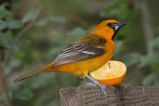 | Altamira Oriole (070517-41) | 2007-05-17 | Sound | uu_wss |
| 133 |  | Altar Falls On Ribbon Creek | 1920; 1921; 1922; 1923; 1924; 1925; 1926; 1927; 1928; 1929 | Image/StillImage | uum_map |
| 134 | 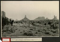 | Amidst these wonderful monuments of south-eastern Utah, like the ruins of an ancient city | 1920; 1921; 1922; 1923 | Image/StillImage | uum_map |
| 135 |  | An-ti-naints, Pu-tu-siv and Wi-chuts, sitting | 1874 | Image/StillImage | uaida_main |
| 136 |  | Ancestors of Thora Bergeson Watson | 1964 | Text | uum_msa |
| 137 |  | Ancient irrigation ditch, La Plata sandstone, Moencopie wash, 10± mil east of Tuba, Ariz., 1909 (photo G-101) | 1909 | Image | uum_map |
| 138 |  | Ancient landslides, 5± mi. southwest of Sunrise Spgs., Ariz. (photo G-44) | 1909 | Image | uum_map |
| 139 | 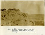 | Ancient ruin, rim of Moenkopi Wash below Moenkopi village. | 1914 | Image | uum_map |
| 140 |  | Andrew Locy Rogers 1910 journal (copy of original) | 1910 | Text | uum_msa |
| 141 |  | Andrew Locy Rogers correspondence, 1878-1925 | 1878; 1879; 1897; 1900; 1920 | Text | uum_msa |
| 142 |  | Andrew Locy Rogers journal (original) | 1882; 1883; 1884; 1885; 1886; 1887; 1888; 1889; 1890; 1891; 1892; 1893; 1894; 1895; 1896; 1897; 1898; 1899; 1900; 1901; 1902 | Text | uum_msa |
| 143 |  | Andrew Locy Rogers journal (transcript) | 1969 | Text | uum_msa |
| 144 |  | Andrew Locy Rogers, Jr., and Rebecca Smith Rogers | 1900; 1901; 1902; 1903; 1904; 1905; 1906; 1907; 1908; 1909; 1910; 1911; 1912; 1913; 1914; 1915; 1916; 1917; 1918; 1919; 1920; 1921; 1922; 1923; 1924; 1925; 1926; 1927; 1928; 1929 | Text | uum_msa |
| 145 |  | Angel's Window | 1950; 1951; 1952; 1953; 1954; 1955; 1956; 1957; 1958; 1959; 1960 | Image/StillImage | dha_alwmc |
| 146 |  | Angel's Window | 1950; 1951; 1952; 1953; 1954; 1955; 1956; 1957; 1958; 1959; 1960 | Image/StillImage | dha_alwmc |
| 147 |  | Annual Report of the Commissioner of Indian Affairs for the year 1865 | 1865 | Text | uaida_main |
| 148 |  | Annual Report upon the Geographical and Geological Surveys and Explorations West of the 100th Meridian, in Nevada, Utah, Colorado, New Mexico, and Arizona | | Image/StillImage | uaida_main |
| 149 | 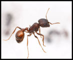 | Ant | 1999 | Sound | uu_wss |
| 150 | 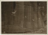 | Antelope petroglyphs, Monument Valley | 1935; 1936; 1937; 1938; 1939; 1940; 1941; 1942; 1943; 1944; 1945; 1946; 1947; 1948; 1949 | Image/StillImage | uum_map_rr |
| 151 |  | Ań-ti-naints and Wí-chuts | 1874 | Image/StillImage | uaida_main |
| 152 |  | Apache Indians P.1 | 1885 | Image | dha_cp |
| 153 | 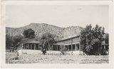 | Apache Lodge | 1934 | Image | uum_map_rr |
| 154 | 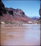 | Approaching Hance Rapid June 1956 | 1956-06 | Image/StillImage | uum_map_rr |
| 155 | 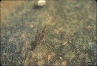 | Aquatic life in pothole, Tuweep 1973 | 1973 | Image/StillImage | uum_map_rr |
| 156 | 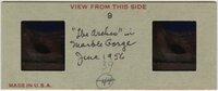 | Arches in Marble Gorge, June 1956 | 1956-06 | Image/StillImage | uum_map_rr |
| 157 | 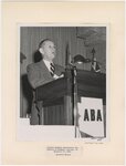 | Arizona Bankers Association Convention at Phoenix, Arizona, on November 11, 1950 | 1950-11-11 | Image/StillImage | uum_map |
| 158 |  | Arizona Bankers Association Convention at Phoenix, Arizona, on November 11, 1950, Biltmore Hotel: Governor Eccles | 1950-11-11 | Image/StillImage | uum_map |
| 159 |  | Arizona Co-op Mercantile Inst. Holbrook Az. P.1 | 1888; 1889; 1890; 1891; 1892; 1893; 1894; 1895; 1896; 1897; 1898; 1899; 1900; 1901; 1902; 1903; 1904; 1905; 1906; 1907; 1908; 1909; 1910 | Image/StillImage | dha_cp |
| 160 |  | Arizona department of water resources: Securing Arizona's water future | 1998; 1999; 2000; 2001; 2002; 2003; 2004 | Text; Image | wwdl_er |
| 161 |  | Arizona mission | 1874 | Text | uum_msa |
| 162 |  | Arizona Peace Officer at Short Creek Home | 1953 | Image | dha_cp |
| 163 |  | Arizona Treefrog | 1994-08-18 | Sound | uu_wss |
| 164 | | Arizona Water Science Center | 2005-01-19 | Text; Image | wwdl_er |
| 165 |  | Arizona waters, April 9, 1948 | 1948-04-09 | Image/StillImage | uum_map |
| 166 |  | Arizona, Jerome | 1890; 1891; 1892; 1893; 1894; 1895; 1896; 1897; 1898 | Image | uum_map |
| 167 |  | Arizona, Jerome | 1930; 1931; 1932; 1933; 1934; 1935; 1936; 1937; 1938; 1939; 1940; 1941; 1942; 1943; 1944; 1945; 1946; 1947; 1948; 1949; 1950; 1951; 1952; 1953; 1954; 1955; 1956; 1957; 1958; 1959; 1960 | Image | uum_map |
| 168 | 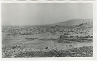 | Arizona, Tombstone, before 1880 | 1877; 1878; 1879 | Image | uum_map |
| 169 |  | Arizona, White Hills [01] | 1940; 1941; 1942; 1943; 1944; 1945; 1946; 1947; 1948; 1949; 1950; 1951; 1952; 1953; 1954; 1955; 1956; 1957; 1958; 1959; 1960; 1961; 1962; 1963; 1964; 1965; 1966; 1967; 1968; 1969; 1970 | Image | uum_map |
| 170 |  | Arizona, White Hills [02] | 1940; 1941; 1942; 1943; 1944; 1945; 1946; 1947; 1948; 1949; 1950; 1951; 1952; 1953; 1954; 1955; 1956; 1957; 1958; 1959; 1960; 1961; 1962; 1963; 1964; 1965; 1966; 1967; 1968; 1969; 1970 | Image | uum_map |
| 171 |  | Arizona, White Hills [03] | 1940; 1941; 1942; 1943; 1944; 1945; 1946; 1947; 1948; 1949; 1950; 1951; 1952; 1953; 1954; 1955; 1956; 1957; 1958; 1959; 1960; 1961; 1962; 1963; 1964; 1965; 1966; 1967; 1968; 1969; 1970 | Image | uum_map |
| 172 | 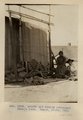 | Arnold and family (Chinlee) Navajo loom. Heald, photo, 1911 (Photo G282) | 1911 | Image | uum_map |
| 173 |  | The arrow maker and his daughter | 1874 | Image/StillImage | uaida_main |
| 174 |  | Arroyo in Cienega (meadow), line of bushes shows position of water table, St. Michaels, Ariz., 1909 (photo G-3) | 1909 | Image | uum_map |
| 175 |  | Arroyo in cienega, St. Michaels, Ariz. (negative for G-3) | 1909 | Image | uum_map |
| 176 |  | Art Gallenson at potholes, 1981 | 1960 | Image/StillImage | uum_map_rr |
| 177 |  | Art Gallenson family and friends, 1982 [04] | 1982 | Image/StillImage | uum_map_rr |
| 178 |  | Art Gallenson family and friends, 1982 [05] | 1982 | Image/StillImage | uum_map_rr |
| 179 |  | Art Gallenson family and friends, early 1960s [08] | 1960; 1961; 1962; 1963; 1964 | Image/StillImage | uum_map_rr |
| 180 | 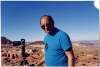 | Art Gallenson with camera, Coyote Buttes, 1990s | 1994; 1995; 1996; 1997; 1998 | Image/StillImage | uum_map_rr |
| 181 |  | Art Gallenson with camera, Coyote Buttes, 1990s | 1994; 1995; 1996; 1997; 1998 | Image/StillImage | uum_map_rr |
| 182 |  | Articles from the Deseret News, 1876-1878 | 1876; 1877; 1878 | Text | uum_msa |
| 183 | 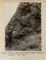 | Ash and tuff near Biddehoche. VI, 84 (Photo G231) | 1911 | Image | uum_map |
| 184 | 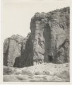 | Ash, Twin Buttes (Photo G252) | 1911 | Image | uum_map |
| 185 | 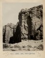 | Ash, Twin Buttes (Photo G252) | 1911 | Image | uum_map |
| 186 | 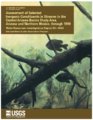 | Assessment of selected inorganic constituents in streams in the Central Arizona Basins Study Area, Arizona and northern Mexico, through 1998 | 2003 | Text | wwdl_er |
| 187 |  | At breakfast typical desert home of Navajo Indians (S. W.) Arizona | 1900; 1901; 1902; 1903; 1904; 1905; 1906; 1907; 1908; 1909; 1910 | Image/StillImage | uaida_main |
| 188 |  | At Grand View | 1900 | Image | uum_map |
| 189 | 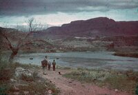 | At Lee's Ferry, April 10, 1948 [01] | 1948-04-10 | Image/StillImage | uum_map |
| 190 |  | At Lee's Ferry, April 10, 1948 [02] | 1948-04-10 | Image/StillImage | uum_map |
| 191 |  | At Lee's Ferry, April 10, 1948 [03] | 1948-04-10 | Image/StillImage | uum_map |
| 192 |  | At Lee's Ferry, April 10, 1948 [04] | 1948-04-10 | Image/StillImage | uum_map |
| 193 |  | At the mouth of Tapeats Creek, Grand Canyon, June 1956 | 1956-06 | Image/StillImage | uum_map_rr |
| 194 |  | At the River | 1900 | Image | uum_map |
| 195 |  | Aunt Eliza [Eliza Lewis Fish] | 1944; 1945; 1946; 1947; 1948; 1949; 1950 | Text | uum_uhrf |
| 196 | 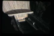 | Auto trip to Arizona, Mexico, Texas, and Louisiana | 1951 | Image/MovingImage | uum_avac |
| 197 |  | Autobiographical notes of my life, by James Warren Le Sueur | 1939-07 | Text | uum_msa |
| 198 | 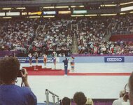 | Awards podium at Nationals, 1993. | 1993 | | uum_map_usa |
| 199 |  | Awards podium at Nationals, 1993. | 1993 | | uum_map_usa |
| 200 |  | Azra [that is, Arza] E. Hinckley journal no. 1, October, 1882 to January, 1884 | 1882; 1883; 1884; 1885; 1886 | Text | uum_msa |