|
|
Title | Date | Type | Setname |
| 1401 |
 |
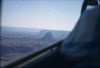
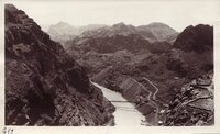
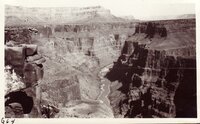
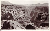
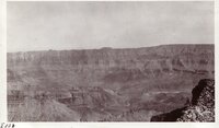
Flight over Grand Canyon, November 1969 [01] | 1969 | Image/StillImage | uum_map_rr |
| 1402 |
 |
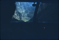
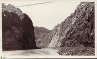
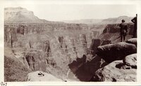
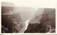
Flight over Grand Canyon, November 1969 [02] | 1969 | Image/StillImage | uum_map_rr |
| 1403 |
 |
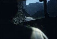
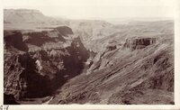
Flight over Grand Canyon, November 1969 [03] | 1969 | Image/StillImage | uum_map_rr |
| 1404 |
 |
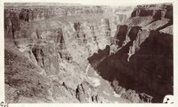
Flight over Grand Canyon, November 1969 [04] | 1969 | Image/StillImage | uum_map_rr |
| 1405 |
 |
Flight over Grand Canyon, November 1969 [05] | 1969 | Image/StillImage | uum_map_rr |
| 1406 |
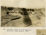 |
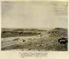
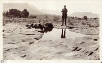
Floor of wind-made depression, Tuba Desert, 1914 | 1914 | Image | uum_map |
| 1407 |
 |
Folds in Moenkopi strata, Short Creek east of Rock Canyon, Mohave County, AZ, 1939 | 1939 | Image | uum_map |
| 1408 |
 |
Folklore gathered from the Mormons in Saint David, Arizona | 1905-04-30 | Text | uum_uhrf |
| 1409 |
 |
Foot prints on Supai SS, Yaki trail 1928 | 1928 | Image | uum_map |
| 1410 |
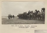 |
Foot race, Ganado, Arizona. Schwemberger, photo. | 1909 | Image | uum_map |
| 1411 |
 |
Foot race, Ganado, Arizona. Schwemberger, photo. | 1909 | Image | uum_map |
| 1412 |
 |
Fort Defiance [X-33455] | 1896 | Image/StillImage | uaida_main |
| 1413 |
 |
Fort Defiance [X-33456] | 1896 | Image/StillImage | uaida_main |
| 1414 |
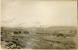 |
Fort Defiance, Ariz., looking northeast across upturned edges of Dolores and La Plata. Mesa in distance is Mesa Verde, 1908 (Schwemberger photo) | 1909 | Image | uum_map |
| 1415 |
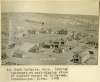 |
Fort Defiance, Ariz., looking northwest at east-dipping slope of hogback capped by Shinarump, 1908 (Schwemberger photo) | 1908 | Image | uum_map |
| 1416 |
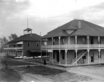 |
Fort Defiance, Arizona [X-33459] | 1896 | Image/StillImage | uaida_main |
| 1417 |
 |
Fort; Public buildings; Joseph City's places of worship | 1971 | Text | uum_msa |
| 1418 |
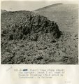 |
Fossil tree stump standing upright. About 1 mi. east of Tanners Crossing (foot print in foreground). In Dolores. | 1913 | Image | uum_map |
| 1419 |
 |
Fossil tree, between Chinlett and Round Rock (Photo G283A) | 1911 | Image | uum_map |
| 1420 |
 |
Four Corners-Marker P.1 | | Image | dha_cp |
| 1421 |
 |
Frances Ibarra with guest | 1998-06 | Image | uum_map |
| 1422 |
 |
Frazier-Kelly Expedition, 1937--Lee's Ferry P.1 | 1937 | Image | dha_cp |
| 1423 |
 |
Fred Wood, June 1956 | 1956-06 | Image/StillImage | uum_map_rr |
| 1424 |
 |
Freight team, Ganado (Photo N-M121) | 1911 | Image | uum_map |
| 1425 |
 |
Freighting in winter between Gallup and St. Michaels, Ariz. Schwemberger, photo. | 1909 | Image | uum_map |
| 1426 |
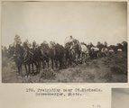 |
Freighting near St. Michaels. Schwemberger, photo. | 1909 | Image | uum_map |
| 1427 |
 |
French kayak party at Lees Ferry, 1938 [1] | 1938-11 | Image/StillImage | uum_map_rr |
| 1428 |
 |
French kayak party at Lees Ferry, 1938 [3] | 1938-11 | Image/StillImage | uum_map_rr |
| 1429 |
 |
French kayak party at Lees Ferry, 1938 [4] | 1938-11 | Image/StillImage | uum_map_rr |
| 1430 |
 |
French kayak party at Lees Ferry, 1938 [5] | 1938-11 | Image/StillImage | uum_map_rr |
| 1431 |
 |
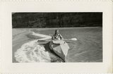
French kayaker | 1938-11 | Image/StillImage | uum_map_rr |
| 1432 |
 |
French party 1938, left river at Lees Ferry | 1938-11 | Image/StillImage | uum_map_rr |
| 1433 |
 |
Froehmer House at Littlefield. 1922 | 1922 | Image | uum_map |
| 1434 |
 |
From Grand View Point | 1920; 1921; 1922; 1923; 1924; 1925; 1926; 1927; 1928; 1929 | Image/StillImage | uum_map |
| 1435 |
 |
From Yavapai Point | 1920; 1921; 1922; 1923; 1924; 1925; 1926; 1927; 1928; 1929 | Image/StillImage | uum_map |
| 1436 |
 |
G.W. McAdam and store, Chinlee. VII, 26 (Photo N-M127) | 1911 | Image | uum_map |
| 1437 |
 |
Gambel's Quail 2 | 2008-03-20 | Sound | uu_wss |
| 1438 |
 |
Game of wolf and deer | 1874 | Image/StillImage | uaida_main |
| 1439 |
 |
Ganado, Ariz. (Negative for photo G-37) | 1909 | Image | uum_map |
| 1440 |
 |
Gateway Canyon | 1965-06 | Image | uum_map_rr |
| 1441 |
 |
Gateway Canyon | 1965-06 | Image | uum_map_rr |
| 1442 |
 |
Gateway Canyon | 1965-06 | Image | uum_map_rr |
| 1443 |
 |
Gathering at Short Creek | 1953 | Image | dha_cp |
| 1444 |
 |
Gathering at Short Creek | 1953 | Image | dha_cp |
| 1445 |
 |
Genealogy tables and family group sheets: Blythe, Brookbank, Porter, Parkinson, Shepherd, Steele, Woodward | 1968; 1969; 1970; 1971; 1972 | Text | uum_msa |
| 1446 |
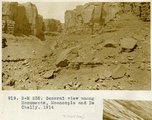 |
General view among monuments, Moencopie and DeChelly, 1914 | 1914 | Image | uum_map |
| 1447 |
 |
General view near Many Waters Lakes, 16± mi., northeast of Leupp, Arizona (photo G-87) | 1909 | Image | uum_map |
| 1448 |
 |
General view near Many Waters Lakes, 16± mi., northeast of Leupp, Arizona (photo G-87) | 1909 | Image | uum_map |
| 1449 |
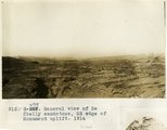 |
General view of DeChelly sandstone, SE edge of Monument uplift, 1914 | 1914 | Image | uum_map |
| 1450 |
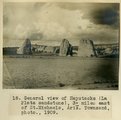 |
General view of Haystacks (La Plata sandstone), 3+ miles east of St. Michaels, Ariz., 1909 (Townsend photo) | 1909 | Image | uum_map |
| 1451 |
 |
General view of LaPlata, west of Chinlee. VII, 29 (Photo G273) | 1911 | Image | uum_map |
| 1452 |
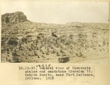 |
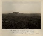
General view of Moencopie shales and sandstone (Permian?). Canyon Bonito, near Fort Defiance, Arizona, 1909 | 1909 | Image | uum_map |
| 1453 |
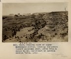 |
General view of upper Moencopie strata, looking northeast toward Monument Pass. Taken from a point 8+ mi. northeast of Agathla Needle, Ariz., 1910 (Photo G158) | 1910 | Image | uum_map |
| 1454 |
 |
General view of upper Moencopie strata, looking northeast toward Monument Pass. Taken from a point 8± mi. northeast of Agathla Needle, Ariz., 1910 (Photo G158) | 1910 | Image | uum_map |
| 1455 |
 |
General view, Mishonginivi and Shipauiluvi (Mesa Verde strata), W. C. Mendenhall phot, 1909 | 1909 | Image | uum_map |
| 1456 |
 |
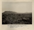
General view, Moqui Buttes region, Cedar Springs area. Barrows, photo. 1911 (Photo G239) | 1911 | Image | uum_map |
| 1457 |
 |
General view, Moqui Buttes, Biddehoche Section. Barrows, photo. 1911 (Photo G234) | 1911 | Image | uum_map |
| 1458 |
 |
General view, Sagy (Towanaoche) Canyon, Ariz., LaPlata strata (C.R. Jefferis photo) | 1910 | Image | uum_map |
| 1459 |
 |
General view, Tuba desert (Photo N-M180) | 1913 | Image | uum_map |
| 1460 |
 |
Generalized hydrogeology and ground-water budget for the C Aquifer, Little Colorado River basin and parts of the Verde and Salt River basins, Arizona and New Mexico | 2002 | Text | wwdl_er |
| 1461 |
 |
Genevieve DeColmont | 1938-11 | Image/StillImage | uum_map_rr |
| 1462 |
 |
Genevieve DeColmont | 1938-11 | Image/StillImage | uum_map_rr |
| 1463 |
 |
Geologic anomaly, Grand Canyon October 1966 | 1966 | Image/StillImage | uum_map_rr |
| 1464 |
 |
Geology field trip, Fall 1929: Black Canyon of the Colorado | 1929-09 | Image/StillImage | uum_map |
| 1465 |
 |
Geology field trip, Fall 1929: Black Canyon of the Colorado | 1929 | Image/StillImage | uum_map |
| 1466 |
 |
Geology field trip, Fall 1929: Black Canyon of the Colorado | 1929 | Image/StillImage | uum_map |
| 1467 |
 |
Geology field trip, Fall 1929: Black Canyon of the Colorado | 1929-09 | Image/StillImage | uum_map |
| 1468 |
 |
Geology field trip, Fall 1929: Black Canyon of the Colorado | 1929-09 | Image/StillImage | uum_map |
| 1469 |
 |
Geology field trip, Fall 1929: Black Canyon of the Colorado | 1929 | Image/StillImage | uum_map |
| 1470 |
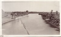 |
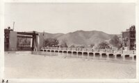
Geology field trip, Fall 1929: Colorado River - at Laguna | 1929 | Image/StillImage | uum_map |
| 1471 |
 |
Geology field trip, Fall 1929: Colorado River - At Laguna | 1929 | Image/StillImage | uum_map |
| 1472 |
 |
Geology field trip, Fall 1929: Colorado River - At Laguna | 1929 | Image/StillImage | uum_map |
| 1473 |
 |
Geology field trip, Fall 1929: Colorado River - At Laguna | 1929 | Image/StillImage | uum_map |
| 1474 |
 |
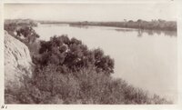
Geology field trip, Fall 1929: Colorado River - at Laguna | 1929 | Image/StillImage | uum_map |
| 1475 |
 |
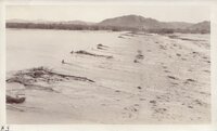
Geology field trip, Fall 1929: Colorado River, near Yuma | 1929 | Image/StillImage | uum_map |
| 1476 |
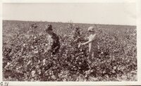 |
Geology field trip, Fall 1929: Cotton field near Yuma - Sadie, Eva | 1929 | Image/StillImage | uum_map |
| 1477 |
 |
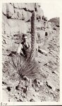
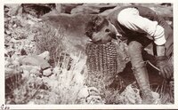
Geology field trip, March 1927: Century plant - Toroweap | 1927-03 | Image/StillImage | uum_map |
| 1478 |
 |
Geology field trip, March 1927: Century Plant - Toroweap - Eugene | 1927-03 | Image/StillImage | uum_map |
| 1479 |
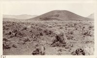 |
Geology field trip, March 1927: Cinder Cone - Near Toroweap | 1927-03 | Image/StillImage | uum_map |
| 1480 |
 |
Geology field trip, March 1927: Cinder cone - near Toroweap | 1927-03 | Image/StillImage | uum_map |
| 1481 |
 |
Geology field trip, March 1927: Eugene at Toroweap | 1927-03 | Image/StillImage | uum_map |
| 1482 |
 |
Geology field trip, March 1927: Eugene at Toroweap | 1927-03 | Image/StillImage | uum_map |
| 1483 |
 |
Geology field trip, March 1927: Eugene at Toroweap | 1927-03 | Image/StillImage | uum_map |
| 1484 |
 |
Geology field trip, March 1927: Toroweap - Lava Flows [01] | 1927-03 | Image/StillImage | uum_map |
| 1485 |
 |
Geology field trip, March 1927: Toroweap - Lava Flows [02] | 1927-03 | Image/StillImage | uum_map |
| 1486 |
 |
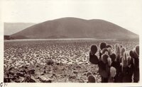
Geology field trip, March 1927: Toroweap - Lava Flows [03] | 1927-03 | Image/StillImage | uum_map |
| 1487 |
 |
Geology field trip, March 1927: Toroweap, Grand Canyon - Dr. Inglesby | 1927-03 | Image/StillImage | uum_map |
| 1488 |
 |
Geology field trip, March 1927: Toroweap, Grand Canyon - Lava flows, from Mt. Trumbull | 1927-03 | Image/StillImage | uum_map |
| 1489 |
 |
Geology field trip, March 1927: Toroweap, Grand Canyon [01] | 1927-03 | Image/StillImage | uum_map |
| 1490 |
 |
Geology field trip, March 1927: Toroweap, Grand Canyon [02] | 1927-03 | Image/StillImage | uum_map |
| 1491 |
 |
Geology field trip, March 1927: Toroweap, Grand Canyon [03] | 1927-03 | Image/StillImage | uum_map |
| 1492 |
 |
Geology field trip, March 1927: Toroweap, Grand Canyon [04] | 1927-03 | Image/StillImage | uum_map |
| 1493 |
 |
Geology field trip, March 1927: Water Pocket - Near Toroweap - Dr Middleton Standing | 1927-03 | Image/StillImage | uum_map |
| 1494 |
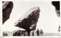 |
Geology field trip, May 1932: Balanced Boulder - Soap Creek | 1932-05 | Image/StillImage | uum_map |
| 1495 |
 |
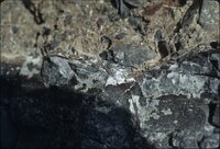
Geology field trip, May 1932: Grand Canyon - Cape Royal - Proterozoic-Cambrian Unconformity | 1932-05 | Image/StillImage | uum_map |
| 1496 |
 |
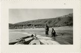
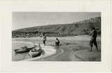
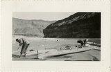
Geology field trip, May 1932: John D Lee Residence - Lees Ferry | 1932-05 | Image/StillImage | uum_map |
| 1497 |
 |
Geology near Phantom Ranch, Grand Canyon, spring 1973 [01] | 1973 | Image/StillImage | uum_map_rr |
| 1498 |
 |
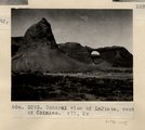
Geology near Phantom Ranch, Grand Canyon, spring 1973 [02] | 1973 | Image/StillImage | uum_map_rr |
| 1499 |
 |
Geology near Phantom Ranch, Grand Canyon, spring 1973 [03] | 1973 | Image/StillImage | uum_map_rr |
| 1500 |
 |
Geology near Phantom Ranch, Grand Canyon, spring 1973 [04] | 1973 | Image/StillImage | uum_map_rr |