|
|
Title | Date | Type | Setname |
| 1301 |
 |
Eastern Grand Canyon landscape, March 1962 [03] | 1962 | Image/StillImage | uum_map_rr |
| 1302 |
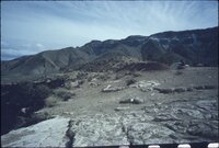 |
Eastern Grand Canyon landscape, March 1962 [04] | 1962 | Image/StillImage | uum_map_rr |
| 1303 |
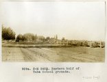 |
Eastern half of Tuba school grounds | 1914 | Image | uum_map |
| 1304 |
 |
Eastern half of Tuba school grounds, 1914. | 1914 | | uum_map |
| 1305 |
 |
Edna's Needle, LaPlata, west of Chinlee. VII, 29 (Photo G274) | 1911 | Image | uum_map |
| 1306 |
 |
Eggert in wee inflatable boat being "rescued," June 1956 | 1956-06 | Image/StillImage | uum_map_rr |
| 1307 |
 |
El Coronado Ranch AZ (070514-42) | | Sound | uu_wss |
| 1308 |
 |
El Coronado Ranch AZ (070514-423) | | Sound | uu_wss |
| 1309 |
 |
El Tovar Hotel | 1920; 1921; 1922; 1923; 1924; 1925; 1926; 1927; 1928; 1929 | Image/StillImage | uum_map |
| 1310 |
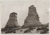 |
Elephant Feet, Arizona | 1920; 1921; 1922; 1923; 1924; 1925; 1926; 1927; 1928; 1929; 1930; 1931; 1932; 1933; 1934; 1935; 1936; 1937; 1938; 1939; 1940; 1941; 1942; 1943; 1944; 1945; 1946; 1947; 1948; 1949 | Image/StillImage | uum_map_rr |
| 1311 |
 |
Elephant Rocks, Arizona | 1928-08 | Image | uum_map_rr |
| 1312 |
 |
Elephant's feet | 1925; 1926; 1927; 1928; 1929; 1930; 1931; 1932; 1933; 1934; 1935; 1936; 1937; 1938; 1939; 1940; 1941; 1942; 1943; 1944; 1945; 1946; 1947; 1948; 1949 | Image | uum_map_rr |
| 1313 |
 |
Elephant's Feet | 1925; 1926; 1927; 1928; 1929; 1930; 1931; 1932; 1933; 1934; 1935; 1936; 1937; 1938; 1939; 1940; 1941; 1942; 1943; 1944; 1945; 1946; 1947; 1948; 1949 | Image | uum_map_rr |
| 1314 |
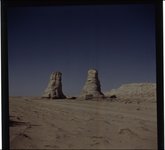 |
Elephant's Feet, near Navajo Mt., April 1952 [01] | 1952-04 | Image | uum_map |
| 1315 |
 |
Elephant's Feet, near Navajo Mt., April 1952 [02] | 1952-04 | Image | uum_map |
| 1316 |
 |
Elephant's Feet, Route 64 and 1, Arizona, May 26, 1962 | 1962-05-26 | Image | uum_map |
| 1317 |
 |
Elve's Chasm | 1965-06 | Image | uum_map_rr |
| 1318 |
 |
Elve's Chasm | 1965-06 | Image | uum_map_rr |
| 1319 |
 |
Elves Chasm | 1965-06 | Image | uum_map_rr |
| 1320 |
 |
Elves Chasm | 1971-08-22 | Image | uum_map_rr |
| 1321 |
 |
Elves Chasm | 1971-08-22 | Image | uum_map_rr |
| 1322 |
 |
Elves Chasm, 22 Aug 71 | 1971-08-22 | Image | uum_map_rr |
| 1323 |
 |
Elves Chasm, Alta, JoAnn, and Merlin | 1971-08-22 | Image | uum_map_rr |
| 1324 |
 |
Elves Chasm, Grand Canyon, Summer 1972 | 1972 | Image/StillImage | uum_map_rr |
| 1325 |
 |
Elves Chasm, Grand Canyon, Summer 1972 | 1972 | Image/StillImage | uum_map_rr |
| 1326 |
 |
Emery Kolb | 1951 | Image/StillImage | dha_alwmc |
| 1327 |
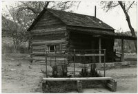 |
Emma Lee's Cabin, Lonely Dell Ranch, near Lee's Ferry, Ariz. | 1985-11 | | uum_map_rr |
| 1328 |
 |
End of run, Hance Rapid June 1956 | 1956-06 | Image/StillImage | uum_map_rr |
| 1329 |
 |
Engleman cactus, Tapeats [creek] | 1971-08-22 | Image | uum_map_rr |
| 1330 |
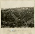 |
Entrenched meanders, Blue Canyon | 1913 | Image | uum_map |
| 1331 |
 |
Environmental Contaminants and their effects on fish in the Colorado River Basin | 2004 | Text | wwdl_er |
| 1332 |
 |
Erastus Snow correspondence, 1878-1886 | 1878; 1886 | Text | uum_msa |
| 1333 |
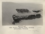 |
Eroded Dune, showing structure, Chinlee (Photo G319) | 1913 | Image | uum_map |
| 1334 |
 |
Eroded neck at northwest corner of Moqui Butte area (Photo G233) | 1911 | Image | uum_map |
| 1335 |
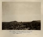 |
Eroded neck at northwest corner of Moqui Butte area (Photo G233) | 1911 | Image | uum_map |
| 1336 |
 |
Erosion column and window, Nazlini canyon, above store. 1911 (Photo G268) | 1911 | Image | uum_map |
| 1337 |
 |
Erosion details, LaPlata strata, 3 mi. west of Moencopie, Ariz. (Pogue photo, 1910) | 1910 | Image | uum_map |
| 1338 |
 |
Erosion details, LaPlata strata, 3 mi. west of Moencopie, Ariz. (Pogue photo, 1910) | 1910 | Image | uum_map |
| 1339 |
 |
Erosion forms in "Painted Desert" west of Tuba | 1913 | Image | uum_map |
| 1340 |
 |
Erosion in Dolores near Tuba. Heald, photo. 1911 (Photo G305) | 1911 | Image | uum_map |
| 1341 |
 |
Erosion in Dolores, Beautiful Valley, north of Ganado. 1911 (Photo G267) | 1911 | Image | uum_map |
| 1342 |
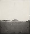 |
Erosion in Dolroes near Tuba. Heald, photo. 1911 (Photo G306) | 1911 | Image | uum_map |
| 1343 |
 |
Erosion in Dolroes near Tuba. Heald, photo. 1911 (Photo G306) | 1911 | Image | uum_map |
| 1344 |
 |
Erosion on column, LaPlata, west of Chinlee. VII, 33 (Photo G275) | 1911 | Image | uum_map |
| 1345 |
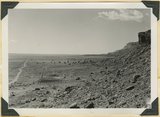 |
Erosion surface at edge of Vermillion Cliffs west of Pipe Springs, Mohave County, AZ. Streams cross Sevier fault from downthrow to upthrow side. 1939 | 1939 | Image | uum_map |
| 1346 |
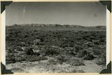 |
Erosion surface produced by bevelling Chinle strata at the base of Vermillion Cliffs south of Cane Beds, Mohave County, AZ, 1939 | 1939 | Image | uum_map |
| 1347 |
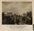 |
Erosion: McElmo capped by Dakota (?), between Steamboat Canyon and Ganado. 1911 (Photo G259) | 1911 | Image | uum_map |
| 1348 |
 |
Escalante Map P.1 | | Image | dha_cp |
| 1349 |
 |
Escalante Route Map P.1 | | Image | dha_cp |
| 1350 |
 |
The Esplanade at Vulcans Throne | 1900 | Image | uum_map |
| 1351 |
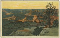 |
Evening, Grand Canyon National Park, Arizona | 1930; 1931; 1932; 1933; 1934; 1935; 1936; 1937; 1938; 1939; 1940; 1941; 1942; 1943; 1944; 1945 | Image | uum_map |
| 1352 |
 |
Excerpts from the Journal of Joseph Fish, with related letters and notes | 1971 | Text | uum_msa |
| 1353 |
 |
Explorer [scout] Grave, President Harding [rapid] | 1966-05 | Image | uum_map_rr |
| 1354 |
 |
Explorer [scout] Grave, President Harding [rapid] | 1966-05 | Image | uum_map_rr |
| 1355 |
 |
Extreme rain | 1971-08 | Image | uum_map_rr |
| 1356 |
 |
É-nu-ints-i-gaip, or one of the ancients | 1874 | Image/StillImage | uaida_main |
| 1357 |
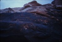 |
F. M. Brown inscription, Marble Canyon | 1960; 1961; 1962; 1963; 1964 | Image/StillImage | uum_map_rr |
| 1358 |
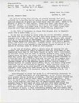 |
F. M. Lyman letter of 8 October 1880 | 1880-10-08; 1970-10-13 | Text | uum_msa |
| 1359 |
 |
Falls on Redwall [limestone] | 1971-08 | Image | uum_map_rr |
| 1360 |
 |
Falls over [_?_] | 1971-08 | Image | uum_map_rr |
| 1361 |
 |
Falls over Bright Angel [shale] | 1971-08 | Image | uum_map_rr |
| 1362 |
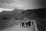 |
Family crossing Navajo Bridge in AZ; August 1941 | 1941-08 | Image | uum_map |
| 1363 |
 |
Family stories of the children of Israel Call | 1969; 1970; 1971; 1972; 1973 | Text | uum_msa |
| 1364 |
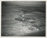 |
Farm empire, Salt River Valley, Arizona | 1945; 1946; 1947; 1948; 1949; 1950; 1951; 1952; 1953; 1954; 1955 | Image | uum_map |
| 1365 |
 |
Farmer ant, Coconino Forest, 1900 | 1900 | Image | uum_map |
| 1366 |
 |
Farmer Ant, Ganado. 1911 (Photo G219) | 1911 | Image | uum_map |
| 1367 |
 |
Farms at Littlefield, Arizona From Townsite | 1913-06-14 | Image | dha_scp |
| 1368 |
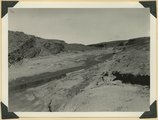 |
Fault in lower Moenkopi shaly sandstone head of Rock Canyon (of Short Creek), Mohave County, AZ, 1939 | 1939 | Image | uum_map |
| 1369 |
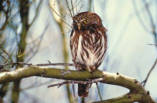 |
Ferruginous Pygmy Owl (Arizona) ambient recording | 2007-05-18 | Sound | uu_wss |
| 1370 |
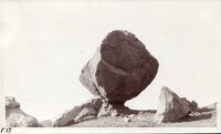 |
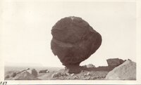
Field trip, May 1931: Balanced Rock, Badger Creek - Near Navajo Bridge [01] | 1931-05 | Image/StillImage | uum_map |
| 1371 |
 |
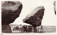
Field trip, May 1931: Balanced Rock, Badger Creek - Near Navajo Bridge [02] | 1931-05 | Image/StillImage | uum_map |
| 1372 |
 |
Field trip, May 1931: Balanced Rock, Badger Creek - Near Navajo Bridge [03] | 1931-05 | Image/StillImage | uum_map |
| 1373 |
 |
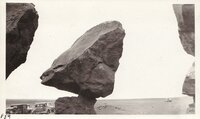
Field trip, May 1931: Balanced Rock, Badger Creek - Near Navajo Bridge [04] | 1931-05 | Image/StillImage | uum_map |
| 1374 |
 |
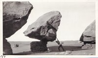
Field trip, May 1931: Balanced Rock, Badger Creek - Near Navajo Bridge [05] | 1931-05 | Image/StillImage | uum_map |
| 1375 |
 |
Field trip, May 1931: Balanced Rock, Badger Creek - Near Navajo Bridge [06] | 1931-05 | Image/StillImage | uum_map |
| 1376 |
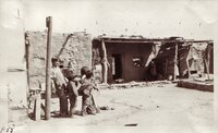 |
Field trip, May 1931: Hopi Indians at Moencopi, Ariz | 1931-05 | Image/StillImage | uum_map |
| 1377 |
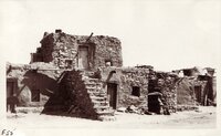 |
Field trip, May 1931: Hopi Indians at Moencopi, Ariz | 1931-05 | Image/StillImage | uum_map |
| 1378 |
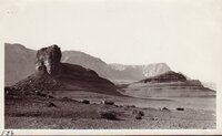 |
Field trip, May 1931: Near Lee's Ferry | 1931-05 | Image/StillImage | uum_map |
| 1379 |
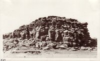 |
Field trip, May 1931: Painted Desert, Arizona. | 1931-05 | Image/StillImage | uum_map |
| 1380 |
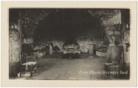 |
Fire Place, Hermits Rest | 1920; 1921; 1922; 1923; 1924; 1925; 1926; 1927; 1928; 1929 | Image/StillImage | uum_map |
| 1381 |
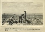 |
First camp out of Fredonia, UT. 1922 | 1922 | Image | uum_map |
| 1382 |
 |
First Mesa Wash, near Walpi, Arizona, after shower, Aug. 1909 (photo G-94) | 1909 | Image | uum_map |
| 1383 |
 |
First Mesa Wash, Walpi (Negative for photo G-94) | 1909 | Image | uum_map |
| 1384 |
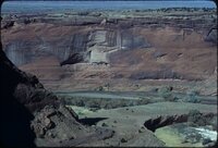 |
First Ruin, Canyon de Chelly, January 1980 | 1980 | Image/StillImage | uum_map_rr |
| 1385 |
 |
First Settlements of San Juan County, Utah | 1928; 1929; 1930; 1931; 1932; 1933 | Text | uaida_main |
| 1386 |
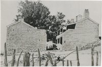 |
First telegraph station in Arizona | 1930; 1931; 1932; 1933; 1934; 1935; 1936; 1937; 1938; 1939; 1940; 1941; 1942; 1943; 1944; 1945; 1946; 1947; 1948; 1949; 1950; 1951; 1952; 1953; 1954; 1955; 1956; 1957; 1958; 1959; 1960 | Image | uum_map |
| 1387 |
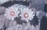 |
Fish hook cactus, Tapeats [creek] | 1971-08-22 | Image | uum_map_rr |
| 1388 |
 |
Flagstaff Area Regional Land Use and Transportation Plan | 2001 | Text | uu_lu_tsp |
| 1389 |
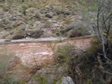 |
Flash Flood Whitmore Wash 1 | | Image/MovingImage | uu_wss |
| 1390 |
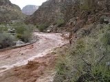 |
Flash Flood Whitmore Wash 2 | | Image/MovingImage | uu_wss |
| 1391 |
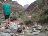 |
Flash Flood Whitmore Wash 3 | | Image/MovingImage | uu_wss |
| 1392 |
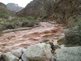 |
Flash Flood Whitmore Wash 4 | | Image/MovingImage | uu_wss |
| 1393 |
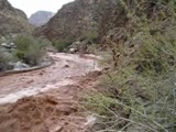 |
Flash Flood Whitmore Wash 5 | | Image/MovingImage | uu_wss |
| 1394 |
 |
Flat at head of Keams Canyon. VII, 3 (Photo G263A) | 1911 | Image | uum_map |
| 1395 |
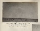 |
Flat between Little Colorado and Dolores cliff, Tolchaco. "Lake" shown is mirage (Photo G411) | 1913 | Image | uum_map |
| 1396 |
 |
Flat between Little Colorado and Dolores cliff, Tolchaco. "Lake" shown is mirage (Photo G411) | 1913 | Image | uum_map |
| 1397 |
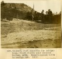 |
Flat possible for irrigation. Wheat fields near Sonsola Buttes, Ariz. Basalt-capped butte in background, 1909 (photo G-103) | 1909 | Image | uum_map |
| 1398 |
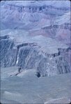 |
Flight over Grand Canyon, March 1963 | 1963 | Image/StillImage | uum_map_rr |
| 1399 |
 |
Flight over Grand Canyon, November 1969 [01] | 1969 | Image/StillImage | uum_map_rr |
| 1400 |
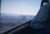 |
Flight over Grand Canyon, November 1969 [02] | 1969 | Image/StillImage | uum_map_rr |