| Title | Date | Type | Setname | ||
|---|---|---|---|---|---|
| 226 |  | Bernheimer Bridge | 1925; 1926; 1927; 1928; 1929; 1930; 1931; 1932; 1933; 1934; 1935; 1936; 1937; 1938; 1939; 1940; 1941; 1942; 1943; 1944; 1945; 1946; 1947; 1948; 1949 | Image | uum_map_rr |
| 227 | 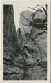 | Bernheimer Bridge | 1925; 1926; 1927; 1928; 1929; 1930; 1931; 1932; 1933; 1934; 1935; 1936; 1937; 1938; 1939; 1940; 1941; 1942; 1943; 1944; 1945; 1946; 1947; 1948; 1949 | Image | uum_map_rr |
| 228 | 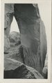 | Bernheimer Bridge | 1925; 1926; 1927; 1928; 1929; 1930; 1931; 1932; 1933; 1934; 1935; 1936; 1937; 1938; 1939; 1940; 1941; 1942; 1943; 1944; 1945; 1946; 1947; 1948; 1949 | Image | uum_map_rr |
| 229 | 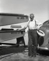 | Bert Loper | 1940; 1941; 1942; 1943; 1944; 1945; 1946; 1947; 1948; 1949; 1950 | Image/StillImage | dha_alwmc |
| 230 | 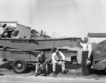 | Bert Loper and others | 1940; 1941; 1942; 1943; 1944; 1945; 1946; 1947; 1948; 1949; 1950 | Image/StillImage | dha_alwmc |
| 231 | 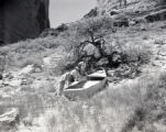 | Bert Loper's Boat | 1940; 1941; 1942; 1943; 1944; 1945; 1946; 1947; 1948; 1949; 1950 | Image/StillImage | dha_alwmc |
| 232 |  | Beryl on Snowball, at V.K. ranch, April 1936 | 1936-04 | Image | uum_map |
| 233 | 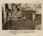 | Betatakin cliff ruins, west branch of Sagy canon, Ariz., (Townsend photo, 1909) | 1909 | Image | uum_map |
| 234 | 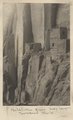 | Betatakin Ruin, Sagy Canyon (Townsend photo) | 1910 | Image | uum_map |
| 235 | 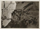 | Betatakin, Navajo National Monument | 1935; 1936; 1937; 1938; 1939; 1940; 1941; 1942; 1943; 1944; 1945; 1946; 1947; 1948; 1949 | Image/StillImage | uum_map_rr |
| 236 | 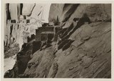 | Betatakin, Navajo National Monument | 1935; 1936; 1937; 1938; 1939; 1940; 1941; 1942; 1943; 1944; 1945; 1946; 1947; 1948; 1949 | Image/StillImage | uum_map_rr |
| 237 |  | Between Phantom [ranch] and Bass | 1971-05-09 | Image | uum_map_rr |
| 238 | 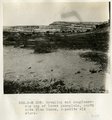 | Beveling and conglomerate cap of lower peneplain, north side Blue Canon, opposite old store. | 1913 | Image | uum_map |
| 239 |  | Beveling below Black Falls, looking north. | 1913 | Image | uum_map |
| 240 | 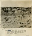 | Beveling of McElmo and conglomerate cap. Edge of Blue Canon, 1 1/2 mile north of old Blue Canon store. | 1913 | Image | uum_map |
| 241 | 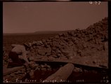 | Big Burro Springs, Arizona, 1909 (negative for photo G-77) | 1909 | Image | uum_map |
| 242 | 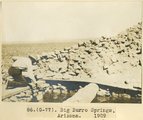 | Big Burro Springs, Arizona, 1909 (photo G-77) | 1909 | Image | uum_map |
| 243 |  | Biography of Joseph Smith Tanner | 1966; 1967; 1968; 1969; 1970; 1971; 1972 | Text | uum_msa |
| 244 |  | Biography of Sarah Ellen Marsden Smith, better known as Nellie Marsden Smith, 1860 - 1924 | 1978 | Text | uum_msa |
| 245 |  | Bit of Grand Canyon cornice work | 1920; 1921; 1922; 1923; 1924; 1925; 1926; 1927; 1928; 1929; 1930; 1931; 1932; 1933; 1934; 1935; 1936; 1937; 1938; 1939; 1940; 1941; 1942; 1943; 1944; 1945; 1946; 1947; 1948; 1949; 1950 | Image | uum_map |
| 246 | 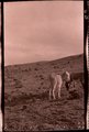 | Black Creek Valley, Arizona (negative for photo G-11) | 1909 | Image | uum_map |
| 247 | 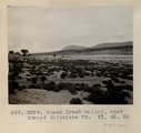 | Black Creek valley, east toward Baigaiche Mt. VI, 45, 55 (Photo G299) | 1911 | Image | uum_map |
| 248 | 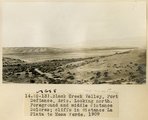 | Black Creek Valley, Fort Defiance, Ariz. Looking north. Foreground and middle distance Dolores; cliffs in distance La Plata to Mesa Verde, 1909 (photo G-13) | 1909 | Image | uum_map |
| 249 | 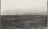 | Black Creek Valley, Fort Defiance, Ariz. Looking north. Foreground and middle distance Dolores; cliffs in distance La Plata to Mesa Verde, 1909 (photo G-13) | 1909 | Image | uum_map |
| 250 | 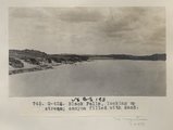 | Black Falls, looking up stream; canyon filled with sand (Photo G426) | 1913 | Image | uum_map |