Home
Browse
Ask Us
Chat
Harmful Language Statement
Log in
Advanced Search
Year
1864
1865
1866
1867
1868
1869
1870
1871
1872
1873
1874
1875
1876
1877
1878
1879
1880
1881
1882
1883
1884
1885
1886
1887
1888
1889
1890
1891
1892
1893
1894
1895
1896
1897
1898
1899
1900
1901
1902
1903
1904
1905
1906
1907
1908
1909
1910
1911
1912
1913
1914
1915
1916
1917
1918
1919
1920
1921
1922
1923
1924
1925
1926
1927
1928
1929
1930
1931
1932
1933
1934
1935
1936
1937
1938
1939
1940
1941
1942
1943
1944
1945
1946
1947
1948
1949
1950
1951
1952
1953
1954
1955
1956
1957
1958
1959
1960
1961
1962
1963
1964
1965
1966
1967
1968
1969
1970
1971
1972
1973
1974
1975
1976
1977
1978
1979
1980
1981
1982
1983
1984
1985
1986
1987
1988
1989
1990
1991
1992
1993
1994
1995
1996
1997
1998
1999
2000
2001
2002
2003
2004
2005
TO
1864
1865
1866
1867
1868
1869
1870
1871
1872
1873
1874
1875
1876
1877
1878
1879
1880
1881
1882
1883
1884
1885
1886
1887
1888
1889
1890
1891
1892
1893
1894
1895
1896
1897
1898
1899
1900
1901
1902
1903
1904
1905
1906
1907
1908
1909
1910
1911
1912
1913
1914
1915
1916
1917
1918
1919
1920
1921
1922
1923
1924
1925
1926
1927
1928
1929
1930
1931
1932
1933
1934
1935
1936
1937
1938
1939
1940
1941
1942
1943
1944
1945
1946
1947
1948
1949
1950
1951
1952
1953
1954
1955
1956
1957
1958
1959
1960
1961
1962
1963
1964
1965
1966
1967
1968
1969
1970
1971
1972
1973
1974
1975
1976
1977
1978
1979
1980
1981
1982
1983
1984
1985
1986
1987
1988
1989
1990
1991
1992
1993
1994
1995
1996
1997
1998
1999
2000
2001
2002
2003
2004
2005
Type
Image
2,504
Text
2
Format
image/jpeg
2,384
application/pdf
118
Collection
American Westward Migration
1
Beckwith Photograph Collection
6
Classified Photographs
285
Photo Archives
1,767
Shipler Commercial Photographers
2
Utah River Running Photo Archives
440
Vernal Express Photographs
1
Western Waters Electronic Resources
2
More
Filters:
Spatial Coverage:
"Arizona"
Type:
"Image"
2351
-
2375
of
2,504
<
90
91
92
93
94
95
96
97
98
99
>
Gallery view
Number of results to display per page
10
25
50
100
200
Sort by Relevance
Sort by Title A-Z
Sort by Title Z-A
Sort by Date Ascending
Sort by Date Descending
Sort by Last Modified Ascending
Sort by Last Modified Descending
Title
Date
Type
Setname
2351
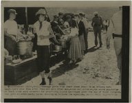
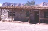
Utah-Arizona Polygamy: Residents of Short Creek, Arizona [01]
1953
Image
uum_map
2352
Utah-Arizona Polygamy: Residents of Short Creek, Arizona [02]
1953
Image
uum_map
2353
Utah-Arizona Polygamy: Residents of Short Creek, Arizona [03]
1953
Image
uum_map
2354
Utah-Arizona Polygamy: Residents of Short Creek, Arizona [04]
1953
Image
uum_map
2355
Valley that drains Red Lake. Looking north from 2 miles north of Moencopie Canon.
1913
Image
uum_map
2356
Vasey's Paradise, Grand Canyon
1940; 1941; 1942; 1943; 1944; 1945; 1946; 1947; 1948; 1949; 1950; 1951; 1952; 1953; 1954; 1955; 1956; 1957; 1958; 1959; 1960; 1961; 1962; 1963; 1964; 1965; 1966; 1967; 1968; 1969; 1970
Image
uum_map_rr
2357
Vegetation, Black Creek Valley, Arizona, 1909 (photo G-11)
1909
Image
uum_map
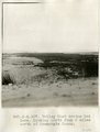
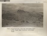
2358
Vegetation, divide between Carrizo Wash and Pueblo Colorado Wash
1913
Image
uum_map
2359
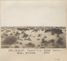
Vegetation, Lower Oraibi Wash, Arizona, 1909
1909
Image
uum_map
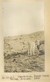
2360
Vegetation, plateau west of Hunter's Pt. Noon camp. May 29 (Photo N-M148)
1913
Image
uum_map
2361
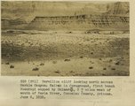
Vermilion cliff looking north across Marble Canyon, Kaibab in foreground, first bench Moenkopi capped by Shinarump, 2+ miles west of mouth of Paria River, Coconino County, Arizona. June 6, 1915.
1915
Image
uum_map
2362
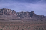
Vermilion Cliffs landscape.
1950; 1951; 1952; 1953; 1954; 1955; 1956; 1957; 1958; 1959; 1960
Image
uum_map
2363
Vermillion Cliffs, Arizona
1950; 1951; 1952; 1953; 1954; 1955; 1956; 1957; 1958; 1959; 1960; 1961; 1962; 1963; 1964; 1965; 1966; 1967; 1968; 1969; 1970; 1971; 1972; 1973; 1974; 1975; 1976; 1977; 1978; 1979; 1980
Image
uum_map_rr
2364
Vermillion Cliffs, Arizona
1950; 1951; 1952; 1953; 1954; 1955; 1956; 1957; 1958; 1959; 1960; 1961; 1962; 1963; 1964; 1965; 1966; 1967; 1968; 1969; 1970; 1971; 1972; 1973; 1974; 1975; 1976; 1977; 1978; 1979; 1980
Image
uum_map_rr
2365
Vermillion Cliffs, Arizona
1950; 1951; 1952; 1953; 1954; 1955; 1956; 1957; 1958; 1959; 1960; 1961; 1962; 1963; 1964; 1965; 1966; 1967; 1968; 1969; 1970; 1971; 1972; 1973; 1974; 1975; 1976; 1977; 1978; 1979; 1980
Image
uum_map_rr
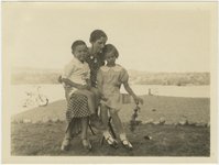
2366
Vernon Jr. and Beryl Knight, at V.K. ranch, April 1936
1936-04
Image
uum_map
2367
Vernon Jr. and Beryl with their "Nanna," at V.K. ranch, April 1936
1936-04
Image
uum_map
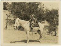
2368
Vernon, Jr. on Snowball, at V.K. ranch, April 1936
1936-04
Image
uum_map
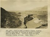
2369
View at head of Marble Canyon, looking S.40 degrees W, from base of LaPlata at point 2+ miles east of Paria River. Vermilion cliff at left, Coconino County, Arizona. June, 1915.
1915
Image
uum_map
2370
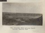
View Dolores Fossil Forest, Carrizo Wash (Photo N-M185)
1913
Image
uum_map
2371
View down canyon from top of Vulcans Throne
1900
Image
uum_map
2372
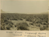
View down Toroweap Valley toward Vulcans Throne
1900
Image
uum_map
2373
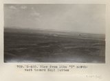
View from Dike "T" northwest toward Hopi Buttes (Photo G400)
1913
Image
uum_map
2374
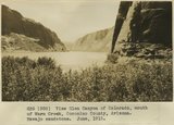
View Glen Canyon of Colorado, mouth of Warm Creek, Coconino County, Arizona. Navajo sandstone. June, 1915.
1915
Image
uum_map
2375
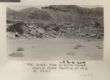
View in North Forest, Carrizo Creek (Section of this IX, 32-33) (Photo G445)
1913
Image
uum_map
2351
-
2375
of
2,504
<
90
91
92
93
94
95
96
97
98
99
>